The Great Lakes Islands You Can Actually Visit
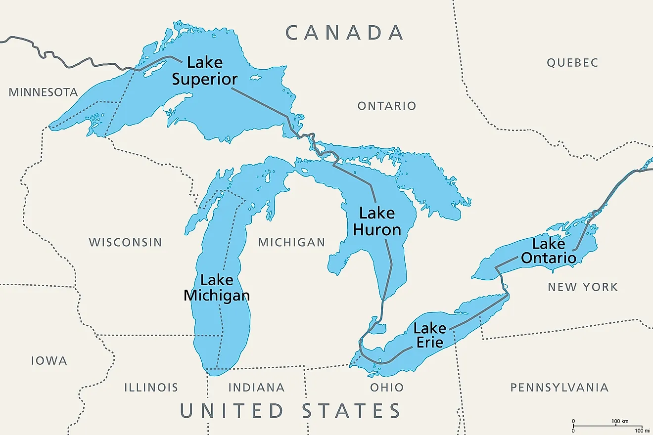
Freshwater seas rarely hold this many islands. The five Great Lakes cover 94,250 mi² (244,160 km²), a surface larger than the entire United Kingdom, and hold around 21% of the world's surface fresh water by volume. Their shoreline runs to more than 10,000 miles (16,000 km) once the islands are counted, a figure behind the region's Third Coast nickname.
Within the lakes, there are over 35,000 islands, and only around 30 are fully accessible for standard public visits. Many of the islands are small and isolated, while others are protected wildlife sanctuaries. The number of privately owned islands not open to the general public is unknown, with many such islands on Georgian Bay in Lake Huron and numbering in the hundreds. Many islands are open to the public but are so remote that most visitors would find them difficult to reach. Of the 30 accessible islands, several are popular and see many tourists during peak season. Some have permanent populations year-round, while others are public lands open for camping and exploring.
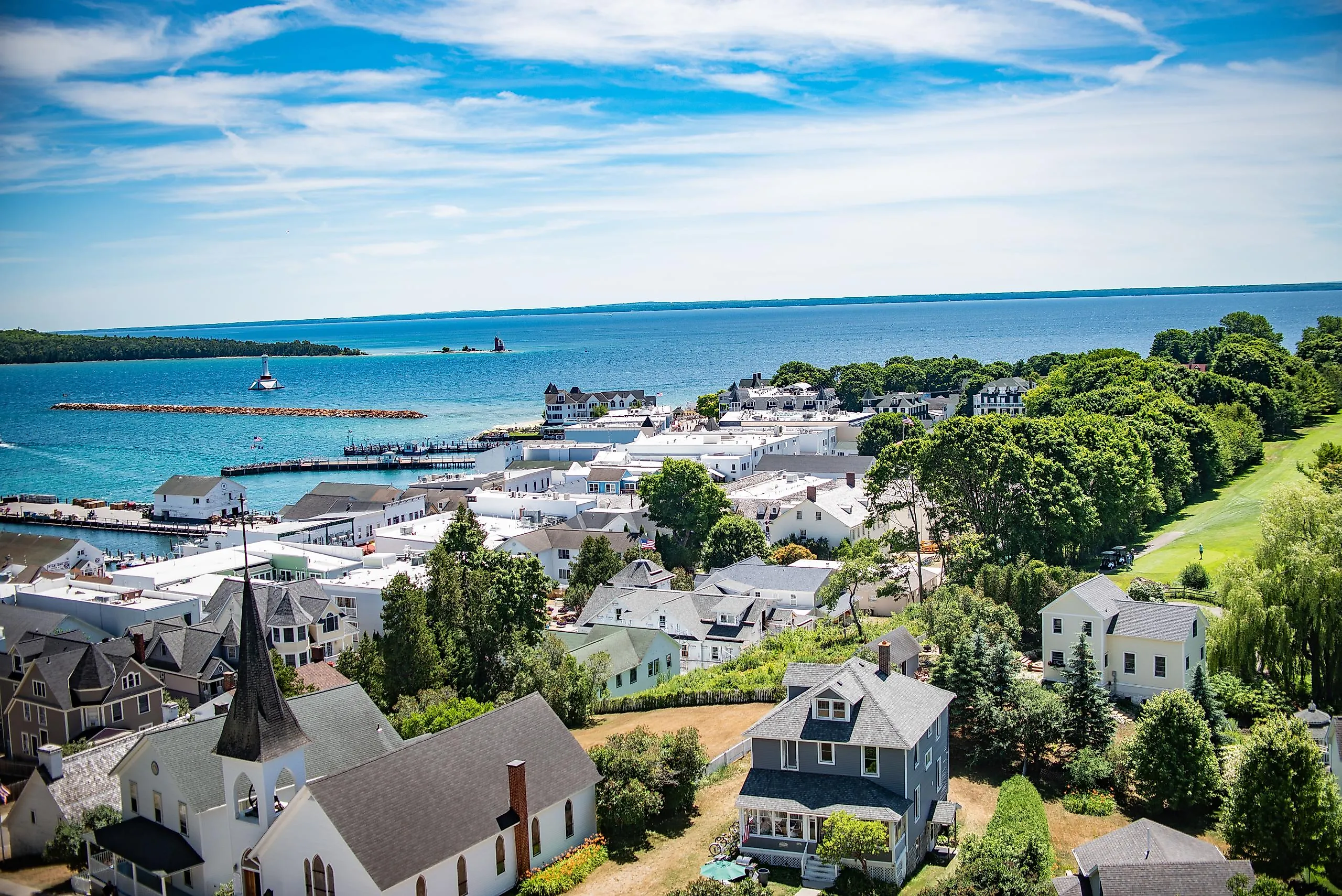
Mackinac Island (Lake Huron, Michigan)

Mackinac Island, on Lake Huron, is an inhabited island renowned as a tourist destination. Located in the Straits of Mackinac, the island is famous for being largely car-free. Ferry services are available from Mackinaw City and St. Ignace, but visitors leave their cars on the mainland. To get around, residents and visitors alike use bicycles, horse-drawn carriages, or simply walk. There is a well-developed tourism infrastructure, with places to stay such as the historic Grand Hotel and The Inn at Stonecliffe. There are also plenty of bed and breakfasts and houses to rent for longer stays.
Historical sites include Fort Mackinac, a late-18th-century military outpost where staff stage costumed reenactments and run a Tea Room. The famed Arch Rock is a limestone arch overlooking Lake Huron inside Mackinac Island State Park. Established in 1895, Mackinac Island State Park covers more than 80% of the island, or about 1,800 acres (728 ha), and was Michigan's first state park. The island had also been home to Mackinac National Park, the second national park in the United States, from 1875 until the land transferred to state control 20 years later. For an active day out, M-185 is a paved highway of about 8 miles (13 km) that loops around the island's outer edge. The island and its town are also famous for fudge. More than a dozen fudge shops operate in town, producing as much as 10,000 pounds (4,536 kg) per day during peak season.
Manitoulin Island (Lake Huron, Ontario)

Manitoulin Island, known in Ojibwe as Mnidoo Mnising, or "Spirit Island," is the largest freshwater island in the world, covering about 1,068 mi² (2,766 km²). Manitoulin Island itself contains more than 100 lakes. The largest of those, Lake Manitou, is the world's largest lake on a freshwater island. Lake Mindemoya contains Treasure Island, the world's largest island in a lake on an island in a lake. As a nested island, Treasure Island sits in Lake Mindemoya, which is on Manitoulin Island, which is in Lake Huron. Treasure Island is privately owned.
Much of Manitoulin is rural and wooded, and a vehicle is the easiest way to reach its communities and hiking trails. The island is accessible via the Little Current Swing Bridge, which connects it to the mainland on Highway 6. A seasonal ferry, the MS Chi-Cheemaun, also links Tobermory on the Bruce Peninsula with South Baymouth on the island. The island has a large network of highways and rural roads, and cycling is also possible. There are motels along the shore, bed and breakfasts, and plenty of camping options. Manitoulin is home to six Anishinaabe First Nations communities, and guided cultural experiences are available through Wiikwemkoong Tourism and the Ojibwe Cultural Foundation in M'Chigeeng. Little Current and Gore Bay are two of the main visitor hubs. Gore Bay is a waterfront town and the administrative center of the Manitoulin District, with a marina and seasonal markets.
Apostle Islands (Lake Superior, Wisconsin)

This 22-island archipelago is scattered across Lake Superior off northern Wisconsin. One island, Madeline Island, is inhabited and can be reached by vehicle ferry. The other 21 islands are accessible only by boat, are rugged and largely undeveloped, and form Apostle Islands National Lakeshore. The islands are famous for their sandstone sea caves and historic lighthouses, the largest collection in the National Park System. They also have sandy beaches and miles of hiking trails. Visitors can take boat tours or paddle sea kayaks. Kayaking offers close views of the wave-carved red sandstone arches and pillars, but Lake Superior conditions can change quickly, so inexperienced paddlers should use a guide. Experienced paddlers can camp for several days and travel between islands, while other visitors can see them on day trips or guided tours.
On Madeline Island, Big Bay State Park has a 1.5-mile (2.4 km) sandy beach, a boardwalk, hiking trails, and picnic areas. There are also rental cottages on Madeline Island. For tours or day trips to the national lakeshore, Bayfield, Wisconsin, serves as the main gateway. The town has lakeside eateries serving local whitefish, along with accommodations, outfitters, and boat launches. A vehicle-and-passenger ferry connects Bayfield with Madeline Island, where cars are permitted. Visitors need a private boat, water taxi, or tour to reach the other islands.
Pelee Island (Lake Erie, Ontario)

Pelee Island is Canada's southernmost inhabited land. It lies just south of the 42nd parallel, farther south than California's northern border. Only uninhabited Middle Island is farther south. Pelee Island is also the largest island in Lake Erie, with wineries, nature reserves, and sandy beaches. Its population was 230 in the 2021 census, rising to around 1,500 during the summer. A mild microclimate supports both winemaking and a diverse ecosystem. More than 700 acres (283 ha) of vineyards cover the island, and visitors can taste wine at the Pelee Island Winery Pavilion. Fish Point Provincial Nature Reserve has walking trails where visitors may see migratory birds and monarch butterflies along a sandy spit. The Pelee Island Heritage Centre holds exhibits on First Nations history and shipwrecks from the western basin of Lake Erie. Seasonal vehicle-and-passenger ferries serve the island from Leamington early in the season and from Kingsville later in the year.
A vehicle is useful but not essential. Cycling is popular, and golf carts and bicycles are available to rent. Visitors wishing to visit Middle Island should be aware that public access is prohibited from March 1 through September 1 each year to protect nesting waterbirds. There are no docks or visitor facilities. The island once had a clubhouse and hotel and became known as a rum-running stop during Prohibition, but it is now part of Point Pelee National Park. Outside the seasonal closure, access is by private boat only, and visitors should check current Parks Canada rules before landing.
Isle Royale (Lake Superior, Michigan)

Isle Royale is the main island of an archipelago of more than 400 smaller islands, all part of Isle Royale National Park. This remote national park is rugged and largely undeveloped, with opportunities for hiking and kayaking, and is home to moose and wolves. Isle Royale is the largest of the archipelago at 45 miles (72 km) long and 9 miles (14 km) wide. Other islands include Amygdaloid Island, which has a seasonally staffed ranger station, and Mott Island, which serves as the park's summer headquarters and is located off the south shore of the main island. Visitors can use ferries from Houghton or Copper Harbor, Michigan, to reach Rock Harbor. Ferries from Grand Portage, Minnesota, serve Windigo and, on some routes, Rock Harbor. The park is open to visitors from April 16 through October 31, although ferries and seaplanes generally operate from mid-May through September.
Seaplane service is also available from the Houghton area, with flights taking about 35 to 45 minutes. Visitor motor vehicles are not permitted on the islands, and bicycles are not allowed on park trails. Visitors reach the islands by boat or seaplane and then travel on foot or by watercraft. Backpacking and hiking are the big draw, with trails including the Greenstone Ridge Trail, which runs along much of the main island. Visitors can explore smaller islands by canoe or kayak, and rentals are available. For accommodations, Rock Harbor Lodge is available, as is camping. There are 36 designated campgrounds across the main island and some of the smaller islands. Campfires are allowed only in designated metal rings or standing grills at certain campgrounds and may be banned during dry conditions.
Visiting the Islands of the Great Lakes
Although most of the 35,000 islands found on the Great Lakes are difficult to visit or are not accessible due to environmental restrictions or being private property, the approximately 30 islands open for visitors are well worth the time to explore. Some have a well-established tourism infrastructure, or are publicly owned parklands open to camping and hiking, and some are permanently populated communities, with the same amenities found on the mainland.