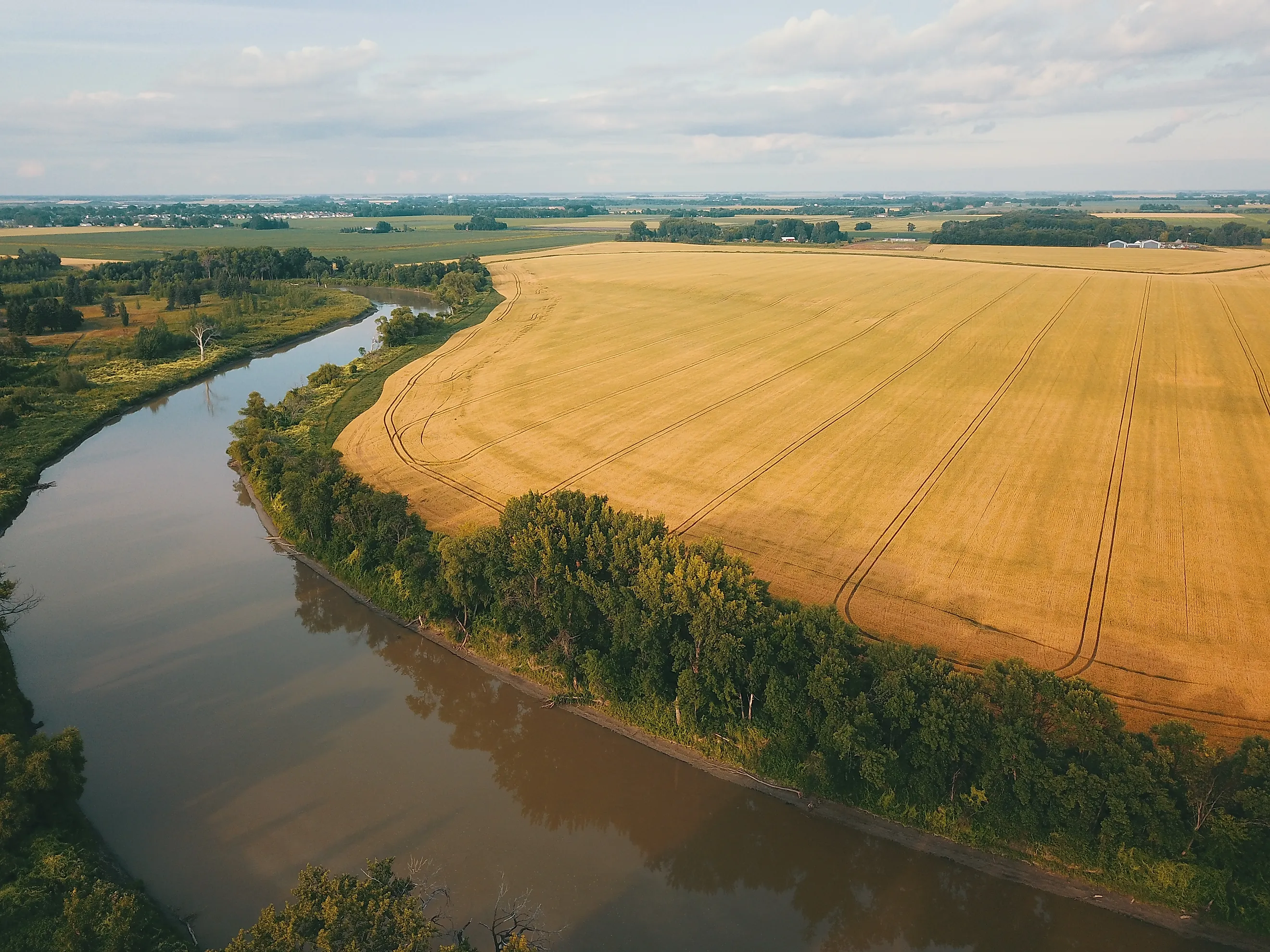
Why The Red River Flows North Into Canada
In April 1997, the river at Grand Forks, North Dakota, crested at 54.35 feet, more than 5 feet above its previous record. Ninety percent of the city was evacuated. The water that forced those people out was on its way to Canada.
The Red River of the North runs the opposite direction from the Mississippi. It follows the line between North Dakota and Minnesota, passes Fargo, crosses the border, and empties into Lake Winnipeg. From there, its water ends up in Hudson Bay. That route was set long before anyone built a town on the river's banks, and the explanation starts in a small Minnesota town at its southern end, on ground so flat that most people driving through would never guess it matters.
The River Begins on the Hudson Bay Side of a 10-Foot Divide

Browns Valley sits on the Laurentian Continental Divide, the line that separates water bound for Hudson Bay from water bound for the Gulf of Mexico. In town, at about 977 feet above sea level, the divide is a rise of only about 10 feet. Lake Traverse lies on the north side of that rise and empties into the Bois de Sioux River, which flows north to meet the Otter Tail River at Wahpeton, North Dakota, and Breckenridge, Minnesota. The Red River of the North begins at that confluence. Big Stone Lake, on the south side of the rise, drains through the Minnesota River instead.
The floor between the two lakes is so flat that floods have temporarily joined them, letting water from one basin spill across the divide into the other. That floor belongs to a valley about a mile wide and 130 feet deep, called the Traverse Gap, and both lakes and the town lie inside it. Glacial meltwater cut the gap while flowing south.
A Glacial River Carved the Low Gap That Now Splits the Water

About 13,000 years ago, the Laurentide ice sheet was melting back across what is now Canada, and its meltwater pooled in front of it as Glacial Lake Agassiz. At its greatest extent, the lake may have covered as much as 170,000 square miles, more than all of the modern Great Lakes combined. The ice sheet stood to the north, so the water had no northern exit. To the south, a ridge of glacial debris called the Big Stone Moraine held it back until the lake rose high enough to spill over.
The overflow, Glacial River Warren, cut the Traverse Gap through the moraine and carried the lake's water south toward the Mississippi. The Minnesota River, a much smaller stream, follows River Warren's old bed today. Once the ice retreated far enough north, Lake Agassiz took a permanent outlet to the north and dropped below the level of the gap, and River Warren stopped flowing. The continental divide now crosses the flat floor of the channel it left, which is why a rise of 10 feet is enough to send Lake Traverse north.
The Ice Pushed the Land Down Hardest Around Hudson Bay

The ice that blocked Lake Agassiz was also pressing on the ground beneath it. At its maximum, the sheet was about 2 miles thick, and ice sheets of that size pushed the Earth's crust down by as much as 1,300 feet. The land sank the most around Hudson Bay, where the ice was thickest, and the bay lies in a depression in the Canadian Shield.
As the ice retreated, Lake Agassiz found new outlets to the northwest and east. Around 8,200 years ago, the melting of the last ice over Hudson Bay let the lake drain nearly completely toward the bay, and it left behind Lake Winnipeg, Lake Manitoba, Lake Winnipegosis, and Lake of the Woods. Water in the Red River valley has followed that path ever since, downhill through Lake Winnipeg and its only outlet, the Nelson River, to sea level at Hudson Bay.
The Old Lake Floor Tilts North About a Foot per Mile

The Red runs across the floor that Lake Agassiz left behind. The ground under Fargo is mostly clay that settled out of meltwater into the lake, and the plain is so smooth that, from Breckenridge to the Canadian border, about 200 miles north, the valley drops only about one foot per mile. With so little slope to straighten its course, the river winds back and forth, and it takes nearly 400 river miles to cover those 200 miles.
That slope sets the river's pace. The National Weather Service describes the Red's flow as slow because the valley is so flat, and the U.S. Geological Survey notes that the gentle grade slows water in the channel and encourages it to spread over land. Spring adds a second problem that comes straight from the river's direction. The warmest temperatures and the first runoff begin at the southern, upstream end of the basin, and that meltwater heads north toward a channel that can still be frozen. Ice jams there can hold back the flow and raise the river further.
In 1997, the water spread across more than 700 square miles of southern Manitoba, an expanse nicknamed the Red Sea. Winnipeg now sends floodwater around the city through the Red River Floodway, a 29-mile channel built in the 1960s. Fargo, where the Red set a record of 40.84 feet on March 28, 2009, is finishing a 30-mile diversion channel of its own, scheduled for completion in 2027.
The Northern Ground Is Still Rising From Under the Ice

The land under the Red River valley is still rising, by 1 to 4 millimeters a year, or up to about an inch and a half per decade, and the Hudson Bay region is rising about 2 feet per century, as the crust recovers from the weight of the ice. The old shorelines of Lake Agassiz show which way that movement runs. Waves built the Campbell beach as a single shoreline, and its northern end now sits more than 490 feet higher than its southern end, because the land farther north was pressed down more and has risen more since the ice left. Over thousands of years, the faster uplift downstream has gradually reduced the river's gradient, and Lake Winnipeg has spread south as the ground at its northern end rose.
The water the Red carries north ends up in Lake Winnipeg, one of the lakes Lake Agassiz left behind, which covers about 9,200 square miles. The river empties into its south basin. The valley the river drains is the old Agassiz lakebed, now farmland planted in sugar beets, potatoes, corn, and wheat, and runoff from those farms and from the valley's towns carries nutrients into the river. About half of the phosphorus in Lake Winnipeg comes from the Red, and phosphorus runs almost three times higher in the south basin than in the north. Some of the algal blooms that follow have covered hundreds of square miles of the lake. The Red, flowing north across the floor of a lake the ice created, is carrying runoff from the old lakebed into one of that lake's last remnants.