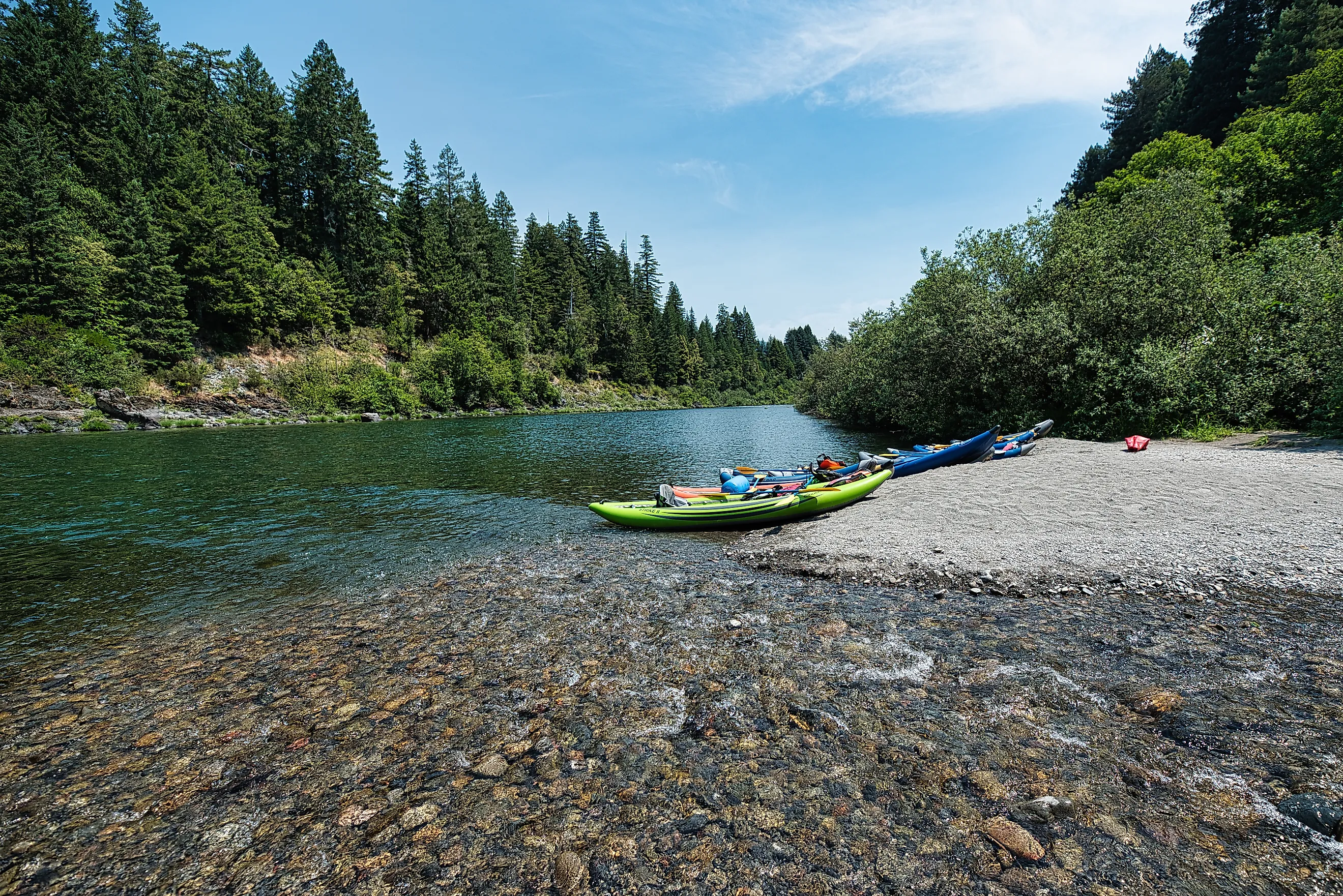
The Clearest River In The United States
California's Smith River is one of the strongest contenders for the title of the clearest river in the United States. Flowing through the forested mountains of the state's far northwest corner, it is known for its exceptionally transparent, emerald-green water. The Smith is also California's only major undammed river system, running free along its entire course to the Pacific Ocean.
Several qualities explain that remarkable clarity. Much of the river's watershed lies on protected public land, where forests and streambank plants help screen sediment from the water. The Smith also clears rapidly after storms, a trait noted by the US Geological Survey. A closer look reveals how these qualities work together, how scientists measure the results, and what pressures even the clearest rivers face.
Where Is The Smith River?

The Smith River flows through Del Norte County in California's far northwest corner, near the Oregon border. Its watershed extends into the Klamath Mountains and includes three forks, the North Fork, Middle Fork, and South Fork, which join to form the main river before it reaches the Pacific Ocean near Crescent City. As the state's only major undammed river system, the Smith follows its natural course without interruption.
Protected public lands surround much of the river, including portions of Six Rivers National Forest and Redwood National and State Parks, and about 325 miles of the river system and its tributaries carry federal Wild and Scenic River designation. Forests and streambank vegetation reduce erosion and limit sediment, and the US Geological Survey has documented the river's sparkling clear water and its ability to recover quickly after storms.
How Scientists Measure River Clarity

The appearance of a river provides clues about its clarity, but scientists use specific measurements to determine how much light can pass through the water. One of the most important is turbidity, which measures the extent to which suspended particles scatter light. Water with low turbidity generally appears clearer, while higher turbidity makes it look cloudy or muddy.
Turbidity is commonly measured in nephelometric turbidity units (NTU). Lower readings generally indicate clearer water, although natural color and lighting conditions can influence how transparent a river appears. Scientists also measure suspended sediment, including fine particles of sand, silt, and clay carried by flowing water. High concentrations of these particles can reduce visibility and limit the amount of sunlight reaching underwater habitats.

River clarity can change significantly throughout the year. Heavy rainfall and flooding wash sediment into waterways and stir up material from the riverbed, temporarily increasing turbidity. During periods of lower flow, suspended particles may settle, allowing the water to become clearer. The Smith River is particularly notable for how quickly its water can clear following storms.
Clarity should not be confused with overall water quality. A transparent river can still contain dissolved pollutants or harmful microorganisms that are invisible to the eye. Although clear water is often associated with healthy aquatic environments, scientists also examine chemical and biological conditions when evaluating river health.
The Duckabush River - Another Clear River Example

The Duckabush River in Washington runs through a largely forested landscape on the eastern side of the Olympic Peninsula, where it has a documented history of favorable water-quality monitoring results. The Environmental Protection Agency has evaluated freshwater ecosystems flowing into the Salish Sea using measurements collected between 2000 and 2017 from rivers in Washington and British Columbia.
Historical NOAA data show that the Duckabush near Brinnon averaged a Water Quality Index score of 90 between 2000 and 2012, indicating consistently high water quality. Its forested watershed and proximity to Olympic National Forest help limit erosion and sediment runoff. The Smith, by comparison, is specifically recognized for its unusually clear water and quick recovery from storm-related turbidity.
What Threatens Even the Clearest Rivers

Although the Smith River flows through a mostly protected landscape, even very clear rivers face environmental pressures. Development, agriculture, and industrial activity can increase erosion and introduce sediment or pollutants into waterways, reducing clarity and affecting aquatic habitats.
Stormwater runoff is a widespread contributor to cloudy river conditions. Roads, parking lots, and buildings prevent rainwater from naturally soaking into the ground. Instead, runoff can carry soil, debris, and other particles into nearby waterways. Agricultural operations can also increase sediment loads when exposed soil is washed into rivers. Excess nutrients from fertilizers may encourage algae growth, further reducing water transparency.

The loss of forests and wetlands creates additional problems. Vegetation along riverbanks stabilizes soil and helps prevent sediment from entering streams. Wetlands slow the movement of water, allowing suspended particles to settle before reaching larger waterways. Removing these natural buffers can increase erosion and turbidity, particularly during heavy rainfall.
Even the Smith River watershed has not escaped every water concern. California's 2026 Integrated Report found that the mainstem Smith River supported its assessed water-quality uses and was not listed as impaired. However, three water bodies within the broader watershed were identified as impaired. Delilah Creek was listed for alkalinity and copper, Tilas Slough for copper, and an unnamed coastal stream for dissolved oxygen. These findings concern water quality rather than measured clarity, but they demonstrate that protected watersheds can still experience environmental problems.
Is the Smith River Really America's Clearest?

The Smith River has a strong case for being considered among the clearest major rivers in the United States. Its transparent emerald-green water, extensive protected lands, and relatively undeveloped surroundings distinguish it from many other American waterways. Its documented ability to clear rapidly after storms further supports that reputation.
Ultimately, the clearest river is not necessarily the one with the best overall water quality or the lowest turbidity reading on a particular day. Water clarity varies with rainfall, sediment levels, and seasonal flow conditions. Nevertheless, the Smith River's exceptional transparency and largely protected watershed make it one of America's most compelling examples of a remarkably clear, free-flowing river.