The Cleanest Reservoirs In The United States
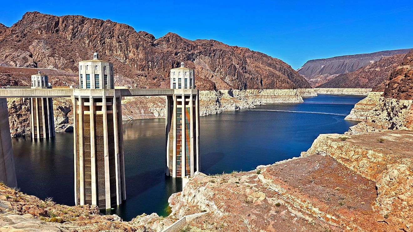
America's cleanest reservoirs are more than crystalline waters. Aside from recreation, these man-made bodies of water provide flood control, crop irrigation, and hydroelectric power generation, and supply drinking water for nearby municipalities. According to the U.S. Environmental Protection Agency's 2012 National Lakes Assessment, roughly 48% of the 111,119 lakes surveyed are reservoirs, meaning the likelihood that your favorite local lake is actually a reservoir is nearly evenly split. To keep up with the constant use these water bodies experience, persistent monitoring by local and regional entities is a must. Water quality is determined by eight key components, with varied emphasis dependent on location and entity: ammonia, lead, dissolved oxygen, turbidity, sulfate, phosphorus, pH levels, and total dissolved solids.
There is no national ranking database for reservoirs; however, the National Water Quality Monitoring Council does provide chemical data for the largest lakes and reservoirs in the country. The list below highlights the top five reservoirs with the safest measured characteristics used to indicate reservoir cleanliness, shedding light on how these waters stay so clean.
Flaming Gorge Reservoir

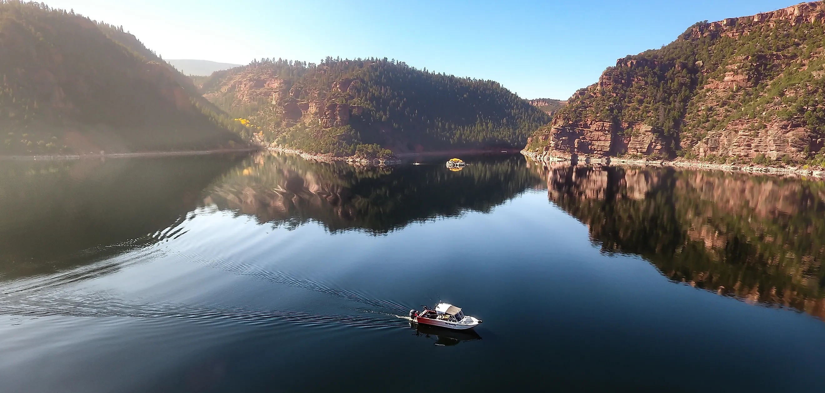
Flaming Gorge Reservoir began filling in 1962, impounded behind a Green River dam that the U.S. Bureau of Reclamation completed in 1964 as part of its Colorado River Storage Project. The reservoir stretches 91 miles, crossing the border of Utah into Wyoming. Unlike many dams and reservoirs in the country that contribute to irrigation and agricultural projects alongside hydroelectric energy production, the Flaming Gorge Reservoir's primary purpose is water flow regulation, a priority during seasons of drought or heavy rainfall in the region's arid climate. Recreation remains a high priority for the reservoir and surrounding landscape as well, given the area's economic dependence on outdoor tourism. The fiscal significance of the reservoir and the area's reliance on the water it regulates translates to how closely the water's health is supervised.
The Bureau of Reclamation takes the lead on managing all operational upkeep, focusing on pool elevations and drought response release. Currently the reservoir sits at 70 percent capacity, which is on track with target levels to balance regional river ecology and downstream drought support for Lake Powell. Routine chemistry data is collected by the bureau, but the U.S. Geological Survey, which operates streamgages on the Green River, leads data collection and analysis of water health in the region. Dissolved oxygen, pH levels, and turbidity are the primary statistics used to determine cleanliness. Present readings are consistent with the federal water quality guidelines for a healthy reservoir in the region. The latest readings showed a pH of 8.4, dissolved oxygen of 7.45 milligrams per liter, and a median turbidity of 0.00 nephelometric turbidity units (NTU), a measure of cloudiness where a lower number means clearer water.
Kentucky Reservoir

Spanning 160,300 acres, the Kentucky Reservoir is the largest man-made lake by surface area east of the Mississippi River. It is located along the Tennessee River, in both Kentucky and Tennessee, and serves as the key waterway used by the Tennessee Valley Authority for flood control on the lower Ohio and Mississippi River. More than that, the reservoir holds the highest capacity of any in the Tennessee Valley Authority system, draining the entire 40,900 square mile Tennessee Valley watershed. The artificial lake's impact extends even further. When Kentucky Reservoir filled in 1944, it linked the Tennessee Valley to the country's Inland Waterway System, opening the Tennessee River to year-round navigation and connecting to an 11,000 mile waterway network reaching Pennsylvania, Florida, South Dakota, and Texas.
The reservoir is also a major recreation destination, particularly for fishermen and boaters. Dotted along the reservoir's 2,064 miles of shoreline are four state parks, the Tennessee National Wildlife Refuge, Land Between the Lakes National Recreation Area, two state wildlife management areas, and countless public access areas, campsites, beaches, and backcountry trails. With the high traffic nature and expansive coverage of the Kentucky Reservoir, water quality monitoring is all hands on deck from the Tennessee Valley Authority, Kentucky Division of Water, Tennessee Wildlife Resource Agency, and Kentucky Department of Fish and Wildlife Resources. The Tennessee Valley Authority leads the way on all water health oversight, focusing on dissolved oxygen, chlorophyll, and pH levels. Based on the data, water column mixing and runoff management are adjusted to address any ecological imbalances in the reservoir. The most recent readings of these levels received "good" ratings with dissolved oxygen at 7.89 milligrams per liter, chlorophyll at 4.9 micrograms per liter, and a pH of 7.4. Standards for these levels are set by the state of Kentucky.
Lake Hartwell

Set on the border of Northeast Georgia and Upstate South Carolina, Lake Hartwell is one of the most visited lakes in the country, attracting roughly nine million visitors each year. Created by the U.S. Army Corps of Engineers, Lake Hartwell was originally constructed as a multiuse reservoir to regulate flooding from the Savannah River and provide regional hydroelectric power. Since the lake was completed in 1962, its popularity for outdoor recreation has grown. The lake's popularity is no surprise given it stretches nearly 56,000 acres at normal pool and features 962 miles of shoreline, 24 percent of which are public recreation areas. Of the remaining shoreline, another 26 percent is protected to maintain the health of the lake and the wildlife that depend on it.
To address the lake's heavy use, the Corps developed a Shoreline Management Plan to protect the ecological health of the reservoir. The plan's main objective is to balance heavy recreational use with lasting preservation of the lake's resources and habitats. It is updated regularly to adapt to public demand and environmental changes. In addition to the management plan, Lake Hartwell's water quality is supervised by collaborative state oversight, local treatment facilities, and watershed protection groups. The South Carolina Department of Environmental Services tracks conditions, issues recreational watches, and lifts advisories when water safety improves. Dissolved oxygen, pH, and turbidity levels are the central health data used to determine the cleanliness of Lake Hartwell. Current reports indicate dissolved oxygen of 8.30 milligrams per liter, turbidity of 1.54 NTU, and a pH of 7.5.
Lake Martin

The state's first "Treasured Alabama Lake," Lake Martin is a major reservoir on the Tallapoosa River in east central Alabama, known for consistently clean, sparkling water. The 31 mile long lake and its dam, Martin Dam, were built by Alabama Power in 1926. Alabama Power owns and operates the dam and reservoir, while Russell Lands owns much of the surrounding shoreline. At the time of construction, Lake Martin was the world's largest artificial body of water. Both the dam and lake quickly became important economic and recreation centers for the state, drawing in fishers, boaters, campers, and other outdoor enthusiasts while simultaneously powering roughly 28,000 homes at any time. Given that economic and recreational significance, Alabama Power and Russell Lands maintain consistent monitoring and resource-protection efforts in cooperation with local nonprofits such as the Lake Martin Resource Association and Lake Watch of Lake Martin. Both Alabama Power and Lake Watch of Lake Martin perform routine sampling through certified monitoring sites throughout the watershed.
In line with the reservoir's historical readings, the most recent data pointed to another year of strong water quality: dissolved oxygen at 8.15 milligrams per liter, ammonia at 0.04 milligrams per liter, no measurable lead, 0.01 milligrams per liter of phosphorus, no measurable sulfate, turbidity at 1.28 NTU, and a pH of 8.5. In addition to near daily data analysis, both the Lake Martin Resource Association and Lake Watch of Lake Martin handle safety buoys, offer educational programs, and plan cleanups along the lakeshore to preserve water health.
Lake Roosevelt

A product of the New Deal era, the 150 mile long Lake Roosevelt was formed by the Grand Coulee Dam, which the Bureau of Reclamation began building in 1933 as part of the Columbia Basin Project. The purpose behind the project was multifaceted, highlighting irrigation, hydroelectric power generation, river regulation, and flood control. What came of it was so much more than initial proposals could have predicted. Today, Lake Roosevelt and the Grand Coulee Dam provide irrigation for over 670,000 acres of agricultural lands, sustain flood control to downstream communities, and provide power for more than four million residential customers across the Pacific Northwest annually. The land encircling the reservoir, supervised by the National Park Service, has become a major recreation destination, attracting roughly 1.5 million visitors each year. Given the lake's substantial economic impact and the heavy use the reservoir sees, maintaining the water's health is a top priority for the agencies involved.
The U.S. Environmental Protection Agency oversees Lake Roosevelt as part of a Superfund site through the Columbia River Basin Restoration Working Group, focusing on eliminating legacy contamination and preventing future pollutants throughout the watershed. The National Park Service prioritizes invasive species prevention, recreation regulation, and sanitation guidelines for the entire Lake Roosevelt National Recreation Area. Extensive water quality monitoring is facilitated by federal and state officials as well as the Confederated Tribes of the Colville Reservation and the Spokane Tribe of Indians. A coalition, named the Lake Roosevelt Forum, was even formed to further water tracking across the expansive reservoir and serve as a bulletin for regional community cleanups. Even with ongoing struggles with historic soil contaminants and droughts across the region, Lake Roosevelt remains one of the cleanest reservoirs nationwide, consistently hitting "good" water health levels with no signs of significant decline. Latest water quality data revealed a 7.8 pH, dissolved oxygen at 9.95 milligrams per liter, and turbidity at 1.36 NTU, pointing toward continued clean and habitable waters. State and federal officials are currently revising desired nutrient levels, such as phosphorus and sulfate, for the region's reservoirs and lakes.
Keeping America's Reservoirs Clean
Reservoirs are central to American life, tied to power generation, flood control, drinking water, and outdoor recreation. In 2022, the Environmental Integrity Project reported that 55% of assessed lake and reservoir acreage in the U.S. is impaired, meaning the water is too polluted to meet safety standards for aquatic life, recreation, fish consumption, or drinking. That figure makes the health of these five water bodies even more notable. Spread across the Southeast and the Pacific Northwest, they show what sustained cooperation among federal agencies, state regulators, tribes, and local groups can accomplish for the nation's man-made waters. Keeping reservoirs and lakes clean depends on exactly that kind of ongoing, shared effort.