The Last Major Undammed River In The Lower 48
The last major undammed river in the Lower 48 is the Yellowstone River, a 671-mile waterway that begins high in Wyoming's mountains and ends at the Missouri River in North Dakota. Along the way, it plunges over a 308-foot waterfall, carves through a canyon more than 1,000 feet deep, and crosses hundreds of miles of Montana countryside.
Unlike most of America's other major rivers, the Yellowstone has no large dam or reservoir interrupting its main channel. Its waters still rise dramatically with spring runoff, sometimes with devastating results. Yet there's an interesting catch to its undammed reputation, and a remarkable story behind why this river remains so different.
A 671-Mile Journey Through the American West

The Yellowstone River begins on the slopes of Younts Peak in Wyoming's Absaroka Mountains, southeast of Yellowstone National Park. It travels through remote mountain country before entering Yellowstone Lake, then resumes its northward journey at Fishing Bridge. A few miles later, the river reaches LeHardys Rapids, where Yellowstone cutthroat trout can sometimes be seen gathering in shallow pools during their spring spawning migration.
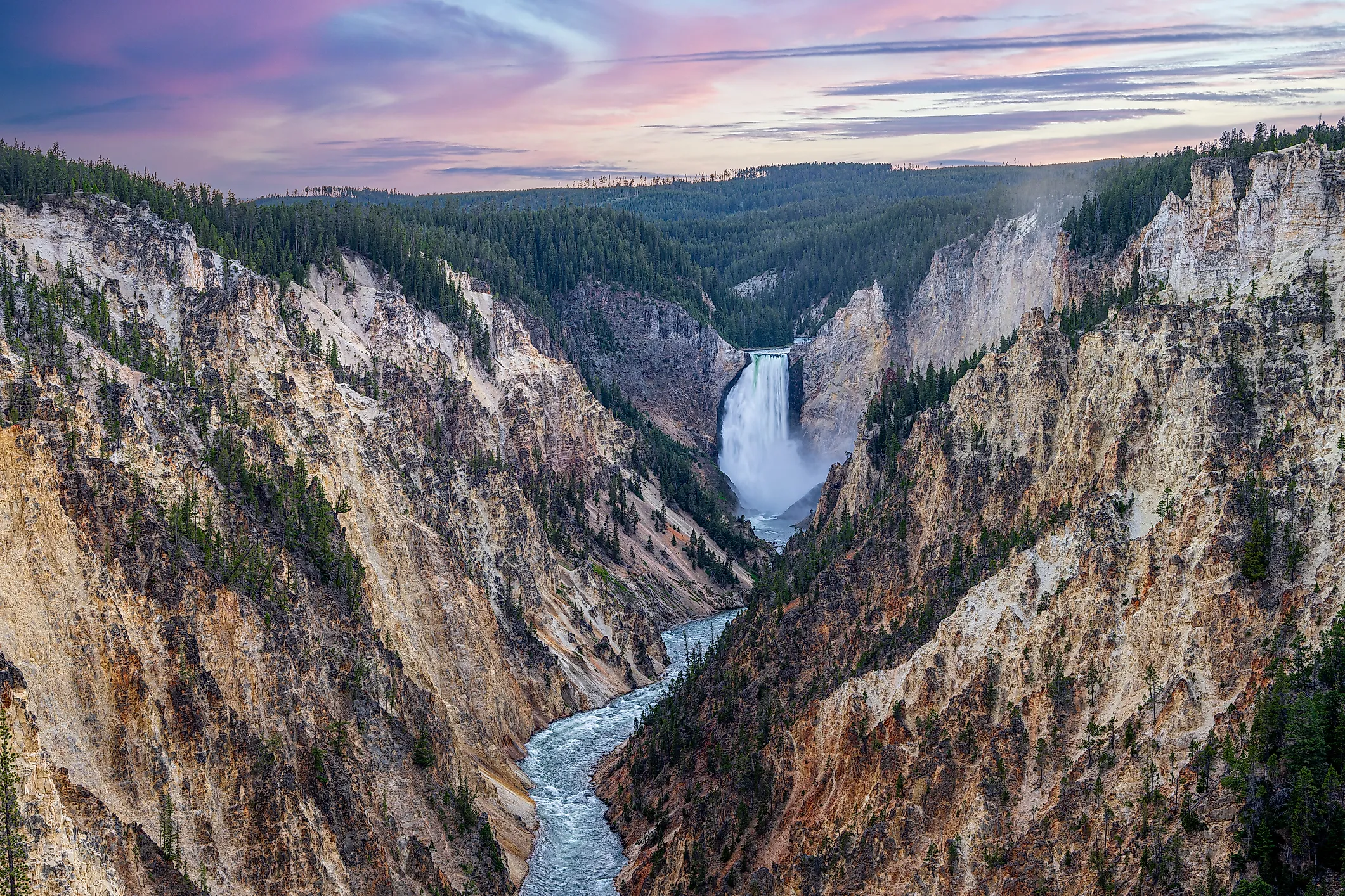
Farther downstream comes the spectacle that makes this stretch unforgettable. The Yellowstone tumbles 109 feet over Upper Falls, then drops another 308 feet at Lower Falls. Below the waterfalls, the river cuts through the Grand Canyon of the Yellowstone, which extends roughly 20 miles and reaches depths exceeding 1,000 feet. At Artist Point, visitors can watch the Lower Falls plunge between yellow, orange, and reddish canyon walls. The rocks owe much of their coloring to hydrothermal alteration, and the river continues eroding the canyon today.
The River Changes Completely After Leaving Yellowstone

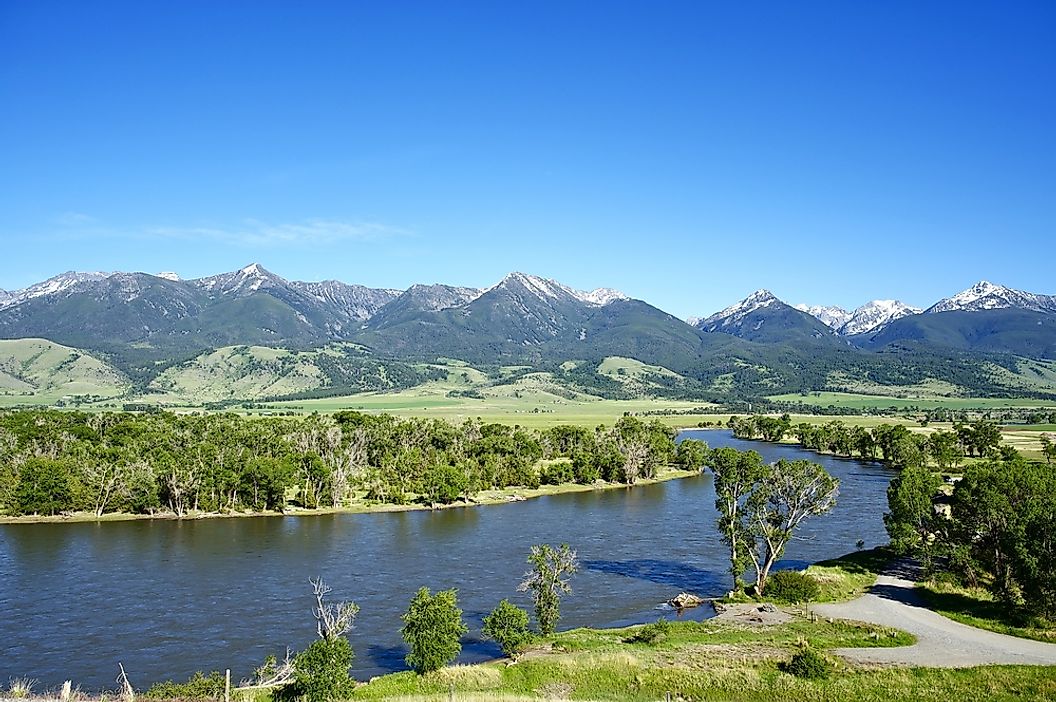
Outside the park, the Yellowstone enters Montana near Gardiner and passes through Paradise Valley, with the Absaroka Mountains rising to the east and the Gallatin Range to the west. This is one of Montana's celebrated fishing and floating destinations, where the river winds past ranchland beneath mountains that can remain snowcapped well into spring. Near Livingston, it begins leaving the narrow mountain landscape behind. Farther east, the Yellowstone passes through Billings and eventually crosses the open plains of eastern Montana, where broad bends and gravel bars replace the steep canyons of its upper course. It finally joins the Missouri River just beyond the North Dakota border. All this occurs without the chain of enormous reservoirs that interrupts so many other major rivers in the American West. Anglers, boaters, and wildlife watchers encounter very different stretches of the same river, and the landscape changes considerably over those 671 miles.
In 2022, The Yellowstone Broke a Historic Flood Record
The Yellowstone's ability to rise with seasonal runoff became painfully clear in June 2022. Heavy rain fell onto melting mountain snow, sending extraordinary amounts of water into the Yellowstone and its tributaries. At the USGS monitoring station near Corwin Springs, Montana, the river reached an estimated peak discharge of 54,700 cubic feet per second. That was more than four times the site's median annual snowmelt peak and the highest instantaneous discharge recorded there in more than a century of measurements.
The flood tore away sections of roads near Yellowstone National Park, damaged infrastructure, and forced the evacuation of visitors. In the northern part of the park, entire stretches of road disappeared as swollen rivers eroded their banks. The disaster showed just how much power the Yellowstone can carry when spring weather turns extreme. Its lack of major main-channel dams does not mean the river is untouched by development, but it does mean much of its natural seasonal variation remains visible along its course.
So Why Does This Undammed River Have a Dam?

Here's the surprising detail behind the Yellowstone's famous title. Near Intake, Montana, a structure known as the Intake Diversion Dam crosses the river. It was built to raise the water level enough to divert water into an irrigation canal serving farms in eastern Montana and western North Dakota. The dam and associated diversion works do not create the kind of enormous reservoir found on the Missouri or Colorado rivers, which helps explain why the Yellowstone retains its reputation as America's last major undammed river in the Lower 48.
But the structure has caused a serious problem for migrating fish. The endangered pallid sturgeon struggled to move upstream past the diversion. In 2022, federal agencies completed a 2.1-mile bypass channel designed to allow sturgeon and other native fish to travel around the barrier. The project was expected to provide access to an additional 165 miles of river habitat. Scientists continue monitoring the channel, while the Yellowstone remains free of major dams and reservoirs along its main course.
What Makes the Yellowstone Worth Protecting?

The Yellowstone supports wildlife far beyond the fish swimming in its waters. In the upper watershed, Yellowstone cutthroat trout provide food for grizzly bears, bald eagles, river otters, and other animals. During the spring spawning season, trout moving into streams around Yellowstone Lake become an especially important food source for bears. Ospreys also nest along the Grand Canyon of the Yellowstone, taking advantage of the river's fish populations.
For people, the river provides irrigation water, municipal water supplies, and some of Montana's most popular fishing and floating opportunities. Its watershed drains approximately one-third of Montana, according to the National Park Service. The Yellowstone's continued flow supports both wildlife habitat and communities that depend on its water, although tributary dams and irrigation withdrawals still influence its volume. Its status as the Lower 48's last major undammed river is remarkable precisely because so much of the surrounding region has been developed. A visitor watching the Yellowstone plunge over Lower Falls is seeing one of the country's great rivers well before it completes its long journey across Montana.