The Divided Sea Islands Of The World
- There are 16 islands in the world that are divided between two or more countries.
- Borneo is the only island in the world that is divided amongst 3 countries.
- Nova Zemlya Island/K Island is the newest divided island, formed naturally in the Black Sea in the early 2000s.
- Passport Island, shared by Saudi Arabia and Bahrain, is an artificial, man-made island.
- Kataja, shared by Finland and Sweden, was once two islands.
The world has an untold number of islands. Most of them belong to one country, though there are some that are divided between two or more countries. In some cases, the countries that share islands now because former colonial powers made border arrangements that carried on when their colonies achieved independence. The island of New Guinea, for example, used to be controlled by different colonial powers, which literally split the island in half. The border that they created became the border that now separates two independent countries. Sometimes, islands are divided amicably, as was the case with the Isla Grande de Tierra del Fuego. Other times, however, dividing islands can lead to conflict. The Caribbean island of St. Martin is a case in point. In other cases, islands like Nova Zemlya Island/K Island and Kataja are divided between countries purely for geographic reasons. There are a total of 16 divided sea islands in the world.
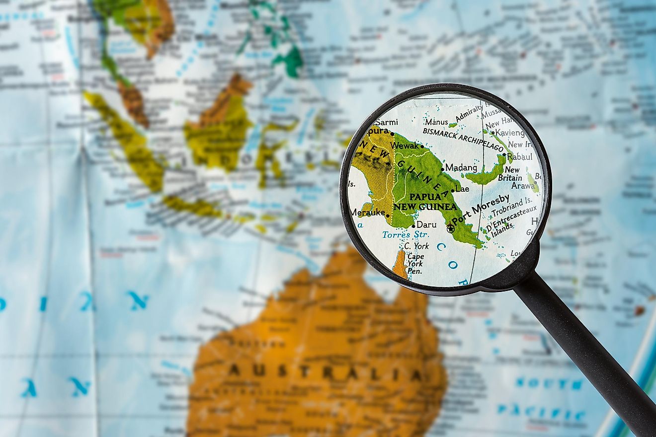
- New Guinea
- Borneo
- Ireland
- Hispaniola
- Tierra Del Fuego
- Timor
- Cyprus
- Dall Island
- Sebatik Island
- Usedom
- Saint Martin
- Kataja
- Passport Island
- Nova Zemlya Island/K Island
- Koiluoto
- Market
New Guinea - Indonesia/Papua New Guinea

New Guinea is divided between the countries of Indonesia and Papua New Guinea. The island was divided by the former colonial powers, the UK and the Netherlands. The Dutch controlled the west, while the British controlled the east. After World War II, Indonesia gained its independence, but the western part of New Guinea remained in Dutch hands. In 1963, however, Indonesia invaded the western part of the island and claimed it as its own. The eastern part of the island gained its independence in 1975 as the country of Papua New Guinea.
Borneo - Malaysia/Indonesia/Brunei

Borneo is shared by Malaysia, Indonesia, and Brunei. Indonesia controls the southern two-thirds of the island, while Malaysia controls the coastal north, except for the small territory belonging to Brunei. The southern two-thirds of the island once belonged to the Dutch East Indies, while the northern part was controlled by the British. In 1950, the Dutch East Indies gained independence as Indonesia, of which the southern part of the island became a part. In 1963, the British-controlled territory in northern Borneo became part of Malaysia, while the sultanate of Brunei gained its independence in 1984.
Ireland - Ireland/UK

The island of Ireland is currently divided between the Republic of Ireland in the south and Northern Ireland in the north. Northern Ireland is part of the United Kingdom. The island became divided in 1921, when the so-called Irish Free State was established in the southern four-fifths of the island. The remainder of the island, which came to be called Northern Ireland, remained under British rule. The Irish Free State became the Republic of Ireland in 1949.
Hispaniola - Haiti/Dominican Republic

Hispaniola is shared by Haiti and the Dominican Republic. Haiti controls the western part of the island, while the Dominican Republic controls the east. The island was formerly controlled by France and Spain, with the former controlling the west and the latter the east. Haiti gained independence from France in 1810, and controlled the entire island of Hispaniola, until a rebellion against Haitian rule took place in the formerly Spanish-ruled east, leading to the creation of the Dominican Republic in 1844.
Isla Grande de Tierra Del Fuego - Chile/Argentina

The Isla Grande de Tierra Del Fuego, literally meaning the large island of the land of fire, is situated in the extreme south of South America, and is separated from the South American mainland by the Strait of Magellan to its north. It is divided between the countries of Chile and Argentina, which agreed to partition the island amongst themselves in 1881.
Timor - East Timor/Indonesia

Timor is a small island in Southeast Asia. One part of the island is controlled by Indonesia, while the other is controlled by Timor-Leste (East Timor). The island was colonized in the 17th century, by both Portugal and the Netherlands. The Dutch controlled the western part of the island, while the Portuguese controlled the east. The Dutch part of the island became part of Indonesia upon its independence in 1949. After the Portuguese withdrew from its part of the island in 1975, Indonesian forces invaded it, triggering a decades-long rebellion by its people, which eventually led to its independence in 2002.
Cyprus - Cyprus/Turkey (disputed)

Cyprus is an island situated in the eastern Mediterranean Sea. The island gained independence from the UK in 1960. In 1974, a coup led by Greek nationalists who wanted to unite the island with Greece took place. Fearing for the sizeable Turkish minority in Cyprus, Turkey invaded and conquered the northern part of the island. Cyprus has remained divided ever since.
Dall Island - US/Canada (disputed)
Dall Island is a small island in the U.S. state of Alaska. It is situated on the northern side of the Dixon Entrance, a waterway separating Alaska from the Canadian province of British Columbia. The island is the subject of a maritime dispute between the U.S. and Canada. A Court of Arbitration was set up in 1903 to resolve the dispute, but the two countries still disagree on the exact border in the area.
Sebatik Island - Malaysia/Indonesia

Sebatik Island is a small island off the northeast coast of Borneo. Its northern half is controlled by Indonesia and its southern half is controlled by Malaysia. This division was formalized by the Anglo-Dutch Treaty of 1824. The UK and the Netherlands, the former colonial powers of Malaysia and Indonesia respectively, used this treaty to demarcate the border between their two colonies. But this treaty was vague as to where the specific border was, leading border disputes between Malaysia and Indonesia.
Usedom/Uznam - Germany/Poland

Usedom, as it is called in German, or Uznam, as it is referred to in Polish, is an island in the Baltic Sea. Germany controls the western part of the island, while Poland controls the east. Before World War II Germany controlled the entire island, but the eastern part was ceded to Poland after the war.
Saint Martin - France/Netherlands

Saint Martin is a small island in the Lesser Antilles, in the eastern Caribbean Sea. The island is shared by France and the Netherlands, who control the northern and southern halves respectively. In 1648, France and the Netherlands agreed to divide the island between themselves. There were border disputes, however, and control of the island changed hands between the two powers 16 times before the border dispute was finally resolved in 1817.
Kataja - Sweden/Finland

The island of Kataja is situated in the Gulf of Finland, and is divided between Finland and Sweden. At one time, Kataja was two islands, and the border between Finland and Sweden ran between them. But post-glacial rebound caused the land between the islands to rise relative to sea level, merging the two islands. As a result, today’s border passes through the now unified island.
Passport Island - Saudi Arabia/Bahrain
Passport Island is a small artificial island situated in the Persian Gulf between Saudi Arabia and the small island kingdom of Bahrain. The former controls the western side, while the latter controls the east. Passport Island was created during the construction of the King Fahd Causeway, the bridge that links Saudi Arabia and Bahrain by land.
Nova Zemlya Island/K Island - Ukraine/Romania
The island called Nova Zemlya in Ukrainian and K Island in Romanian, is one of the newest islands in the world. Situated in the Black Sea, the island began forming in the early 2000s. The island is 7 km long, but just 80 m wide. The border between Ukraine and Romania now runs through it.
Koiluoto - Russia/Finland
Koiluoto is a tiny offshore island that sits on the border between Russia and Finland. The island is uninhabited, as it is off limits to the general public in both countries.
Market - Sweden/Finland
The island of Market sits in the Aland Strait between the Swedish mainland and the island of Fasta Aland, in the Gulf of Bothnia, straddling the border between Sweden and Finland.


