Maps of The Netherlands

The Netherlands, often referred to as Holland, lies in Northwestern Europe. It shares borders with Germany to the east, Belgium to the south, and faces the North Sea to the north and west. The country encompasses a total area of approximately 41,865 km2 (16,164 mi2).
Three primary geographic regions form the Netherlands: The Lowlands, The Veluwe and Utrecht Hill Ridge, and The Limburg Hills.
The Lowlands: The most defining characteristic of the Dutch landscape is its flatness. The Lowlands, which cover the majority of the country, consist predominantly of flat terrain. Much of this region stands at or below sea level. As a result, over centuries, the Dutch have developed a complex system of dikes, polders, and pumping stations to keep the land dry and prevent it from being inundated by the sea.
The Veluwe and Utrecht Hill Ridge: In contrast to the extensive flat landscapes, the Veluwe and Utrecht Hill Ridge provide a slightly elevated relief. Located in the central part of the Netherlands, the Veluwe comprises forests, heathlands, and sand dunes. The Utrecht Hill Ridge, situated to the south of the Veluwe, consists of a ridge of low sandhills, offering a semblance of elevation in the otherwise flat landscape.
The Limburg Hills: In the southernmost province of Limburg, one encounters the Limburg Hills. This region presents undulating terrain and stands as one of the few hilly areas in the Netherlands. Its highest point, Vaalserberg, reaches a height of just 322 meters (1,058 feet) above sea level.
Bodies of Water: The North Sea borders the Netherlands to the north and west. The country's ports along the North Sea, especially the Port of Rotterdam, have historically been crucial for trade and commerce. Next, a saltwater inlet formerly-named the Zuiderzee, the IJsselmeer now stands as a large freshwater lake in the central Netherlands. The Afsluitdijk, a massive causeway built in the 1930s, separated the Zuiderzee from the North Sea, turning its saltwater into freshwater over time. The Ijsselmeer now serves as an essential freshwater reserve for the country. In regard to major rivers, three flow through the Netherlands: the Rhine, the Meuse (Maas), and the Scheldt. The Rhine enters the Netherlands from Germany and splits into several branches, with its most significant being the Waal. The Meuse, originating from France, flows through Belgium before entering the southern part of the Netherlands. Lastly, the Scheldt river, primarily in Belgium, has its estuary in the southwestern part of the Netherlands. These rivers, together with their tributaries and deltas, create a complex network that has historically facilitated trade, agriculture, and habitation. They also hold significance in shaping the country's system of water management due to the potential threat of flooding.
Provinces of The Netherlands Map

The Netherlands is divided into 12 administrative regions or provinces (provincies, singular - provincie). In alphabetical order, these provinces are: Drenthe, Flevoland, Fryslan (Friesland), Gelderland, Groningen, Limburg, Noord-Brabant (North Brabant), Noord-Holland (North Holland), Overijssel, Utrecht, Zeeland (Zealand) and Zuid-Holland (South Holland). These provinces are further subdivided into 355 municipalities (gemeenten). The three overseas special municipalities namely, Bonaire, Saba and Sint Eustatius in the Caribbean Netherlands, are not part of any province.
With more than 3.7 million people, the province of South Holland is the most densely populated province in Netherlands. Located in the western part of the country, in North Holland province is, Amsterdam – the capital and the most populous city of Netherlands. Amsterdam is the major cultural, commercial and economic hub of the country, with the Port of Amsterdam being the 5th largest port in Europe. Situated in the western part of the country, in South Holland province, The Hague is the administrative center of the country and houses the important government institutions of Netherlands, as well as the International Court of Justice.
Where is The Netherlands?

The Netherlands is a country located in Northwestern Europe. It is geographically positioned both in the Northern and Eastern hemispheres of the Earth. The Netherlands is bordered by Germany in the east; and Belgium in the south. It is bounded by the North Sea in the north and west. The Netherlands shares its maritime borders with UK and France.
Netherlands Bordering Countries: Belgium, Germany.
Regional Maps: Map of Europe
Outline Map of The Netherlands

The Netherlands is a sovereign country in northwest Europe. The outline map above represents the country. It can be downloaded, printed, and used for coloring or geography education.

The Netherlands is a country in northwestern Europe with a coastline on the North Sea to the north. The country occupies territory on mainland Europe as well as has several islands in the North Sea.
Key Facts
| Legal Name | Kingdom of the Netherlands |
|---|---|
| Flag |
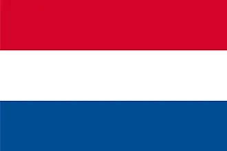
|
| Capital City | Amsterdam; note - The Hague is the seat of government |
| 52 21 N, 4 55 E | |
| Total Area | 41,543.00 km2 |
| Land Area | 33,893.00 km2 |
| Water Area | 7,650.00 km2 |
| Population | 17,332,850 |
| Major Cities |
|
| Currency | Euros (EUR) |
| GDP | $909.07 Billion |
| GDP Per Capita | $52,447.83 |
This page was last updated on August 21, 2023