Maps of Malaysia
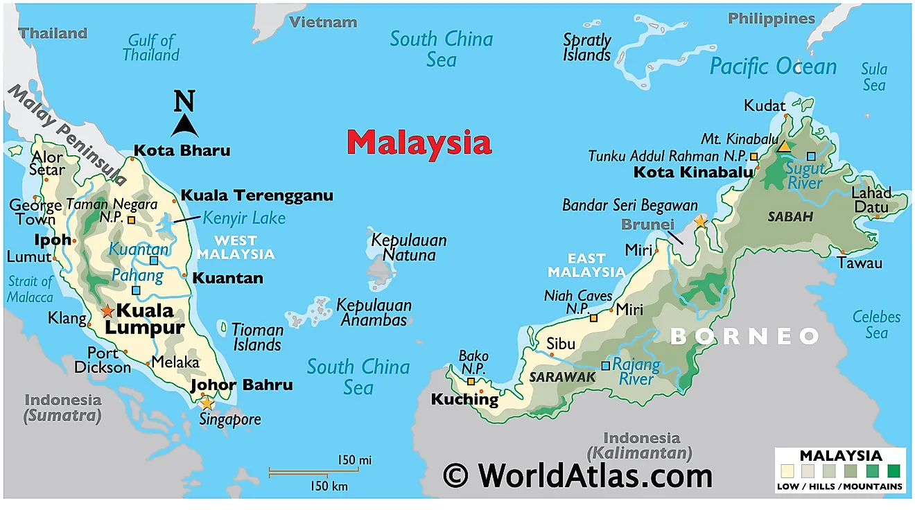
Malaysia occupies a strategic location in Southeast Asia, split between two regions - Peninsular Malaysia and East Malaysia. Peninsular Malaysia, to the west, shares borders with Thailand to the north and is situated to the south of the Vietnamese part of the Indochinese peninsula, while East Malaysia, to the east, borders Indonesia and Brunei on the island of Borneo. The South China Sea separates these two regions. The country's total area stands at approximately 330,803 km2 (127,720 mi2), encompassing both flatlands and rugged terrains. Furthermore, running along the peninsula are numerous caves, carved out by water eroding limestone, with the Mulu Caves in East Malaysia being one of the largest cave systems in the world. In general, the coastal plains of Malaysia rise gently into hills and mountains, all covered by dense rain forests.
Peninsular Malaysia constitutes the southernmost tip of the mainland Asian continent to the west of East Malaysia. This region mainly consists of the Malayan Mountain Range, running the length of the peninsula with the highest peak, Mount Tahan, reaching 2,187 m (7,175 ft) above sea level. The range primarily serves as a watershed, with rivers flowing into the Straits of Malacca to the west and the South China Sea to the east. The coastal plains adjacent to the Malacca Straits are wider and more fertile, supporting agriculture, while the eastern plains are narrower and less fertile.
East Malaysia consists of the northern part of the island of Borneo and includes the two states of Sabah and Sarawak. Sarawak has a diverse topography with swampy lowlands along the coast and hills inland, leading up to the rugged highlands towards the border with Indonesia. The highest peak in Sarawak, Mount Murud, measures 2,424 m (7,946 ft). Sabah, on the other hand, features the Crocker Range, where Mount Kinabalu, the highest peak in Malaysia and Southeast Asia, is located at a height of 4,095 m (13,435 ft).
Rivers and Lakes: Malaysia's major rivers predominantly run through the country's vast and fertile plains, providing essential water resources for agricultural, industrial, and residential use. The longest river in Peninsular Malaysia, the Pahang River, measures approximately 459 km (285 mi), while the longest river in East Malaysia, the Rajang River, spans about 563 km (351 mi). There are only two natural lakes within Malaysia's borders: Bera Lake and Tasik Chini. Created in 1985, Kenyir Lake is an artificial lake that is said to be the one of the largest (man-made) in the world, covering some 260 km2 (100 mi2).
Seas and straits: To the west of Peninsular Malaysia lies the Straits of Malacca, one of the most significant shipping lanes in the world. The South China Sea borders the east of the peninsula, while the Celebes Sea and the Sulu Sea border Sabah in East Malaysia.
Islands: The country also comprises many islands and archipelagos. Off the west coast of Peninsular Malaysia, one can find the Langkawi archipelago, composed of about 99 islands (an additional 5 bring the total to 104 during low tide). On the east coast, the islands of Redang, Perhentian, and Tioman are popular for their coral reefs and marine biodiversity. In East Malaysia, Labuan, a federal territory, is notable as an offshore financial center. Sipadan Island off the coast of Sabah, famous for its diving spots, forms part of the Coral Triangle. Regarding biodiversity, tuna spawn in the Coral Triangle and 75% of all coral species inhabit it: around 600 in total.
States and Federal Territories Map of Malaysia
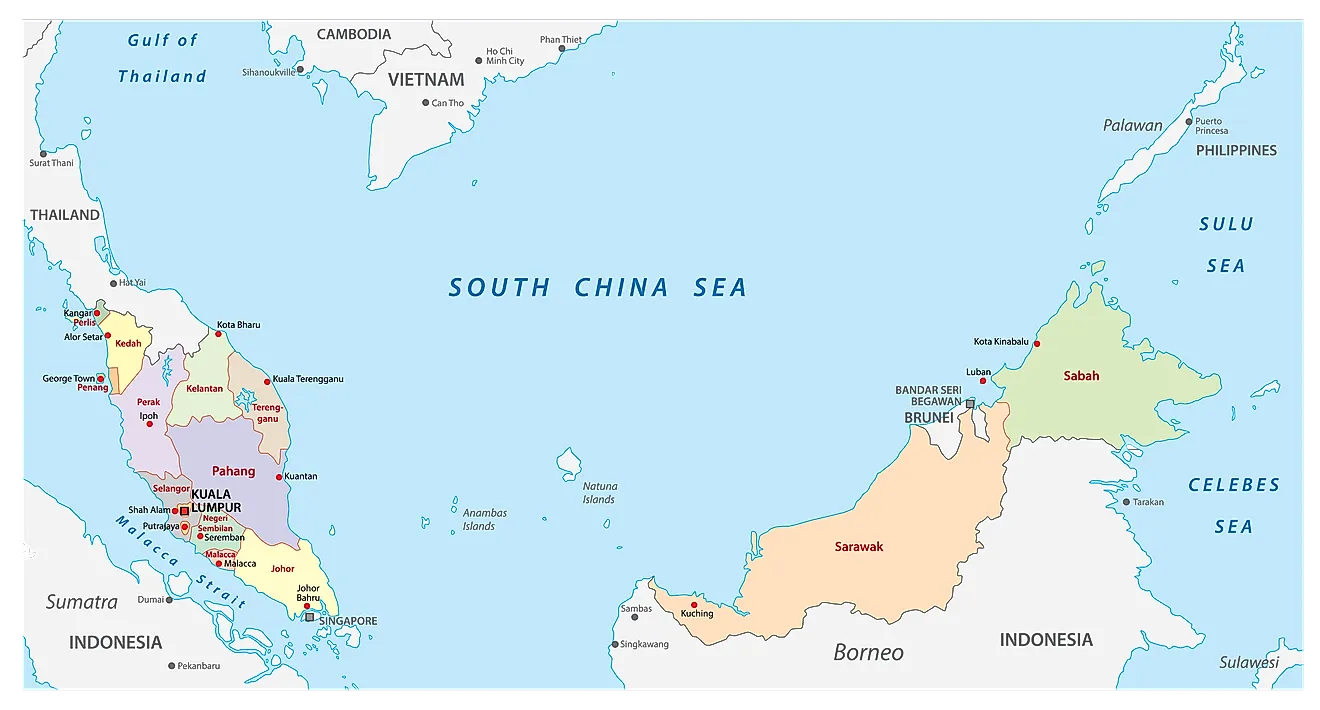
Malaysia is divided into 13 states (Negeri) and 3 federal territories (Wilayah Persekutuan). Out of these – 11 states and 2 federal territories are situated in West Malaysia; 2 states and 1 federal territory in Borneo Island (East Malaysia). In alphabetical order, the 13 states are: Johor, Kedah, Kelantan, Malacca, Negeri Sembilan, Pahang, Penang, Perak, Perlis, Sabah, Sarawak, Selangor and Terengganu. Kuala Lumpur, Labuan and Putrajaya are the federal territories in Malaysia. The states are further subdivided into districts and smaller subdivisions.
Located in the Klang Valley, Kuala Lumpur is the capital and the biggest city in Malaysia. Besides being, the cultural and economic center of Malaysia, Kuala Lumpur is also one of the top tourist destinations in the world.
Where is Malaysia?
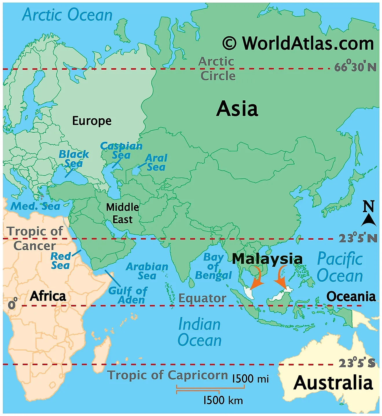
Malaysia is a Southeast Asian country located in the Northern and Eastern hemispheres of the Earth. The South China Sea separates Malaysia into two regions: Peninsular Malaysia (West Malaysia) and East Malaysia. Peninsular Malaysia is a part of mainland Southeast Asia and lies in the southern part of the Malay Peninsula, bordered by Thailand. The states of Sabah and Sarawak located on the northern edges of the Borneo Islands forms the East Malaysian region, and are bordered by Brunei and Indonesia. West Malaysia shares its maritime borders with Singapore, Indonesia and Vietnam, while East Malaysia shares it with Philippines and Vietnam.
Malaysia Bordering Countries: Brunei Darussalam, Indonesia, Thailand.
Regional Maps: Map of Asia
Outline Map of Malaysia
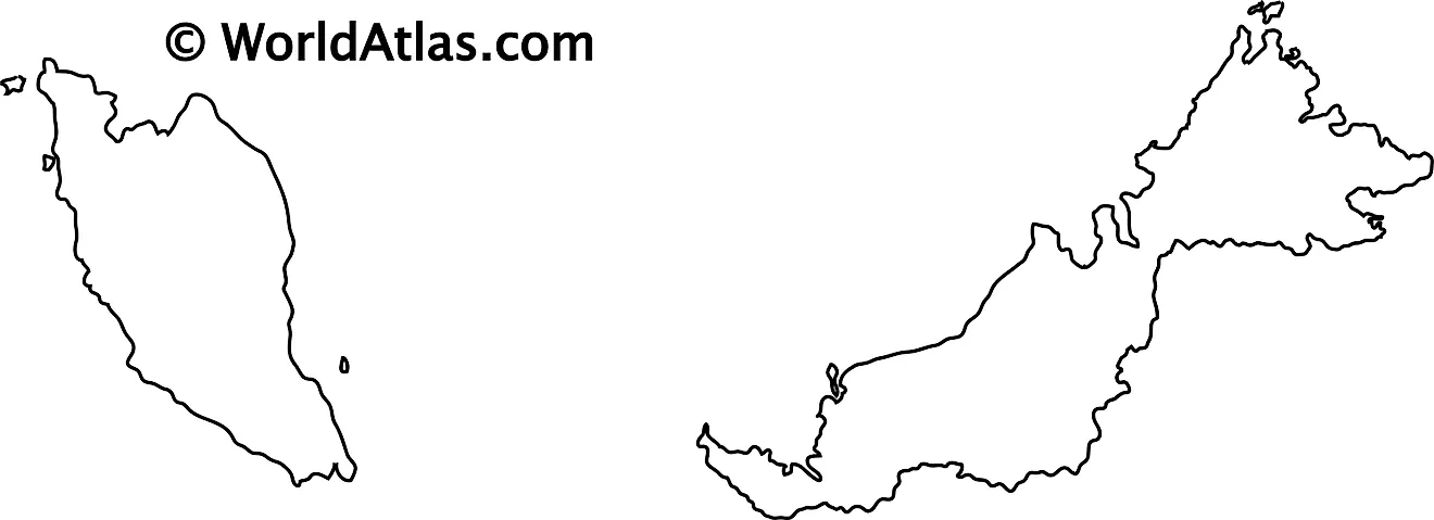
The above map represents the SoutheastAsian country of Malaysia with two major regions, Peninsular Malaysia (West Malaysia) and East Malaysia. The map can be downloaded, printed for free, and used for educational work like map-pointing activities.
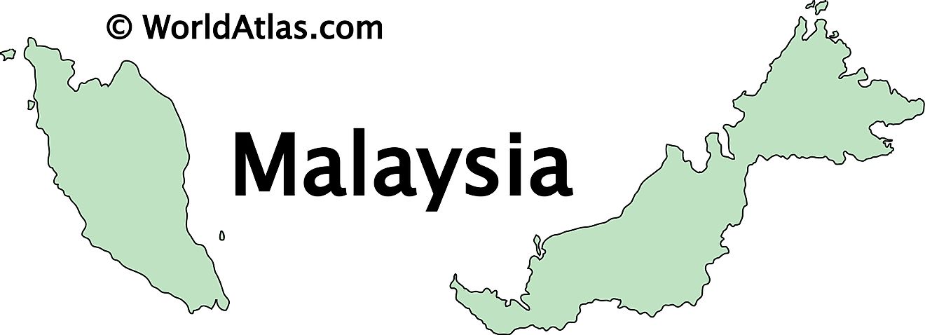
The above map represents Malyasia. The country is divided into two main regions. The peninsular Malaysia (on the left) and insular Malaysia (on the right). The latter is part of the island of Borneo.
Key Facts
| Legal Name | Malaysia |
|---|---|
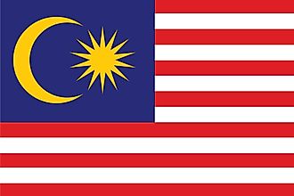
| Flag |
|
| Capital City | Kuala Lumpur; note - nearby Putrajaya is referred to as a federal government administrative center but not the capital; Parliament meets in Kuala Lumpur |
| 3 10 N, 101 42 E | |
| Total Area | 329,847.00 km2 |
| Land Area | 328,657.00 km2 |
| Water Area | 1,190.00 km2 |
| Population | 31,949,777 |
| Major Cities |
|
| Currency | Ringgits (MYR) |
| GDP | $364.70 Billion |
| GDP Per Capita | $11,414.84 |
This page was last updated on July 13, 2023
