Maps of Germany

Germany, situated in Central Europe, covers a total area of approximately 357,022 km2 (about 137,847 mi2). This country shares its borders with nine countries: Denmark to the north, Poland and the Czech Republic to the east, Austria and Switzerland to the south, and France, Luxembourg, Belgium, and the Netherlands to the west. The Baltic Sea and the North Sea form the northern maritime borders.
The geography of Germany generally consists of four regions: the North German Plain, the Central Uplands, the Southern German Scarplands, and the Bavarian Alps.The North German Plain is a flat, low-lying area that extends from the country's northern coastline to as far south as the foothills of the Central Uplands; it is a small segment of the North European Plain. The region displays a range of terrain, from sandy beaches and marshlands along the coast to fertile farmlands more centrally located. The North German Plain also incorporates major urban centers, including Hamburg and Berlin.
The Central Uplands: To the south of the North German Plain lies the Central Uplands, which are essentially a collection of several low mountain ranges. The Harz Mountains, the Thuringian Forest, the Black Forest, the Ore Mountains, and the Schwäbische Alb are among the most notable features of this region. The Central Uplands offer an undulating terrain, interspersed with forests, valleys, and rivers. The region forms a watershed divide between the major river systems of Germany, namely the Rhine and Elbe.
The Southern German Scarplands, which encompass the Swabian and Franconian Jura, as well as the Bavarian Plateau, occupy the region south of the Central Uplands. This geographical region, featuring Jurassic limestone plateaus, is characterized by its stepped topography, rolling hills, and extensive forests.
The Bavarian Alps: On the extreme southern edge of the country lie the Bavarian Alps, part of the greater European Alps range. The Zugspitze, the highest peak in Germany at 2,962 meters (about 9,718 feet), resides here. These mountains, renowned for their snow-covered peaks and glacial valleys, are a significant part of Germany's geographical profile.
Bodies of Water: The North Sea and the Baltic Seas, connected by the Kiel Canal, serve as important waterways for international shipping in and around Germany. In the interior, Lake Constance is the largest freshwater lake, bordering Germany, Austria, and Switzerland. Lake Müritz is another notable body of water, being the largest lake entirely within Germany's borders.
Rivers: The most substantial rivers in Germany are the Rhine, the Elbe, and the Danube. The Rhine, the longest river in Germany, originates in the Swiss Alps and meanders northwards, and the upper Rhine portion forms a natural border with France before flowing through western Germany and into the North Sea. The Elbe, flowing from the Czech Republic through eastern Germany, also empties into the North Sea. The Danube, the second-longest river in Europe, rises in the Black Forest of southwest Germany and flows eastwards across multiple countries before reaching the Black Sea.
Islands: Germany is also home to a collection of islands, mostly found in the North and Baltic Seas. The largest of these are Sylt, Rügen, and Usedom. Sylt, a part of the North Frisian Islands, is known for its long sandy beaches. Rügen and Usedom, situated in the Baltic Sea, feature popular beach resorts and nature reserves.
States of Germany

Germany (officially, the Federal Republic of Germany) is divided into 16 states (Lander, sing. Land) [commonly, referred to as Bundeslander (federal states)]. In alphabetical order, the states are: Baden-Wuerttemberg, Bayern (Bavaria), Berlin, Brandenburg, Bremen, Hamburg, Hessen (Hesse), Mecklenburg-Vorpommern (Mecklenburg-Western Pomerania), Niedersachsen (Lower Saxony), Nordrhein-Westfalen (North Rhine – Westphalia), Rheinland-Pfalz (Rhineland-Palatinate), Saarland, Sachsen (Saxony), Sachsen-Anhalt (Saxony-Anhalt), Schleswig-Holstein and Thueringen (Thuringia).
The states are further divided into 401 administrative districts, of which there are 294 rural districts (Kreise) and 107 urban districts (Kreisfreie Stadte).
[Note: Bayern, Sachsen and Thueringen refer to themselves as Free states (Freistaaten, sing. Freistaat), while Bremen calls itself a Free Hanseatic City (Freie Hansestadt) and Hamburg considers itself a Free and Hanseatic City (Freie und Hansestadt)]
With an area of 357,022 sq. km, Germany is the 7th largest country in Europe. It is also the 2nd most populous country in Europe and the most populous member-state of EU. Located in north eastern Germany, in the east of Elbe River is, Berlin – the capital and the largest city of Germany. It is also the most populous city of EU. The city of Frankfurt is the financial center of the country, while the city of Ruhr is the largest urban area in Germany.
Where is Germany?

Germany is located in central Europe. It is positioned both in the Northern and Eastern hemispheres of the Earth. Germany is bordered by 9 countries: by Denmark in the north; by Poland and Czech Republic in the east; by Austria in the southeast; by Switzerland in the southwest; by France, Luxembourg and Belgium in the west; and by Netherlands in the northwest. Germany is bounded by the North Sea in the northwest and by the Baltic Sea in the northeast.
Germany Bordering Countries: The Netherlands, Belgium, Switzerland, Denmark, Austria, The Czech Republic, Luxembourg, Poland.
Regional Maps: Map of Europe
Outline Map of Germany

The above blank map represents Germany, a country located in Central Europe.The above map can be downloaded, printed and used for educational purposes like map-pointing activities and coloring.

The above outline map represents Germany, a Central European country. Covering an area of 357, 022 sq. km, it is the 7th largest country in Europe. Germany is also the 2nd most populous country in Europe and the most populous member-state of EU.
Key Facts
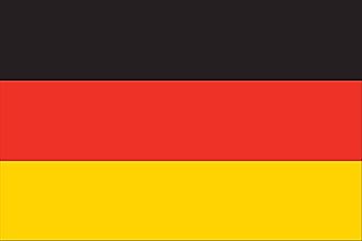
| Legal Name | Federal Republic of Germany |
|---|---|
| Flag |
|
| Capital City | Berlin |
| 52 31 N, 13 24 E | |
| Total Area | 357,022.00 km2 |
| Land Area | 348,672.00 km2 |
| Water Area | 8,350.00 km2 |
| Population | 83,132,799 |
| Major Cities |
|
| Currency | Euros (EUR) |
| GDP | $3.85 Trillion |
| GDP Per Capita | $46,258.88 |
This page was last updated on August 4, 2023