Wyoming Is Home To The Most Mountainous County In America
Singling out the most mountainous county in America takes us not to the Denali Borough of Alaska (home to the nation's highest mountain), nor the rarified air of many Colorado counties, but rather, to the peak-riddled swaths of western Wyoming.
According to PeakVisor, Fremont County, Wyoming, has 319 named mountains, setting it head and shoulders above the rest of the country. With that said, its neighbor, Teton County, sports 277 identified peaks in an area less than half the size of Fremont County. This difference in density of peaks, therefore, certainly shifts subjective impressions.
In terms of the raw number of peaks within a set county, none outrank Fremont, Wyoming. However, as you drift from the Wind River Mountains along its western border and into the rolling plains of central Wyoming, this statistical fact might feel less palpable.
From an experiential standpoint, much of Teton County will appear more mountainous. Let's first roam the ranges of Fremont, but then set our sights on the Tetons, so that we can better comprehend the scale of America's most mountainous counties.
Key Facts From Fremont County, WY

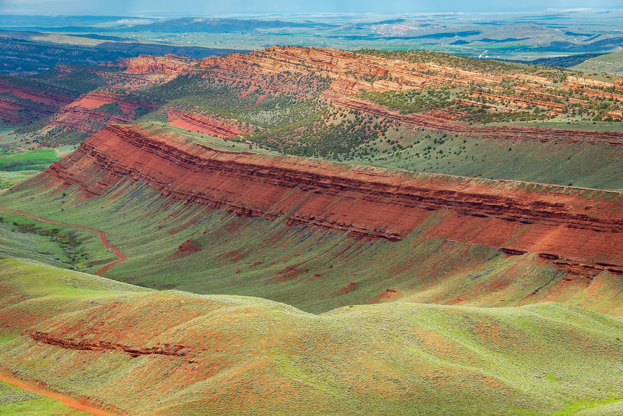
Fremont County sprawls far and wide across west-central Wyoming. According to the U.S. Census Bureau, it has a land area of 9,183 square miles, making it the second-largest county in Wyoming. The Owl Creek Mountains sweep across the north of Fremont County, whereas its western boundary is largely flanked by the Wind River Mountains — both subranges of the Rocky Mountains.
Fremont County is also bordered by eight other Wyoming Counties. Starting in the north-central region (i.e. 12 o'clock) and proceeding clockwise it goes: Hot Springs, Washakie, Natrona, Carbon, Sweetwater, Sublette, Teton, and Park. We'll visit three of these exceptionally mountainous counties later in the article.
As of the July 1st, 2025 Census Bureau estimate, Fremont County holds a population of 39,464. Its county seat is the city of Lander, while its most populous city, with 10,910 residents, is the city of Riverton. With an area of 3,438 square miles and a population of 12,500 (3,900 Eastern Shoshone and 8,600 Northern Arapaho), the Wind River Reservation constitutes a significant part of Fremont County.
Mountains of Wyoming's Fremont County

The Wind River range forms an integral part of the Rocky Mountains and the Continental Divide. Its craggy, 100-mile spine is home to many of Wyoming's highest mountains, including the outright apex: Gannett Peak. Named after Henry Gannett of the USGS and National Geographic Society, this 13,810-foot summit was first ascended in 1922 by Arthur Tate and Floyd Stahlnaker.
Along with the strenuous altitude, Gannett Peak is a technically challenging mountain to climb, even today.
The Owl Creek Mountains constitute another of Fremont County's Rocky Mountain subranges. Topping out at 9,665 feet, this short, east-west range exists entirely within Wind River Reservation and intersects the southern terminus of the Absaroka Range.
All told, there are 319 named peaks throughout Wyoming's Fremont County. The majority of these lie in the western, Wind River range portion of the county. But the topography of the north and southern reaches is still distinct and significant.
In terms of everyday outdoor recreation, Fremont County is notable for its chunk of Shoshone National Forest. This 2.4-million-acre beauty was America's first national forest. Today, it harbors 1,300 miles of trails, 32 campgrounds, four scenic byways, and epic views in all directions — from the glaciers of the Absaroka Range to the wildflower accents in the winding valleys below.
The Mountainscape of Teton County

Teton County boasts 277 named mountains, but with a land total area of 3,997 square miles — well under half of Fremont County — those eye-catching peaks are much more concentrated. The Absaroka Range divides eastern Teton County from northwestern Fremont County, but it is the iconic Teton Range to the west that turns the most heads, or should I say, tilts the most heads.
The highest peak within this pointy, youthful range, but also Teton County as a whole, is Grand Teton at 13,775 feet.
Using the county seat/resort town of Jackson as a base, Teton County introduces all-comers, first and foremost, to Grand Teton National Park, but also some of Yellowstone National Park's most famous attractions, including Old Faithful, Morning Glory Pool, Grand Prismatic Spring, and Yellowstone Lake.
Teton County is also famous for its three ski resorts: Grand Targhee, Jackson Hole, and Snow King. So whether you linger in the snow-covered peaks of the south, or venture to the steaming vents in the foothills of the north, Teton County readily showcases its underlying tectonic activity.
Neighboring Mountainous Counties

Along with the one-two punch of Wyoming's Fremont and Teton Counties, together totalling nearly 600 identified mountains, two other neighboring counties have plentiful prominences of their own.
Park County, in the northwest corner of Wyoming has 271 named peaks, primarily belonging to the Absaroka Range. West of Fremont County and southeast of Teton County, Sublette County contributes another 244 mountains to the region, thanks in large part to the Wyoming and Wind River Ranges.
Moving Mountains
Alaska has the highest mountain in America, and Colorado consistently covers the highest-elevation populated regions, but Wyoming tops the charts in terms of most mountainous counties. This wild, minimally-populated state is adorned with multiple Rocky Mountain extensions.
Not just lumbering masses, impressive as those may be, but contrastingly jagged peaks. These mountains, so prominent, yet approachable in terms of their base elevations, move us to create, to climb, and to carve out vacations deep in the heartland.
In terms of the amount of mountains, Fremont County takes the crown with 319 peaks. However, you might find that the condensed Teton County feels more mountainous. Thankfully, these two counties are neighbors, so you don't really have to choose.