8 Most Breathtaking Towns In Arizona
Arizona's most breathtaking towns offer more than sunshine and a postcard view. Sedona rises beneath Devil's Bridge while Jerome clings to the hillside above the Douglas Mansion. Page opens onto Antelope Canyon, Williams sends trains to the Grand Canyon, and Prescott keeps its frontier spirit alive on Whiskey Row. Bisbee climbs through the stairways of the Bisbee 1000 while Patagonia follows Sonoita Creek, and Cottonwood meets the Verde River. These towns carry travelers from the red-rock desert to the pine-covered high country in just a few hours.
Sedona

Devil's Bridge, the largest natural sandstone arch in the Sedona area, sits northwest of town off Dry Creek Road. The walk to it runs roughly four miles round trip from the lower lot on Dry Creek, or under two miles for anyone with a high-clearance vehicle who can reach the upper trailhead. Hikers can step out onto the top of the span itself, which is the reason the trail fills before seven in the morning most days. Keyhole Cave is the harder option, a 2.1-mile route that leaves Teacup Trail at the Sugarloaf trailhead and becomes an unmarked path partway up. Getting inside the cave means a 30-foot Class III climb onto a ledge, so the route is one to do with a partner.
Ambiente sits along State Route 89A in West Sedona, an adults-only hotel of 40 freestanding glass-walled suites raised on pillars, with the Adobe Jack trailhead at its edge and the Velvet Spa on the grounds. Its restaurant, Forty1, was the 41st structure built on the property and serves modern American plates beside the pool. Some of the art in the suites and common rooms comes from Exposures International Gallery of Fine Art.
Page

Glen Canyon Dam stands just outside Page, rising 710 feet above bedrock and running 1,560 feet across the canyon, which makes it the second-highest concrete arch dam in the country behind Hoover Dam. Water backed up behind it forms Lake Powell, and the Carl Hayden Visitor Center on the rim looks down on the Colorado River below the wall and out over the reservoir above it. The Glen Canyon National Recreation Area spreads out in both directions with trails and side canyons that take a full day to sample. Biidi the Arch sits inside the city limits behind the Big Lake Trading Post on Coppermine Road. Locals called the wind-carved sandstone alcove the Sand Cave for years before mapping services picked up the current name. Reaching it takes a short scramble up loose sand instead of a permit or a guide.
Antelope Canyon lies east of town inside the LeChee Chapter of the Navajo Nation, but no section of it is open to unguided visitors. Navajo Parks and Recreation charges a $15 entry fee per person per day at each location, and an authorized Navajo tour is a separate cost on top of that, so the tours sell out weeks in advance in summer. Back in town, the Grandview Inn is a three-room bed and breakfast on Grandview Street, a few minutes on foot from the Grandview Overlook. Breakfast runs between 7 and 9 a.m., and the menu rotates: chilaquiles one morning, blueberry pancakes the next.
Jerome

Copper baron James Douglas built his mansion above the Little Daisy Mine in 1916, and the house is now the centerpiece of Jerome State Historic Park, where photographs, mine carts, assay equipment, and period rooms explain how Jerome went from a mining camp of 15,000 to a town of a few hundred. The porch looks straight down the Verde Valley toward the red rocks. Douglas put up a Spanish Colonial Revival hotel two years later to house the Little Daisy miners. That building has come back as the Little Daisy Jerome, a private estate now rented out for weddings, retreats, and milestone parties.
The Clinkscale occupies a Main Street building finished in 1899, a year after fire took the previous one. Its ground floor held a mercantile long before the current restaurant and bar moved in. Six guest rooms sit upstairs, and brunch, lunch, and dinner run downstairs. A short walk along Main leads to Firefly, a small gallery of pottery, glass, metal sculpture, and jewelry made largely by artists working in the area.
Bisbee

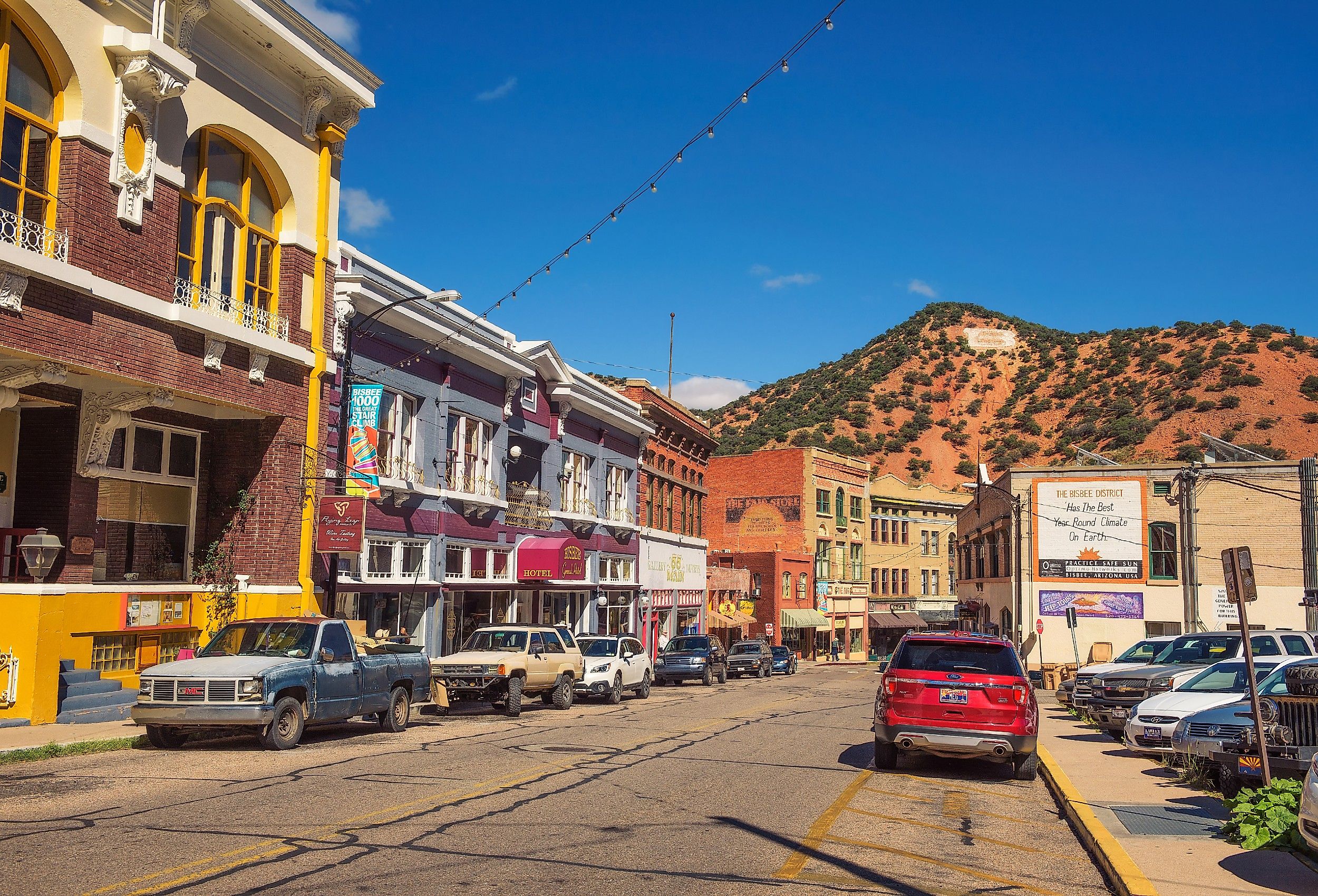
Nine public staircases climb the hillsides of Old Bisbee, and together they carry more than 1,000 concrete steps that follow the mule paths worn into the slope during the copper years. Every October, the town strings them together into the Bisbee 1000, a 4.5-mile course that starts and finishes on Tombstone Canyon Road and can be run hard or walked at a conversational pace. The rest of the year, the stairs are simply how people get home. The Bisbee Mining and Historical Museum downtown holds the photographs, tools, ore samples, and mine carts from that era. Its staff also runs walking tours of the district.
The Jonquil Motel keeps a handful of rooms behind a roadside sign of the same vintage, welcomes dogs, and rents its backyard for small weddings and parties. Café Roka has been serving New American cooking on Main Street since 1992, inside a building with its art deco detail intact, and a jazz trio plays there on Friday nights. Reservations are worth making; the dining room is small, and the town is not.
Williams

Trains have left Williams for the South Rim of the Grand Canyon since 1901, and the Grand Canyon Railway still runs the 64-mile route daily through grassland and ponderosa forest in about two hours each way. The depot sits at the center of town, roughly 33 miles west of Flagstaff. Across the tracks, the Grand Canyon Railway Hotel keeps an indoor pool, a hot tub, and a fitness center, plus two places to eat off the lobby: the Fred Harvey Restaurant and Spenser's Pub.
Williams was the last town on Route 66 to be bypassed by Interstate 40 in October 1984, and the old road is still the main street. The Sultana Bar has held its spot on that stretch for generations. Inside, it is wood-paneled and tin-ceilinged and hung with animal trophies. Live music plays on weekend nights, and a local troupe stages an Old West gunfight out front most evenings. South of downtown at the end of Sixth Street, Buckskinner Park has picnic ramadas, grills, volleyball and basketball courts, and trailhead access toward Bill Williams Mountain. The City Reservoir beside it is stocked with rainbow trout, channel catfish, and sunfish, and only electric motors are allowed on the water.
Prescott

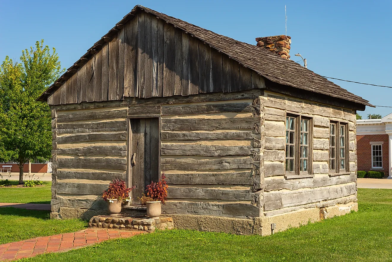
The log Territorial Governor's Mansion of 1864 still stands on its original site, a couple of blocks west of the courthouse plaza. Nearby is the Sharlot Hall Museum, whose four-acre campus holds eleven exhibit buildings. The Territorial Women's Memorial Rose Garden on the same grounds honors more than 400 pioneer and Native women who lived in Arizona during the territorial years. Sharlot Hall herself was territorial historian, the first woman to draw a salary in Prescott's territorial government, and the museum grew out of her own collection. About four miles west of downtown, the Thumb Butte area adds hiking, mountain biking, horseback riding, and day-use picnic sites under the ponderosas.
Whiskey Row runs one block along Montezuma Street opposite the plaza, and its saloons, hotels, and galleries all date from the rebuild that followed the 1900 fire. The Hotel St. Michael has stood at the north end of the row since 1901. Wild West-themed rooms fill the upper floors, leather couches and a piano fill the Lobby Bar, and the Fire and Sword speakeasy sits below, where the original brick and restored copper ceilings are the point. A speakeasy operated in that space under several names for more than a century, Prohibition included. Live music runs Thursday through Saturday.
Patagonia

The Nature Conservancy's Patagonia-Sonoita Creek Preserve protects one of the last stands of riparian cottonwood and willow forest in southern Arizona, and its trails start a mile from the middle of Patagonia. A one-mile nature trail links the preserve to the Tucson Audubon Society's Paton Center for Hummingbirds, where feeders and native plantings have drawn more than 200 bird species and where the folding chairs are open to anyone. The town sits about 18 miles northeast of Nogales on State Route 82, at just over 4,000 feet. The Patagonia Museum keeps the photographs, records, and artifacts of eastern Santa Cruz County inside the original 1914 elementary school. It opens Thursday through Saturday afternoons or by appointment.
Downtown covers a few walkable blocks, and Patagonia Lumber Co. pours local craft beer there, with local musicians on the small stage and food trucks parked in the yard. On the second full weekend of October, Town Park fills with the Fall Festival: more than 120 artisans, food and wine vendors, live music under the cottonwoods, a library book sale, and the fire department barbecue. The weekend draws upward of 15,000 people to a town of fewer than 1,000.
Cottonwood

North Main Street in Old Town Cottonwood carries more than a dozen tasting rooms inside a few hundred feet, and the Arizona Stronghold Vineyards room at 1023 North Main is one of the older ones, pouring wines made from fruit grown near Willcox in Cochise County. Flights come with skewers and small plates, and there is a garden patio out back. The town sits in the middle of the Verde Valley between Sedona and Prescott, which puts the red rocks on one horizon and the Black Hills on the other.
The Verde River Greenway State Natural Area protects the riverbank on the far side of Old Town, a Fremont cottonwood and Goodding willow gallery forest of a kind that survives in only a handful of places in Arizona. The short Jail Trail drops to it from the north end of Main Street, and longer routes run out from Dead Horse Ranch State Park. Nearby on Mabery Ranch Road, the Blazin' M Ranch opens its frontier town at five in the evening, Wednesday through Sunday, and rings the dinner bell at half past six, with a Western music show following at half past seven. The ranch closes for the month of January. Golfers have Coyote Trails at the base of Mingus Mountain, a nine-hole par-33 course with a driving range on elevated tees.
Breathtaking Adventure in the Grand Canyon State
These breathtaking towns found throughout Arizona offer travelers unique geological features, well-preserved Wild West history, and enchanting communities with lively downtowns. Cottonwood and Patagonia are glorious natural paradises; Sedona is an alluring resort town; and Prescott's Whiskey Row knows how to keep the party going for the night and the weekend. These gorgeous towns in the "Grand Canyon State" know how to attract people from far and wide to experience Western nostalgia and the most iconic natural desert attractions found in America.