2026's 11 Most Scenic Pacific Coast Towns
Near one town along the Oregon coast, the Pacific appears to drain through a hole in the volcanic rock before surging back out. Farther north, a white-balconied hotel dating to 1886 stands above a harbor crowded with boats and surrounded by forested islands. Down in California, sand dunes that can reach 100 feet high roll across miles south of a notable surfing spot. We'll travel through the western coast of the contiguous US, from Washington's island communities, down through Oregon, and all the way into Southern California. That includes offshore towns as well as coastal ones on the mainland. In 2026, these 11 small towns stand out for scenery that could only belong to this particular stretch of the continent.
Roche Harbor, Washington

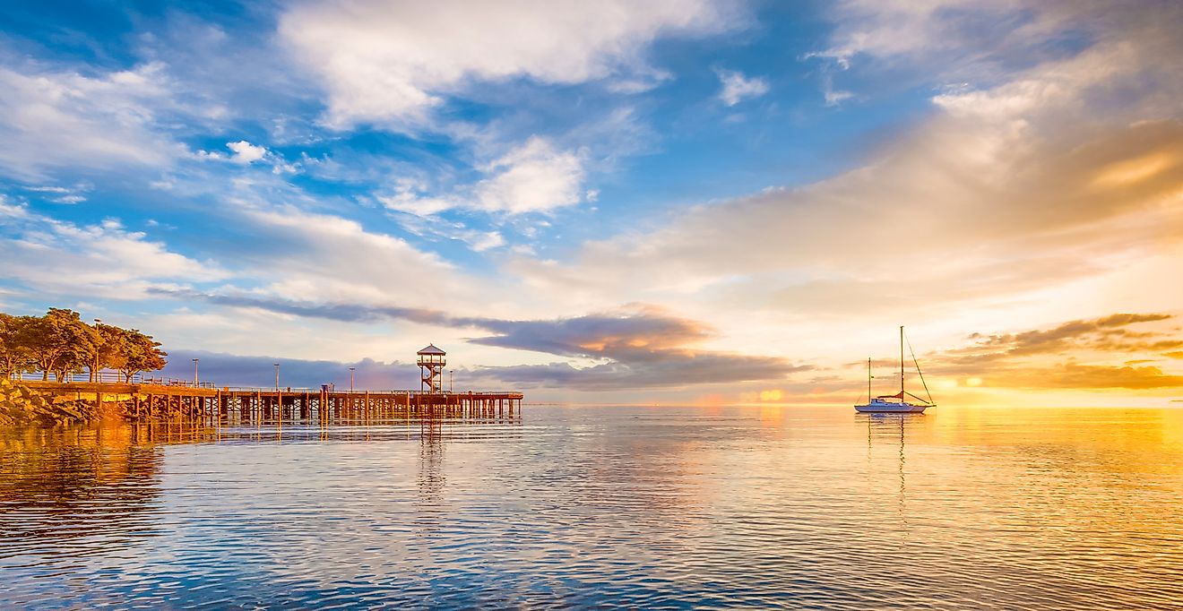
Roche Harbor starts the coast at almost the Canadian border, where the scenery is less about open-ocean surf than the maze of land and water around the San Juan Islands. The harbor itself is enclosed by San Juan, Pearl, and Henry Islands, with the 425-slip marina filling much of the protected water. Above it stands the white-balconied Hotel de Haro, built in 1886 and surrounded by formal gardens that flower from March through October. Just behind the waterfront, the San Juan Islands Sculpture Park spreads more than 150 creations across 20 acres. This includes sculptures of frogs and dragons, as well as abstract art amongst the trees. The strangest scene is deeper in the woods. Afterglow Vista consists of a limestone table and six stone chairs enclosed by an open ring of limestone columns. Built in 1936 for Roche Harbor Lime Company founder John S. McMillin, the mausoleum represents his family gathered around the dinner table after death, with their ashes interred beneath the chairs. The pale stone monument, surrounded by tall evergreens, gives Roche Harbor a visual unlike anything along the open beaches farther south.
La Push, Washington

La Push is farther west than any other inhabited community in the contiguous United States, sitting at the mouth of the Quillayute River with the open Pacific beyond it. At First Beach, forested James Island stands offshore, while the north end of the beach is a Whale Trail site where gray whales and orcas are commonly seen. Much of the surrounding coastline is part of Olympic National Park, which ranked ninth among America's busiest 63 National Parks with 3.58 million visits in 2025. Along Olympic's wilderness coast, dense forest ends at beaches covered with enormous drift logs and sea stacks. The crowds ease considerably outside summer, with October bringing another viewable gray whale migration along this coast. A 0.7-mile forest trail reaches Second Beach, where bald eagles and seals are also regularly spotted around the sea stacks. Across the river, Rialto Beach has a pebble shoreline leading 1.5 miles north to the sea-carved Hole-in-the-Wall.
Cannon Beach, Oregon

Haystack Rock is so closely associated with Cannon Beach that the 235-foot sea stack has become part of the town's identity. At low tide, the protected Marine Garden around Haystack's base exposes pools containing purple and orange sea stars, green anemones, crabs, and other intertidal life. Through October 2026, the Haystack Rock Awareness Program stations interpreters here during daytime low tides, with scopes for viewing the seabirds nesting higher on the rock. Several miles north, Ecola State Park extends across nine miles of coastline around Tillamook Head, where Sitka spruce forest reaches the bluffs above the Pacific and viewpoints look south across Cannon Beach and its offshore formations. Within the park, Indian Beach sits in a cove below Tillamook Head, with tide pools among the exposed rocks and Tillamook Rock Lighthouse visible offshore.
Yachats, Oregon

The 804 Trail follows the edge of Yachats (pronounced 'Ya-hoots') for nearly two miles, passing tide pools and pebbled coves before reaching a long sandy beach north of town. Yachats State Recreation Area adds an accessible viewing platform above the mouth of the Yachats River, plus a steep path to the rocky intertidal area that's accessible when the tide is low. Three miles south, Cape Perpetua reaches roughly 800 feet above the Pacific. Below it, Thor's Well is a roughly 20-foot-deep opening thought to have formed when the roof of a sea cave collapsed. Seawater surges into the opening from below, sometimes spraying above the rocks, before water washing across the surface pours back into it, creating the illusion of a hole swallowing the Pacific. The nearby Spouting Horn produces almost the opposite effect. Here, the waves rush into a sea cave at Cook's Chasm and compress the water and air inside, forcing a plume of seawater upward through an opening in the rock.
Bandon, Oregon

Cat and Kittens, Elephant Rock, Table Rock, Cathedral Rock, and Face Rock are not nicknames for hiking trails. They are some of the enormous sea stacks scattered just offshore from Bandon, many isolated by water at high tide and protected as part of the Oregon Islands National Wildlife Refuge. Face Rock State Scenic Viewpoint overlooks the largest concentration, with beach access leading down among the formations and their tide pools. On selected mornings through August 15 in 2026, that same beach became part of the scenery when Circles in the Sand participants raked enormous freehand labyrinths into the sand, where they remained until the returning tide erased them. The surrounding area, including Bowman Bogs Farm, produces roughly 90% of Oregon's cranberries, a connection marked by the 80th Bandon Cranberry Festival on September 12 and 13. The crop also adds its own color to the landscape during fall harvest, when some cranberry beds are flooded and the loosened crimson berries float together across the water.
Mendocino, California

Mendocino is nearly encircled by its namesake state park, with Mendocino Headlands wrapping around three sides of town. Miles of trails follow the grassy bluffs above sea arches, hidden grottos, small beaches, and offshore rocks. At the southern edge of the headlands, Big River empties into Mendocino Bay beside a broad sandy beach. The protected Big River lands extend inland as part of a 7,400-acre wildlife corridor, connecting the tidal estuary with redwood and hardwood forests. Canoes and kayaks can follow the estuary inland, where river otters and harbor seals are regularly spotted. A few miles north, a half-mile walk across another Pacific headland reaches Point Cabrillo Light Station. Completed in 1909, the restored lighthouse remains open daily in 2026, with the surrounding preserve open from sunrise to sunset.
Carmel, California

Carmel's fairytale reputation makes more sense when its walkable downtown and coastline are considered together. Storybook cottages, cobblestone courtyards, and narrow streets descend toward Ocean Avenue, which ends directly at the white sand of Carmel Beach. Above the water, the Scenic Pathway runs through wind-shaped Monterey cypress, with stairways dropping from the bluff to the sand. Not far from downtown, Mission Trail Nature Preserve covers about 35 acres of Monterey pine and oak woodland, threaded by roughly five miles of paths. Then there is Point Lobos State Natural Reserve just south of town, where the Bird Island Trail looks across China Cove and the rocks frequently used by harbor seals. Carmel also marks the northern end of the Big Sur coast, where Highway 1 begins its famous run south between the Santa Lucia Mountains and Pacific.
Pismo Beach, California

The 1,200-foot Pismo Pier cuts across the broad sandy shoreline directly in front of downtown, putting fishermen above the water and surfers on either side of it. Head a few miles north, and that flat, expansive coast changes to sheer cliffs and small coves. Dinosaur Caves Park covers 11 acres on one of those bluffs, taking its name from a short-lived 1940s attraction built around a 230-foot sea cave below. The 880-acre Pismo Preserve climbs considerably higher behind town, crossing oak woodland before reaching ridgelines with the Pacific and Point Sal in view. But Pismo's biggest change in scenery can be seen south of town at Oceano Dunes State Vehicular Recreation Area. Wind has built an extensive field of coastal dunes here, with some reaching roughly 100 feet high. The sand continues on for miles beside the Pacific, creating one of California's largest remaining coastal dune systems.
Laguna Beach, California

Laguna Beach has long had a reputation for beautiful people, expensive homes, and a social scene decidedly less sleepy than Carmel or Pismo Beach. But people come here for a reason, and in 2026, it remains one of the state's most scenic towns with an unusually fragmented coastline. Over seven miles, sandstone headlands divide the shore into a succession of small coves rather than one long beach. In Heisler Park, trails run along the bluff before dropping toward exposed rock and protected tide pools. At Crescent Bay Point Park, the land projects into the Pacific between two coves. Crescent Bay curves below the headland and Seal Rock sits offshore. Treasure Island Park is farther south, where the bluff ends abruptly above rock shelves and pockets of sand. Laguna's scenery also extends inland. More than 20,000 acres of protected wilderness surround the city, preserving steep coastal canyons and ridgelines immediately behind its developed neighborhoods.
Avalon, Catalina Island, California

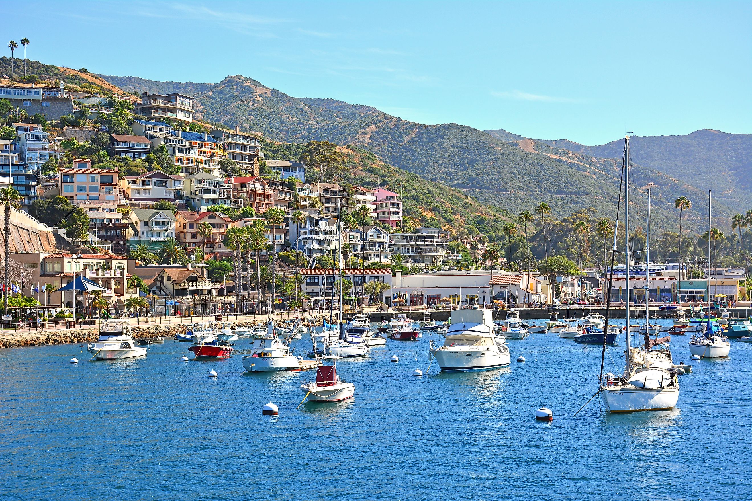
Across the water from Laguna Beach, Avalon is packed into the hills around a small harbor on Santa Catalina Island. Hundreds of boats can fill the moorings in Avalon Bay, backed by houses climbing the slopes and the circular 1929 Catalina Casino at the water's edge. Just beyond the casino is Descanso Beach, with its rows of cream umbrellas and clear blue water. It's one of the state's last private beaches that's open to the public. High up on the hill beyond town, the 38-acre Wrigley Memorial & Botanic Garden contains plants found only on Catalina and the other California islands. The distinct 80-foot-high reinforced cement memorial features a platform with panoramic views of the island. The Garden to Sky Trail continues from there toward Catalina's central ridge, where even better viewpoints take in both sides of the island and the Pacific beyond them. The Catalina Island Conservancy protects roughly 42,000 acres, or 88% of Catalina, meaning that most of the views from the top will remain the way they are.
Del Mar, California

Passenger trains run along Del Mar's coastal bluffs with the Pacific below, passing through a city covering less than two square miles. Del Mar Beach follows more than two miles of shoreline, with sandy stretches interrupted by the bluffs that carry the tracks through town. At its northern end, the San Dieguito River reaches the ocean beside San Dieguito Lagoon, a restored coastal wetland containing tidal channels, salt marsh, mudflats, and open water used by migratory birds along the Pacific Flyway. The geology becomes more pronounced to the south at Torrey Pines State Beach, where red and tan sandstone cliffs stand behind 4.5 miles of coastline. Above them, Torrey Pines State Natural Reserve protects deeply eroded ravines and the rare Pinus torreyana. The species grows naturally in only two places on Earth, this section of the San Diego County coast and Santa Rosa Island.
A 235-foot sea stack, a collapsed sea cave that appears to swallow the Pacific, cranberry beds flooded red during harvest, and bald eagles and seals around the sea stacks at Second Beach are all part of the same coast. Farther south, Catalina remains 88% protected, while one of the world's rarest pines survives above Del Mar. The Pacific Coast may share one ocean, but little else about its scenery stays consistent for long.