The Westernmost Town In The Lower 48

It is La Push, Washington, sitting at 124 degrees 38 minutes west in Washington on the Quileute Reservation at the mouth of the Quillayute River. That is the answer, and it is also the beginning of an argument, because La Push is an unincorporated community of a few hundred people and the two towns behind it each have a claim of their own. Neah Bay loses by about two-thirds of a mile and is more than twice the size. Forks is the westernmost place that is actually an incorporated town, and it sits twelve miles further inland. Even the westernmost point in the Lower 48 changes depending on the tide, and the westernmost community is currently in the process of moving east on purpose.
Here is how the three of them stack up, and why every part of this question is less settled than it sounds.
La Push Wins, And Has The Receipt

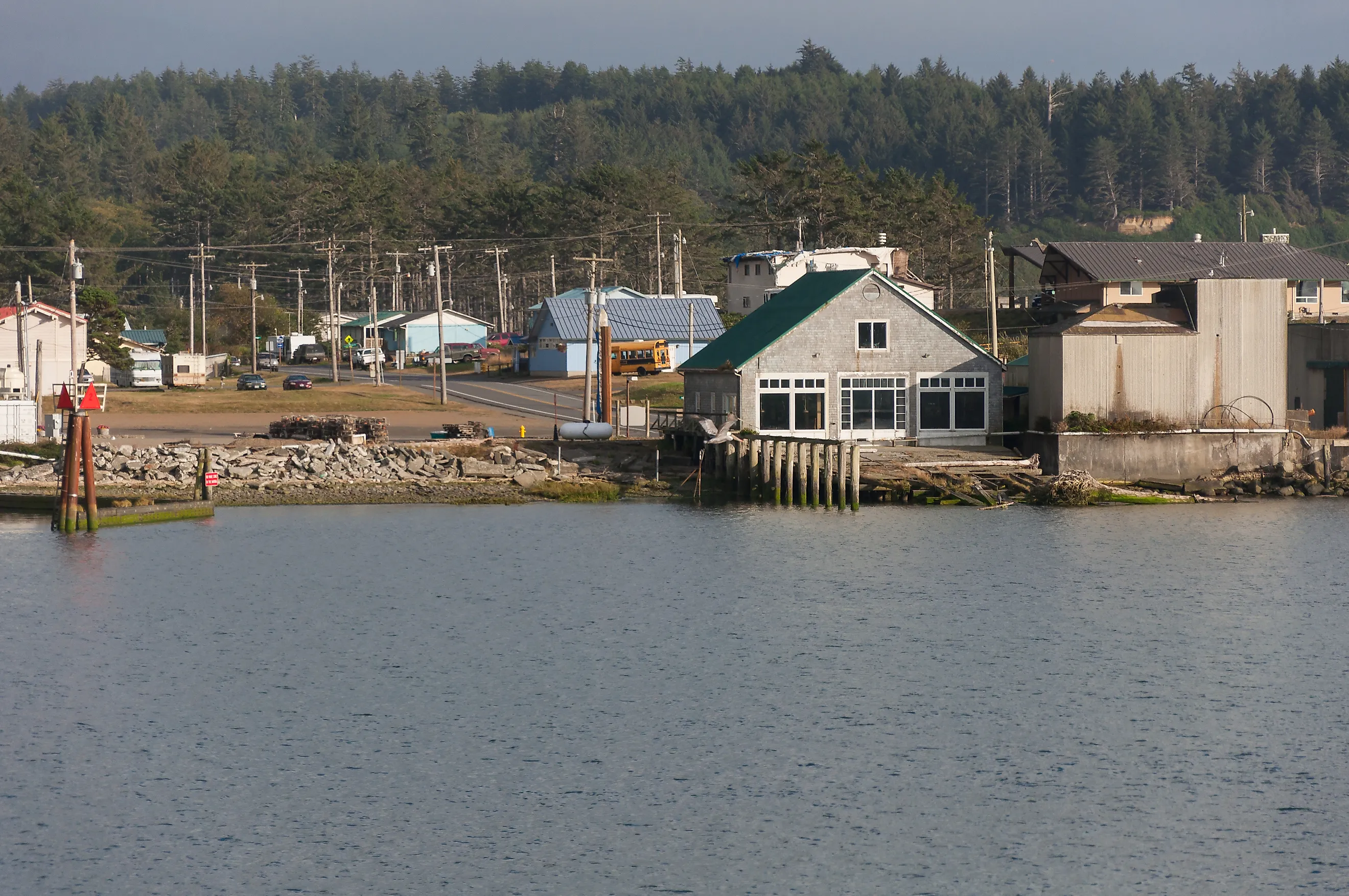
La Push sits at 124.63667 degrees west, which puts it further toward the Pacific than any other inhabited place in the contiguous United States. It is the main population center and de facto capital of the Quileute Indian Reservation, home to the federally recognized Quileute tribe, and the last census figure available put it at 371 people.
The tidiest proof is bureaucratic rather than geographic. La Push holds ZIP code 98350, which is the westernmost ZIP code in the contiguous United States. When a superlative gets contested, it helps to have the Postal Service on your side.
Two beaches sit either side of the river mouth, Rialto Beach to the north and La Push Beach to the south, and the Pacific Northwest National Scenic Trail runs through.
Neah Bay Loses By Two-Thirds Of A Mile

Neah Bay sits at 124.62222 degrees west. The gap between the two is about a hundredth of a degree of longitude, which at this latitude works out to roughly two-thirds of a mile.
By most other measures Neah Bay is the more substantial place. It had 935 residents at the 2020 census, against La Push's few hundred. It is a census-designated place, meaning the Census Bureau formally recognizes it as a community, which La Push is not. It has the Makah Museum, holding artifacts from a Makah village at Ozette that a mudslide buried around 1750 and preserved. And it is a working port with a Coast Guard presence and an emergency response tug that has pulled 41 vessels out of trouble in the Strait of Juan de Fuca since 1999.
It is also the closest town to Cape Flattery, which matters in a moment.
Forks Is The Westernmost Actual Town
If the question specifies an incorporated town, the answer moves twelve miles inland to Forks, at 124.38556 degrees west.
Forks incorporated on August 7, 1945, has 3,335 residents, and operates with a mayor and council, which is more municipal machinery than either place west of it. It was previously the unincorporated town of Quillayute, and it calls itself the Logging Capital of the World.
It is also, for a certain generation of reader, the rainiest fictional real estate in America, having been chosen as the setting for the Twilight novels on the strength of being the wettest town in the contiguous United States. La Push appears in those books too, which is how a community of a few hundred people on a reservation ended up with international name recognition.
Even The Westernmost Point Depends On The Tide

Towns are one thing. The westernmost point of land is a separate contest and somehow an even closer one.
Cape Alava, in Olympic National Park, holds the title at 124 degrees 44 minutes 11.8 seconds west. Cape Flattery, up the coast near Neah Bay, sits at 124 degrees 43 minutes 54.7 seconds west. The difference is about five seconds of longitude, roughly 360 feet at high tide.
And Cape Alava only wins on a technicality. That coordinate requires low tide and a walk across the tombolo connecting Tskawahyah Island, also called Cannonball Island, to the mainland, then out to the island's western side. At high tide the margin narrows further. The westernmost point in the Lower 48 is, strictly speaking, tidal.
Cape Blanco in southern Oregon is not far behind either, at 124 degrees 34 minutes west, which means the three westernmost points in the contiguous United States are within about ten minutes of longitude of one another.
Things Wash Up Here

Being the last land before several thousand miles of open Pacific has consequences, and the historical record here is mostly shipwrecks.
In early 1834 a Japanese rice transport ship called the Hojun Maru made landfall at Cape Alava after drifting for fourteen months. It had been bound for Edo, lost its mast and rudder in a storm, and crossed the entire Pacific unpowered. Three of the crew were still alive when it arrived, the youngest a teenager named Otokichi.
In 1886 the Austria, a three-masted bark sailing from San Francisco to Tacoma, lost sails in a gale and was pushed onto the rocks just south of Tskawahyah Island. Residents of the Ozette village got the entire crew ashore. The captain then walked thirty miles to Neah Bay to report the wreck.
Thirty miles on foot to reach a telephone is a reasonable summary of what this coastline was like, and to some extent still is.
The Westernmost Town Is Moving East

Here is the part that will eventually make this article wrong, and the Quileute are doing it deliberately.
La Push sits at an elevation of 23 feet at a river mouth on an open coast in a subduction zone, which is close to a worst case for tsunami exposure, and rising sea levels have made the arithmetic worse. The tribe secured federal legislation to move the village to higher ground, which required Congress to modify the boundaries of Olympic National Park to release the land.
The K-12 school moved first, which tells you what the priority was. As more of the village relocates uphill and inland, the coordinates that make La Push the westernmost community in the Lower 48 will drift east.
It is a small, specific example of a much larger pattern: American communities on the outer coast doing the calculation and choosing to retreat before the ocean makes the choice for them.
The Honest Answer

Pick your definition and the answer moves, which is true of most superlatives once you look closely.
Westernmost inhabited community: La Push, at 124.637 west, with the westernmost ZIP code in the country as a tiebreaker. Westernmost census-recognized place: Neah Bay, two-thirds of a mile behind. Westernmost incorporated town with a mayor: Forks, twelve miles inland. Westernmost point of land: Cape Alava, at low tide, by 360 feet, and only if you are willing to walk out to an island.
All four are in Clallam County, Washington, on the same peninsula, within about twenty-five miles of each other. Whichever definition you use, the far western edge of the Lower 48 is a rainforest coast with a few hundred people on it, and one of those communities is packing up and moving inland.