What Happens When A Dam Uses Its Spillway For The First Time
A spillway is the one part of a dam that can go decades without doing its job. It carries excess water away from a reservoir during floods, protecting the dam from dangerous water levels, so it runs only when the reservoir climbs unusually high. That can take years. Lake Texoma sat below its spillway crest for more than a decade after Denison Dam was completed in 1944, and Canyon Lake went 38 years before water reached its crest. Garrison Dam's 28-gate spillway was never used for flood releases from the dam's completion in 1953 until 2011. At Oroville Dam, the main spillway had operated many times before 2017, but the emergency spillway beside it had never carried water.
That wait is what makes the first spill a real test. When the first real flow finally arrives, the crest, the chute or tunnel, the drainage beneath it, and the ground at the bottom all face flood conditions together, and whatever the design did not anticipate tends to surface. At six American reservoirs, the results took four distinct forms. On August 6, 1941, water from Lake Mead entered the Arizona spillway at Hoover Dam and eventually carved a cavity up to 45 feet deep in the dam's concrete lining. In Texas, Canyon Lake's first overflow stripped a wooded valley down to bedrock. At Garrison Dam in North Dakota, water forced its way beneath the spillway's concrete slabs. At Lake Texoma, by comparison, the first spill was largely uneventful.
When Everything Goes According To Plan

Lake Texoma shows what a first spill looks like when a spillway works as designed. Denison Dam impounds Lake Texoma on the Red River between Texas and Oklahoma. Its spillway is a concrete-lined channel about 2,000 feet long, set in a natural saddle away from the main earthen dam. Late on May 27, 1957, Lake Texoma overflowed it for the first time. The initial flow was only about two inches deep, and Army engineers indicated that the spillway was designed for infrequent floods and did not anticipate significant additional downstream flooding beyond the initial overflow.
The most noticeable damage was to the grass on parts of the spillway. Local families had used the grassy slope for picnics and recreation, and once water began flowing, it stripped away the sod. The spillway itself performed its intended function without major structural damage. It operated again in 1990, 2007, and twice in 2015. During the 2015 floods, a whirlpool about 6 to 8 feet across developed near the spillway intake, and officials warned boaters away from the currents and placed buoys around the area.
Fast Water Tears Into Concrete

Texoma's spillway sends overflow down an open concrete channel. At Hoover Dam, overflow drops into steep tunnels instead, and the first spill went very differently. The dam impounds the Colorado River on the border between Nevada and Arizona. Its two spillways sit near the ends of the dam, with their crests about 27 feet below the top of the structure. Each sends overflow into a tunnel about 50 feet in diameter that drops steeply before joining one of the original river diversion tunnels. In the summer of 1941, Lake Mead rose to about 1,220 feet above sea level, and on August 6, the Arizona spillway began operating for the first time. An inspection eight days later found the concrete lining intact.
Water then continued flowing through the spillway until December 1942, averaging about 13,500 cubic feet per second, and the damage developed during that extended run. The cause was cavitation, a process in which high-speed water forms vapor bubbles that collapse with enough force to damage concrete. The erosion eventually opened a cavity about 115 feet long and 30 feet wide, reaching a maximum depth of 45 feet. Engineers repaired the tunnel and smoothed its interior to reduce the chance of further cavitation. The spillways then went unused for decades until exceptionally high inflows in 1983 forced both into operation, causing additional damage.
A Small Flaw Can Open A Large Hole

Hoover put engineers on notice, yet four decades later, Glen Canyon Dam showed that cavitation does not need a major defect to start. By the time its spillways faced their first major test, engineers already understood the risk. Besides Hoover, Montana's Yellowtail Dam had experienced similar problems during spillway operations in 1967. Improvements at Yellowtail included an aeration device that introduces air into high-speed water to reduce the damaging effects of collapsing vapor bubbles. Glen Canyon Dam, near Page, Arizona, has two spillway tunnels, each about 41 feet in diameter. Lake Powell reached full capacity for the first time in 1980, but the spillways saw little use before the unusually heavy Colorado River runoff of 1983.
Operators opened the left spillway on June 2. Early on June 6, loud rumbling from inside the tunnel signaled serious trouble. High-velocity water passing over an irregularity in the concrete surface had triggered cavitation. As inflows continued, crews installed temporary extensions above the spillway gates to help prevent uncontrolled releases, and the reservoir reached about 3,708 feet in July. When engineers inspected the left tunnel in August, they found that cavitation had broken through the concrete lining, allowing the flow to erode the sandstone behind it. The cavity measured about 134 feet long, 50 feet wide, and 35 feet deep.
Overflow Can Strip The Ground Below

At Hoover and Glen Canyon, the damage started inside concrete tunnels. Where the overflow lands on natural ground instead, the first spill can reshape the landscape. Canyon Dam has impounded the Guadalupe River in the Texas Hill Country since 1964. Its spillway crest sits about 943 feet above sea level, 31 feet below the top of the dam, and below it lay a valley of soil and vegetation that included mesquite and oak trees. In late June and early July 2002, extraordinary rainfall struck the upper Guadalupe River watershed, and some locations received more than 34 inches in about a week.
On July 4, Canyon Lake began overflowing its spillway for the first time. Discharge eventually exceeded 67,000 cubic feet per second, and the overflow continued for about six weeks. The water stripped away the vegetation and soil, then cut into the limestone beneath. Research by geologists Michael Lamb and Mark Fonstad found that much of the erosion occurred during the three days of highest discharge, as the flow exploited existing fractures, removed blocks of stone, and created waterfalls about 33 to 39 feet tall that retreated upstream. The result is Canyon Lake Gorge, a roughly 64-acre feature that exposes limestone formations, fossils, and dinosaur tracks. The Guadalupe-Blanco River Authority now offers guided access to the gorge.
Erosion Can Threaten The Structure Itself

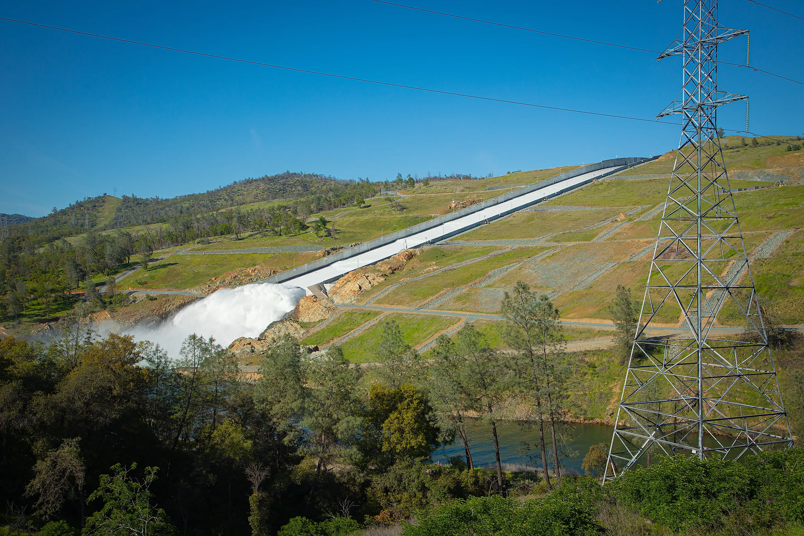
Canyon Lake's overflow carved a gorge downstream. At Oroville, erosion below a first spill moved fast enough to put the spillway's own structure at risk. Oroville Dam stands 770 feet tall on the Feather River in the Sierra Nevada foothills of California, making it the tallest dam in the United States. The dam forms Lake Oroville and uses two spillway systems: a gated concrete main spillway and an emergency spillway with an ungated concrete weir about 1,700 feet long, designed to carry excess water once the lake passes an elevation of about 901 feet. The emergency spillway's first use came in the middle of a crisis. On February 7, 2017, a section of the main spillway's concrete chute failed during a scheduled release, and the resulting flow exacerbated the damage and eroded the hillside beneath it.
Operators reduced releases, but heavy rainfall continued to raise the reservoir. At about 8 a.m. on February 11, water began flowing over the emergency spillway for the first time since the dam's construction, running down an unlined hillside. Erosion there became a serious concern almost immediately. On February 12, officials observed rapid erosion near the concrete weir. Fearing the structure could fail and release a dangerous surge of water, authorities ordered the evacuation of about 188,000 downstream residents. Operators raised releases through the damaged main spillway to roughly 100,000 cubic feet per second, lowering the reservoir and stopping the emergency overflow that evening.
Pressure Can Work Beneath The Slabs

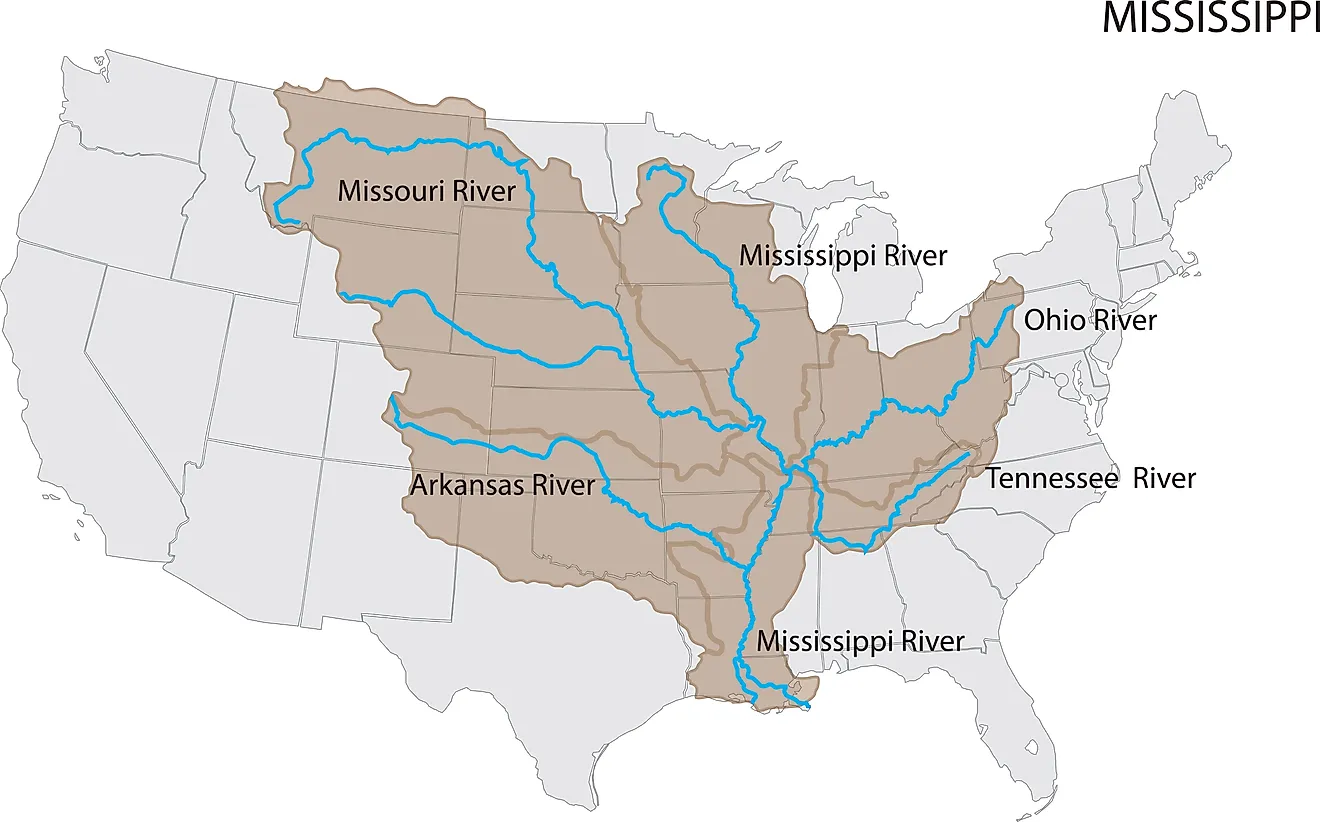
Oroville's erosion played out in plain view of officials on the ground. At Garrison Dam, the most serious problem never showed on the surface. The dam blocks the Missouri River in central North Dakota, creating Lake Sakakawea, one of the largest reservoirs in the United States. Its spillway is a concrete chute controlled by 28 gates. During the historic Missouri River flooding of 2011, heavy inflows pushed the reservoir toward its maximum operating levels, and the U.S. Army Corps of Engineers opened the spillway gates for the first time on June 1.
An early inspection spotted water spraying from the spillway apron, and operators temporarily suspended releases. The spillway later returned to operation, and by June 23, all 28 gates were open, releasing about 150,000 cubic feet per second. Those high-volume releases exposed weaknesses in the drainage system under the concrete chute. Water pressure dislodged a manhole cover, opening a pathway for water to get beneath the spillway slabs. Engineers became concerned that greater pressure during a more extreme flood could lift or displace sections of concrete. The spillway stayed in service through the flood, yet its first use revealed a hidden vulnerability that required substantial engineering attention.
What A First Spill Leaves Behind
Each of these first spills changed what came after it. At Glen Canyon, engineers installed aeration slots in both spillway tunnels to introduce air into the flow, and the modified spillways handled substantial runoff in 1984 without another major cavitation failure. At Oroville, crews rebuilt the main spillway with much thicker reinforced concrete and improved drainage beneath the chute, then strengthened the emergency spillway with a concrete buttress, an underground cutoff wall, and additional erosion protection. The reconstructed main spillway returned to operation on April 2, 2019.
At Garrison, the spillway operated again during high-water events in 2018 and 2019, and in June 2026 the Corps conducted a controlled-flow test involving 23 gates as part of its ongoing investigations. The Corps has recommended extensive improvements, including modifications to the drainage system and the removal of manhole covers from inside the chute, and the rehabilitation effort remains a multiyear undertaking. At Canyon Lake, the first overflow left a new gorge behind. A first spill tests every part of a spillway at once, and what it exposes shapes how engineers inspect, repair, and maintain these structures long before a reservoir reaches flood stage again.