The Largest Valley In The United States
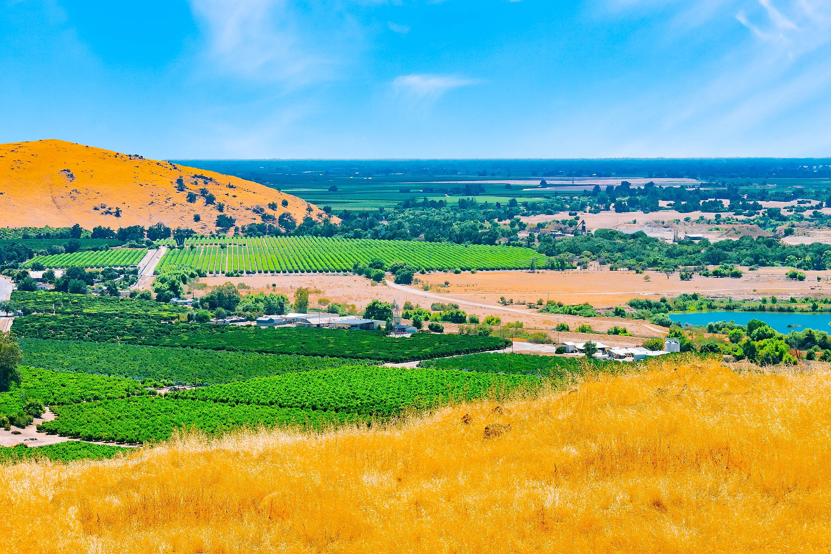
California’s Central Valley is the largest valley in the United States enclosed by mountains, a trough about 400 miles long that covers roughly 20,000 square miles. That is a little more ground than Vermont and New Hampshire combined. Mountains rise on all four sides, and fewer than 1 percent of the nation’s farmland lies on the floor between them. That sliver produces 8 percent of the country’s agricultural output.
A larger lowland follows the lower Mississippi River, open to the Gulf with no ranges around it. In California, farms draw heavily on aquifers held in sediment that has been collecting for about 160 million years, and decades of pumping from those aquifers have pulled the land surface down across parts of the valley floor. The largest drop measured anywhere in the United States is in Fresno County.
Mountains On All Four Sides

The Central Valley’s exact size depends on where the valley floor is judged to end. The US Geological Survey (USGS), which studies the aquifers beneath it, puts it at about 20,000 square miles and 400 miles long. Britannica traces a slightly smaller outline of about 18,000 square miles, stretching roughly 450 miles between Kern County and Shasta County. Either figure makes it the largest mountain-enclosed valley in the country.
The ring of mountains is complete. The Klamath Mountains and the Cascade Range sit at the north end, the Tehachapi Mountains at the south, the Sierra Nevada along the east, and the Coast Ranges along the west. Rivers draining all that ground have a single natural exit. Federal hydrologists identify it as the Carquinez Strait, a narrow channel leading out to San Francisco Bay.
The Mississippi Lowland Covers More Ground

By area alone, one American lowland is larger. The Lower Mississippi Alluvial Valley spans more than 24 million acres in seven states, about 37,500 square miles, and the National Fish and Wildlife Foundation calls it the nation’s largest floodplain. It follows the Mississippi for 954 river miles south of the Ohio River junction, and the USGS ranks the Mississippi Alluvial Plain, which covers much of the same land, as the third-largest area of irrigated cropland in the United States. Open to the Gulf of Mexico and bordered by no mountain ranges, it is a river floodplain.
The Great Appalachian Valley is longer. Britannica traces that chain of lowlands through the Appalachian Mountains system as far south as Alabama, and the Shenandoah and Tennessee valleys are among its segments. Colorado’s San Luis Valley covers about 8,000 square miles, roughly 40 percent of the Central Valley’s area, on a floor averaging about 7,700 feet above sea level.
A Basin Filling Since The Jurassic

Beneath the orchards and row crops lies a deep structural trough. State geologists describe a basin where sediment has piled up almost continuously since the Jurassic, about 160 million years ago. The aquifers that supply the valley’s wells are held in that fill.
Two rivers cross the top of it. The Sacramento River drains the northern part, known as the Sacramento Valley, and the San Joaquin River drains the southern San Joaquin Valley. Most of their flow comes from Sierra Nevada snowmelt between January and June. The two rivers meet in the Delta, where farmed islands behind the levees lie 10 to nearly 25 feet below sea level.
What Grows On The Valley Floor

The valley floor holds about 17 percent of all irrigated land in the United States, along with roughly three-quarters of California’s. More than 250 different crops grow on it by the USGS count, among them cotton, rice, grains, nuts, and grapes. The agency credits the valley with about a quarter of the nation’s food, including 40 percent of the country’s fruits, nuts, and other table foods.
Much of the water behind that harvest is pumped from below. Central Valley aquifers meet about 20 percent of US groundwater demand, which makes them the second-most-pumped aquifer system in the country.
The Ground Near Mendota Dropped About 30 Feet

Southwest of Mendota, a farm town west of Fresno, the USGS marks the approximate location of maximum land subsidence in the United States. Between 1925 and 1977, the land surface there dropped about 30 feet as heavy pumping drained water from the aquifer system and its fine-grained layers compacted. A USGS photograph from 1977 shows hydrologist Joseph Poland beside a utility pole at the site. Signs fixed to the pole mark the ground level in 1925, 1955, and 1977.
Corcoran Sank While Tulare Lake Came Back

Farther south, in Kings County, satellite radar caught the ground near Corcoran sinking 13 inches over eight months spanning 2014 and early 2015, according to a NASA analysis. The city’s flood levee had already been raised several times because the land beneath it kept settling, most recently in 2017.
Storms in March 2023 refilled Tulare Lake, once the largest freshwater lake west of the Mississippi. The rivers that fed it had been dammed and diverted for farming starting in the 1920s, and fields of cotton, tomatoes, pistachios, and almonds covered the dry lakebed. With the lake back on Corcoran’s edge, the city’s 14.5-mile levee was raised again in May 2023, to an elevation of 192 feet. As of late June 2023, the levee and other barriers had kept significant flooding out of the city and its prisons.
Canals And The Aqueduct Have Dropped With The Land

Subsidence has also reduced how much water the valley’s canals can carry. By early 2023, the Friant-Kern Canal had lost 60 percent of its conveyance capacity through its sunken middle stretch, on a channel built with a slope of about six inches per mile so gravity could move the water. The 152-mile canal runs along the valley’s east side and serves about 1 million acres of farmland and more than 250,000 people. Construction began in 2022 on a planned 31-mile fix that includes about 19 miles of new canal beside the old one, and the first 10 miles of new concrete-lined channel opened in June 2024.
The state’s California Aqueduct has gone down as well. According to NASA, segments between Los Banos and Lost Hills have sunk more than 5 feet since the aqueduct was built. Radar flights between July 2013 and March 2015 recorded more than 7 inches of new sinking near Huron and Kettleman City.
A 2040 Deadline And California’s First Probation

On April 16, 2024, the State Water Resources Control Board placed the Tulare Lake Subbasin, which covers most of Kings County including Corcoran, on probation. It was the first groundwater basin in California to receive that designation, and the Tule Subbasin followed that September. Under the 2014 Sustainable Groundwater Management Act, critically overdrafted basins have until January 31, 2040, to reach sustainability, with local agencies writing the plans and the state board stepping in when a plan falls short.
Under probation, anyone drawing more than 500 acre-feet a year must install a flow meter, and fees run $300 per well plus $20 per acre-foot pumped. In August 2026, a Kings County judge paused enforcement against two of the subbasin’s five groundwater agencies, leaving the other three on probation. Subsidence was among the deficiencies the board found in the local plan.
The Central Valley holds its record in square miles, while parts of its floor have spent the past century dropping in elevation. Near Mendota, the ground fell about 30 feet between 1925 and 1977, and the USGS describes the compaction behind that drop as largely nonrecoverable. The fine-grained layers that squeezed together under pumping cannot be restored to their former thickness, and the water storage they once held is gone with them. A wet year can refill Tulare Lake, but it cannot lift the land around Corcoran back to where it stood. Under state probation in Kings County, the largest pumpers must meter their wells, and the deadline for the valley’s critically overdrafted basins to reach sustainability falls on January 31, 2040.