The 10 Tallest Mountains In New York
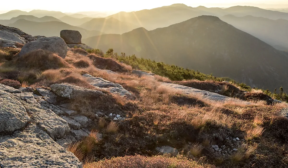
New York's 10 tallest mountains are concentrated in the Adirondack Mountains, many within reach of Lake Placid. Although their underlying bedrock is more than a billion years old, the mountains' present landscape developed through much more recent uplift, erosion, and glaciation. Their rocky summits, composed largely of ancient anorthosite and other metamorphic and igneous rocks, continue to attract hikers and winter mountaineers. Most lie within New York's High Peaks Wilderness, where alpine vegetation, steep trails, and deep valleys reveal the region's natural history. These peaks also have human stories that include a presidential succession and the development of one of America's best-known winter sports destinations.
Mount Marcy - 5,344 feet (1,629 meters)

On September 13, 1901, US Vice President Theodore Roosevelt was returning from a hike on Mount Marcy when a messenger informed him that President William McKinley's condition had deteriorated. McKinley had been shot in Buffalo a week earlier. Roosevelt hurried back to his mountain retreat and later traveled through the night by horse-drawn carriage toward North Creek, where he learned on September 14 that McKinley had died, making him the 26th president of the United States.
Today, Mount Marcy is New York's highest mountain at 5,344 feet, with the popular Van Hoevenberg Trail providing a challenging route to its summit from the Adirondack Loj area near Lake Placid. The mountain is also known as Tahawus, commonly translated as "Cloud Splitter," a name popularized in the 19th century. Its southern slopes drain into Lake Tear of the Clouds, a small alpine lake recognized as the highest body of water in the Hudson River watershed and traditionally identified as one of the river's sources.
Algonquin Peak - 5,114 feet (1,559 meters)

The summit of Algonquin Peak features approximately 23.5 acres of rare alpine tundra, where fragile plant communities survive in an environment shaped by cold temperatures and powerful winds. These conditions resemble those found much farther north, allowing species adapted to harsh alpine climates to persist above the surrounding forests. A popular destination during the warmer months, Algonquin is regularly visited by members of the Adirondack Summit Steward Program, who educate hikers about staying on durable rock surfaces to protect sensitive vegetation.
Winter ascents present a different challenge, as strong winds, deep snow, and ice can make the upper mountain hazardous. Depending on conditions, hikers may need snowshoes, crampons, and other specialized winter equipment. Located west of Mount Marcy in the MacIntyre Range, Algonquin is New York's second-highest peak and is known for its steep trails and wide summit views.
Mount Haystack - 4,960 feet (1,512 meters)

Mount Haystack takes its name from its profile, which resembles a rounded stack of hay when viewed from surrounding mountains. At 4,960 feet, it is New York's third-highest peak and one of the most recognizable summits in the Adirondack Great Range. Haystack stands east of Mount Marcy, separated from it by Panther Gorge, a deep valley bordered by steep rock faces and abrupt changes in elevation. Its bare summit offers views of nearby mountains, including Marcy and the surrounding High Peaks.
Reaching Haystack requires a substantial hike, with approaches involving long distances, significant elevation gain, and rocky terrain. The final ascent crosses exposed bedrock, where footing can become challenging in wet or icy conditions. Its remote location and long trails make Haystack a destination for experienced hikers prepared for a full day in the backcountry.
Mount Skylight - 4,926 feet (1,501 meters)

Mount Skylight received its name in 1857 from artist Frederick S. Perkins and Adirondack guide Orson Schofield Phelps, reportedly because a rock formation near the summit resembled a window or skylight. The mountain stands south of Mount Marcy, with Lake Tear of the Clouds situated near the saddle between them. Marked trails connect the two mountains through the Four Corners junction, from which a trail climbs approximately half a mile to Skylight's summit.
Although the connection makes it possible to combine the peaks in a single outing, reaching Skylight from established trailheads still requires a long, strenuous hike through the High Peaks Wilderness. Its broad summit provides views of neighboring mountains and the surrounding wilderness. Skylight is also associated with a local hiking tradition in which visitors carry a small stone to the summit cairn, supposedly to encourage favorable weather on their descent.
Whiteface Mountain - 4,867 feet (1,483 meters)

Whiteface is the only mountain on this list where visitors can reach the summit without completing a lengthy wilderness hike. The Whiteface Veterans' Memorial Highway, opened in 1935, winds up the mountain to a parking area just below the summit. From there, visitors can follow a short, steep alpine trail or pass through a tunnel to an elevator that rises approximately 27 stories to the Summit House. The mountain is also home to Whiteface Mountain Ski Center, a major venue during the 1980 Winter Olympic Games in Lake Placid.
With a vertical drop of 3,430 feet, Whiteface has the greatest lift-served vertical descent of any ski area in the eastern United States. Located northeast of Lake Placid and separated from the main concentration of High Peaks, Whiteface provides panoramic views of the Adirondacks, Lake Champlain, Vermont, and, on exceptionally clear days, parts of Canada. The highway and summit facilities are seasonal, with access depending on weather and operating conditions.
Dix Mountain - 4,857 feet (1,480 meters)

In 1837, New York State geologist Ebenezer Emmons named this peak in honor of John Adams Dix, who was serving as New York's secretary of state. Dix later became governor of New York and served as a Union major general during the Civil War, commanding federal military operations in Maryland amid intense political conflict over secession. Dix Mountain stands in the southeastern portion of the High Peaks Wilderness, separated from the central High Peaks by valleys and forested ridges.
A notable feature is the Beckhorn, a sharp, rocky prominence along the mountain's southern ridge. From there, hikers have views of the surrounding Dix Range and distant mountains. Although Dix can be climbed as a standalone summit, experienced hikers often combine it with neighboring peaks, such as Hough and Grace Peak, on multi-mountain routes.
Gray Peak - 4,840 feet (1,475 meters)

Located on the western shoulder of Mount Marcy, Gray Peak is one of the highest mountains in New York without an officially marked trail leading to its summit. Instead, hikers follow an unmarked herd path through dense vegetation and steep, rocky terrain. The route commonly begins near Lake Tear of the Clouds, making Gray a frequent addition to hikes involving Mount Marcy or Mount Skylight.
Although the final climb is relatively short compared with the lengthy approach, the narrow path can be muddy, overgrown, and difficult to follow, especially when snow obscures the route. Gray's wooded upper slopes offer a different experience from the broad, open summits of neighboring peaks. Small openings near the top offer views of Mount Marcy and the surrounding wilderness for hikers comfortable navigating less-developed routes.
Iroquois Peak - 4,840 feet (1,475 meters)

Like Gray Peak, Iroquois has no officially marked trail leading directly to its summit. Instead, hikers typically approach from Algonquin Peak, descending from its summit before following a narrow herd path across the MacIntyre Range. This route passes through a high-elevation bog described by local tourism authorities as the highest in the eastern United States. The surrounding alpine environment contains sensitive vegetation that can be easily damaged by hikers leaving established paths.
Iroquois, New York's eighth-highest peak, has a windswept summit with views across the neighboring mountains, including the terrain around Indian Pass. Reaching the peak requires navigating rocky sections and crossing Boundary Peak, while winter conditions can bring deep snow, ice, and challenging route-finding. Its combination of alpine scenery and access to unmarked trails makes it especially appealing to experienced High Peaks hikers.
Basin Mountain - 4,827 feet (1,471 meters)

Climbing New York's ninth-highest mountain requires a substantial commitment through steep forests, open bedrock, and rough mountain terrain. Basin lies deep within the Adirondack Great Range, between Saddleback Mountain to the northeast and Mount Haystack to the southwest. The mountain's remote location means most routes involve considerable mileage and elevation gain, making it challenging even for experienced hikers.
Its summit and upper slopes provide views of the surrounding peaks, including neighboring Saddleback and Haystack. Basin also rises above heavily forested valleys and mountainsides characteristic of the High Peaks Wilderness. The area's difficult terrain has helped limit development, preserving an extensive landscape of protected forest. Hikers often incorporate Basin into longer Great Range traverses, although the steep sections between neighboring summits require careful footing and endurance.
Gothics Mountain - 4,736 feet (1,444 meters)

Gothics is one of the most recognizable peaks in the Adirondack Great Range, with open rock faces and sharply defined ridges that resemble the pointed architectural forms of Gothic cathedrals. This resemblance inspired the mountain's name during the 19th century. At 4,736 feet, Gothics is New York's tenth-highest mountain and a popular destination for hikers seeking challenging terrain and summit views.
One approach follows a steep ridge equipped with cables to assist hikers on exposed rock, although other routes reach the summit without using the cable section. In winter, snow and ice can make these slopes hazardous, requiring appropriate equipment and advanced mountaineering experience. The mountain's broad rock slides are reminders of the powerful role of weathering, erosion, and slope failures in shaping the Adirondack landscape. Today, its rock slides and steep trails make Gothics a memorable summit in the High Peaks Wilderness.
High-Alpine History
New York's 10 highest mountains preserve a long record of geological change and human history. Their ancient bedrock has been shaped by uplift, erosion, and glaciers, while their slopes have witnessed Theodore Roosevelt's hurried return from Mount Marcy in 1901 and the Winter Olympic competitions held on Whiteface Mountain in 1980. The region's natural features include Algonquin's alpine tundra, the rock faces of Gothics, and the deep valley of Panther Gorge. Although these summits differ in accessibility and terrain, each offers a distinct perspective on the Adirondacks, where ancient geology, protected wilderness, and generations of mountain exploration continue to intersect.