How The Sierra Nevada Compares To The Rockies
Mount Whitney is 65 feet taller than Mount Elbert, about the height of a six-story building. That is the whole gap between the summit of the Sierra Nevada and the summit of the Rocky Mountains. The ranges beneath those two peaks are on another scale entirely. The Sierra Nevada is 400 miles long. The Rockies are 3,000. A climber could drive the length of the Sierra in a day and spend a week on the Rockies.
The two ranges were also built by different forces, and it shows in the rock. One is a single slab of granite that rose within the last ten million years. The other is a belt of folded rock lifted more than 55 million years ago. The clean granite walls of Yosemite and the glaciers of the Rockies both trace back to that split. So does the gear a climber packs for each one.
The Rockies Are Seven Times Longer Than the Sierra Nevada

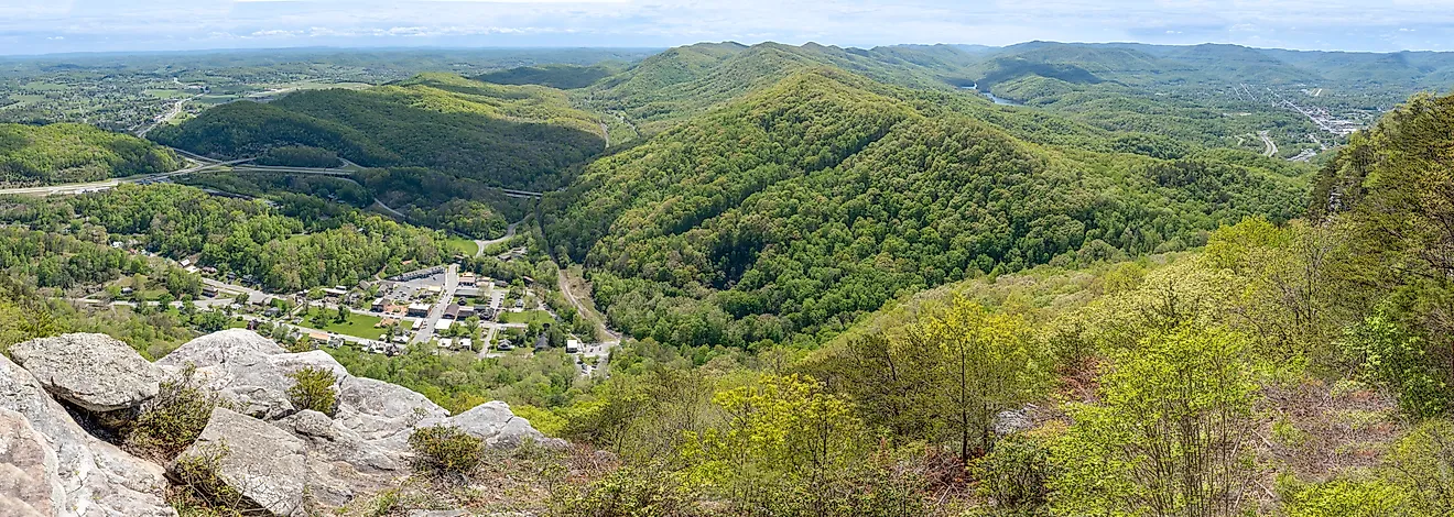
The Rockies cover about 3,000 miles in a straight line between northern British Columbia and Alberta in Canada and New Mexico in the United States. The system is 70 to 300 miles wide and takes in at least 100 separate ranges. Geographers group them as the Canadian Rockies, the Northern Rockies, the Middle Rockies, and the Southern Rockies. The Southern Rockies hold the highest ground. Colorado alone has more than 50 peaks over 14,000 feet.
The Sierra Nevada is about 400 miles long, measured between Fredonyer Pass in the north and Tehachapi Pass in the south. Its width is 50 to 80 miles. The range sits almost entirely inside California, with only the Carson Range spur reaching into Nevada. The Rockies are roughly seven times longer than the Sierra and cover far more ground across two countries and eight states and provinces. The Sierra still holds the taller summit.
The Sierra Nevada Is One Block of Granite, the Rockies Are Folded Layers of Rock

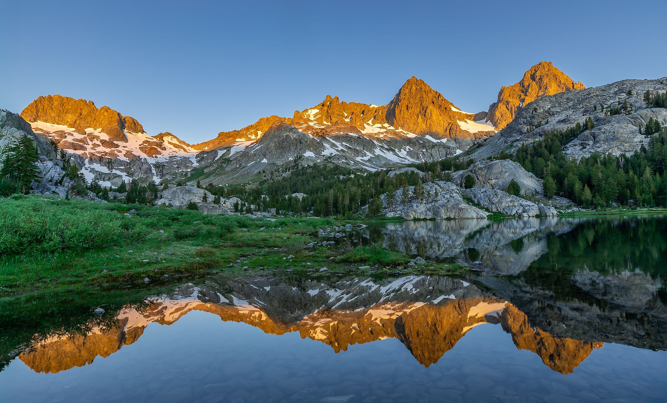
The Sierra Nevada is essentially one body of granite. Starting around 220 million years ago, the Farallon plate slid beneath North America and fed magma into the crust in pulses. Most of that magma cooled into granite between 105 and 85 million years ago, several miles underground. Over tens of millions of years, erosion stripped away the volcanic and metamorphic rock on top. Within roughly the last ten million years, faulting lifted the block and tilted it westward. The result is a steep eastern escarpment above the Owens Valley and a gentle western slope toward the Central Valley. Uplift continues today along the eastern faults and produced the 1872 Lone Pine earthquake.
The Rockies came out of the Laramide orogeny between 80 and 55 million years ago. The Farallon plate subducted at a shallow angle, which pushed mountain building hundreds of miles inland. Thick layers of sedimentary rock were folded and thrust upward over crystalline cores dating to the Precambrian. In the Canadian Rockies, sheets of Paleozoic limestone were shoved eastward over younger rock by 20 to 30 miles. The outcome is a patchwork of sedimentary, igneous, and metamorphic rock across many separate ranges, with little of the uniform granite that defines the Sierra.
Glaciers reworked both ranges during the last 2.6 million years. In the Sierra, moving ice scoured the granite into the domes, polished faces, and U-shaped valleys of Yosemite Valley. In the Rockies, glaciers carved cirques and knife-edge ridges, and in Canada left icefields that remain on the peaks today.
Mount Whitney Is 65 Feet Taller Than Mount Elbert

Mount Whitney stands at 14,505 feet (4,421 meters) and Mount Elbert at 14,440 feet (4,401 meters), a gap of 65 feet (20 meters). Mount Whitney can be climbed year-round, although a quota season is implemented between May 1 and November 1. The Mount Whitney Trail is the most common route up the mountain. Although it is a non-technical trail, it is a strenuous 12-14 hour, 22-mile round-trip hike. During winter, spring, and early summer, ice axes and crampons may be required. The Mountaineer's Route, on the other hand, is more technical than the Mount Whitney Trail. The Mountaineer's Route goes up a steep couloir that separates the northeast ridge from the east buttress. This route involves climbing in a snow or rock-filled gully and technical scrambling.

Similarly, Mount Elbert in Colorado has a mixture of non-technical and technical routes. The Northeast Ridge is the standard route to the summit. It is a non-technical ascent comprising a 9.75-mile round-trip hike. There is no true technical mountaineering route to Mount Elbert's summit, although during winter, crampons and ice axes may be required for the Box Creek Couloirs, a steep snow ascent.
The Sierra Nevada Has the Bigger Rock Walls

Climbing in the Sierra Nevada features vertical cliffs, spires, and granite domes and walls, like Half Dome and El Capitan in Yosemite National Park. Over 90% of the park is composed of Mesozoic granitic rocks, and the glacial polish left on that granite produces the clean faces and long crack systems that define Sierra climbing.
The tallest face of El Capitan rises 3,000 feet (914 meters) above Yosemite Valley. It has long captured the attention of rock climbers since its first ascent in 1958, when Warren Harding spent 47 days using fixed ropes on The Nose climbing route. There are now over 70 established routes on El Capitan, including the challenging Salathe Wall and the Dawn Wall. In 2017, Alex Honnold completed a free solo on the Freerider of El Capitan in less than four hours.
The Rockies Have the Glaciers and the Alpine Routes

Climbing in the Rockies comprises exposed ridges, couloirs, and high alpine peaks, with a mixture of snow, rock, and ice forming many routes. The mixed geology means a single route can cross solid granite, loose shale, and glacier ice in one day.
The Diamond on Longs Peak begins at 13,100 feet (3,992 meters) and follows a vertical ascent to its summit at 14,259 feet (4,346 meters). Although it is vertical granite, it differs from El Capitan due to its position above 13,000 feet, which makes it an alpine big wall. Climbers are exposed to loose rock, snow, ice, and afternoon thunderstorms. The first ascent was completed in August 1960 by David Rearick and Robert Kamps, facing challenges like afternoon snow flurries and cold winds numbing their fingers.

Across the border in Canada, the Rockies are glaciated; many of the peaks feature permanent glaciers, icefields, and snowpacks. Mount Robson is the highest peak in the Canadian Rockies, sitting at an elevation of 3,954 meters (12,972 feet). The Infinite Patience route on the Emperor Face requires scrambling on the Mist Glacier, mixed rock and alpine ice climbing, traversing an ice ledge, and multiple days on the mountain, with nights spent bivouacking on the mountain. The first ascent took four days. It was completed by Barry Blanchard, Eric Dumerac, and Philippe Pellet.
Weather Is More Extreme in the Rockies and Access Is Tighter in the Sierra Nevada

In any mountainous region, weather can change at any time. The Sierra Nevada has generally warm and dry summers; however, this can be dependent on spring conditions and the volume of snowpack. There are roughly 100 climbing accidents, like fractured skulls or broken legs, each year in Yosemite National Park alone. Common injuries are attributed to falls, rockfall, free soloing, and mistakes with equipment. Climbing in some Sierra Nevada locations is regulated by permits and quotas, such as Mount Whitney or Half Dome.
Similarly, weather in the Rockies can rapidly change, although it is generally more extreme than the warm summers in California. Mountain weather can be unpredictable, bringing lightning storms, rain, snow, wind, and cold temperatures, even during the summer months. Snow can remain in the Rockies until mid-July. Not only does the unpredictable weather pose a threat to climbers, but altitude sickness, rockfalls, avalanches, and falling into crevasses are all potential hazards.
Similar Heights, Very Different Mountains
The Sierra Nevada and the Rockies share high points within 65 feet (20 meters) of each other and share little else. One is a 400-mile granite block lifted and tilted within the last ten million years. The other is a 3,000-mile belt of folded and faulted ranges raised more than 55 million years ago. Those origins account for the clean granite walls of Yosemite on one side and the loose mixed rock, snow, and glaciers of the Rockies on the other. Climbers choose the Sierra for technical rock and the Rockies for ice and alpine terrain, and that choice follows directly from the geology.