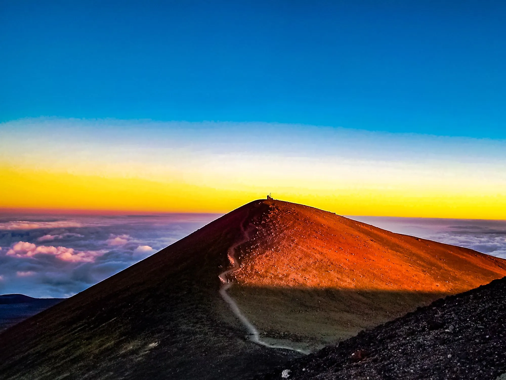
The 10 Tallest Mountains In Hawaii
The 10 tallest mountains in Hawaii include towering volcanoes, remote rainforest summits, and some of the most geographically distinctive peaks in the United States. Mauna Kea is taller than Mount Everest when measured from its underwater base to its summit, while neighboring Mauna Loa is the world's largest active volcano. Other peaks belong to the Kohala Mountains, West Maui Mountains, and Waiʻanae Range. Some are accessible by road or established hiking trails, while others, such as Olokuʻi, are isolated within protected natural areas. These mountains also carry considerable importance in Hawaiian history and cultural traditions, with documented Western ascents dating back to the late 18th and early 19th centuries.
Mauna Kea, Hawaii - 13,803 Feet

Mauna Kea is the tallest mountain in Hawaii, rising 13,803 feet above sea level on the Big Island. The dormant shield volcano is even taller than Mount Everest when measured from its underwater base to its summit, reaching approximately 33,500 feet in total height. Its name translates to "White Mountain," a reference to the snow that sometimes caps its summit. The mountain is also known as Mauna a Wākea and has profound spiritual significance in Native Hawaiian traditions. It is associated with Wākea, the sky father, and Papa, the earth mother, who occupy important places in Hawaiian genealogy and creation traditions.
In 1823, American missionary Joseph Goodrich made one of the earliest documented non-Hawaiian ascents of Mauna Kea. Nearly two centuries later, marine biologist Clifford Kapono and deep-sea explorer Victor Vescovo completed a remarkable expedition that began on the Pacific Ocean floor and ended at the summit on February 3, 2021. The journey spanned approximately 30,587 feet of vertical elevation and involved both underwater exploration and mountaineering. Today, reaching the summit still requires caution because its elevation can cause altitude sickness, particularly among visitors who ascend too quickly from sea level.
Mauna Loa, Hawaii - 13,679 Feet

Mauna Loa is the largest active volcano on Earth, with a summit standing 13,679 feet above sea level, just 124 feet below neighboring Mauna Kea. According to the US Geological Survey, its submarine flanks extend approximately 16,400 feet below sea level, while the enormous weight of the volcano has depressed the underlying ocean floor by an additional 26,200 feet. Including this depression, the summit stands approximately 55,700 feet above the volcano's base. Mauna Loa translates to "Long Mountain" in Hawaiian, an appropriate name for a basaltic shield volcano that spans roughly half of the Big Island.
The first documented Western ascent of Mauna Loa occurred in 1794, when Scottish surgeon and botanist Archibald Menzies reached the summit with a small expedition that included Lieutenant Joseph Baker. Menzies used a portable barometer to estimate the mountain's elevation at approximately 13,564 feet, remarkably close to modern measurements. Today, hikers can reach the summit through challenging backcountry routes within Hawaiʻi Volcanoes National Park. The journey requires considerable preparation, as trails cross exposed volcanic terrain at high elevations. Mauna Loa remains active, with its most recent eruption occurring in November and December 2022.
Haleakalā, Maui - 10,023 Feet

Spanning much of eastern Maui, Haleakalā is a massive shield volcano rising 10,023 feet above sea level. Its Hawaiian name translates to "House of the Sun," reflecting a traditional story in which the demigod Māui captures the sun to slow its journey across the sky. Haleakalā has cultural and spiritual importance for Native Hawaiians and remains one of the island's most recognizable natural landmarks. Although its last eruption is estimated to have occurred between 1480 and 1600, the volcano is not considered extinct and could erupt again.
Among the earliest documented Western ascents of Haleakalā was an expedition on August 21, 1828, involving American missionaries Lorrin Andrews, Jonathan F. Green, and William Richards. Today, the summit area is accessible by road through Haleakalā National Park, where visitors can observe the volcano's enormous summit depression and volcanic cinder cones. One of the park's best-known hiking routes is the Keoneheʻeheʻe, or Sliding Sands, Trail, which descends from near the summit into the volcanic landscape. An approximately 11-mile one-way hike connects the Sliding Sands and Halemauʻu trailheads, so transportation is required because the route does not return to its starting point.
Hualālai, Hawaii - 8,278 Feet

Hualālai rises 8,278 feet above sea level on the western side of Hawaii's Big Island. This active shield volcano is one of the five volcanoes that formed the island and has played an important role in shaping the Kona region. Its volcanic slopes have contributed to the area's soils, including those used for Kona coffee cultivation. Hualālai last erupted in 1800 and 1801, producing lava flows that reached the coast. Some flows carried mantle xenoliths, fragments of older rock transported toward the surface by ascending magma. The 1801 Huʻehuʻe lava flow underlies part of what is now Ellison Onizuka Kona International Airport.
Scottish surgeon and botanist Archibald Menzies also explored Hualālai in 1795, following his documented ascent of Mauna Loa the previous year. His expedition contributed to early Western scientific observations of Hawaii's volcanoes. Today, parts of Hualālai's volcanic landscape can be explored through guided excursions, including tours of its craters and lava fields. Access to some areas is restricted because the mountain includes privately owned land. Although Hualālai has not erupted in more than two centuries, the US Geological Survey continues to classify it as an active volcano with the potential for future eruptions.
Puʻu Kukui, Maui - 5,788 Feet

Puʻu Kukui, meaning "Candlenut Hill," is the highest point in the West Maui Mountains, rising 5,788 feet above sea level. The name refers to the kukui tree, which produces candlenuts and has cultural significance in Hawaii. The mountain is part of an older volcanic complex that has been deeply eroded over millions of years. Its summit region receives exceptionally heavy rainfall, creating a wetland and rainforest environment that supports numerous native Hawaiian plants and animals. Unlike the island's younger volcanoes, the West Maui volcanic complex is no longer active.
Puʻu Kukui is protected within a watershed conservation area that safeguards native forests and freshwater resources. Its exceptionally wet environment contains fragile bogs and ecosystems that are vulnerable to disturbance. Conservation work includes protecting native vegetation and controlling invasive species. Access is highly restricted because much of the land is privately owned and managed for conservation. Selected volunteers and authorized visitors may occasionally reach a portion of the elevated boardwalk by ATV, but the mountain is not open for general recreational hiking. These restrictions help protect one of Maui's most important natural watersheds.
Kaumu o Kaleihoohie, Hawaii - 5,480 Feet

Kaumu o Kaleihoohie is the highest point in the Kohala Mountains, rising 5,480 feet above sea level on the northern side of Hawaii's Big Island. The Kohala volcanic complex is the oldest of the five volcanoes that formed the island, and erosion has transformed its original shield shape into a landscape of steep valleys and heavily forested ridges. The mountain's slopes receive substantial rainfall, supporting dense vegetation and contributing to the region's watersheds. Parts of the surrounding Kohala region were historically used for agriculture, including sugarcane cultivation.
Unlike Mauna Kea and Haleakalā, Kaumu o Kaleihoohie lacks a well-documented history of early Western summit expeditions. Modern hikers have recorded ascents through the surrounding forests, but reaching the summit is considerably more difficult than visiting Hawaii's better-known volcanic peaks. Routes may cross dense vegetation, steep slopes, and areas with restricted access. The mountain's isolated summit and wet terrain make it a challenging destination, while its surrounding forests remain important for protecting native habitats and water resources.
Kawaikini, Kauai - 5,243 Feet

Kawaikini is the highest point on Kauai, rising to 5,243 feet above sea level in the island's mountainous interior. The summit belongs to the ancient volcanic highlands associated with Mount Waiʻaleʻale, an area renowned for exceptionally heavy rainfall. The surrounding slopes receive hundreds of inches of precipitation in some years, helping sustain the island's streams, waterfalls, and rainforest ecosystems. Millions of years of erosion have carved deep valleys and steep ridges into the volcanic landscape, making Kawaikini one of Hawaii's most geographically isolated high summits.
Reaching Kawaikini is considerably more complicated than hiking the established trails of Hawaii's national parks. The summit is surrounded by wet forests, boggy terrain, and thick vegetation, with no maintained public trail leading directly to the highest point. The nearby Alakaʻi Wilderness Preserve contains important native habitats, including areas accessible from the unpaved Mōhihi-Camp 10 Road. However, reaching the preserve does not provide a straightforward route to Kawaikini's summit. The remote terrain, frequent rainfall, and absence of established summit trails make this mountain unsuitable for casual hiking.
Kamakou, Molokai - 4,961 Feet

Kamakou is the highest mountain on Molokai, rising 4,961 feet above sea level. Its slopes contain some of Hawaii's most significant remaining native rainforest habitats, including the approximately 2,774-acre Kamakou Preserve. According to Hawaii's official tourism website, the preserve supports more than 250 rare Hawaiian plants, including 219 that occur nowhere else in the world. These forests also provide habitat for native birds and other wildlife while helping protect the island's freshwater resources. The mountain is part of the ancient East Molokai volcanic complex, whose steep valleys and ridges have been shaped by extensive erosion.
The Nature Conservancy manages Kamakou Preserve in partnership with other conservation organizations and landowners. Access is limited, with guided visits offered when conditions and conservation requirements permit. The preserve is known for its elevated boardwalk through native rainforest and bog habitats, although trail conditions and access arrangements can change. Visitors may also encounter views of the surrounding valleys, including the dramatic landscape of Waikolu Valley. The fragile ecosystem requires careful management because invasive species and human disturbance can threaten its rare plants and wildlife.
Olokuʻi, Molokai - 4,602 Feet

Olokuʻi is Molokai's second-highest summit, rising approximately 4,602 feet above sea level. The mountain is distinguished by its remote, elevated plateau and the steep cliffs that surround it. Much of its landscape is protected within the approximately 1,620-acre Olokuʻi Natural Area Reserve, which preserves native rainforest and bog ecosystems. These habitats support rare Hawaiian plants and animals, including native land snails such as Partulina mighelsiana. The mountain's isolation has helped protect some of its natural communities from the extensive changes experienced elsewhere in the Hawaiian Islands.
Olokuʻi also has significance in the history and cultural traditions of Molokai, particularly those associated with the nearby Pelekunu Valley. Its steep terrain and isolated plateau create substantial obstacles to human access, and there is no maintained public hiking route to the summit. Unlike more accessible Hawaiian mountains, Olokuʻi is primarily managed for conservation rather than recreation. Its protected forests and wetlands remain valuable for preserving native biodiversity, making the mountain an important part of Hawaii's natural heritage.
Mount Kaʻala, Oahu - 4,025 Feet

Mount Kaʻala is the highest peak on Oahu, standing 4,025 feet above sea level in the Waiʻanae Range. The mountain forms part of the ancient Waiʻanae volcanic complex and is known for its relatively flat summit plateau, which supports a rare cloud forest ecosystem. The surrounding Mount Kaʻala Natural Area Reserve protects approximately 1,100 acres of native habitats, including wet forests and bog vegetation. The mountain is culturally significant to Native Hawaiians, and its name is often interpreted as "the fragrant mountain." Hawaiian traditions also associate the mountain with Hiʻiaka, a prominent figure in Hawaiian mythology.
Reaching Mount Kaʻala on foot is a demanding undertaking. Hiking routes from the Waiʻanae side involve substantial elevation gain, steep ridges, and sections of rugged terrain. Some routes include ropes to assist hikers on difficult sections, making the ascent unsuitable for inexperienced visitors. Near the summit, a boardwalk helps protect the fragile cloud forest and its native vegetation. Although views of the Waiʻanae Range are possible during the ascent, the summit itself is often shrouded in clouds and mist. The mountain's ecological importance and difficult trails make it one of Oahu's most distinctive high-elevation destinations.
Reach the Hawaiian Summit
Hawaii's 10 tallest mountains demonstrate the geological history and ecological diversity of the islands. Mauna Kea and Mauna Loa stand among the world's most remarkable volcanic mountains, while Haleakalā offers accessible views of an enormous volcanic landscape. Remote peaks such as Kawaikini, Kamakou, and Olokuʻi protect rare native ecosystems that are difficult to find elsewhere. Their cultural significance, volcanic origins, and varied accessibility make these mountains important landmarks in Hawaii's natural and human history.