The Lakes That Used to Be Part of the Ocean
Earth looks very different today than it did millions of years ago. Some of the lakes we see today were once connected to ancient seas and oceans, but due to tectonic uplift, falling sea levels, evaporation, and other geological changes, they became isolated and cut off from the global ocean system. The Caspian Sea, for example, is actually the world’s largest lake because, despite its name and salty water, it is completely surrounded by land and no longer has a natural connection to the ocean.
These six bodies of water were selected because they formed within former marine basins, were once directly connected to the ocean, or remain partially connected today.
What Is A Lake?

Lakes are inland basins filled with water that form when water collects in depressions on Earth’s surface. These basins can be created in many ways, including by moving glaciers, shifting tectonic plates, volcanic activity, or the construction of dams. Unlike the global ocean, they are enclosed by land, although some drain to the sea through rivers or narrow channels.
Lakes can be big or small. Some huge lakes stretch for hundreds of miles, while others are small enough to be mistaken for ponds. They can also be shallow or extremely deep. Unlike rivers, lakes generally contain slow-moving or still water rather than a continuous current. The difference between a lake and a pond is not always clearly defined, but lakes are usually larger, deeper bodies of water that remain year-round.
Caspian Sea

Stretching approximately 149,000 square miles (386,000 km²), roughly the same size as Japan, the Caspian Sea seems far too big to be a lake. However, because it is completely landlocked and cut off from the global ocean system, it is technically classified as a lake.
The Caspian Sea wasn’t always a lake: it is actually an ancient relic of the Paratethys Sea, a huge body of water that stretched from the Alps to Central Asia around 30 million years ago. Over millions of years, tectonic uplift and changing water levels fragmented the Paratethys Sea. By the late Miocene and Pliocene, the Caspian basin had become increasingly isolated, although temporary connections with neighboring basins occurred at various times.
Located between Europe and Asia and bordering Russia, Iran, Kazakhstan, Turkmenistan, and Azerbaijan, the Caspian Sea is home to unique life forms, including the Caspian seal, endemic sponges, and multiple sturgeon species. The Caspian Sea contains salty water left behind from its marine past, and its southern basin rests on ancient oceanic crust, whereas most lakes sit on continental crust.
The Caspian Sea is classified as an endorheic basin, meaning it has no outlet to the ocean. Water is fed into the Caspian Sea by around 130 rivers, including Russia’s Volga River. Water flows into the Caspian Sea, but it does not flow out. Instead, it leaves mainly through evaporation. The surface of the Caspian Sea sits around 89 feet (27 meters) below global sea level, making it one of the lowest bodies of water on Earth.
Aral Sea

Before the Pliocene period, around 5.3 million to 2.6 million years ago, a dry depression formed in this region. During the late Pliocene, the Aral depression was periodically occupied by waters associated with the much larger Akchagylian and Apsheronian inland seas. The basin later experienced long dry periods before the modern Aral Sea developed during the late Pleistocene.
Once the fourth-largest lake in the world at around 26,300 square miles (68,000 km²), the Aral Sea bordered Uzbekistan and Kazakhstan. However, in the 1960s, the Soviet government diverted two rivers that fed the lake to support agriculture and cotton production. Because the Aral Sea has no connection to the ocean and no outlet, this had a devastating impact, causing much of the lake to dry up. Since the 1960s, the Aral Sea has lost roughly 90% of its volume and has fragmented into several smaller water bodies. The water that remains is extremely saline, impacting fisheries and much of its former lake ecosystem.
Lake Enriquillo

Beneath the dry mountains of southwestern Hispaniola, Lake Enriquillo occupies a basin that was once part of a Caribbean marine channel. Tectonic movement and accumulating sediment gradually isolated the basin from the Caribbean Sea.
Even after its formation, rising sea levels periodically reconnected Lake Enriquillo with the sea and influenced the lake’s salt levels. When sea levels fell again, Lake Enriquillo was once more cut off from the ocean, causing water levels to drop and salinity to increase through evaporation. This cycle has repeated over thousands of years, creating Lake Enriquillo’s unique conditions. Today, the lake contains water that is generally saltier than the sea and is surrounded by arid land and cacti.
Already the largest lake in the Dominican Republic at around 145 square miles (375 km²), Lake Enriquillo expanded dramatically during the 2000s and early 2010s, inundating farmland, roads, and parts of nearby communities.
Lake Maracaibo

Lake Maracaibo’s history dates back millions of years. As tectonic activity lifted the Andes Mountains and reshaped northern South America, the once-open marine basin became partially enclosed. Unlike some former marine basins that became completely isolated, Lake Maracaibo still maintains a narrow connection to the Caribbean Sea through the Strait of Maracaibo and the Gulf of Venezuela, giving it its unusual status somewhere between a lake, bay, and estuary.
Located in Venezuela, Lake Maracaibo glistens against a backdrop of the snow-dusted Andes Mountains and the sunny Guajira Peninsula, while its southern shores are lined with wetlands and forests. Covering 5,130 square miles (13,280 km²), Lake Maracaibo has a maximum depth of around 115 feet (35 meters). The water tends to be warm year-round, averaging around 80°F (27°C).
Lake Maracaibo is full of wildlife, including endangered dolphins and manatees, and over 100 species of fish, some of which are found nowhere else on Earth. The lake is also famous for Catatumbo lightning, which develops near the mouth of the Catatumbo River on roughly 300 days a year. Warm, moisture-rich air over the lake interacts with winds and the surrounding mountains, helping generate an exceptional concentration of nighttime thunderstorms.
Lake Pontchartrain

Lake Pontchartrain is another “lake” that is technically more of an estuary or tidal lagoon, as it connects to the Gulf of Mexico through nearby Lake Borgne. Located next to New Orleans, Louisiana, Lake Pontchartrain’s history dates back around 5,000 years to the formation of the Mississippi River Delta, which gradually separated it from the Gulf of Mexico. The Choctaw called the lake Okwata, commonly translated as “wide water.”
Lake Pontchartrain is Louisiana’s largest inland body of water, covering around 630 square miles (1,630 km²). It is remarkably shallow, averaging only about 12 to 14 feet (3.7 to 4.3 meters) deep, although dredged navigation channels are deeper. Its mixture of saltwater and freshwater creates a diverse environment for wildlife, including alligators, stingrays, and pelicans. The Lake Pontchartrain Causeway, the world’s longest continuous bridge over water at 23.83 miles (38 km), stretches across the lake.
Dead Sea

The Dead Sea is a landlocked lake with a history shaped by millions of years of geological change. The Dead Sea’s marine ancestry is tied to the Sedom Lagoon, an ancient arm of the Mediterranean that entered the Dead Sea Basin during the late Pliocene and early Pleistocene. After tectonic and geological changes closed that connection, a succession of landlocked lakes occupied the basin, eventually producing the modern Dead Sea. This marine phase left behind layers of sediment and salt deposits that would later influence the unique landscape of the Dead Sea region.
Located between Israel, the West Bank, and Jordan, the Dead Sea occupies part of the area once filled by Lake Lisan, a much larger prehistoric lake that covered large parts of the Jordan Valley 70,000 to 14,000 years ago. Around 14,000 to 12,000 years ago, Lake Lisan gradually receded. Today, the Dead Sea is a remnant of this ancient lake and contains concentrated mineral deposits.
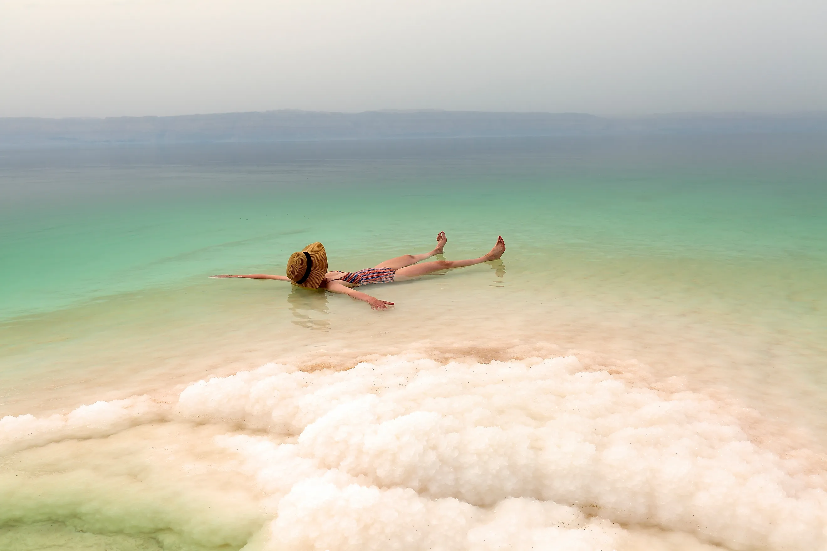
Though still shrinking, the Dead Sea spans around 214 square miles (554 km²) and is one of the saltiest bodies of water on Earth. With a salinity of around 33.7 percent, it is roughly 10 times saltier than regular seawater. Its shoreline, now more than 1,400 feet (427 meters) below sea level and continuing to fall, is the lowest exposed land surface on Earth. It receives most of its water from the Jordan River, but because it has no outlet, water leaves mainly through evaporation. As the water evaporates, salts and minerals become increasingly concentrated, creating conditions where most life forms cannot survive.
Constant Evolution
It’s hard to imagine how much Earth’s landscape has changed over the last few million years. Continents have shifted, mountains have formed, and some bodies of water have been cut off from the ocean to become lakes. As we’ve seen, some “seas,” like the Caspian Sea, are actually lakes, while some “lakes,” like Lake Maracaibo, are not true lakes because they still maintain a connection to the sea. Some lakes are drying up, while others are expanding, and both have significant ecological consequences. If you ever get the chance to visit one of these incredible bodies of water, take a moment to consider how much its shape has changed over time, and how much it may continue to change in the future.