The 10 Deepest Lakes in the World
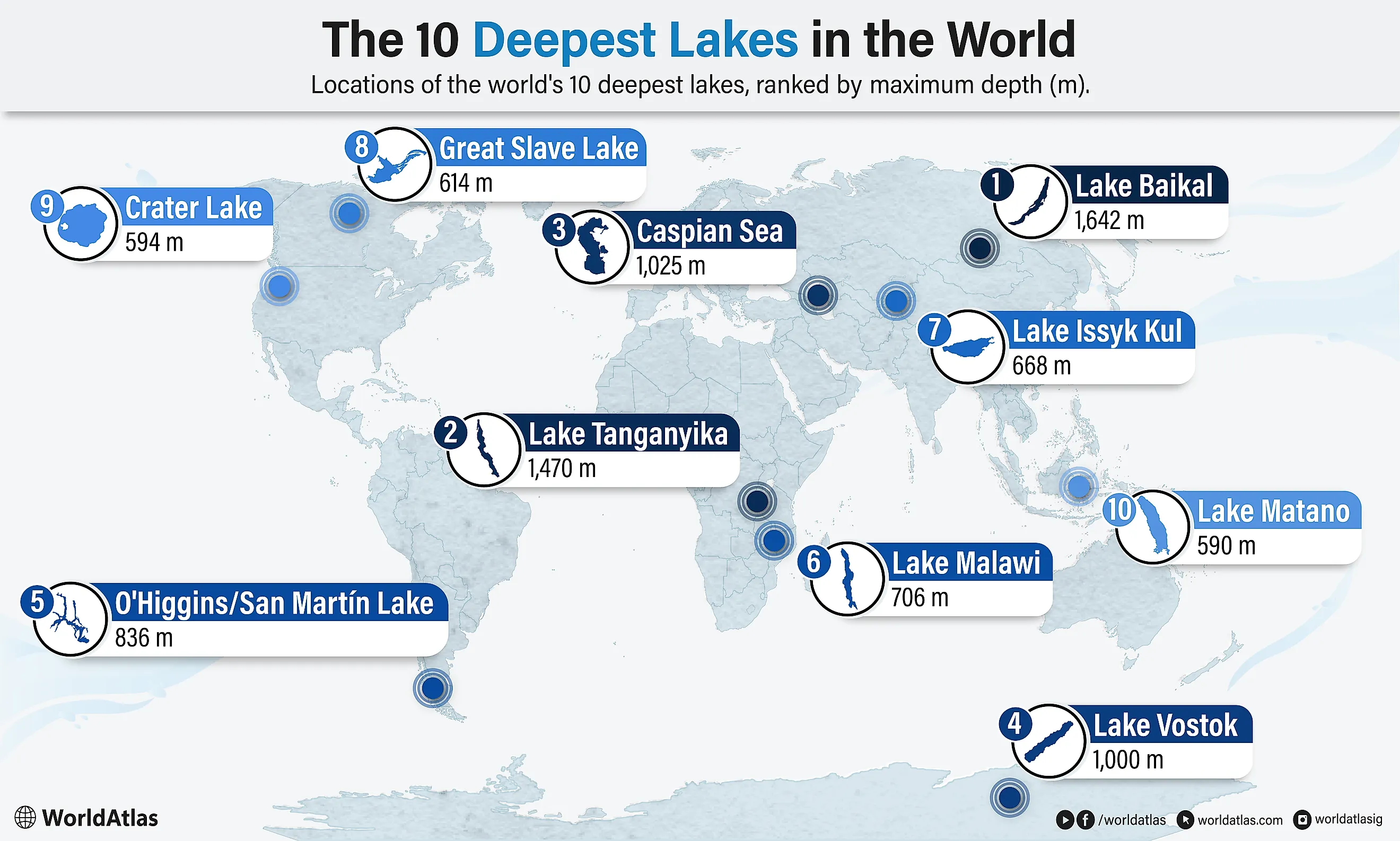
The world's deepest lakes were born from catastrophe. Tectonic rifts tore the crust apart and glaciers gouged out bedrock over millions of years. Supervolcanoes blew their tops and left craters that slowly filled with rain. Baikal alone holds a fifth of the planet's unfrozen surface freshwater. Vostok stays liquid under two miles of Antarctic ice. Each basin filled its own way and grew its own creatures. These 10 lakes plunge deeper than any others on Earth.
This ranking uses the most widely cited maximum-depth measurements for named natural lakes. Because some remote and subglacial lakes have not been comprehensively surveyed, estimates and rankings may vary by source.
The 10 Deepest Lakes in the World
| Rank | Lake (Country) | Depth (m) |
|---|---|---|
| 1 | Lake Baikal (Russia) | 1,642 |
| 2 | Lake Tanganyika (Tanzania, DR Congo, Burundi, Zambia) | 1,470 |
| 3 | Caspian Sea (Iran, Russia, Azerbaijan, Kazakhstan, Turkmenistan) | 1,025 |
| 4 | Lake Vostok (Antarctica) | 1,000 |
| 5 | O'Higgins-San Martin Lake (Chile, Argentina) | 836 |
| 6 | Lake Malawi (Malawi, Mozambique, Tanzania) | 706 |
| 7 | Lake Issyk-Kul (Kyrgyzstan) | 668 |
| 8 | Great Slave Lake (Canada) | 614 |
| 9 | Crater Lake (United States) | 594 |
| 10 | Lake Matano (Indonesia) | 590 |
1. Lake Baikal, Russia - 1,642 m
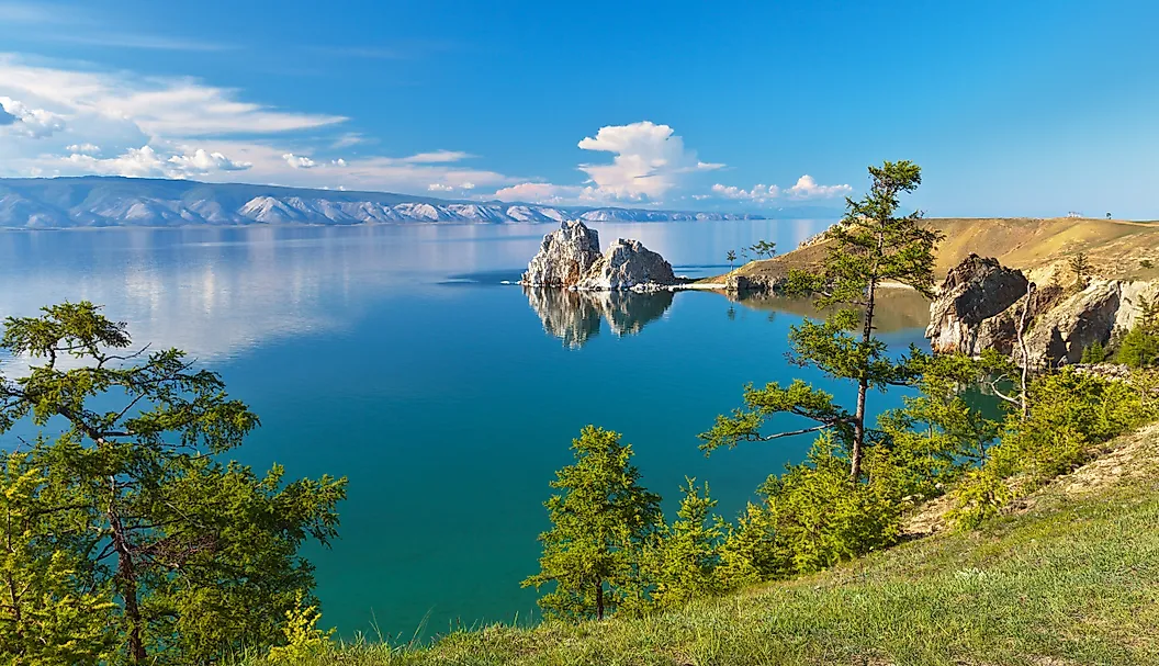
Located in southeast Russia, Lake Baikal is not only the world's deepest lake at 5,387 feet (1,642 meters), but also the oldest, formed roughly 25 million years ago. This lake is so deep it holds roughly 20 percent of the planet's unfrozen surface freshwater, making it the largest lake by volume, surpassing all of North America's Great Lakes combined. With a surface area of 12,200 square miles (31,500 square kilometers), it contains around 5,600 cubic miles (23,000 cubic kilometers) of freshwater fed by more than 330 rivers and streams, with the Selenga, Barguzin, and Upper Angara rivers providing the majority of water. And it continues to slowly widen. Lake Baikal sits on the Baikal Rift Zone, an active continental rift where the Earth's crust is pulling apart, causing the rift valley to widen and deepen. The rift is one of the deepest active rifts on Earth, with up to five miles of sediment accumulated at the bottom. Because of its deep, oxygen-rich waters and millions of years of isolation, Baikal has evolved into a biological wonderland, and more than half of its 2,500-plus recorded plant and animal species are endemic, including the Baikal seal, the only exclusively freshwater pinniped (seal) in the world.
2. Lake Tanganyika, Tanzania - 1,470 m
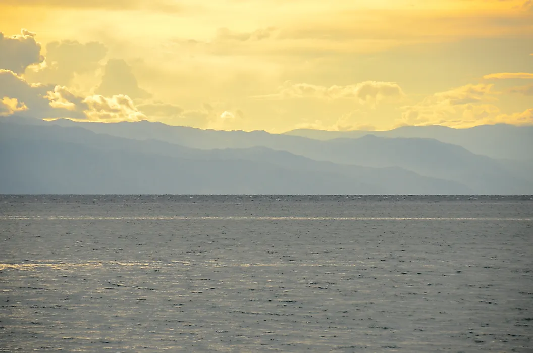
Spread across four countries, including Tanzania, the Democratic Republic of the Congo, Burundi, and Zambia, Lake Tanganyika is the longest freshwater lake in the world. It has a maximum depth of 4,823 feet (1,470 meters), making it the second deepest on the planet. It holds about 4,553 cubic miles (18,980 cubic kilometers) of water, accounting for roughly 17 percent of the Earth's available unfrozen surface freshwater. Stretching 420 miles in length (675 kilometers) and an average width of 30 miles (50 kilometers), Lake Tanganyika is primarily fed by seasonal rainfall and river flows, with major tributaries including the Malagarasi, Ruzizi, and Kalambo rivers. Its only outlet, the Lukuga River, spills toward the Congo system when the lake level runs high, but for long stretches the lake loses almost all its water to evaporation instead. Estimated to have been formed between nine and 20 million years ago, it resulted from the Earth's crust pulling itself apart to create the western arm of the East African Rift Valley. The tectonic separation caused the land to drop, creating a steep, deep, narrow trough that eventually filled with water. That deep isolation turned the lake into a cichlid factory, and more than 90 percent of its several hundred cichlid species swim nowhere else on Earth.
3. Caspian Sea, Iran - 1,025 m

Classified as a salt lake because it is completely landlocked and has no natural outlet to an ocean, the Caspian Sea is the world's largest inland salt lake. Spanning 143,200 square miles (370,886 square kilometers), it is bordered by five countries: Iran, Russia, Azerbaijan, Kazakhstan, and Turkmenistan. It reaches a maximum depth of 3,363 feet (1,025 meters), making it the world's third deepest lake. Stretching about 750 miles north to south, it accounts for roughly 44 percent of the world's inland lake water by volume. Its depth varies drastically, ranging from depths of less than 20 feet (six meters) in the north, and following a deep depression to its maximum depth in the south. The Caspian Sea's water is brackish, with salinity levels increasing from north to south due to the massive freshwater inflow from the Volga River. It originated as part of the ancient Tethys Ocean before becoming isolated 30 million years ago. About 5 million years ago, shifting tectonic plates and a drop in global sea levels caused the region to buckle, contributing to the formation of mountains that isolated the basin from the world ocean. That long isolation left the Caspian with a cast of its own, including the Caspian seal and much of the world's remaining wild sturgeon.
4. Lake Vostok, Antarctica - 1,000 m
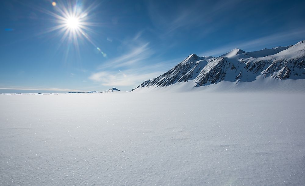
Nobody has directly observed Lake Vostok, but it's there, buried 2.5 miles (four kilometers) beneath the East Antarctic Ice Sheet. Comparable in surface area to Lake Ontario, Vostok may reach depths of 3,300 feet (1,000 meters) and contains about 1,300 cubic miles of liquid freshwater. Insulation from surrounding ice, geothermal heating from the Earth's crust, and immense pressure from the overlying ice sheet all help significantly lower the freezing point of water, keeping it from turning to ice. Stretching 150 miles (240 kilometers) in length and 30 miles (50 kilometers) wide, Vostok sits in a deep tectonic depression that began to form around 60 million years ago when shifting plates cracked the bedrock. As the Antarctic climate cooled dramatically around 34 million years ago and again 14 million years ago, ice sheets expanded and eventually sealed off the water for good. Scientists have detected microbial material in accretion ice formed where lake water froze onto the bottom of the ice sheet, but contamination makes the findings difficult to interpret. Whether the lake itself contains a substantial ecosystem remains unresolved.
5. O'Higgins-San Martin Lake, Chile - 836 m

Characterized by an irregular, octopus-like morphology with eight distinct arms spreading into flooded valleys, Lago O'Higgins (called Lago San Martin in Argentina) stretches across the Chile-Argentina border and is the deepest lake in the Americas. It reaches a maximum depth of 2,743 feet (836 meters) and covers 391 square miles (1,012 square kilometers), between the two countries. Located in a glacial basin in the Patagonian Andes, it has a distinct milky-turquoise color caused by the heavy concentration of glacial "rock flour" suspended in its waters. Sometimes difficult to navigate due to persistent high winds, Lago O'Higgins-San Martin is predominantly fed by the retreating O'Higgins and Chico glaciers, and is drained by the Pascua River, which ultimately flows into the Pacific Ocean. The lake's basin was carved out by intense glacial abrasion of the Patagonian Ice Sheet, and its shape was formed by the geological evolution of the Patagonian Andes. The lake itself, due to its deep, icy waters, contains a resilient but sparse sub-polar ecosystem with relatively low aquatic biodiversity.
6. Lake Malawi, Malawi - 706 m

Lake Malawi, also known as Lake Nyasa, is the second deepest lake in Africa and sixth deepest on Earth with a maximum depth of 2,316 feet (706 meters). Spanning Malawi, Mozambique, and Tanzania, this lake is 365 miles (587 km) long and 52 miles (84 km) at its widest point, giving rise to the nickname "Calendar Lake." Lake Malawi is a meromictic lake, meaning its distinct thermal layers do not mix, and it experiences substantial fluctuations in water levels based on regional rainfall and evaporation cycles. The lake is situated in a deep tectonic valley, formed over roughly the past one to two million years as the East African Rift pulled the African plate apart. It is noted for its clear southern waters, its extraordinary cichlid diversity, and its importance to local fisheries that feed millions along its shores.
7. Lake Issyk-Kul, Kyrgyzstan - 668 m

Located in the Tian Shan mountains of eastern Kyrgyzstan, Issyk-Kul is the world's seventh deepest lake and second largest high-altitude lake by surface area. The name translates to "hot lake" in Kyrgyz, as geothermal springs and its impressive maximum depth of 2,191 feet (668 meters) typically prevent the saline waters from ever freezing despite sitting at an altitude of 5,272 feet (1,607 meters) above sea level. Issyk-Kul is an endorheic basin, meaning it has no outflow to rivers or oceans, but more than 100 rivers feed the lake, and dissolved minerals left behind create a mild salinity. The basin was formed around 25 million years ago during the Cenozoic era due to tectonic shifts in the Earth's crust. As the basin sank and filled with glacial meltwater, the surrounding lands rose rapidly to form the Tian Shan Mountains.
8. Great Slave Lake, Canada - 614 m

Great Slave Lake is North America's deepest lake, plunging to a maximum depth of 2,015 feet (614 meters) in Canada's Northwest Territories. It features exceptionally clear waters and has a surface area of 11,030 square miles (28,568 square kilometers). The Slave River is the lake's primary inflow, while the Mackenzie River serves as its sole outflow, eventually draining it into the Arctic Ocean. Great Slave Lake was formed around 10,000 years ago when the last of the great glaciers, the Wisconsinan, carved out the bedrock then retreated, filling the basin with meltwater. Its name comes from the Slavey, a term applied by outsiders to a group of Dene people who have long lived along its shores. Today the lake hosts remarkable cold-water ecosystems teeming with world-class lake trout, northern pike, and Arctic grayling.
9. Crater Lake, United States - 594 m

The deepest lake in the United States, Oregon's Crater Lake plunges to an impressive maximum depth of 1,949 feet (594 meters). The lake is relatively young, forming just 7,700 years ago during a massive eruption of the Mount Mazama stratovolcano, which ejected around 12 cubic miles of magma, covering the Pacific Northwest in ash. The evacuation of the underlying magma chamber caused the 11,000-foot volcanic peak to collapse inward, creating a six-mile-wide basin known as a caldera. Over hundreds of years, rains and snowmelt filled the caldera, creating the Crater Lake we know today. As a nod to its violent past, a cinder cone known as Wizard Island rises 764 feet above the lake's surface, which formed during smaller eruptions after the initial collapse.
10. Lake Matano, Indonesia - 590 m

With a maximum depth of 1,936 feet (590 meters), Indonesia's Lake Matano is the deepest lake in Southeast Asia and the 10th deepest globally. It is a classic "ancient lake," estimated to be between 1 million and 4 million years old. It formed when tectonics along the active Matano Fault split, creating a deep rift valley that eventually filled with water. Interestingly, because its surface sits 1,253 feet (382 meters) above sea level while its floor drops 1,936 feet down, the lowest part of the lake lies below sea level, making it what geographers call a cryptodepression. Fed mostly by underground springs, Lake Matano has very clear waters, allowing the lake's bottom to sometimes be seen as deep as 65 feet down. Because it has remained physically stable for millions of years in an isolated region, its waters and shores are an evolutionary hotspot, featuring a large number of endemic flora and fauna, including ancient fish and snail species.
Into The Deep
Though violent forces created these 10 lakes, today these waters host a wide array of aquatic and shore fauna, and provide humans with important resources like drinking water, tourism opportunities, and points of national pride. Oregon's Crater Lake draws thousands of visitors a year to peer into its collapsed volcano, while Tanganyika's cichlids fill aquariums around the globe. Together they map out how water, ice, and shifting crust shaped the planet we live on.