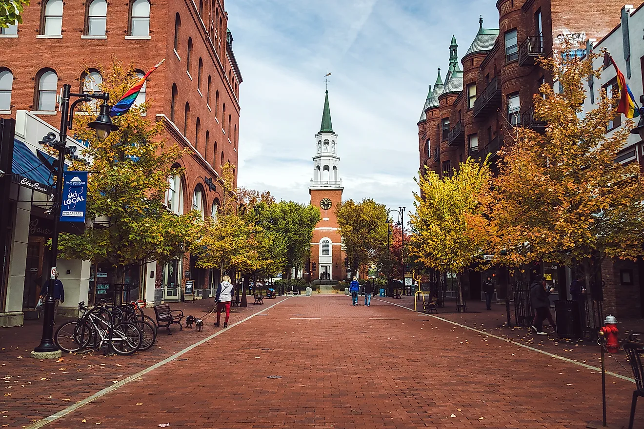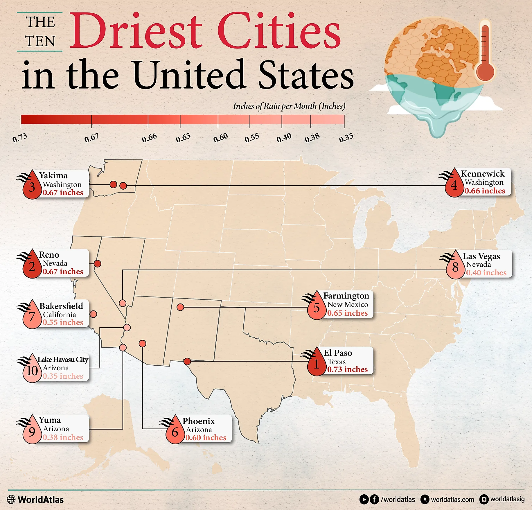
The 10 Driest Cities in the United States
When climatologists talk about the “driest cities,” they measure average annual precipitation using 30-year climate records. In most of the United States, rainfall averages close to 30 inches a year, but some cities get less than a third of that. These places often face challenges with water supply, agriculture, and wildfire risk. They also shape how residents live, from landscaping to building practices.
The cities in this list all have over 45,000 residents, with Phoenix, Arizona, the most populous city, at 1.75 million as of 2025. Each city chosen has reliable records and consistent weather monitoring, not just isolated desert stations. Numbers are reported in inches for clarity. This helps compare rainfall levels across regions and shows just how dry these cities are.
The 10 Driest Cities in the United States
| City | State | Inches of Rain per Month |
| El Paso | Texas | 0.73 inches |
| Reno | Nevada | 0.67 inches |
| Yakima | Washington | 0.67 inches |
| Kennewick | Washington | 0.66 inches |
| Farmington | New Mexico | 0.65 inches |
| Phoenix | Arizona | 0.60 inches |
| Bakersfield | California | 0.55 inches |
| Las Vegas | Nevada | 0.40 inches |
| Yuma | Arizona | 0.38 inches |
| Lake Havasu City | Arizona | 0.35 inches |
El Paso, Texas

El Paso sits in the Chihuahuan Desert along the U.S.-Mexico border and averages only 8.78 inches of rain each year, or 0.73 inches every month, according to the El Paso International Airport. The city’s desert climate means long stretches of hot, dry weather with clear skies. Most of El Paso’s rain falls in late summer during the North American Monsoon.
From July to September, moist air moves in from the Gulf of Mexico, fueling afternoon thunderstorms. These storms can bring heavy downpours, often very localized, so one part of the city may see flooding while another remains dry. Outside of the monsoon season, rainfall is scarce.
Reno, Nevada

According to the Reno Weather Forecast Office, a National Weather Service office, the city averages about 8.09 inches of precipitation each year and just 0.67 inches monthly. Reno is in the high desert at the base of the Sierra Nevada.
Moist air from the Pacific Ocean hits the Sierra Nevada mountains, rises, cools, and drops rain and snow on the western slopes. By the time the air moves east into Reno, it is much drier. This “rain shadow” effect explains why the city receives so little precipitation. Summers are hot and very dry, with long stretches without measurable rain.
Yakima, Washington

According to the data from Yakima Air Terminal, this city receives about 8.01 inches of rain a year, an average of 0.67 inches a month. The city sits in central Washington, directly in the rain shadow of the Cascade Range. Moist air from the Pacific Ocean rises over the mountains and loses most of its moisture as rain and snow on the western slopes.
By the time the air reaches Yakima, it is much drier, leaving the valley with limited rainfall. The climate has a Mediterranean-like rhythm. Summers are long, hot, and almost completely dry, with July and August seeing very little measurable rainfall.
Kennewick, Washington

Kennewick averages just 7.87 inches of rain each year, or 0.66 inches per month, making it one of the driest cities in the Pacific Northwest. The city sits in the Columbia Basin, directly in the rain shadow of the Cascade Range. As moist air from the Pacific rises over the mountains, it cools and drops most of its rain on the western side.
By the time the air reaches Kennewick, it is much drier. Unlike many other parts of Washington, Kennewick sees very few rainy days each year. Thunderstorms are rare but can bring sudden downpours that make up a small share of the yearly total.
Farmington, New Mexico

According to the Four Corners Regional Airport report, Farmington receives about 7.76 inches of precipitation each year, averaging 0.65 inches per month. It is located in the San Juan Basin of northwestern New Mexico, a region shaped by a semi-arid high desert climate. Summers bring the North American monsoon, but rainfall is usually modest compared to other parts of New Mexico.
With low humidity, abundant sunshine, and frequent breezes, much of the limited rainfall evaporates quickly, leaving less water available for soil and vegetation. This pattern creates challenges for farming and water storage, while also increasing wildfire risk during dry spells.
Phoenix, Arizona

Phoenix is one of the largest cities in the country, and it has a desert climate. According to NOAA’s 1991-2020 Climate Normals, the city receives about 0.60 inches of rain each month with an annual average of 7.22 inches. Most of the time, the weather is hot, dry, and cloudless.
Phoenix sits in the Sonoran Desert, which explains its low rainfall and high summer temperatures. Rain usually comes in short bursts during the late summer monsoon season. These storms can be intense, with heavy downpours, lightning, and strong winds, but they rarely last long enough to compensate for the overall dryness.
Bakersfield, California

According to NOAA’s 1991-2020 Climate Normals, the city receives an average of 0.55 inches of rain each month, with an annual precipitation of 6.65 inches, making it one of the driest cities in California. It sits in the southern part of the San Joaquin Valley, surrounded by the Coast Ranges to the west and the Sierra Nevada to the east.
These mountains block much of the moisture coming from the Pacific Ocean, leaving the valley floor in a rain shadow. Bakersfield has a dry Mediterranean climate with long, hot summers and mild winters. Most of its rain falls between December and March, while summers are almost completely dry.
Las Vegas, Nevada

According to the Las Vegas Weather Forecast Office, the city averages just 0.40 inches of rain each month, with an annual precipitation of 4.78 inches, making it one of the driest cities in the United States. Its location in the Mojave Desert explains the scarcity of rainfall. The surrounding Sheep Peak and Black Mountain, along with the tall Sierra Nevada to the west, block most Pacific moisture before it reaches the valley.
This rain shadow effect keeps the city dry almost year-round. Most of the annual rainfall that does occur comes in short bursts. The city’s dry climate has shaped its landscape, water use policies, and daily life, making efficient water management a constant challenge.
Yuma, Arizona

According to Yuma 13.8 ESE, a weather station located 13.8 miles East-Southeast of Yuma, Arizona, this city has an average of just 0.38 inches of rain each month. It sits in the Sonoran Desert, where skies are sunny almost year-round and rain is scarce. The city’s location keeps it especially dry.
High-pressure systems in the subtropics limit cloud formation, while surrounding mountains block moisture from moving in. Most days pass without any measurable rainfall. When storms do arrive, they are usually tied to the summer monsoon. Irrigation from the Colorado River supports large fields of lettuce, citrus, and other crops, showing how desert cities adapt to very limited natural water.
Lake Havasu City, Arizona

Lake Havasu City is one of the driest cities in the United States, averaging just 0.35 inches of rain a month according to NOAA’s 1991-2020 Climate Normals. The city sits in the Mojave Desert along the Colorado River and is surrounded by rugged mountains. Its desert location explains the combination of extreme heat and very low rainfall.
Most of the year is hot and dry, with long stretches of clear skies. The little rain that does fall usually comes from short but intense summer monsoon storms. With scarce rainfall and high evaporation, water management is a constant concern.
Finishing Thoughts
Some U.S. cities get far less rain than the national average of 30 inches a year. These dry conditions affect water supply, farming, and even daily life. The locations highlighted here show how geography, mountains, and desert air patterns shape rainfall. Living in them requires careful water management, creative adaptation, and a respect for the environment. Together, they reveal how people thrive in places that receive remarkably little rain.