San Juan River
The San Juan River was named by San Juan Bautista (Saint John the Baptist). The river threads its way through Colorado, New Mexico, and Utah to the border of northern Arizona. Around 90% of the river’s flow comes from its headwaters in the San Juan Mountains of southwestern Colorado and drains nearly 64,749 square km of the Four Corners region as it drops from an altitude of 4,276 meters to around 1,097 meters above sea level.
The San Juan River’s flow is controlled mainly by the waters released from the Navajo Dam in New Mexico into the river. The river travels around 616 km and terminates in Lake Powell.
The Course Of The San Juan River

The San Juan River originates in Archuleta County in Colorado, at the confluence of its East and West Forks. Both forks begin in the eastern San Juan Mountains in the San Juan National Forest. San Juan River flows southwest past the foothills of the Rocky Mountains through Pagosa Springs, reaching the Navajo Lake reservoir north of the New Mexico border, near Arboles, Colorado. Below the Navajo Dam, the river travels through a narrow farming valley in the high desert county of the Colorado Plateau. At Farmington, New Mexico, the San Juan River is joined from the north by the Animas River, its main tributary, which rises in the San Juan Mountains near Silverton, Colorado.
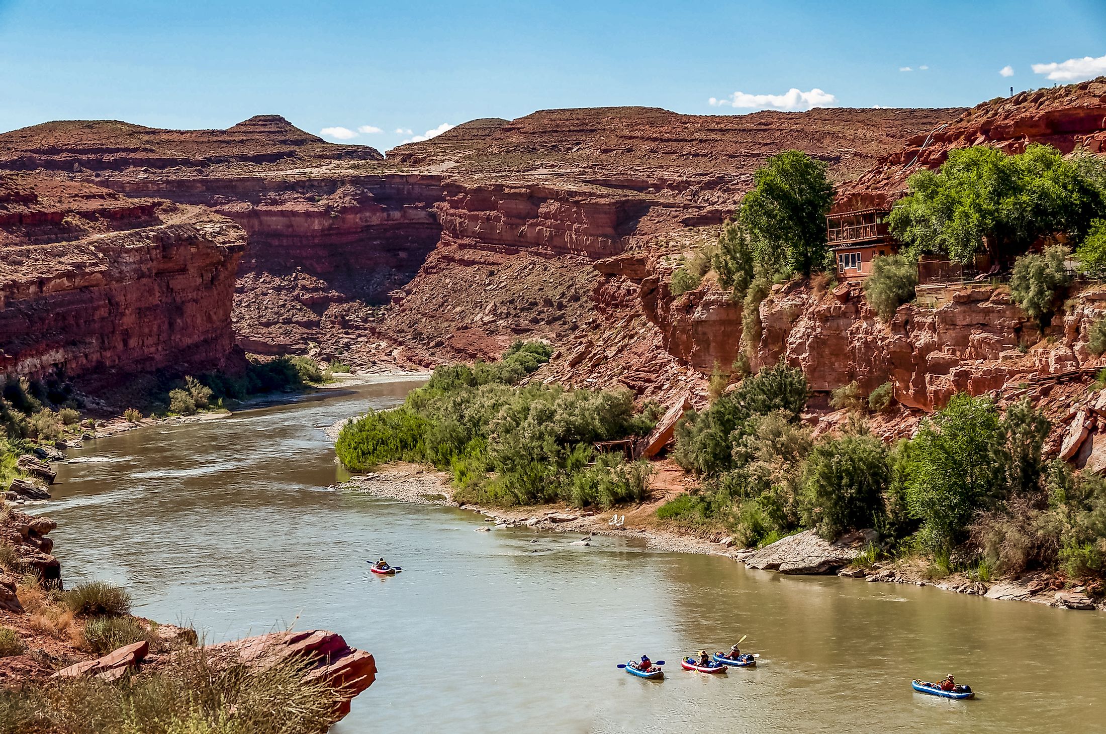
The river flows through the Navajo Nation, turning northwest near Shiprock, crossing briefly back into southwest Colorado before entering southeastern Utah. West of Bluff in Utah, the San Juan River slices through the Comb Ridge and enters a series of canyons. The river joins Colorado in San Juan County, Utah, to the north of Navajo Mountain and northeast of Page, Arizona.
The Piedra River, Los Pinos River (Pine River), Rio Blanco, and the Navajo River are all tributaries of the upper San Juan River and join it in Navajo Lake. The Animas River and several major tributaries join below Farmington, including the La Plata River and Mancos River in New Mexico and McElmo Creek in Utah.
Geography Of San Juan River

With a watershed land area almost the same size as the state of West Virginia, the San Juan River drains in Colorado, Utah, New Mexico, and Arizona. San Juan’s main stem does not actually travel through Arizona but comes close to the Four Corners. Windom Peak is the highest point in the San Juan River watershed. It is located near the headwaters of the Animas River. On the other hand, the lowest elevation where the river flows into Lake Powell has a normal maximum elevation of most of the watershed.
The agricultural use of the river is scarce due to the lack of substantial groundwater reserves and low rainfall. The agricultural use is mainly in the river valleys and in higher foothill areas influenced by wetter montane climates. Around 2.3% of the watershed is dryland farms, and 1.6% is irrigated. Forests cover approximately 20% of the watershed, mostly at high elevations.
While Ute Mountains and the San Juan Mountains bound watershed on the north, various upland and mesa areas of the Colorado Plateau lie to the south and west, and the Jemez Mountains to the east.
The San Juan Basin is a geologic structural basin known for its abundant fuel resources. It is a distinct area of the San Juan River watershed and is roughly conterminous with the southeast quadrant of the river.
Brief History Of San Juan River

The San Juan River has played a significant role as a continuous source of water in an arid climate and a major part in Navajo mythology, where it is known as Old Age River, One-With-a-Long-Body, or One-With-Wide-Body. The river is characterized variously as a snake coiled at the Goosenecks, an old man with hair of white foam, a flash of lightning, and a black club of protection. The latter theme is important to the Navajos. They considered the river a separation line between their safe confines and the land of the Utes and white men, even before the river became an official reservation boundary in 1884.
The first substantial settlement on the Utah part of the San Juan River occurred at Riverside (Aneth) in 1878-1879 when eighteen families from Colorado established a small community. The Mormons made their trek through the Hole-in-the-Rock and settled Bluff a year later. In the following decades, trading posts flourished as Navajos herded sheep and planted small horticultural plots while settlers struggled to prevent destructive flooding.
Besides agriculture, the San Juan River has focused on various economic endeavors. There were attempts to find gold between the 1890s and early 1900s, but they were futile, and the interest shifted to oil. Oil companies started drilling in earnest in the 1920s, giving rise to the petroleum industry still in operation today near several river towns, including Aneth, Mexican Hat, and Montezuma Creek. By the 1940s, Norman Nevills and Jack Frost established a strong reputation in the river-running business as they took hundreds of tourists down the San Juan River.


