The Day The Chesapeake Bay Froze Over
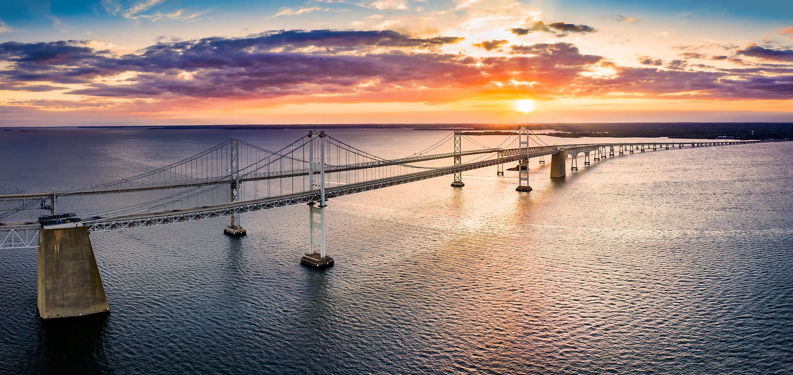
The Great Freeze of 1977 was a severe weather event that affected much of the eastern United States, the Mid-Atlantic ,Northeast, and Canada. Beginning in late 1976 and continuing through February 1977, the eastern United States saw record low temperatures, heavy snowfall, frozen waterways, and widespread shortages and travel disruptions. Chesapeake Bay and its surrounding regions typically experience cold days, occasional snowstorms, and a considerable variation in temperatures between the northern and southern parts of the estuary. Chesapeake Bay does not usually freeze over, though surface ice can appear in parts of the bay. In 1977, surface ice coverage was around 85% and was around 8 to twelve inches thick in some areas. The last time such a severe winter occurred, causing much of the bay to freeze over, was the winter of 1779-1780, occurring during the American Revolution, while the winter of 1917-1918 saw similar ice coverage. In 1977, the Great Freeze impacted much of the life around Chesapeake Bay and the communities dependent on the bay, with shipping disrupted; fishing and especially oystering were brought almost to a standstill, and the inhabited Chesapeake islands, Smith Island and Tangier Island, were cut off from food deliveries and fuel, with no access to the mainland. Smith Island was recorded as being isolated from the mainland for up to nine weeks.
The Great Freeze

Beginning in the autumn of 1976 and continuing well into February 1977, record low temperatures devastated the Mid-Atlantic states and the Northeast, extending into much of eastern Canada. Not a single, isolated storm, the weather patterns began in October through December when unusually cold conditions impacted the eastern United States. Waterways began to freeze much earlier than normal, and snowfall increased. By January 1977, the cold intensified, with repeated Arctic air outbreaks bringing in severe temperatures and heavy snowfall disrupting transportation, and energy supplies. In February, the temperatures stabilized but remained colder than average. With frozen waterways, accumulated snow, and other problems caused by ice buildup, the region continued to face challenges. January 1977 experienced some of the coldest temperatures in the eastern United States in around 200 years.
The unusual weather was mainly caused by atmospheric circulation patterns that allowed Arctic air to move southward and into the eastern United States. These repeated movements of cold continental polar air brought the temperatures to well below seasonal averages. A high-pressure ridge disrupted the normal west-to-east movement of weather systems, maintaining the cold temperatures. Unusually cold surface waters in the North Pacific contributed as well to the atmospheric circulation patterns, while the heavy snow coverage on the ground maintained the low surface temperatures by reflecting incoming solar radiation. The National Weather Service's meteorological analysis of the weather patterns during that winter describes the unusually strong atmospheric blocking as a key contributor to the unusual cold temperatures of 1977. The eastern United States experienced some of the most persistent cold weather in decades, with the cold weather reaching into the continent as far as the Ohio Valley. Washington, DC, experienced an average January 1977 temperature of 25.4°F (-3.7°C) compared to the normal January average of 34.6°F (1.4°C). The Great Lakes region was also affected, with extensive ice coverage disrupting shipping and maritime operations.
When Chesapeake Bay Froze

Chesapeake Bay experienced its most famous freeze during the severe winter of 1976-1977. Communities on the shoreline of the bay were particularly affected by the unusually cold winter, as the ice on Chesapeake Bay averaged 8 to 12 inches in some areas. The bay experienced up to an approximate 85% surface ice coverage during 1976-1977. In comparison, the average maximum surface ice coverage during a normal winter is around 10% of its total surface area. This includes the bay's tributaries. In normal winter conditions, the Upper Chesapeake Bay area, especially around the Elk and Northeast Rivers, is generally the first to freeze, followed by the upper tributaries, shallow rivers, sheltered coves, and creeks. Middle Chesapeake Bay tends to have less ice coverage, except during a more prolonged winter. Lower Chesapeake Bay rarely freezes due to the influence of warmer ocean water and the deeper channels found in this area.
In the winter of 1976-1977, in what is called the Great Freeze, the freezing over began in December 1976, in the Upper Chesapeake Bay tributaries. By mid-January, the ice had spread to the middle portion of the upper bay. By February, persistent westerly winds pushed ice toward the eastern shores of the bay, creating massive ice formations. On February 7-8, NASA's Landsat satellite imagery captured the conditions in the bay, and by February 10, it was reported that ice covered 85% of Chesapeake Bay. In the upper bay, ice thickness reached 6 to 12 inches (15 to 30 cm), while the lower bay experienced ice thickness of around 2 to 8 inches (15 to 20 cm). In some tributaries, the ice was found to be up to 24 inches (60 cm) in thickness.
The ice thickness measurements were documented in NASA's technical analysis of the freeze, published in 1980. With such quantities of ice, much of it moving, the physical impact on the shoreline was significant. Tidal currents and strong winds pushed the ice into large, fragmented piles, often forcing slabs of ice over one another, creating massive formations known as floebergs. In the shallow waters between North Point and Rock Hall, Maryland, floebergs were reported to be as high as 20 feet, with a width of 40 feet and a length of 100 feet, although the report suggested that the ice did not present hazards for shipping. The ice ridges pressing against the shore impacted the shoreline, causing erosion, damaging coastal infrastructure, and affecting beaches and shallow coastal areas. The US Coast Guard documented moving ice exerting enormous pressure on vessels and shoreline structures, with ice freezing around piers, pilings, and navigational markers being lifted or damaged. Sharps Island Lighthouse, at the entrance of the Choptank River, was reported as having tilted 15 degrees under the pressure of the ice ridges.
The Impact

On January 14, 1977, the Washington Post reported that most ship traffic on Chesapeake Bay had ceased. Ships were stranded, including two barges carrying a combined 1.365 million gallons of oil that were stuck in Tangier Bay. The US Coast Guard and other local agencies deployed icebreakers and other support vessels to reopen shipping channels and to aid stranded vessels trapped in the ice. Navigation buoys had been pushed underwater by the ice, or had been pushed from their positions. What ships managed to get through due to the efforts of icebreakers still faced long delays and continued dangerous conditions. A 1978 article in the US Naval Institute Proceedings described the efforts to break through the ice, reporting that ice measuring two to four feet was found between the head of the bay and the Potomac River.
The two inhabited islands in Chesapeake Bay with no bridge connection to the mainland, Tangier Island and Smith Island, were in particular seriously impacted by the freezing of the bay. These two communities, with a combined population of 923 according to the 1970 US Census, depended on boats for transportation, food and other supplies, and access to the mainland. With the freezing of the waters of Chesapeake Bay, supply routes were cut off, and the islands were isolated. Food and heating fuel supplies were nearly exhausted by the middle of January, with an estimate of less than three days of diesel fuel remaining to operate Smith Island's two electricity-generating facilities. The Maryland National Guard began an emergency helicopter operation on January 19, delivering food, fuel, and other essentials. Without access to medical assistance, helicopters were employed to provide transportation during medical emergencies.
There was also a serious impact on local economies during the winter of 1976-1977. Oystering was particularly affected as watermen were prevented from reaching their harvesting grounds. Commercial fishing in general was disrupted. On January 31, the Washington Post reported that oystering was devastated by the freezing of the bay. Seafood-processing facilities were interrupted, heating-fuel shortages on the mainland were affected, and unemployment during the winter increased as all fishing-related industries were halted. Many of the Eastern Shore communities depended directly on the bay for their livelihood, and the economic impact was particularly serious for those communities. The long period of cold temperatures was accompanied by several snowstorms, especially across the Mid-Atlantic and Great Lakes regions. In Maryland and Virginia, roads and highways were blocked by accumulated snow and snow drifts. Snow accumulated faster than municipal crews could clear it, with the blowing and drifting snow being particularly dangerous for road traffic. Rail traffic was interrupted, and schools and businesses closed during the worst periods of the winter.
The End Of The Freeze
By February 1977, temperatures began to stabilize, becoming somewhat less severe. However, the ice on Chesapeake Bay did not disappear immediately. Around February 23, temperatures were reported to have approached 70°F (21°C). This sudden warming accelerated the breakup of ice in the bay. Melting ice, however, created further problems. The broken ice moved in large quantities through tributaries and other waterways, creating ice jams and causing further hazards for boats. By March, the temperatures rose further, ending the severe weather of the winter.
The winter of 1976-1977 is an example of how extreme cold over an extended period can affect an entire region. For meteorological studies, this was one of the most exceptional winter weather events in the eastern United States. The near-total freezing of Chesapeake Bay was a crucial example of how prolonged Arctic air outbreaks could affect large bodies of water. The economic and social impact emphasized the difficulties communities can face in extreme winter weather conditions, and what needed to be prepared in advance for future cold periods and winter storms. The satellite images from Landsat 1 were an important record of the bay's ice coverage and demonstrated the crucial role of satellite observation in monitoring environmental conditions.
The Freezing Of Chesapeake Bay
The Great Freeze of 1977 was not the only time Chesapeake Bay came close to freezing over. Other periods experienced extremes in cold temperatures, such as the winter of 1779-1780 during the American Revolution, and Chesapeake Bay froze enough for people to walk from Annapolis to Kent Island, Maryland. The winter of 1917-1918 also produced extensive ice coverage. More recently, the winter of 1978-1979 saw surface ice coverage of 60% of the bay's waters, while winter 1984-1985 experienced a slightly higher-than-average coverage of 20%. For many who lived through the winter of 1976-1977, the Great Freeze remains a significant experience and the most recent time when Chesapeake Bay froze over.