The US Coastal Highways Most At Risk From Rising Seas
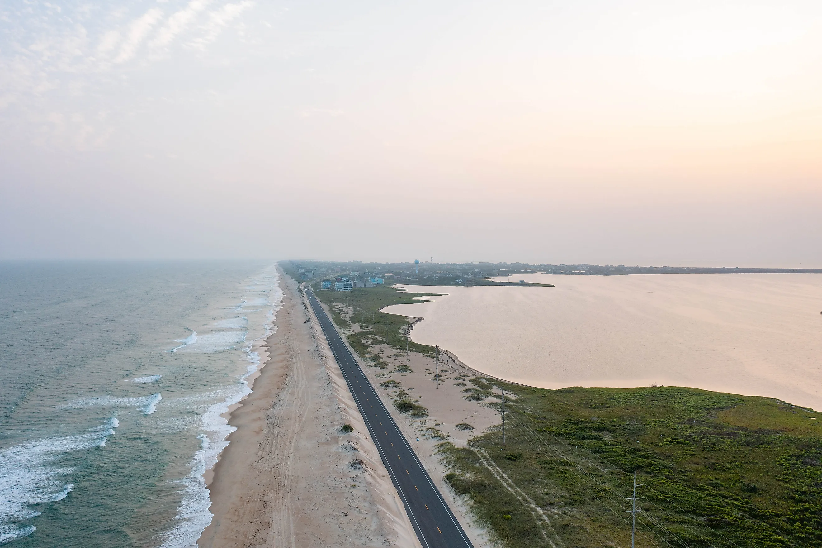
North Carolina rebuilt the same short stretch of Highway 12 north of Rodanthe again and again, until it finally gave up and moved the road into the water. In 2022, traffic began crossing a 2.4-mile bridge that loops out over Pamlico Sound, bypassing a section of beach that was eroding by about 11 to 12 feet a year, according to state transportation data. NOAA projects that sea levels along US coasts will rise another 10 to 12 inches by 2050, and many coastal highways were built only a few feet above the water. That makes roads like NC 12 some of the most vulnerable pieces of infrastructure in the country. Several states are already racing to raise, reroute, or rebuild their shoreline roads before the sea gets there first.
NC 12, North Carolina's Outer Banks

NC 12 is a 148-mile, mostly two-lane highway that strings together the villages of the Outer Banks, and for much of its length, it is the only road in or out. It runs along narrow barrier islands where waves can wash over the dunes and push sand and water across the pavement, while the sound side can flood during storms. The state built the Jug Handle Bridge for about $155 million, designing it to handle water 10 to 14 inches higher than today. The problems have simply moved. The next trouble spot is near Pea Island National Wildlife Refuge, and state planners are considering an even longer bridge, about 10 miles, to carry the road around it.
Louisiana Highway 1, Golden Meadow To Port Fourchon

Louisiana Highway 1 is the only land route to Port Fourchon, a major hub for offshore energy work, and to Grand Isle, the state's only inhabited barrier island. As the surrounding marsh sinks and erodes, the open water has crept right up to the road's edge. According to the Louisiana Department of Transportation and Development, the old, low section of LA 1 near Leeville now floods even during weak storms. The state has responded by building a new elevated highway on concrete pillars. Nine miles between Leeville and Port Fourchon are already raised, and work continues north toward Golden Meadow, with completion projected in 2027.
Highway 1 At Gleason Beach, California

On the Sonoma Coast north of Bodega Bay, California's famous Highway 1 sits on top of crumbling 70-foot bluffs at Gleason Beach. A study by Caltrans, the state's transportation agency, found that the bluffs are retreating by about a foot a year, a pace that could speed up as sea levels rise and winter waves strike higher on the cliffs. Rather than keep patching the road, Caltrans launched a $73 million project to move about 3,700 feet of the highway roughly 400 feet inland, onto a new alignment with a bridge over a creek canyon. Similar erosion threatens other stretches of Highway 1, where closures from slides, erosion, and flooding have become more frequent in recent years.
State Route 37, San Pablo Bay, California

Inside San Francisco Bay's northern arm, State Route 37 crosses miles of low marsh along San Pablo Bay, linking the North Bay's growing communities with almost no high ground beneath it. Much of the road sits barely above the water, and heavy rain combined with high tides can overwhelm the levees that protect it. Caltrans closed the highway for days after flooding and levee problems in 2019, and again for three days in January 2023. Parts of the road have already been raised, and Caltrans has moved ahead with a replacement bridge and higher roadway near Novato Creek. Longer-term plans call for elevating much more of the corridor, possibly on a causeway above the marsh, as sea levels rise.
The Overseas Highway, Florida Keys

The Overseas Highway, the southern end of US 1, hops across the Florida Keys on a string of bridges and low causeways for more than 100 miles to Key West. It is the only road into or out of the Keys, which makes it the islands' lifeline for food, fuel, and hurricane evacuation. Most of the Keys sit only a few feet above sea level, and many local streets already flood during the highest tides of the year, even on sunny days. Monroe County has begun studying and raising some of its most flood-prone roads. Keeping the main highway above the water as seas rise will be one of the most expensive challenges facing the islands.
A1A At Flagler Beach, Florida

On Florida's Atlantic coast, State Road A1A runs right along the dune line through Flagler Beach, with little more than a strip of sand between the pavement and the ocean. When Hurricane Matthew passed offshore in 2016, waves tore away parts of the road, and Hurricane Irma caused more damage the following year. The state rebuilt the highway and buried a long steel wall beneath the dunes to help protect it from future storms. The project bought time, but with sea levels rising and storms pushing water higher, roads built this close to the beach will need constant attention.
Kamehameha Highway, Oahu, Hawaii

On Oahu, Kamehameha Highway loops around the island's northern and eastern shores, and in many places, it runs only a few feet from the sand. Along the windward coast, in communities such as Hauula and Kaaawa, waves have eaten into the shoulder and undermined the pavement during high surf, forcing emergency repairs and lane closures. Because the road is often the only route connecting these small communities, every washout cuts off homes, schools, and businesses. Hawaii transportation officials have studied moving the most vulnerable stretches inland, but in places, the mountains rise so close to the shore that there is little room left to move.
Why Coastal Roads Are So Vulnerable
Rising seas threaten highways in more ways than one. The most obvious danger is waves and storm surge breaking over the pavement or eating away the land beneath it. But engineers also worry about what happens underground. As sea levels climb, the water table under low coastal roads rises too, soaking the layers of rock and soil that hold the pavement up. A road that sits on wet ground cracks and sinks faster, even if the ocean never touches its surface. Higher tides also make drainage pipes back up, so rain that once flowed off a road can pool on it for hours.
Raise, Reroute, Or Retreat
Every highway on this list shows a different way to respond to rising water. North Carolina moved its road into the sound on a bridge. Louisiana lifted its highway onto pillars above the marsh. California is pulling Highway 1 back from the cliffs and raising Route 37 above the bay, and Florida has buried walls beneath its dunes. None of these fixes is cheap, and none is permanent. As the ocean creeps higher over the next few decades, the cost of keeping America's coastal roads open will keep climbing.