The US Highways That Flood Most Often
A handful of US highways flood so often that the closures have become routine. North Carolina transportation records log dozens of weather closures on NC 12 along the Outer Banks. TxDOT has counted 10 flood events where a sunken stretch of Interstate 10 passes White Oak Bayou in Houston. One 2017 flood closed California's SR 37 for 28 days. The water reaches the pavement by a different route in each place: Atlantic overwash, Gulf storm surge, swollen rivers, high tides, failed levees, and city drainage that cannot empty fast enough.
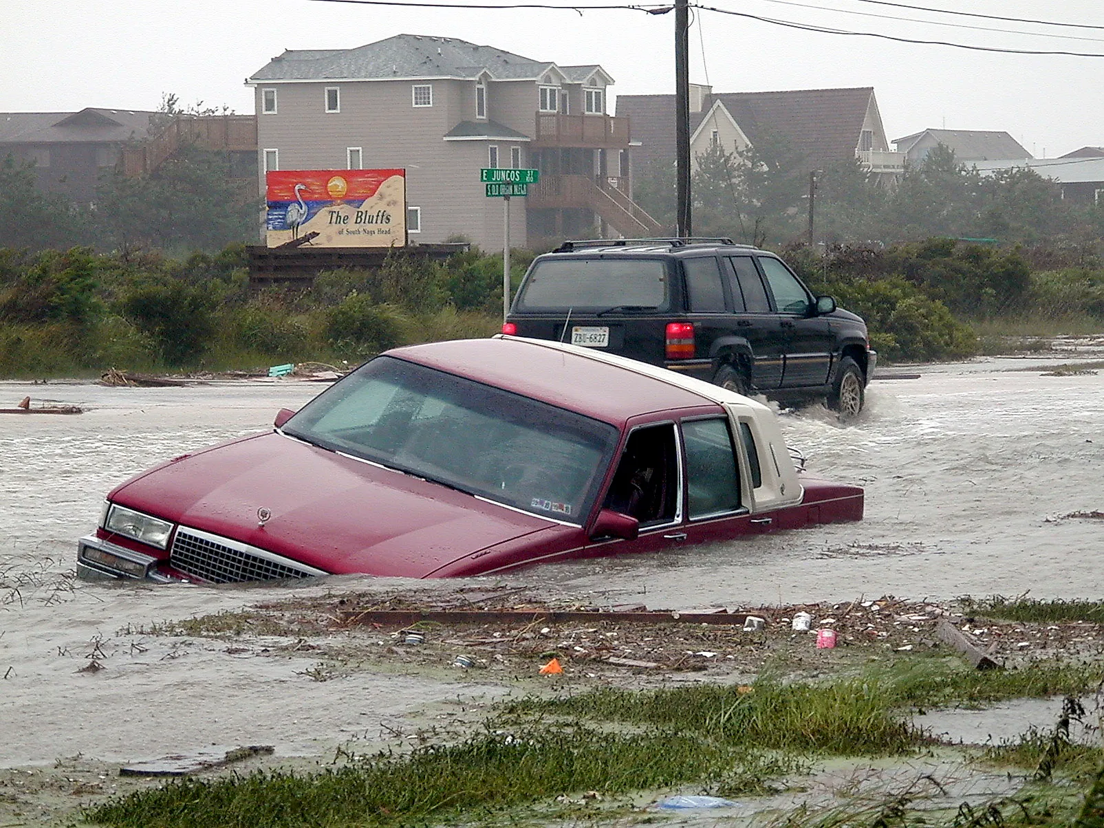
North Carolina Highway 12, Outer Banks

A 2026 analysis of NCDOT records counted 79 weather-related closures on North Carolina Highway 12 in Dare and Hyde counties from 2012 to early 2026. The National Park Service separately recorded 22 closure or impassable events in 2019 alone. NC 12 runs along narrow barrier islands where ocean overwash, storm surge, dune breaches, erosion, and flooding from the sound side can all put water or sand across the pavement.
After repeated damage near Rodanthe, the route itself was changed. Traffic was moved onto the 2.4-mile Jug Handle Bridge over Pamlico Sound, bypassing a vulnerable section of surface road. Hurricane Dorian left parts of NC 12 impassable in 2019, and later coastal storms have continued to push water and sand across other sections of the highway. The physical consequences of repeat coastal flooding are rarely this visible: parts of NC 12 have had to be moved off the barrier island and onto bridges.
US 101, Seaside And Tillamook, Oregon

Clatsop County describes river flooding on US 101 south of Seaside as an annual problem. Heavy winter rain can raise the Necanicum River enough to make the highway impassable, sometimes closing it to passenger vehicles. About 50 miles farther south, another vulnerable section crosses the Wilson River floodplain around Tillamook. Local hazard planning has documented frequent deep flooding there, while Oregon transportation studies have examined how river flow and high tides affect low parts of the road. Both areas sit in flat coastal valleys where rivers have room to spread once they leave their channels. Long stretches of US 101 sit within those valleys, close to the rivers that drain Oregon's wettest coastal terrain.
Louisiana Highway 1, Golden Meadow To Leeville

Louisiana DOTD says the old section of LA 1 near Leeville now often floods during low-level storms. The highway crosses coastal wetlands south of Golden Meadow, where subsidence, meaning sinking land, and coastal erosion have reduced its height relative to nearby water.
Louisiana has been replacing the low road with an elevated highway. Nine miles between Leeville and Port Fourchon are already raised, and construction has continued north toward Golden Meadow, with completion projected for 2027.
LA 1 is also the main land route to Port Fourchon, a major Gulf Coast base for offshore energy operations. Flooding can therefore interrupt worker traffic, freight, and access to the port as well as local travel. The state has chosen to raise the road above the marsh instead of repeatedly repairing a surface route that sits too close to the surrounding water.
Kūhiō Highway At Hanalei, Kauaʻi

A Hawaii environmental study published in 1980 found that the Hanalei River flow associated with closing Kūhiō Highway was exceeded about once a year at the time, and sometimes twice in one year. That study is too old to establish today's annual closure rate, but it shows how long flooding has affected this crossing.
Kauaʻi County closed Kūhiō Highway near Hanalei Bridge during flooding on July 20, 2025, after heavy rain raised water across the north shore. Heavy rain on Kauaʻi's steep interior sends runoff quickly into the Hanalei River, which then spreads across its broad floodplain. Kūhiō Highway is the main road through Hanalei and toward the smaller communities west of town, so flooding near the bridge can interrupt access along much of the island's north shore.
California State Route 37, Novato To Vallejo

Flooding closed both directions of California State Route 37 for 28 days in 2017. Caltrans records another eight days of closures after flooding and levee problems in 2019, followed by a three-day shutdown in January 2023. SR 37 crosses low marshland along the northern edge of San Pablo Bay, where winter rain, creek flows, tides, and levees all affect water levels. Parts of the road have already been raised, and Caltrans has advanced further work around Novato Creek, including a replacement bridge and higher roadway. Longer-term plans call for more of the corridor to be elevated as sea levels rise. Much of SR 37 runs directly through wetlands with little height separating the pavement from surrounding water.
Interstate 10 At White Oak Bayou, Houston

TxDOT has counted 10 flood events on Interstate 10 at White Oak Bayou since March 1992. Tropical Storm Allison, Hurricane Harvey, and Tropical Storm Imelda are among them, along with other periods of extreme rain. The affected section of freeway sits low beside the bayou. Once the water rises far enough, it can reach the interstate and make the road impassable.
Houston's large paved area sends runoff into drainage channels quickly during intense rain, and the depressed freeway sits low enough that little margin remains once White Oak Bayou is already high. TxDOT designed a specific project around that problem.
The state is raising the main lanes through about 1.8 miles of the corridor above the floodplain. The 10-event figure comes from TxDOT flood-gauge and maintenance records rather than a collection of individual news reports, making this one of the better documented repeat-flooding locations on the list.
Florida State Road A1A, Hollywood

A hurricane is not required to put water on A1A in Hollywood. City records describe flooding associated with higher tides as a common occurrence along parts of the coastal corridor. Some drains there depend on gravity, meaning water has to flow downhill toward the coast without pumps. When coastal water is already high, those drains can empty more slowly or allow water to back up. Heavy rain at the same time makes flooding more likely.
FDOT recommended four stormwater pump stations around Bougainvilla Terrace and Franklin, Sherman, and Van Buren streets. The pumps are designed to keep moving water when gravity drainage becomes ineffective.
The recurring problem comes from elevation as much as weather. Parts of A1A sit on a narrow strip between the Atlantic Ocean and the Intracoastal Waterway, with little vertical distance for stormwater to drain away.
US 17, Septima P. Clark Parkway, Charleston

Charleston says construction of the US 17 Crosstown increased stormwater runoff without adding enough drainage capacity to carry that water away. Moderate or heavy rain near high tide has historically left parts of the road impassable for hours because tidal water slows drainage from the low peninsula.
The city responded with the Spring/Fishburne drainage project, which includes deep tunnels, shafts, pumps, and other infrastructure built to reduce how often flooding occurs and how long it lasts. That work means older closure patterns should not automatically be treated as current conditions. It also provides direct evidence that flooding along and around US 17 was persistent enough to require a large engineering response.
US 90/US 98 Causeway, Mobile Bay, Alabama

National Weather Service reports document causeway closures during Tropical Storm Cindy in 2017, Tropical Storm Cristobal in 2020, Tropical Storm Claudette in June 2021, and Hurricane Ida two months later. Hurricane Nate also closed the road in 2017. Earlier, Hurricane Ike put water over the causeway for two days in 2008.
The road runs very low across Mobile Bay between Mobile and Baldwin counties. Strong onshore winds and storm surge can raise bay water high enough to cover the pavement, even when the center of a tropical system passes elsewhere.
The causeway's height is the main vulnerability. Long sections sit only slightly above the surrounding bay and wetlands, so rising water has little distance to cover before it reaches the road.
Interstate 5, Centralia And Chehalis, Washington

WSDOT records show a one-day flood closure of Interstate 5 around Centralia and Chehalis in 1990, four-day closures in 1996 and 2007, and another closure lasting about two days in January 2009. These events are separated by years, but each affects the main north-south freeway between Seattle and Portland.
I-5 crosses the Chehalis River floodplain through a broad, low valley. Long periods of winter rain can raise the Chehalis and its tributaries until water spreads beyond their normal channels and across the surrounding land. The December 2007 flood stopped traffic on the interstate for days and disrupted freight movement across the region. WSDOT has continued studying flood-reduction measures because there are few practical alternatives for through traffic when I-5 closes.
Interstate 29, Western Iowa

Missouri River flooding closed 67 miles of Interstate 29 in Iowa in 2011. During the much larger 2019 flood, roughly 63 miles closed in southwest Iowa, and FHWA estimated $40 million in damage to I-29 alone.
The Missouri can remain above flood stage for long periods, and water flowing over or through damaged levees can spread across large parts of the river's floodplain. That can affect multiple interchanges and many miles of interstate at the same time.
Iowa DOT closed I-29 north of Council Bluffs again in June 2024 as Missouri River levels rose, including the section between 25th Street and the I-29/I-880 interchange near Loveland. The road reopened in stages as water levels fell. Floods on the scale of 2011 or 2019 are not annual events, but when they do occur, the length of highway affected can be enormous.
What The Repeat Closures Share
Two patterns run through almost every entry on this list. The first is elevation. These roads sit low, often only slightly above the water beside them, so a modest rise is enough to shut a lane. The second is the response. Where flooding has become routine, agencies have stopped patching the surface and started lifting the road: onto a bridge over Pamlico Sound, onto an elevated causeway toward Port Fourchon, onto raised main lanes above a Houston bayou. That work is expensive, and the number of states now committed to it is the clearest measure of how often these roads close.