How Many US States Border A Great Lake?
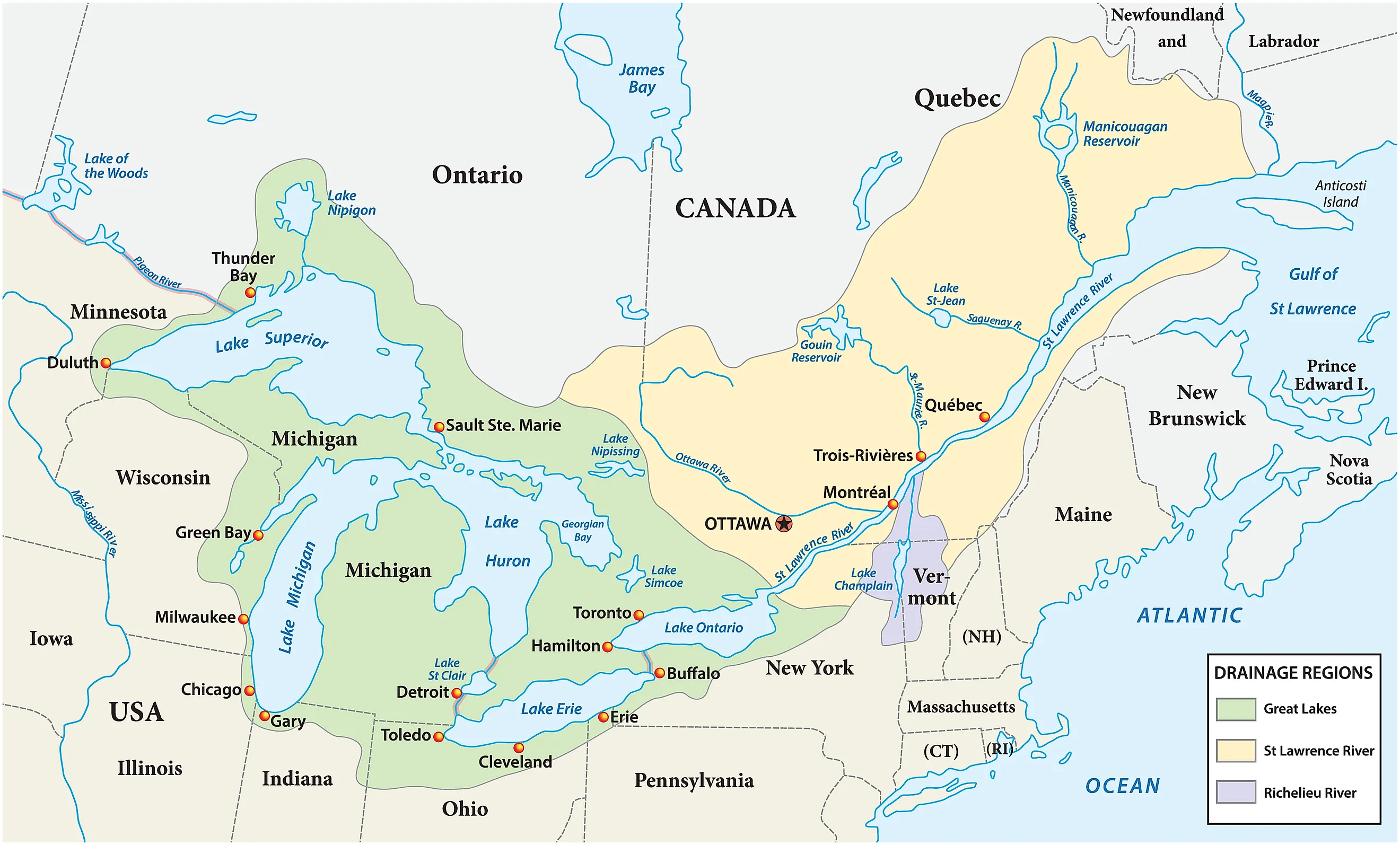
Eight US states border a Great Lake. Running west to east, they are Minnesota, Wisconsin, Illinois, Indiana, Michigan, Ohio, Pennsylvania, and New York. Of these states, three border two or more Great Lakes, while five only border one Great Lake. Michigan alone touches four of the five, and it is the only state on Lake Huron. What follows is the lake each state borders, along with some of the most scenic places on each shoreline.
Minnesota

Grand Marais on the north shore of Lake Superior, Minnesota.
Minnesota is called the Land of 10,000 lakes for its vast array of natural lakes and reservoirs. One of those lakes is Lake Superior. Northeastern Minnesota juts out into Lake Superior, the largest freshwater lake in the world by surface area at 31,700 square miles and third largest by water volume at 2,900 cubic miles.
Lake Superior was utilized as a fur trading hub for Native Americans, French, British, and Americans. One of the most crucial places for this trade was the Gichi Onigamiing, the Great Carrying Place, which connected Lake Superior to waterways up further north into Canada. It was a portage corridor that was free of the falls and gorges that made water travel difficult. Today that trail is part of the Grand Portage National Monument, sitting on Minnesota's far northeastern shore on Lake Superior.
Lake Superior has inspired local artists for decades, especially at the lakeside community of Grand Marais. Initially explored by the French, today Grand Marais is the home of the oldest art colony in Minnesota: the Grand Marais Art Colony. Since 1947, they have supported local Minnesota art.
Wisconsin

Wisconsin borders Lake Superior to the Northwest and Lake Michigan to the east. Combined, these equal more than 800 miles of Great Lakes shoreline, and more than 1.6 million citizens get their drinking water directly from one of these lakes.
On Wisconsin's Lake Superior shoreline is the Apostle Islands National Lakeshore. These are a series of 21 islands originally populated by the Ojibwe people. Due to its position on the lake, it had one of the largest concentrations of lighthouses on Lake Superior to help guide ships navigating the treacherous waters of the Great Lake, especially during the fall storms that make the lake dangerous to navigate. Visit several of these historic lighthouses, such as the 1856 Old Michigan Island Lighthouse or the 1858 Old La Pointe Lighthouse, or go sightseeing at the beaches and sea caves.
On the Lake Michigan side, there are beaches right next to large cities, such as Milwaukee. This city of around 577,000 people offers the lakefront Bradford Beach, with a pathway that goes out right to the edge of the water, allowing those with accessibility issues to enjoy the Lake Michigan breeze.
Illinois

Chicago skyline aerial drone view from above, Lake Michigan.
Illinois borders Lake Michigan to its northeast, with 63 miles of shoreline within Lake and Cook Counties. These are the most populated counties in Illinois, with 719,339 people in Lake County and 5.19 million people in Cook County. Cook County's seat is the metropolis of Chicago.
Illinois lakefront has a distinctly urban character, with the Chicago Lakefront Trail traversing through 18 miles of shoreline on Lake Michigan and linking up with Northerly Island, a peninsula with nature trails. The city also hosts kayaking tours of the Chicago River and Lake Michigan via Urban Kayaks.
Lake County meanwhile has several Lake Michigan parks, including the Adeline Jay Geo-Karis Illinois Beach State Park, the only place in Illinois with a beach ridge shoreline and dunes. Fort Sheridan Forest Preserve meanwhile sits on the grounds of a former U.S. Army post and offers views of Lake Michigan above a 70-foot-tall bluff.
Indiana

Indiana has the smallest Great Lake shoreline of the eight states, with 45 miles across Lake Michigan in its northwestern corner. These include the counties of Lake, Porter, and LaPorte. However, along this shoreline is one of the rarest habitats on Earth: freshwater dunes.
Indiana's dunes were created at the end of the last ice age, when glaciers retreated, forming both Lake Michigan and leaving behind sediments. The dunes formed 10,000 years ago via waves and winds, which accumulated to form massive sand dunes. One of the best known is Mount Baldy, a dune standing 126 feet tall, which today is part of the Indiana Dunes National Park, the only national park in Indiana.
It protects the dunes, the Lake Michigan shoreline, and rare environments within its borders, such as the Pinhook Bog. In addition to the national park, Indiana also has the Indiana Dunes State Park, with 2,182 acres of dunes and beaches.
Michigan

Michigan has the longest Great Lake shoreline of all the states at 3,200 miles in total. This is because the state borders four of the five Great Lakes. Its Upper Peninsula connects with Lake Superior, Lake Huron, and Lake Michigan, while the Lower Peninsula borders Lake Michigan, Lake Huron, and a small section of Lake Erie in the southeastern corner of the Lower Peninsula. It is the only US state to share a border with Lake Huron.
Michigan's only national park lies far out in Lake Superior at Isle Royale National Park, roughly 15 miles from the Minnesota shore and 56 miles from Michigan's own Upper Peninsula. At 206.73 square miles, it is the largest island in Lake Superior and is accessible only by boat, ferry, or seaplane. On the Lake Michigan side, one can find 450-foot-tall dune bluffs at the Sleeping Bear Dunes National Lakeshore.
On Lake Huron, Michigan has Lakeport State Park, which has a rocky beach, while Sleeper State Park has a sandy beach and 723 acres of forest dunes and wetlands. Michigan has a small shoreline on Lake Erie, which is accessible from the Lake Erie Metropark in Brownstown, with three miles of shoreline, hiking trails, and a golf course.
Ohio

Aerial panorama of the Cedar Point peninsula at dusk, in Sandusky, Ohio, on Lake Erie.
Ohio has 313 miles of shoreline along Lake Erie, consisting of eight counties in total. In 1835, the state had to fight with the territorial government of Michigan for control of the Toledo strip along Lake Erie during the Toledo War. The conflict ended when the federal government transferred ownership of the Upper Peninsula from Wisconsin to Michigan, and let Ohio keep the Toledo strip.
Much of the Lake Erie coastline in Ohio is connected via the 293-mile Lake Erie Coastal Ohio Scenic Byway, passing by several lakeside attractions. One is the Maumee Bay State Park, with a beach on Lake Erie itself and an inland lake. Due to this wet environment, it has several swamps and marsh wetlands to hike through, along with a Bird's Nest Observation Tower to see Lake Erie, wetlands, and more than 300 species of birds.
The other attraction is the Cedar Point amusement park. Owned by Six Flags, it sits on a peninsula of Lake Erie in the town of Sandusky. This amusement park is popular among thrill-seekers for having some of the tallest and fastest roller coasters in the US, such as the 120 miles per hour Top Thrill 2.
Pennsylvania

Pennsylvania has the third smallest Great Lakes shoreline, with approximately 76.6 miles of shoreline on Lake Erie at its northwesternmost point. What makes this shoreline unique among the Great Lakes states is how much of it is made up of bluffs.
90% of its total shoreline consists of bluffs formed out of glacial sediment. At the same time, these river bluffs have gradually been decreasing in size, especially on the bluff face, both by erosion from the waves of Lake Erie and human development. The lower sections of these bluffs are made of gray-blue clay that came from the last Ice Age, which created Lake Erie.
One of the primary attractions on Lake Erie is Presque Isle State Park, situated on a peninsula a few miles to the west of the city of Erie. Across its 3,200 acres, one can take a ship out onto Lake Erie, swim in the warm summer waters of Lake Erie, or go out on 11 miles of hiking trails through dunes and old-growth forests.
New York

New York is the easternmost of the Great Lakes states, connecting with Lake Erie in Chautauqua and Erie Counties and Lake Ontario across seven counties. Furthermore, its northern border is on the St. Lawrence River, which allows Lake Ontario to drain into the Atlantic Ocean.
Its shoreline with Lake Erie is around 77 miles, while its Lake Ontario shoreline is 294 miles from the banks of the St. Lawrence River to Fort Niagara. Due to Lake Erie's warm temperatures, it draws groups in the summer at historic sites such as Barcelona Lighthouse State Park, where one can find an 1829 40-foot-tall lighthouse, which was the first natural gas lighthouse on Earth. Also at the park is the Barcelona Harbor Beach, allowing access both to swimming and fishing for walleye.
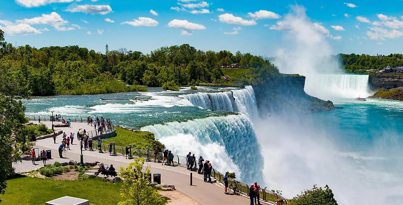
Between Lake Erie and Lake Ontario, New York protects a section of Niagara Falls, from which more than 6 million cubic feet of water flows down from Lake Erie into Lake Ontario every minute. On the Lake Ontario side itself, New York has the Fort Ontario State Historic Site, a star fort originally built in the 1840s over an older fort from the War of 1812. It was also the only refugee camp for Jewish victims of the Holocaust from 1944 to 1946.
The Great Lakes are a lifeline for these states
The Great Lakes are more than just a place for recreation. They offer drinking water, fishing, and commerce for many people. In fact, 30 million Americans rely on the Great Lakes for drinking water. The maritime economy of the Great Lakes also provides 8.8 billion dollars in wages through 311,000 jobs. The Great Lakes also provide wildlife diversity, supporting more than 3,500 species of plants and animals. Lastly, all of these lakes are connected, forming a system that has far more in common with an inland sea than mere lakes.