The Counties With The Strangest Borders In America
Most county lines in the United States follow something a surveyor could stand on, such as a river channel, a range line, or the 49th parallel. A few follow none of those things. One county in Washington includes 4.9 square miles that can be reached by car only through British Columbia; a corner of Kentucky sits inside a loop of the Mississippi River with a single road in from Tennessee; and Colorado's newest county was assembled from pieces of four older ones. These six county borders rank among the strangest in the country, and every one of them has a documented reason behind it.
Point Roberts, Whatcom County, Washington

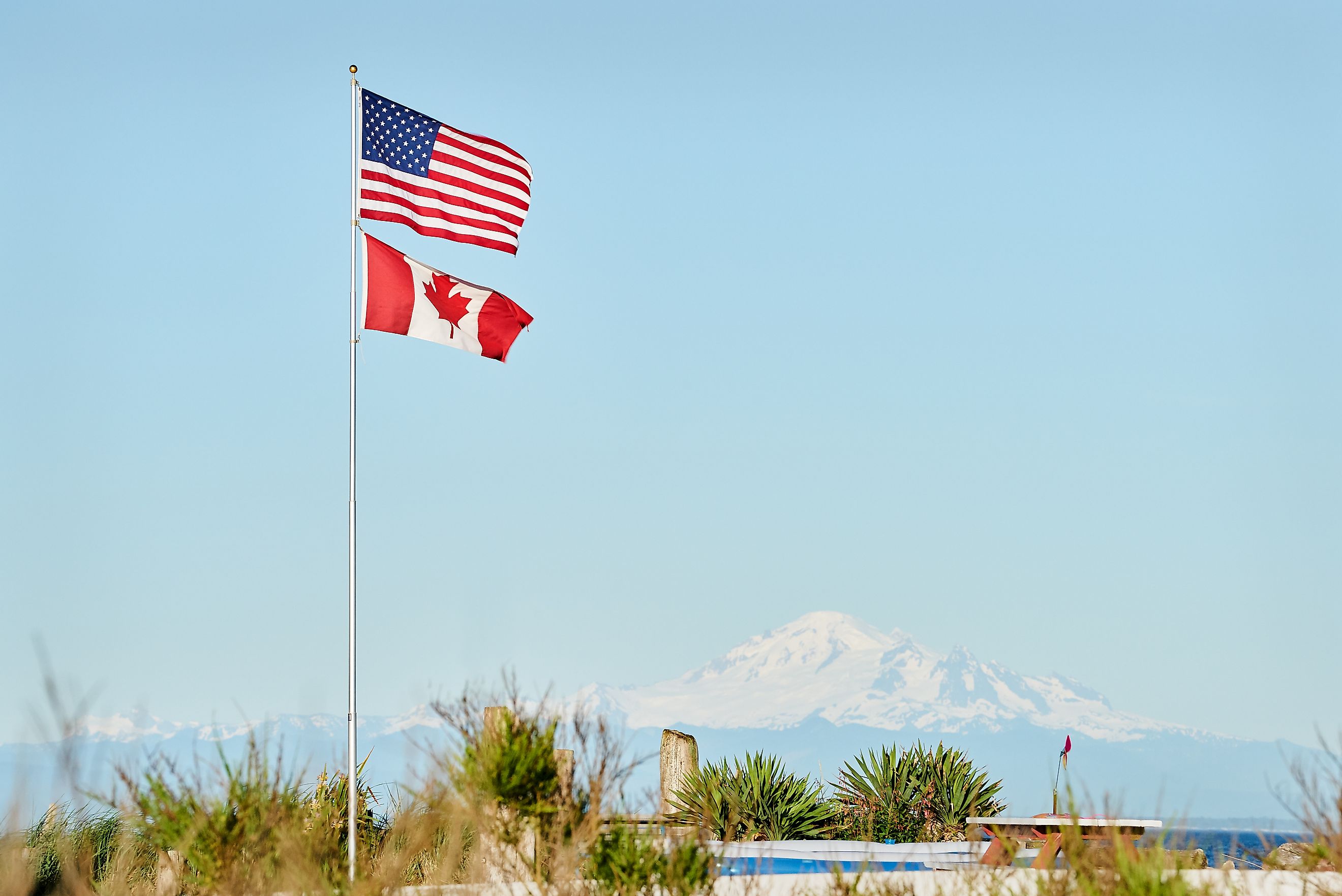
Driving to Point Roberts from anywhere else in Washington means about 25 miles in British Columbia and two international border crossings. The Oregon Treaty of June 1846 set the boundary between the United States and British North America at the 49th parallel, and that line cut across the base of the Tsawwassen Peninsula, stranding 4.9 square miles of American territory below it.

The result is a census-designated place in Whatcom County that recorded 1,191 residents in the 2020 census. It has no municipal government of its own and no land connection to the county it belongs to. Border crossing became more involved in June 2009, when the Western Hemisphere Travel Initiative began requiring a passport or an approved equivalent document at land and sea crossings. Boats and small aircraft are the alternatives.
Northwest Angle, Lake of the Woods County, Minnesota

The Northwest Angle is the only part of the United States outside Alaska that lies north of the 49th parallel, and it exists because of a bad map. The 1783 Treaty of Paris drew the boundary westward from the northwesternmost point of Lake of the Woods, relying on John Mitchell's map, which misplaced both the lake and the headwaters of the Mississippi River. The Convention of 1818 corrected the error by dropping a line due south from that point to the 49th parallel, which left roughly 123 square miles of Minnesota above the line and cut off by water.

About 70 percent of that land is held in trust for the Red Lake Band of Chippewa. Travelers arriving on the gravel road report to customs by videophone at a shelter known as Jim's Corner, and an ice road across the lake opens a direct winter route. In the late 1990s, Representative Collin Peterson introduced a constitutional amendment that would have let Angle residents vote on joining Canada, a bargaining move in a fishing-rights dispute with Ontario. Ontario eased the rules, and the Angle stayed in Minnesota.
Red River Border Counties, Texas and Oklahoma

The Red River separates Texas from Oklahoma, but the boundary does not sit in the middle of the channel. A 1923 Supreme Court ruling placed it at the south bank, on the Texas side, which meant the county lines moved whenever the river shifted its sand. Texas and Oklahoma adopted the Red River Boundary Compact in 1999, and Congress consented in October 2000, fixing the political line at the vegetation line along the south bank everywhere except the Lake Texoma stretch.

Oklahoma holds the riverbed north of the river's medial line, while the strip between that line and the south bank is federal land held in trust for the Kiowa, Comanche, and Apache tribes. At Denison Dam, the arrangement leaves Grayson County, Texas, and Bryan County, Oklahoma, facing each other across water that is almost entirely Oklahoma's.
City and County of Broomfield, Colorado
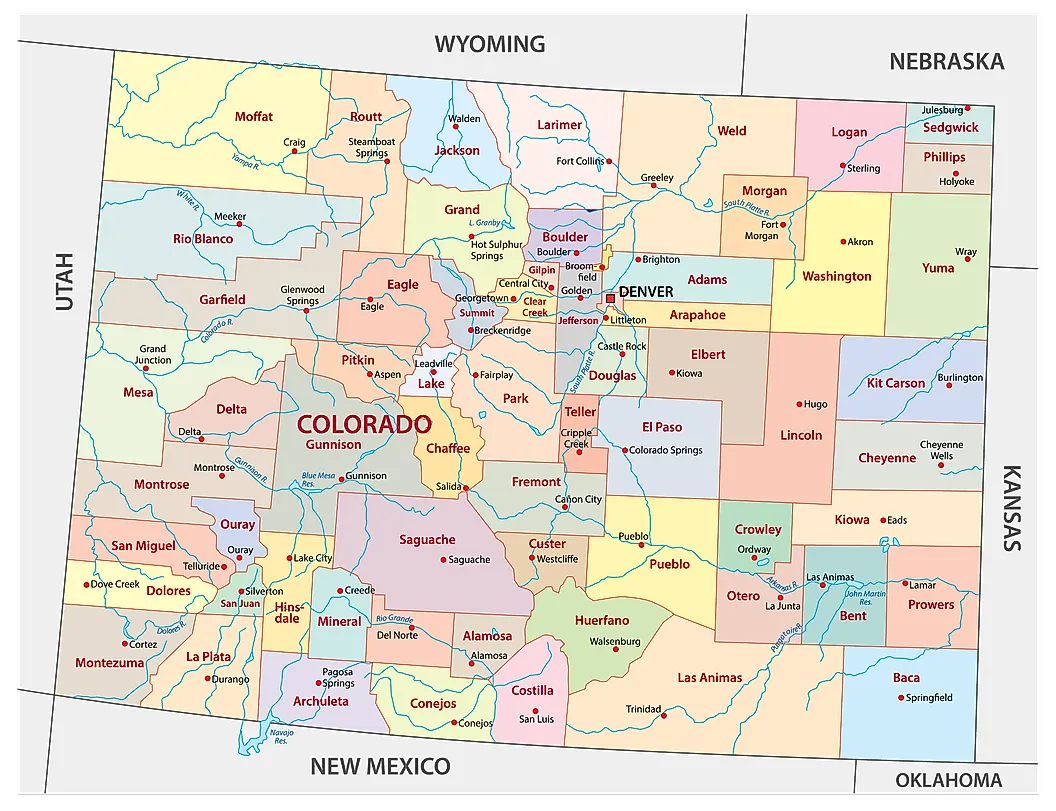
Broomfield incorporated as a town in Boulder County in 1961, then annexed its way across three more county lines until the city was divided among Adams, Boulder, Jefferson, and Weld. One community meant four county clerks, four assessors, four court districts, and four sales tax bases. Colorado voters approved a constitutional amendment in November 1998 that consolidated the entire system into a single jurisdiction.

After a three-year transition, the City and County of Broomfield came into existence on November 15, 2001, as the state's sixty-fourth and smallest county, covering about 33 square miles. It is one of two consolidated city-county governments in Colorado, the other being Denver. The outline is not the work of a survey grid. It traces decades of annexation, which is why the boundary turns through a long series of right angles instead of following section lines, and why the 1998 amendment capped further growth at the annexation map the city council had approved that April.
New Castle County, Delaware
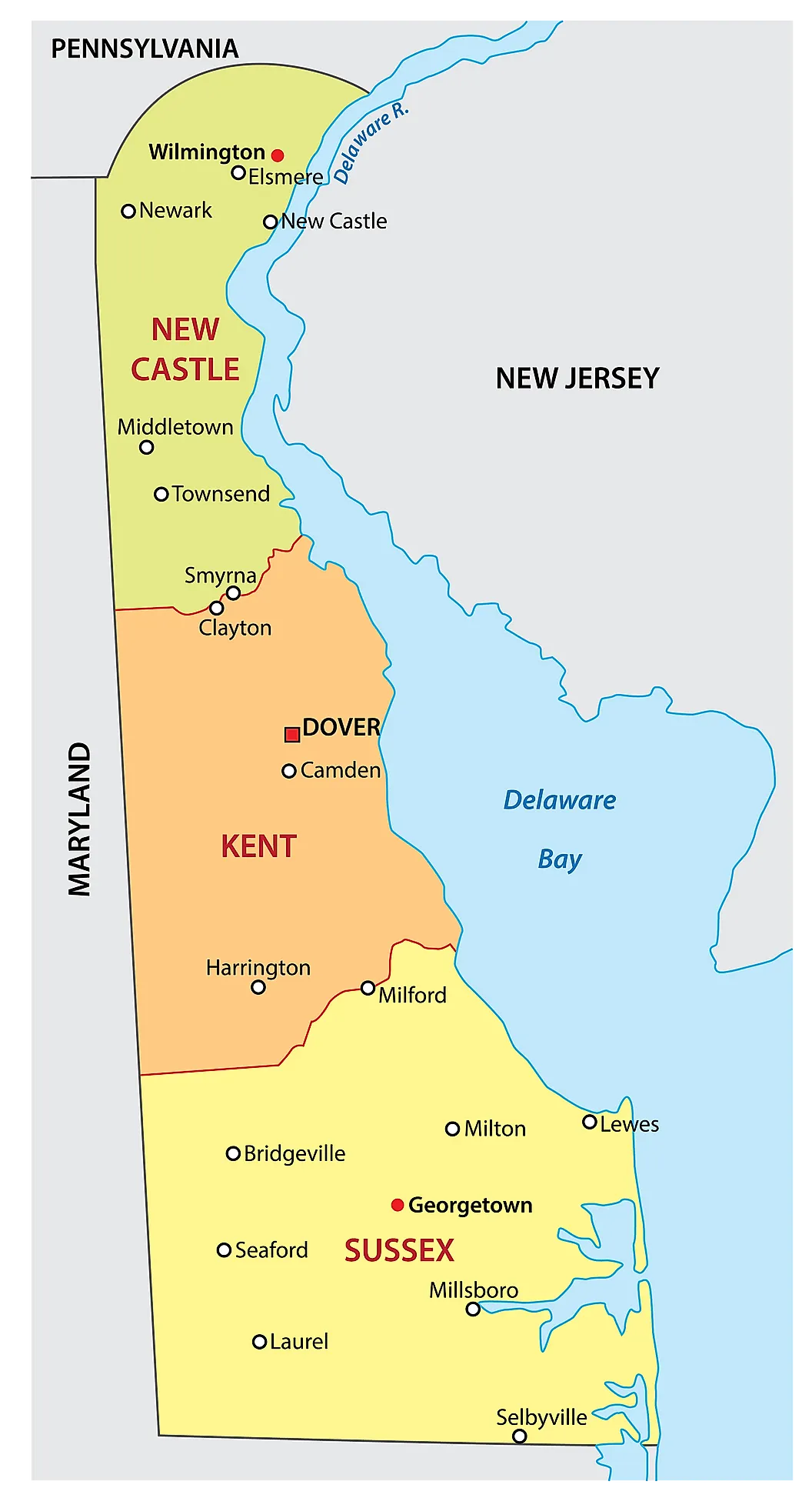
New Castle County carries a border shaped like nothing else in the country. Its northern line is an arc swung twelve miles out from the cupola of the courthouse in New Castle, a shape inherited from a 1682 deed conveying the town and everything within twelve miles of it to William Penn. Surveyors Taylor and Pierson laid out the arc in 1701, and the geometry produced a consequence its authors never intended.

Where the circle crosses the Delaware River, Delaware extends to the low-water mark on the New Jersey shore, so the riverbed and the bridges above it belong to Delaware rather than being split down the channel. New Jersey has disputed that since the 1870s and lost again at the Supreme Court in 2008. Kent and Sussex counties to the south get conventional straight lines; the arc belongs to New Castle alone.
Kentucky Bend, Fulton County, Kentucky

Fulton County comes in two pieces, and the smaller piece can be reached by road only through Tennessee. The Kentucky Bend occupies a hairpin loop of the Mississippi River at the extreme southwestern corner of Kentucky, with Missouri across the water on three sides and Tennessee along the fourth.

The Kentucky and Tennessee boundary was drawn along a line of latitude at a time when the river's course through the loop was poorly charted, and Tennessee contested the bend's inclusion in Kentucky into the 1840s before dropping the claim. Tennessee State Route 22 is the only road in, and mail arrives through Tiptonville, Tennessee. The Census Bureau counted nine residents in the Kentucky Bend county census division in 2020. The land inside the loop covers about 17.5 square miles, most of it planted in row crops.
The Logic Behind America's Strangest County Lines
Every one of these lines was drawn deliberately, by people working from the information in front of them. The negotiators of 1783 fixed a boundary at the northwesternmost point of Lake of the Woods while reading a map that misplaced the Mississippi headwaters, and Minnesota still carries the correction north of the 49th parallel. A seventeenth-century deed measuring twelve miles out from a courthouse cupola decides to this day which state owns the bed of the Delaware River. Along the Red River, a line tied to a moving bank took a compact and an act of Congress to hold in place. The strangest county borders in America are mostly old decisions that outlived their assumptions.