12 Most Peaceful Small Towns In The Finger Lakes
Calm in the Finger Lakes tends to gather where building stopped. Hemlock Lake has supplied a public water system for over a century, and state forest surrounds it today. In Newfield, everyday traffic still rolls through an 1853 covered bridge. Moravia ends at a glen with five waterfalls. In these 12 towns, the land next door belongs to the public. That land takes the form of a gorge or a national forest ridge, a protected watershed or a bay. The order runs west to east across the southern lakes of New York, then turns back west along Lake Ontario.
Mount Morris

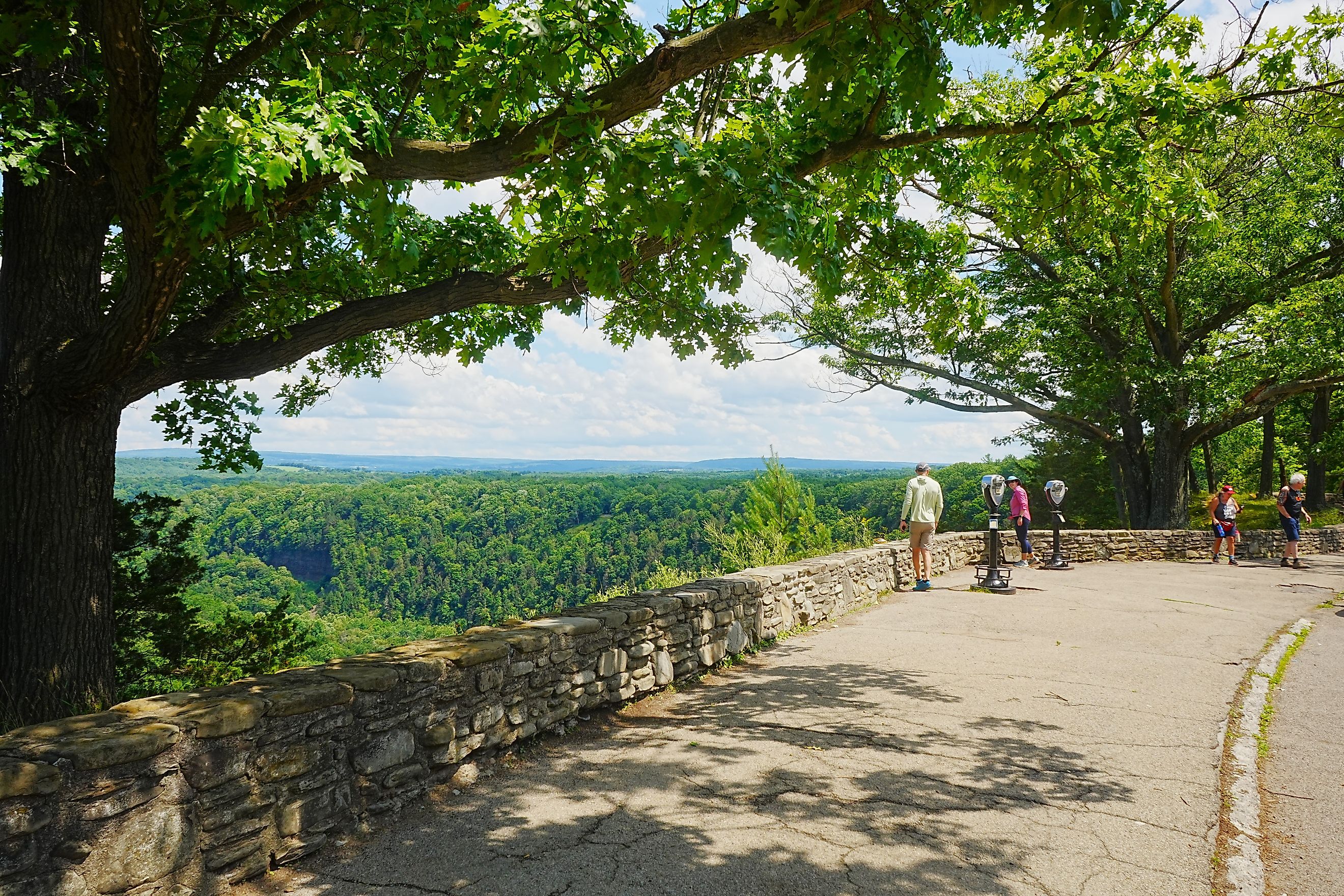
The Genesee River gorge opens at Mount Morris, a Livingston County village at the north end of Letchworth State Park. The Mount Morris Entrance leads to the Highbanks Recreation Area and the northern reach of a gorge whose cliffs climb as high as 600 feet in places. The Highbanks Trail covers 4.75 miles on this end of the park.
The strangest sight in the gorge is concrete. The Mount Morris Dam rises 250 feet and spans 1,028 feet. The US Army Corps of Engineers calls it the largest concrete dry-bed dam east of the Mississippi River. The dam guards against floods, and the reservoir behind it can hold nearly 302,000 acre-feet of water when the Genesee runs high.
The dam’s William B. Hoyt II Visitor Center opens in season, and ranger-led walking tours go inside the dam itself. North of the cabin area, Parker’s Hideaway survives as a building put up by the Civilian Conservation Corps (CCC). The dam entrance closes for winter, while the Mount Morris Entrance keeps the north end reachable all year.
Dansville

About 15 miles of Interstate 390 and Route 36 separate Mount Morris from Dansville. The village occupies a glacially formed valley in Livingston County, with Stony Brook State Park to its south. The park’s Gorge Trail leaves a stream-fed pool at the North Entrance and passes three major waterfalls, among them Northern Falls and Pittsburg Falls.
Above the gorge, the East Rim and West Rim trails each run about a mile, and both carry plenty of stairs. Swimming and wading in the gorge itself are prohibited. Instead, a 1.5-foot wading area at the pool opens from late June to early September.
The Gorge Trail was set to close for seasonal maintenance on November 2, and the park lists a tentative reopening on May 29, 2027. The park uses a Dansville mailing address, yet its land belongs to the Town of Dansville in Steuben County, across the line from the village.
Hemlock

In 1976, New York’s last nesting pair of bald eagles held on near Hemlock Lake. When that pair’s eggs broke, state biologists swapped in plaster dummies and fostered chicks bred in captivity in the nest.
Hemlock and Canadice Lakes have supplied drinking water for more than 100 years. Two large undeveloped parcels surround them. The Hemlock-Canadice State Forest now covers 6,849 acres around both lakes. Roughly 14 miles of marked hiking trails run through the forest. Camping and campfires are prohibited throughout.
The Livingston County hamlet of Hemlock is one nearby stop for supplies, and the Hemlock Lake North Boat Launch on East Lake Road offers access to both mechanical and non-mechanical vessels. Nearby, the Town of Livonia keeps Hemlock Lake Park beside the watershed grounds. The park has a gazebo, picnic tables, and a play area. Swimming is off the table. So is a big engine, since state rules bar motors above 10 horsepower and powered boats longer than 17 feet.
Honeoye

Honeoye Lake ranks 10th in size among the 11 Finger Lakes, at 4.5 miles long and 30 feet at its deepest. The Town of Richmond keeps its offices in the hamlet of Honeoye, in Ontario County. One state park near the lake answers to the same office as the Dansville gorge.
Run from Stony Brook, Harriet Hollister Spencer State Recreation Area rises just south of the lake and tops 2,000 feet of elevation. Its 1,596 acres carry 22.83 miles of multi-use trails. Overlook Road passes a view down the full length of the lake, and its gate is open from May 1 to late October. Down at the water, the Honeoye Lake Boat Launch opens sunrise to sunset all year on the southeast corner, with docks in from mid-April to late October.
Up on the north shore, the town’s Sandy Bottom Park marks off a swimming area off West Lake Road. Just north of its lagoon, a concrete weir built in 1999 sets the lake level. No gates control it. Water simply spills over once the lake reaches 803.5 feet.
Honeoye Falls

By road, Honeoye Falls is 13.5 miles from Honeoye. The village grew up in the Monroe County town of Mendon, on the upper falls of Honeoye Creek. That creek serves as the main outflow of Honeoye Lake.
The Zebulon Norton Trail leaves Harry Allen Park on North Main Street and heads down to the Lower Falls before continuing to Rotary Park. For a quicker look, the Vest Pocket Park on West Main Street frames the creek. Back on North Main Street, the Lower Mill has been on the National Register since 1973.
Mendon Ponds Park carries a Honeoye Falls address and covers 2,500 acres of woods, ponds, and wetlands, the largest of Monroe County’s parks. Its kames, eskers, and kettles earned a place on the National Registry of Natural Landmarks in 1969. One kettle pond goes by the name Devil’s Bathtub.
Branchport

Keuka Lake bends into a Y, and Branchport marks the tip of its northwest arm in Jerusalem, a Yates County town. The lake stretches 19.6 miles and reaches 183 feet deep.
Keuka Lake State Park puts its boat launch off Route 54A just east of the hamlet. Concrete ramps and a marina serve boaters through the warm months. The park keeps 150 campsites. Seven color-coded hiking trails loop through the grounds. Once snow arrives, the same paths carry snowshoers and cross-country skiers, since the park stays open dawn to dusk all year.
Camping and the marina closed for the season on October 12. Oddly, the park’s official address reads Bluff Point, not Branchport.
Burdett

Cattle graze the Finger Lakes National Forest on purpose. The grazing keeps grassland open for birds such as the Henslow’s sparrow and the bobolink. New York’s only national forest covers about 16,000 acres on the ridge called “the backbone” between Seneca and Cayuga Lakes. Its trails total more than 30 miles.
Burdett is a small Schuyler County village in the Town of Hector, on the east side of Seneca Lake. On Route 414, Hector Falls spills down beside the highway where a bridge crosses Hector Falls Creek.
Up on the ridge, the national forest’s Gorge Trail follows a gorge through hemlock and hardwood between Burnt Hill Road and Mark Smith Road. Its Mark Smith Road parking area is about three-quarters of a mile north of Route 79, and Gorge Pond is close by, east of the Burnt Hill trailhead. For maps and conditions, the forest’s Hector Ranger Station keeps an office on Route 414.
Newfield

A covered bridge from 1853 still carries everyday traffic in Newfield. A county marker beside the Newfield Covered Bridge calls it the oldest covered bridge in daily use in New York. It is also the only covered bridge left in Tompkins County.
Newfield is unincorporated today, though it kept a village charter from 1895 to 1925. The town’s name signaled that its land held the latest fields open to settlers. Newfield State Forest covers 1,552 acres in the town, ground where CCC crews once planted trees. The forest has no formal trails, so snowshoers and skiers make their own way.
Robert H. Treman State Park, whose lower Gorge Trail trailhead carries a Newfield address, runs through Enfield Glen. The glen counts 12 waterfalls, including the 115-foot Lucifer Falls. The Gorge and Red Pine trails generally close from late November until late May.
Dryden

The Tompkins County village of Dryden describes itself as sitting above two state forests, with Dryden Lake to the south. The lake covers 104 acres inside a 197-acre state area. Only electric motors are allowed. The town maintains a fishing pier along the shore.
The Jim Schug Trail runs 4.2 flat miles from the village to the Town of Harford in Cortland County, where it meets the Finger Lakes Trail. Benches turn up about every half mile. The trail took its current name in 2002, honoring the late town supervisor who helped secure the land.
Hammond Hill State Forest spans 3,697 acres and a 20-mile network of multiple-use trails. CCC crews planted about 708,000 seedlings there between 1935 and 1940. Its neighbor, Yellow Barn State Forest, has a stranger past, since the forest was once home to a small hamlet called California.
Moravia

At the south end of Owasco Lake in Cayuga County, Moravia runs straight into Fillmore Glen State Park at the village edge. About 20 miles by road separate Moravia from Dryden. Cool, dense woods crowd into the long, narrow gorge. Five waterfalls drop through the glen.
The park also keeps the Millard Fillmore Cabin, a replica of the future president’s childhood home, open in daylight from mid-April to mid-November. Summer swimming happens in a pool fed by the stream, and campers spread out across 60 sites.
North of the village, the Owasco Flats Wildlife Management Area protects wetland along the Owasco Inlet, the largest stream feeding the lake. A 92-acre addition in 2025 more than doubled the preserve. Owasco Lake itself supplies drinking water to more than 40,000 people.
Fair Haven

The bluffs at Fair Haven Beach State Park rise above Lake Ontario on the Cayuga County shore. The park’s sand beach runs about 1,500 feet, and boaters can choose between the open lake and Little Sodus Bay, the harbor inside the village of Fair Haven.
Inland, Sterling Pond and its creek lie among the woods, and the park rents canoes and kayaks for that water alone. The CCC worked here from 1934 to 1942, building roads, cabins, and erosion barriers. One of the park’s cabins is the oldest survivor of that work. Two cottages stay rentable after the beach closes, one of them into early December.
In the Town of Sterling, the Sterling Nature Center covers more than 1,400 acres with nearly two miles of Lake Ontario shoreline. Its Eagle’s View trail climbs to an overlook atop McIntyre’s Bluff.
Sodus Point

About 22 miles of the Great Lakes Seaway Trail connect Fair Haven and Sodus Point. The village’s waterfront runs along both Sodus Bay and Lake Ontario in Wayne County. Its first lighthouse went up in 1825.
Builders finished the current limestone tower on June 30, 1871. Its light went dark in 1901. Since 1985, the Sodus Bay Lighthouse Museum has occupied the building. Wayne County runs Sodus Point Beach Park, where a dune restoration got underway in 2020 with sand fencing and beach grass planted by volunteers. In 2022, the American Shore and Beach Preservation Association named it one of the country’s best restored beaches.
For calmer water, the Sill Landing Kayak Launch waits at the end of South Ontario Street on the bay. In the Town of Huron, Chimney Bluffs State Park lets hikers look over earthen spires that the lake has carved from the shore.
Where The Land Stays Open
The 12 towns reach their calm by different routes. Mount Morris looks into the Letchworth gorge, and Moravia meets Fillmore Glen at its edge. Hemlock keeps the watershed lake where the state’s last eagle pair survived. Newfield, Dryden, and Burdett lean on state and national forest, while the two villages on Lake Ontario look out on open water. In each one, the calm comes from public land beside the town.