The Counties With The Most Lakes
Before examining which United States counties have the most lakes, let's cover some background information. The National Association of Counties notes that there are 3,069 county governments within the U.S. According to the United States Environmental Protection Agency, as of 2022, there are 111,119 total lakes in the U.S. that are at least 2.5 acres in size and at least 3.3 feet deep. Using information from the U.S. Geological Survey National Hydrography Dataset (USGS NHD), here, we are defining a lake as an inland body of water greater than 10 acres in area, filtering out small ponds and shallow depressions. Minnesota, traditionally called the "Land of 10,000 Lakes," actually holds 11,842 lakes, per the Minnesota Department of Natural Resources. It is no surprise that Minnesota counties hold the top seven spots and eight of the top 10 spots among our list of the counties with the most lakes.
A Special Note on Alaska's Wilderness Basins
When analyzing national hydrographic data, Alaska presents a unique geographic anomaly. The state is not divided into standard county governments. Instead, its vast landmass consists of organized boroughs and large census areas within unorganized boroughs. If census areas were ranked alongside standard U.S. counties, regions like the Yukon-Koyukuk Census Area (which spans nearly 148,000 square miles, larger than the state of Montana) and the Kenai Peninsula Borough would dominate the top of the list. Alaska's Arctic and interior lowlands are covered with tens of thousands of unnamed thaw and kettle lakes formed by melting permafrost and ancient glacial retreat. Because these administrative divisions cover immense, unorganized wilderness expanses without traditional county governance, and because the vast majority of their lakes remain unnamed and unmanaged, Alaska is treated as a separate category in federal geographic comparisons.
Read on to discover the top ten standard U.S. counties containing the highest number of mapped inland lakes measuring 10 acres or more.
1. Otter Tail County, Minnesota - 1,073 lakes

Located in west-central Minnesota where the eastern hardwood forests meet the western tallgrass prairie, Otter Tail County holds the national title for the most inland lakes over 10 acres, at 1,073, per the Minnesota Department of Natural Resources (MNDNR). Encompassing over 1,900 square miles of area, the county contains roughly 10% of the entire state's lakes. Its unique terrain was carved during the retreat of the Laurentide Ice Sheet about 10,000 years ago, leaving behind a dense network of deep basins and interconnected river systems that anchor the region's agricultural and resort economies.
- Largest lake: Otter Tail Lake. Spanning 13,725 acres with a maximum depth of 124 feet, this massive body of water is a renowned walleye fishery and anchors the local tourism industry.
- Other major lakes: Dead Lake (7,545 acres), famous for its irregular, sprawling shoreline and shallow bays; West Battle Lake (5,614 acres), a deep, clear basin popular for muskie fishing.
2. St. Louis County, Minnesota - 969 lakes

Covering nearly 6,800 square miles, St. Louis County is the largest county by land area east of the Mississippi River, and includes 969 lakes over 10 acres, per MNDNR. Extending from the port city of Duluth on Lake Superior northward to the Canadian border, its landscape encompasses vast forests, bedrock, and 4,510 miles of lake shoreline, the highest of any county in Minnesota. The northern half of the county forms the heart of the Superior National Forest and Voyageurs National Park.
- Largest lake: Lake Vermilion. Spanning approximately 40,000 acres, Vermilion features the longest lake shoreline (313 miles) and the most islands (365) in the state. It is one of the most structurally complex glacial lakes in North America.
- Other major lakes: Rainy Lake (210,000 acres, with 75,000 acres stretching into northern St. Louis and Koochiching Counties), which serves as the main aquatic gateway to Voyageurs National Park; Lake Kabetogama (24,000 acres), a heavily forested wilderness shared with Koochiching County.
3. Itasca County, Minnesota - 897 lakes

Anchored by the city of Grand Rapids in north-central Minnesota, Itasca County covers over 2,900 square miles of dense pine forests. While local historical conservation surveys, including the Itasca County Soil and Water Conservation District, previously cataloged up to 950 total water basins, including smaller ponds less than 10 acres, modern MNDNR data confirms that 897 lakes meet the 10-acre threshold. Water covers about 9% of the county, driving a thriving forestry and outdoor recreation landscape centered around the Chippewa National Forest.
- Largest lake: Lake Winnibigoshish - Covering 56,544 acres at the western edge of Itasca County and shared with Cass County, "Big Winnie" is the fourth-largest natural lake completely within Minnesota's borders.
- Other major lakes: Bowstring Lake (9,528 acres), a shallow, highly productive lake favored by waterfowl and anglers; Pokegama Lake (6,721 acres), a deep reservoir directly adjacent to the city of Grand Rapids.
4. Cass County, Minnesota - 758 lakes

Cass County is a central aquatic hub in northern Minnesota, containing more than 258,000 acres of open surface water and 758 lakes, per MNDNR. The county's geography is defined by lake chains interconnected by the headwaters of the Mississippi River. The northern part of Cass County has the Chippewa National Forest and the Leech Lake Indian Reservation, making it an ecological sanctuary for bald eagles, wild rice beds, and cold-water fisheries.
- Largest lake: Leech Lake - Spanning 111,527 acres, Leech Lake is the third-largest lake entirely within Minnesota. Its configuration of many bays creates over 190 miles of shoreline.
- Other major lakes: Cass Lake (15,596 acres), anchors the eight-lake Cass Lake Chain of Lakes; a portion of Lake Winnibigoshish (56,544 acres), shared with Itasca County.
5. Lake County, Minnesota - 742 lakes

Bordered entirely to the southeast by Lake Superior, the largest freshwater lake on Earth, Lake County sits in Minnesota's northeastern "Arrowhead" region, stretching from the rocky bluffs of Lake Superior's North Shore into a vast, pristine wilderness. The county contains 742 lakes, per MNDNR. Its northern half is occupied by the Boundary Waters Canoe Area Wilderness within Superior National Forest. Glaciation here scraped deep troughs into granite bedrock, creating long, crystal-clear lakes surrounded by forest.
- Largest lake: Lake Superior - Forming the entire southeastern border of Lake County, Superior is the largest freshwater lake in the world by surface area (31,700 sq. miles, or more than 20,200,000 acres), with a maximum depth of 1,333 feet.
- Other major lakes: Knife Lake (4,919 acres), a remote lake sitting along the border with Canada; Fall Lake (2,258 acres), an entry hub for canoeists near the town of Ely.
6. Becker County, Minnesota - 701 lakes
Located in the heart of the state's "Park Region" in west-central Minnesota, Becker County has 701 lakes according to MNDNR. It serves as a major continental divide, with waters in the western half flowing north via the Red River towards Hudson Bay, and eastern waters draining south toward the Mississippi River. The county is home to the Detroit Lakes resort area and the Tamarac Wildlife Refuge.
- Largest lake: Height of Land Lake - Covering 3,794 acres, this shallow, wild-rice-rich basin sits near the headwaters of the Otter Tail River.
- Other major lakes: Big Cormorant Lake (3,657 acres), a clear-water hub for summer recreation and cottage communities with a maximum depth of 75 feet; Shell Lake (3,147 acres).
7. Cook County, Minnesota - 698 lakes

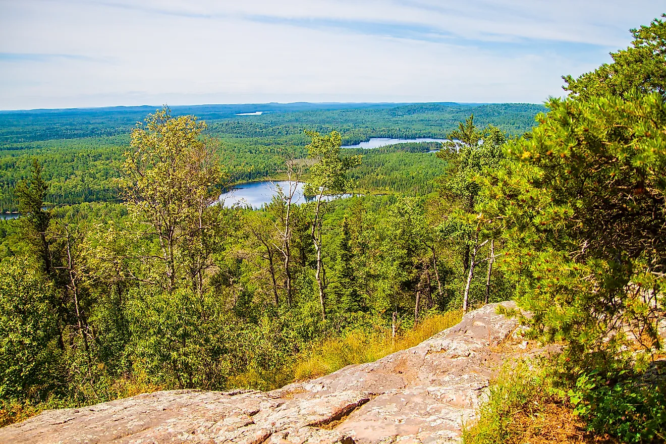
Occupying the extreme northeastern tip of the state's Arrowhead region, Cook County features 698 lakes, per MNDNR. Its wilderness is bordered directly by Lake Superior to the south, Canada to the north, and Lake County to the west. It features the highest average elevation in Minnesota, including Eagle Mountain (2,301 feet). The eastern part of the Boundary Waters Canoe Area Wilderness is found within the interior of Cook County, where rocky lakes feature clear water and are a habitat for lake trout.
- Largest lake: Lake Superior borders the entire southern length of the county along the scenic Highway 61 corridor.
- Other major lakes: Saganaga Lake (18,766 total acres) is a massive wilderness dotted with islands straddling the Minnesota-Ontario border, with a maximum depth of 280 feet; Brule Lake (4,326 acres), a popular entry lake to Boundary Waters Canoe Area Wilderness surrounded by steep, pine-covered ridges.
8. Vilas County, Wisconsin - 560 lakes

Located along Wisconsin's Northern Highlands border with Michigan's Upper Peninsula, Vilas County features one of the highest concentrations of freshwater lakes on Earth. There are 560 lakes over 10 acres in area in Vilas County, according to the Wisconsin Department of Natural Resources. If you count lakes from 2.2 acres and up, the number of lakes in Vilas County rises to 1,318. The region's sandy soil and lake networks make it a top vacation destination in the Midwest.
- Largest lake: Lac Vieux Desert - Covering 4,017 acres across the Wisconsin-Michigan border, this historic lake forms the headwaters of the Wisconsin River.
- Other major lakes: Trout Lake (3,864 acres), a deep, cold-water lake with a maximum depth of 117 feet; Fence Lake (3,483 acres), known for its clear water and connection to the 10-lake Flambeau Chain.
9. Polk County, Florida - 554 lakes

The state of Florida has over 7,700 lakes statewide measuring over 10 acres, per the Florida Department of State. Situated along the rolling hills of the Lake Wales Ridge in Central Florida, Polk County contains 554 freshwater lakes over 10 acres in size, occupying 135 square miles, according to the Polk County Water Atlas. Unlike the glacial lakes of the Upper Midwest, Florida's lakes were formed primarily through sinkholes and shallow depression basins in sandy terrain. The county features the famous Winter Haven Chain of Lakes, connecting 22 individual lakes via a series of navigable canals.
- Largest lake: Lake Hancock - Spanning 4,584 acres, this shallow, ecologically significant lake lies between Lakeland and Bartow and feeds into the Peace River watershed.
- Other major lakes: Reedy Lake (3,507 acres), a popular bass-fishing lake; Lake Parker (2,109 acres), an urban lake anchoring the northeast side of Lakeland.
10. Crow Wing County, Minnesota- 416 lakes

Serving as the geographic center of Minnesota's famous Brainerd Lakes Area, Crow Wing County contains 416 lakes spanning over 101,000 acres of water and framed by over 2,000 miles of shoreline, according to MNDNR. Carved by the Superior Lobe of the last glacier, the county's heavily wooded landscape features deep, sandy-bottomed lakes fed by the Mississippi and Crow Wing Rivers, supporting a multi-million-dollar resort, golfing, and summer residency economy.
- Largest lake: Gull Lake - Covering 9,419 acres across Crow Wing and Cass Counties, Gull Lake is one of Minnesota's most heavily visited recreational lakes, famous for its resort history and winter ice-fishing events.
- Other major lakes: Pelican Lake (8,367 acres), renowned for its sandy beaches and high water clarity; the Whitefish Chain of Lakes, 14 interconnected lakes spanning 14,000 acres of water.
Lots of Lakes Within Many Counties
By establishing a standardized 10-acre threshold, geographic comparison can more accurately be made, shifting from arbitrary local definitions to verifiable hydrographic data. Although Alaska's vast wilderness holds the highest raw volume of uncharted water bodies, traditional U.S. counties in the Upper Midwest and Florida dominate mapped freshwater density. From Minnesota's glacial lake basins to Florida's sinkhole chains, these top ten counties showcase the unique geological forces that shaped North America's most water-rich landscapes.