How Roman Roads Helped Rome Conquer The World
Ancient Rome ruled one of the largest empires the ancient world had seen, and holding it together took more than legions. Historians often credit Roman military skill for the conquest of Europe, the Middle East, and parts of Africa. The engineering that carried those legions gets less attention. Rome moved troops, grain, tax revenue, and orders across three continents on a road network no state would match for more than a thousand years. That network was the quieter reason the empire held.
The medieval proverb "all roads lead to Rome," first recorded in Latin by the French theologian Alain de Lille around 1175, described a literal fact about the empire that had collapsed centuries earlier. Roman surveyors laid down roughly 50,000 miles of stone-paved highway, and a far larger web of gravel and dirt roads brought the total to an estimated 250,000 miles. Those roads reached Egypt in the south, Scotland in the north, Portugal in the west, and Syria in the east. Speed was the payoff. A rider or a column could cover ground fast enough that a distant frontier still answered to the capital. Four things made the system work: the way the roads were built, how they were routed, the relay network that ran along them, and the soldiers who kept them safe.
Expert Engineering

Durability was the whole point of a Roman road, and it came from building in layers. A finished highway rested on four of them. Crews first dug a trench and set a foundation of large stones, the statumen. On top went the rudus, a bed of smaller crushed stone bound with lime mortar, then the nucleus, a finer layer of gravel and sand compacted smooth. The visible surface, the summa crusta, was fitted from tightly cut stone slabs or, in Italy, blocks of volcanic rock. Soldiers and forced laborers did most of the work, and the layered design meant that even when the top slabs cracked, the roadbed underneath held. Roughly 600 years of steady construction followed the same basic recipe across the empire.

Straightness mattered as much as strength. Roman roads held their line across whatever lay in the way, curving only when a grade left no choice. Surveyors called gromatici sighted those lines using a simple cross-staff instrument and marked them with signposts, so a road could be laid out over hills, marsh, or open country and still run true. Engineers cut through slopes, bridged rivers, and drove tunnels through high ground rather than bend the route around it. Drainage ditches and low retaining walls ran along both sides to carry off water and slow erosion. A straight, well-drained road was shorter to march and faster to build, which is exactly what a moving army needed.
Efficient Navigation

The Appian Way came first. Begun in 312 BCE by the censor Appius Claudius Caecus, it ran southeast from Rome as a military supply route during the Second Samnite War and earned the nickname "Queen of the Roads." It set the pattern every later highway followed, and as the empire grew, Rome pushed new roads out to each conquered territory as fast as its engineers could build them.

Milestones spaced along every route told a traveler exactly how far he had come and how far remained. A legion on the march could make about 20 miles in a day on these roads, fast enough to reach a trouble spot before it spread. The same routes fed Roman map-making. The Peutinger Table, the only Roman road map to survive, comes down to us as a medieval copy of a Roman original that traced back to a great survey map from the age of Augustus. It laid out the cities, rivers, and stations of the network as a single connected diagram, which is only possible when the roads themselves are measured and consistent.
Advanced Communication

What the roads really carried was information. Under the imperial courier system, the cursus publicus established by Augustus, relay stations lined the main routes so a rider never had to nurse a tired horse. Small posts for changing mounts sat every several miles, and larger stops offered food and a bed. Riding station to station on fresh horses, an official courier could cover more than 50 miles a day, and an urgent dispatch could travel far faster. That was the speed at which the capital learned of a border raid or a rebellion.

Lodging along the roads sorted travelers by rank. The mansiones, official inns set roughly every 20 to 30 miles, put up government officials and postal couriers. Ordinary travelers stopped at the cauponae and tabernae, which sold dorm beds, hot wine, and soup. Wealthy and well-connected travelers had the hospitia. Whatever a traveler's station, the roads offered a reliable place to eat, sleep, and repair gear on a long journey. That chain of inns and relay posts is a direct ancestor of the postal routes and roadside hotels that came after it.
Steadfast Security

A road that could move an army could also move a raiding party, so Rome guarded its highways closely. Every kind of traveler used them: soldiers on the march, families, merchants hauling goods, official couriers, and the occasional enemy. Keeping order along thousands of miles of open road, much of it far from any city, was a standing job rather than an occasional one.
Soldiers assigned to the roads, the stationarii and beneficiarii, patrolled from posts and watchtowers set along the busy and the isolated stretches alike. They gave directions, passed along messages, and collected tolls and taxes at the crossings. Without that steady presence, the traffic the roads were built to carry would not have moved safely for long.
The Legacy of Roman Roads
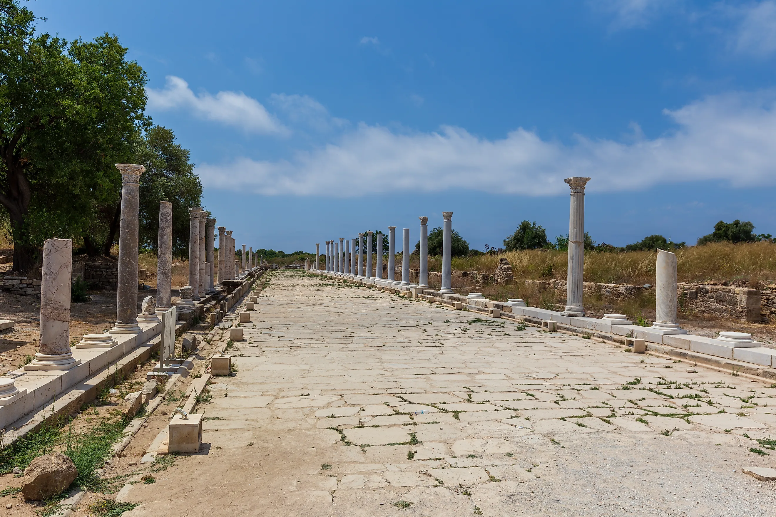
When the Western Roman Empire fell in 476 CE, the money and labor that maintained the roads went with it. Drainage ditches clogged, surfaces broke up, and trees and brush reclaimed long stretches. Yet the foundations were built to last, and their line survived even where the paving did not. Many modern European highways still follow Roman routes, and paved segments remain in use across England, Italy, and France. The system also outlived Rome as an idea. Layered road construction, a state postal service, distance markers, mapped route networks, and inns spaced for a day's travel all trace back to it. Rome is remembered for its law and its armies, but the roads did work those institutions could not, and they carried the empire as long as anyone kept them open.