6 Most Alligator Filled Rivers In Louisiana
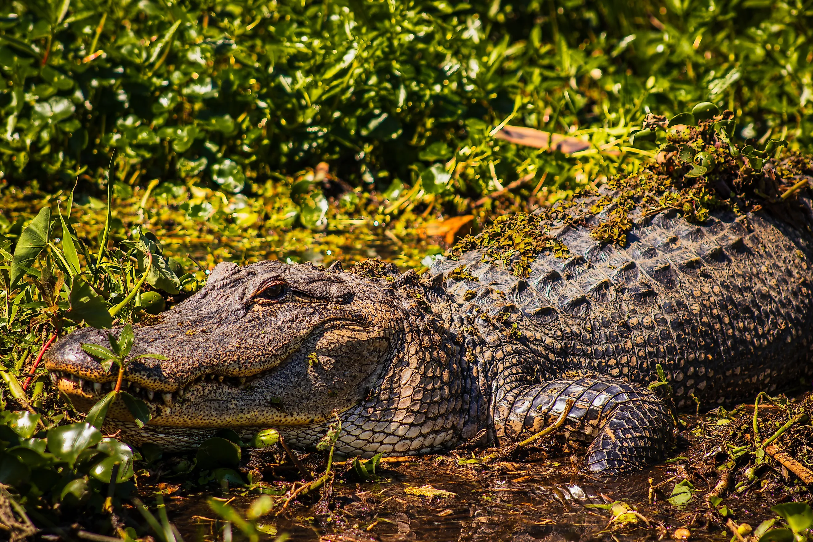
Louisiana is a state defined by water. The Mississippi River marks its eastern edge with the eponymous state, and the Sabine draws its western border with Texas. Between them flows a maze of bayous, swamps, and floodplains, where the line between land and river disappears. The Pearl winds through bottomland forests near the Gulf, the Calcasieu and Vermilion twist through marsh and prairie, and the Atchafalaya plows through the heart of Cajun Country. On any given day, paddlers, anglers, and nature lovers share the rivers with the two million alligators that live in and along these waterways, a reminder that the six most alligator-filled rivers are living ecosystems where the state’s oldest residents still thrive.
Atchafalaya River

A Choctaw word meaning “long river,” the Atchafalaya River is a tributary of the Mighty Mississippi, flowing 125 miles from Simmesport to Morgan City, where it meets the Gulf of Mexico. Along its course, it cuts a 15-mile-wide swath across southern Louisiana, winding through a vast expanse of cypress swamps, bayous, and backwater lakes collectively known as the Atchafalaya Swamp, the largest swamp in the United States, spanning 860,000 acres.
An abundance of wildlife inhabits the basin, including 300 species of birds, and most notably the largest wintering population of American woodcock in North America. The American alligator, along with 65 other species of reptiles and amphibians, can also be found in the swamp. There are numerous ways to spot wildlife in this vast river-basin swamp by boat with an outfitter such as Atchafalaya Basin Landing Airboat Swamp Tours. Based in Henderson, the family-owned company offers a variety of 90-minute airboat, traditional swamp, and private tours.
Calcasieu River

The Calcasieu River in southwest Louisiana is another fantastic, but underrated, place to see alligators in the wild. The 200-mile-long river begins in Leesville, flows through the Kisatchie National Forest, and past towns like Oakdale and Lake Charles, until it reaches the Calcasieu Lake estuary, where the fresh river water mixes with the salty seawater. According to the U.S. conservation nonprofit American Rivers, the Calcasieu River was named as one of “America’s Most Endangered Rivers of 2025.”
Unlike the massive, tangled Atchafalaya Basin, the Calcasieu offers a mix of open water, marshes, and bayous, giving you plenty of ways to spot alligators safely. The 1,087-acre Sam Houston Jones State Park includes numerous waterways and two boat launches located on the west fork of the Calcasieu River. Landlubbers can explore the park on foot, along the 1.6-mile Riverwalk Trail or the 3.5-mile Longleaf Pine Trail, where alligators are often visible along the banks and in the lagoons.
Sabine River

The Sabine River flows about 510 miles from its headwaters in northeast Texas to the Gulf of Mexico. It forms most of the border between Texas and Louisiana, crossing into Louisiana near the small town of Logansport. From there, the river winds south through pine forests and lowlands before widening into the Toledo Bend Reservoir, a 65-mile-long lake created by the Toledo Bend Dam in the 1960s. Below the dam, the Sabine continues its path through cypress swamps and marshes before emptying into Sabine Lake, an estuary shared by both Texas and Louisiana.
South Toledo Bend State Park overlooks the Toledo Bend Reservoir, offering outdoor enthusiasts trails, fishing piers, and stunning views of the winding river, where alligators are sometimes seen basking on logs near the shore. In September 2024, during Louisiana’s regulated alligator hunting season, a 13-foot alligator, along with three other gators measuring over 8 feet long, was harvested from the Toledo Bend Reservoir.
Vermilion River

The best time to see alligators in the Vermilion River is spring through early fall (April-September) when the water’s warm, and one of the best places to see them is Palmetto Island State Park, where the Vermilion River runs along its western edge. The 70-mile Vermilion River flows north to south entirely within the Pelican State, starting near Lafayette, and winding its way to Vermilion Bay, an inlet of the Gulf of Mexico.
Palmetto Island State Park is a 1,300-acre preserve of hardwood forest, swamps, and bayous connected to the river’s backwaters. The presence of wild palmetto plants and cypress trees gives the park a jungle-like atmosphere, perfect for renting a canoe and paddling along the park’s many water trails, where alligators are a common sight near the ponds. There are six vacation cabins in the park, as well as 95 premium campsites, a primitive campground, and backcountry campsites. You can launch a boat to go fishing, or cast a line from the shore of the river. Other wildlife in the state park includes egrets, armadillos, herons, turtles, and otters.
Pearl River

The 444-mile-long Pearl River forms part of the border between the Pelican State and Mississippi in its lower stretches, originating near the small town of Philadelphia (not that Philadelphia) in Neshoba County, Mississippi. The Pearl empties into Lake Borgne and the Mississippi Sound, forming coastal marshes and estuaries along the way—prime alligator country.
Along the lower section of the Pearl, you’ll find the 250-square-mile Honey Island Swamp, one of the most beautiful islands in Louisiana. The wilderness area encompasses nearly 70,000 acres, which was established as the Nature Conservancy’s first Louisiana Nature Preserve. Book Dr. Wanger’s Honey Island Swamp Tour, where you will discover that the swamp is teeming with wildlife, everything from black bears, wild boars, nutria, caiman, and alligators. If you’re lucky, you may even catch a glimpse of the mythical Honey Island Swamp Monster, a humanoid cryptid rumored to live in the swamp since 1963.
Mississippi River Delta Backwaters

The Mississippi River Delta backwaters are among the richest wetland ecosystems in North America, providing a prime habitat for alligators, herons, egrets, turtles, and numerous fish species. These backwaters are a sprawling maze of oxbow lakes, swamps, and bayous that branch off from the lower Mississippi River, mainly in Louisiana and southern Mississippi. Offering some of the richest fishing grounds in the U.S., the Barataria Basin is a top destination for anglers looking for a mix of freshwater and saltwater species of fish, unique to the Mississippi Delta backwaters, like redfish, largemouth bass, and speckled trout.
Gators are common in these waters, especially near reedy banks and the warm shallow water. Once far more abundant in these coastal waters, alligators suffered steep declines due to habitat loss and oil spill disasters, like the Deepwater Horizon oil spill in the Gulf of Mexico in 2010. Today, wetland restoration projects are helping Louisiana’s coastal marshes restore more than 17,000 acres of wetlands to ensure a stable future for alligators and other wildlife in the basin.
Where Alligators and Adventure Meet on the Rivers of Louisiana

From the cypress-tangled Atchafalaya to the bends of the Vermilion, Louisiana’s rivers reveal some of the most unspoiled landscapes in the South. Each waterway offers a different window into the state’s wildlife, where you can see herons standing in the reeds, turtles basking on logs, and alligators drifting quietly through the shallows. These six most alligator-filled rivers in Louisiana are perfect for alligator spotting and outdoor adventure, such as paddling through the vast Atchafalaya Basin, fishing the brackish waters of the Calcasieu or Sabine, or exploring the swampy trails of Palmetto Island State Park and Honey Island Swamp. Thanks to ongoing restoration and conservation efforts, these fragile ecosystems are being protected from erosion and pollution, ensuring Louisiana’s wild rivers, wetlands, and alligators continue to thrive for generations to come.


