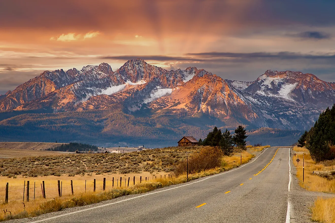
9 Most Scenic Drives in British Columbia
If you're craving a winding drive with expansive views at every turn, these British Columbia routes should be on your radar. The province serves as Canada's gateway to the Pacific, and its landscapes run the gamut: mountains, forests, grassy plains, lakes, beaches, and even inland deserts. You can drive mountainous terrain along the Cariboo Highway, head toward the Yukon on the Stewart-Cassiar Highway, or wind your way across Vancouver Island on Highway 4. Each of these scenic British Columbia drives delivers something different, and all of them reward the time behind the wheel.
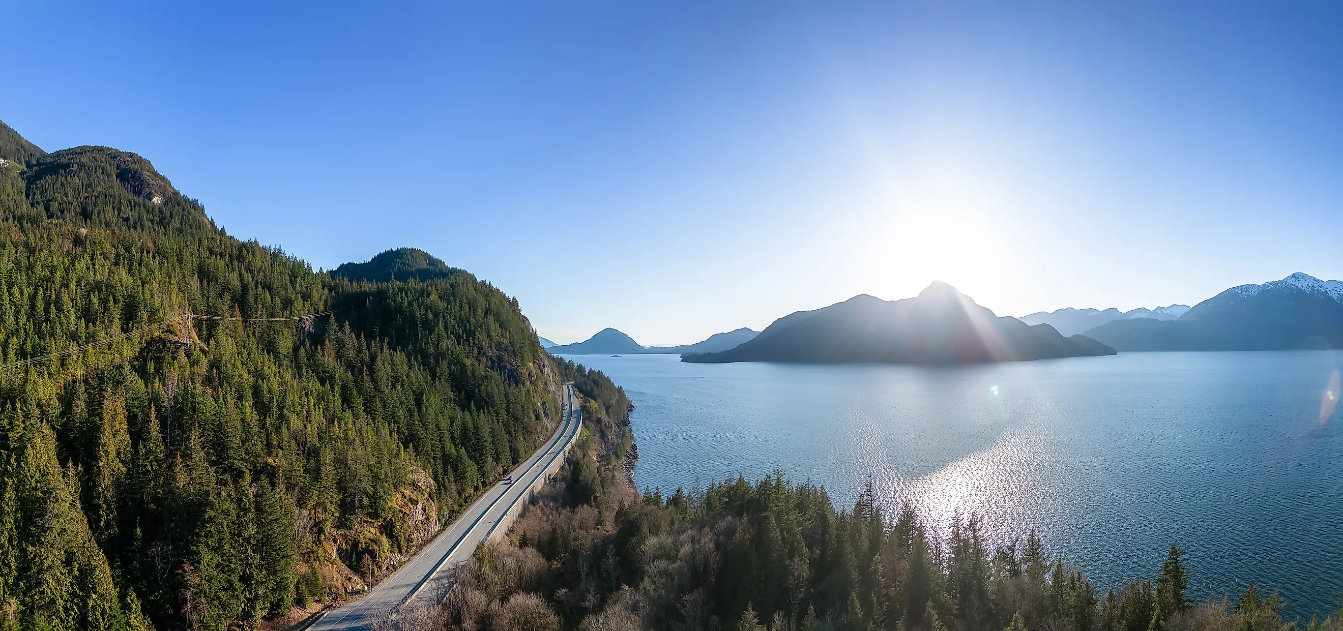
Sea to Sky Highway

Our first thoroughfare begins fittingly in British Columbia's largest city, Vancouver, and runs about 160 miles to the former mining town of Lillooet. Officially known as Highway 99, the road roughly follows a route long used by the Squamish and Stó:lō Nations, with mountain ranges fully within eyesight. Much of the region turned to mining over the years. To learn more, make a pit stop at Britannia Beach just outside of Vancouver. The Britannia Mine Museum digs into the history of the mining industry and the mark it left on the area, with galleries of archival photos, fluorescent minerals, and volcanic rocks. There's even an interactive exhibit where you can try your hand at gold panning. If you'd like a leisurely walk, drive on down to Squamish Canyon, where a one-mile elevated boardwalk winds through hemlock and cedar forests to platforms above Mamquam Falls. Shoppers and skiers should also stop in Whistler, a town right along the highway lined with restaurants, cafes, and galleries, not to mention the largest ski resort in North America.
Highway 4

Situated on Vancouver Island, Highway 4 snakes its way east to west across the island. It starts just outside Parksville and ends in Port Alberni, and in between you'll see mountains, lakes, and ancient forests. Begin at Petroglyph Provincial Park, where you can wander forest paths past rock carvings etched over 1,000 years ago by the First Nations peoples. As you near Port Alberni, prepare yourself for Cathedral Grove, a forest of enormous, centuries-old Douglas fir and red cedar trees. Tired of the outdoors? Visit the Ahtsik Gallery and Gordon Dick Studio, a focal point for local Indigenous art.
Highway 101

Running up and down British Columbia's Sunshine Coast, Highway 101 takes you out of the province's often wet, gray climate to where the sky is far clearer, with about 2,400 hours of sunshine a year. Marine adventures, wide coastlines, and sun-soaked beaches await. Some consider it part of the Pan-American Highway that runs all the way down to Chile (though the BC stretch is separated from the rest of the route), and British Columbia's Highway 101 packs plenty into its own 97 miles between Langdale and Lund. Make a stop in the town of Sechelt, an artistic community with marinas, pubs, kayaking, and wildlife to appreciate. Further along Highway 101, you'll have to board a ferry to reach the rest of the road, but once you do, stop at Saltery Bay Provincial Park. The shoreline draws sea lions, killer whales, and seals to its waters.
Pacific Marine Circle

Beginning and ending in the provincial capital of Victoria is the Pacific Marine Circle, a mostly secluded loop twisting through dense rainforests and seaside hamlets via Highways 1, 14, 18, and Pacific Marine Road. Since you'll start in Victoria, use the chance to tour the city, especially the arresting Parliament Buildings. Heading southwest, you'll reach Sooke Potholes Provincial Park, full of geological rock pools carved out by glacial action around 15,000 years ago during the last ice age. Anglers can also sit by the accessible Sooke River to catch the coho and chinook salmon native to its waters. Continue west to find the Juan de Fuca Marine Trail, then camp out under the stars or follow one of the many hiking trails deeper into the Canadian wilderness. As the Pacific Marine Circle winds down, you'll pass the Malahat Skywalk, a spiraling tower walkway high above the Salish Sea.
Meadows in the Sky Parkway

Turning and curving its way through Mount Revelstoke National Park is the aptly named Meadows in the Sky Parkway, a road that climbs the park's namesake mountain. At the base of the parkway, next to the city of Revelstoke, are trails for casual walks or more seasoned hikers, so you may want to get out of the car and stretch your legs first. The parkway has six viewpoints and picnic areas: Revelstoke, Rainforest, Monashee, Columbia, Eagle Pass, and Panorama Point. Each one offers a different view of the surrounding country, from the town of Revelstoke to the Illecillewaet and Columbia River valleys, depending on your elevation. Bear in mind, however, that dogs aren't permitted above the Columbia viewpoint, and parking at the summit is limited. It's best to arrive early in the day to truly take in the scenery from the top. RVs, buses, towed vehicles, and vehicles over 26 feet long are restricted from the parkway entirely.
Crowsnest Highway

Another thoroughfare originating near Vancouver, the Crowsnest Highway, otherwise known as Highway 3, meanders through deep canyons, vineyards, and scorched deserts, oh my. After leaving the big city, you'll hit E.C. Manning Park, where outdoor adventurers can hike, camp, photograph the light-pollution-free night sky, or go Nordic skiing. Further along, you'll reach Osoyoos, a jumping-off point for the wineries and breweries that call out for tasting. Carry on, and you'll find chances to soak in hot springs. Ainsworth Hot Springs sits just a hop from the towns of Kaslo and Nelson. Soak in its mineral waters and take in the views of Kootenay Lake.
Stewart-Cassiar Highway

At over 500 miles, the Stewart-Cassiar Highway, or Highway 37, isn't for the faint-hearted. As one of the longer roads on the list, it delivers towering mountains, rushing rivers, and deep lakes between the Kitwanga Junction and the edge of the wild Yukon territory. The ruggedness is best shown by the glacial landscape, specifically Salmon Glacier and Bear Glacier, two of the most striking ice fields in the region. The feeling of nature on steroids doesn't halt there. Further north, Mount Edziza Provincial Park protects 230,000 hectares of volcanic terrain shaped by ancient lava flows, leaving behind cinder fields, cinder cones, and basalt plateaus. For a more traditional park experience, head next door to Spatsizi Plateau Wilderness Park, one of Canada's largest, where countless hiking trails draw hikers and where moose, caribou, stone sheep, and mountain goats are only some of the animals that roam the preserve. If you'd like more aquatic diversions, there's always Stikine River Provincial Park to explore by canoe.
Cariboo Highway

This memorable section of Highway 97 is called the Cariboo Highway, so don't be surprised if some actual caribou tailgate your bumper. The road runs north from Cache Creek to Prince George, covering over 275 miles of sweeping prairies, gentle hills, deep forests, enclosed canyons, and rivers. Start in Cache Creek, a former settlement of the Shuswap Nation for thousands of years, and spend a night or two at the motels in town. Heading north, the next attraction worth stopping for is Gold Country, a region with a long past full of rough cowboys, wealth-obsessed prospectors, and the men who sold them goods. Historic Hat Creek Ranch is a fun stop that re-creates a Gold Rush town and highlights Indigenous traditions. Once you're done taking in the country all around, step into the lakeside community of Canim Lake. Grab a cabin at a lakeside resort and enjoy some hiking, fishing, canoeing, and maybe kayaking.
Yellowhead Highway

Finally, this giant of a road shows you just how wide Canada really is. Starting in Masset, British Columbia, and ending at the Manitoba capital of Winnipeg, the Yellowhead Highway, or Route 16, crosses mountain ranges and prairieland for a whopping 1,859 miles. The British Columbia portion alone is impressive enough, beginning at the western terminus near the ferry to Haida Gwaii, offshore islands draped in ancient Pacific rainforest. Further along, Mount Robson comes into view, the highest peak in the Canadian Rockies. While traversing the highway, you'll also cross the Alexander Mackenzie Heritage Trail, one of the longest hiking trails in the province.
The Road Ahead in BC
As this list makes clear, British Columbia isn't all misty weather and Vancouver. Its highways run through high mountains, wide-open deserts, and alongside clear lakes. The roadways here can be just as far-reaching and diverse as anything its southern and northern American neighbors have to offer. Fuel up the gas guzzler or charge up your electric vehicle, because the open road is calling.