The State Parks With The Best Mountain Biking Trails
State park systems across the United States manage specialized mountain biking networks that traverse distinct geological zones. These span the slickrock fins of the Colorado Plateau and the Appalachian foothills. Unlike federal wilderness areas that often restrict mechanized travel, state parks frequently design trails specifically for bicycle flow. Many incorporate berms, switchbacks, and technical rock gardens while adhering to strict erosion control protocols. Seven state parks across the United States preserve mountain biking environments with verified trail metrics, elevation profiles, and surface conditions for cyclists seeking diverse terrain.
Dead Horse Point State Park, Utah

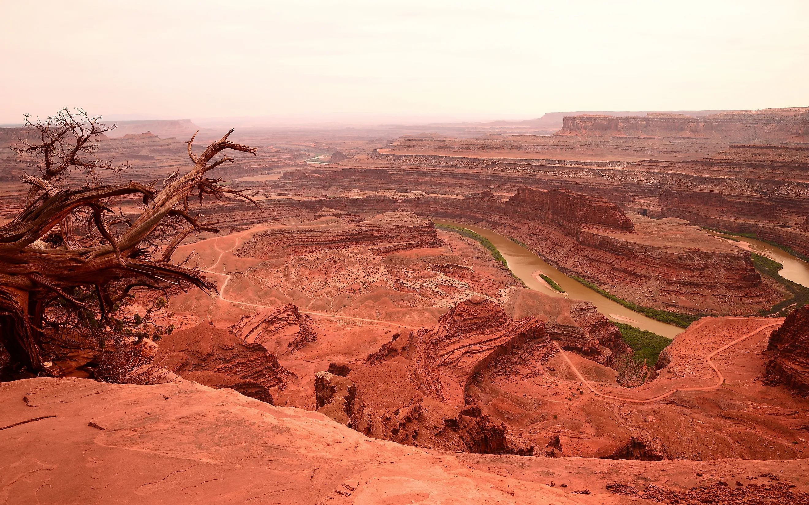
Dead Horse Point State Park manages the Intrepid Trail System, a network of nested loops totaling over 17 miles carved into the Wingate Sandstone mesa top. Unlike the nearby BLM-managed Slickrock Trail, this system features true singletrack winding through pinyon-juniper woodlands and exposed sandstone fins.
The terrain is characterized by gentle rolling topography with short grade changes of 50 to 100 feet, rather than steep vertical relief, making it accessible for beginner to intermediate riders. The surface alternates between hardpack dirt and exposed sandstone, providing high traction trails. Elevations hover consistently around 5,900 to 6,000 feet, placing the ride in a high-desert climate where summer temperatures frequently exceed 95 degrees Fahrenheit.
The park's location, perched 2,000 feet above the Colorado River, provides panoramic views of the Canyonlands region, though the exposed nature of the trails offers little shade. Optimal riding conditions occur in spring and autumn, as winter snow and ice can render the slickrock sections hazardous.
Lake Tahoe Nevada State Park, Nevada

Lake Tahoe Nevada State Park manages 50 miles of multi-use trails centered around Spooner Lake and the Marlette Canyon basin, distinct from the adjacent federal lands. The park's primary riding corridors begin at Spooner Lake, where riders ascend North Canyon Road, a wide dirt doubletrack that serves as the main climbing route through dense Washoe pine forests.
This ascent transitions into the park's signature singletrack sections, most notably the Marlette Flume Trail, which originates at Marlette Dam within the park boundaries before transitioning into the adjacent Humboldt-Toiyabe National Forest. This route contours along steep, exposed granite cliffs overlooking the alpine basin, featuring narrow treads carved directly into the mountainside with significant drop-offs.
The trail surface consists of loose, fast-moving decomposed granite that offers high speed but requires higher skills due to lower traction in dry conditions, particularly on the park's frequent switchbacks and technical descents. Vegetation transitions from the dense lower forests to open manzanita chaparral on the exposed ridges, providing panoramic views of the lake through the canopy. Elevations range from roughly 6,200 feet at the lake shore to over 8,000 feet on the upper ridges near Marlette Peak.
Snow accumulation typically covers the higher elevations from December through May, limiting the prime riding season to late spring through early autumn. The park's trail system offers a self-contained experience of technical, cliffside riding on unique granite terrain, with connections to the broader Tahoe Rim Trail corridor for those seeking extended routes.
Oak Mountain State Park, Alabama

Oak Mountain State Park contains over 40 miles of mostly single-track mountain bike trails maintained in partnership with the Birmingham Urban Mountain Pedalers, ranking as one of the most extensive networks in the Southeast. The Double Oak Trail, a red-blazed loop, spans approximately 22 miles and circumnavigates the park's two highest peaks, featuring steep climbs, rocky descents, and wooden bridges spanning creek crossings.
The trails are within the Appalachian foothills, with soil composed of red clay and chert rock that offers high traction when dry but becomes hazardous and slick during wet conditions. Elevation changes are significant, with the Double Oak Trail accumulating about 1,600 feet of climbing over the full loop. Technical sections feature exposed roots and tight switchbacks through dense pine and hardwood forests.
The park hosts International Mountain Bicycling Association sanctioned events, reflecting a high standard of trail maintenance and design. The humid subtropical climate allows for year-round riding, though trails close immediately after rainfall to prevent erosion. Distinct zones cater to different skill levels, marked by green circles for beginners and black diamonds for expert riders.
Cacapon Resort State Park, West Virginia

Cacapon Resort State Park, located in the Eastern Panhandle of West Virginia near Berkeley Springs, features over 30 miles of trails, including a purpose-built singletrack network designed specifically for modern mountain biking. Developed in partnership with IMBA, the system includes flow trails, technical descent lines, and a skills park built alongside classic Appalachian singletrack. The terrain climbs from 800 feet at the park base up the flanks of Cacapon Mountain to 2,300 feet at the ridge, giving riders over 1,400 feet of vertical drop and long, physical climbs.
The surface consists of hardpack dirt mixed with shale, sandstone, and technical rock gardens, necessitating active bike handling on fast descents. Dense hardwood forests of oak, maple, and mountain laurel shade the trails, keeping summer riding conditions comfortable.
The park offers routes spanning beginner-friendly green loops to expert black-diamond lines equipped with rock drops, bermed corners, and tabletop jumps. Trails drain relatively well across the rocky soil, though rain closures are enforced during soft ground periods to preserve trail integrity.
Curt Gowdy State Park, Wyoming

Curt Gowdy State Park, situated in the Laramie Range between Cheyenne and Laramie, manages over 35 miles of maintained singletrack that traverse a high-altitude granite landscape, a distinction that earned the network an IMBA Epic designation. The trail system features renowned routes such as Mo' Rock, Stone Temple Circuit, El Alto, Albert's Alley, and Crow Creek, alongside specialized play areas like the Middle Kingdom and the IMBA Freeride Skills Area.
The terrain is defined by the park's unique geology, where trails climb over and around massive Precambrian granite formations, offering technical rock gardens and fast, flowy sections on hardpack dirt. Elevations range from roughly 6,800 feet at the reservoir shores to over 8,000 feet along the upper ridges, creating a semi-arid high-plains climate with cool summers and significant temperature swings. The soil consists of decomposed granite and sandy loam, which drains exceptionally well, allowing for a long riding season. Unlike many northern parks, Curt Gowdy does not close its trails in winter. Instead, the snow-packed routes become a prominent regional hub for fat-biking from November through April.
Technical difficulty varies from beginner-friendly loops to advanced descents with steep, rocky chutes. The park's proximity to two major universities makes it a vibrant hub for mountain biking, yet the extensive trail system disperses traffic effectively across the granite outcrops and ponderosa pine forests.
Patapsco Valley State Park, Maryland

Patapsco Valley State Park stands as the premier mountain biking destination in the Mid-Atlantic, drawing thousands of riders annually to its extensive network that stretches along 32 miles of the Patapsco River valley. The park's six distinct districts, Hilton, Avalon, Orange Grove, Hollofield, Daniels, and McKeldin, collectively offer about 200 miles of a multi-use trail system (most of which is open for mountain biking), including over seven miles of dedicated single-track. The Avalon and Orange Grove areas function as the central hub for riding, where tight, winding singletrack carves through steep ravines and dense deciduous forests of oak, tulip poplar, and hickory.
The soil composition of clay-loam and weathered schist provides a fast, hard surface when dry but transforms into a slick, rutted hazard after rainfall. While the park remains open year-round without blanket seasonal closures, strict moisture-based trail etiquette is enforced, and riders are expected to avoid the trails immediately after heavy rains to prevent severe erosion and rutting on the vulnerable clay base.
In the Hilton Area, popular bike-legal routes like the Valley View and Hilton Loop feature a dynamic mix of flowy berms and technical challenges, including exposed root networks, rock gardens, and steep, narrow descents that drop sharply toward the river floodplain. The Avalon and Orange Grove areas offer a unique character where trails such as the Ridge Trail, Morning Choice, Santee Branch, and Grist Mill Trail weave through the remnants of a 19th-century industrial corridor. Riders navigate over historic stone foundations, across old railroad grades, and past the ruins of mills and dams, adding a cultural layer to the physical ride.
Blue Mound State Park, Wisconsin

Blue Mound State Park, situated at the highest point in southern Wisconsin at 1,719 feet, protects about 10 miles of off-road singletrack renowned for its technical difficulty. The trails traverse the Driftless Area's unique unglaciated topography, featuring sharp ridges and deep valleys carved into limestone and dolomite bedrock. Contrary to flow-style descriptions, the system is famous for its relentlessly rocky and root-heavy surface, with trails like Holy Schist and Pokerville demanding constant focus and precise bike handling.
The surface is primarily hardpack dirt interspersed with exposed rock gardens, offering a rugged ride through oak and hickory forests. The park's elevation provides a distinct advantage, with cooler temperatures and lower humidity compared to the surrounding agricultural lowlands. Technical difficulty ranges from intermediate to advanced, with natural obstacles dominating the landscape rather than constructed berms or jumps.
Winter snow, spring mud, and freeze-thaw cycles can close the trails, so the riding season depends on conditions rather than a fixed calendar. The compact nature of the trail system allows riders to complete multiple loops in a single session, maximizing trail time within a small footprint.
The State Park Mountain Biking Network
These seven state parks collectively protect a diverse array of mountain bike trails, showcasing the geological variety of the United States, spanning the slickrock domes of Utah and the red clay ridges of Alabama. Management of these trails requires a balance between high-speed recreation and soil conservation, with specific closures based on moisture content to prevent erosion. The technical specifications of these networks, including elevation profiles, surface composition, and trail width, cater to a wide range of skill levels.
Riders must verify current trail conditions before visiting, as state parks often implement temporary closures after rainfall to protect the trail base. The accessibility of these parks, often located near urban centers, provides a critical outlet for outdoor recreation without the logistical hurdles of remote federal wilderness areas. By maintaining these dedicated networks, state agencies preserve the unique riding characteristics that define each region's landscape.