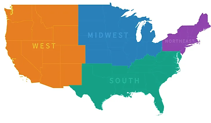
The Regions of the United States
- There are four main regions in the US according to the Census Bureau including the northeast, midwest, south, and west, although some add more divisions.
- The south is a large economic driver, producing a large part of the country's GDP.
- Historically speaking, the midwest and northeast have the highest median annual household income, which are both above the national average.
The US is a huge country with a diverse population and an extraordinary range of landscapes. It claims the Grand Canyon, towering redwood forests, multiple mountain ranges, vast deserts, and long coastlines, with something for just about everyone.
The country covers about 3.8 million square miles (9.8 million square kilometers) and is home to major cities, small towns, and plenty of open, lonely space in between. Because it is so big, the federal government divides it into regions to make it easier to study and discuss the issues particular to each area.

The US Census Bureau, the agency that surveys Americans and produces data about their lives, splits the country into four main regions: the Northeast, Midwest, South, and West. It subdivides these further into groupings like the Pacific, Mountain, West North Central, and Mid-Atlantic, which are useful for analysis even if few people use them in casual conversation. The main four, on the other hand, come up all the time.
It is worth noting that other agencies carve up the country differently. The federal court system references eleven circuits, the Federal Reserve uses twelve districts, and the Bureau of Economic Analysis works with eight regions. For simplicity, this guide sticks to the Census Bureau's main four.
Northeast

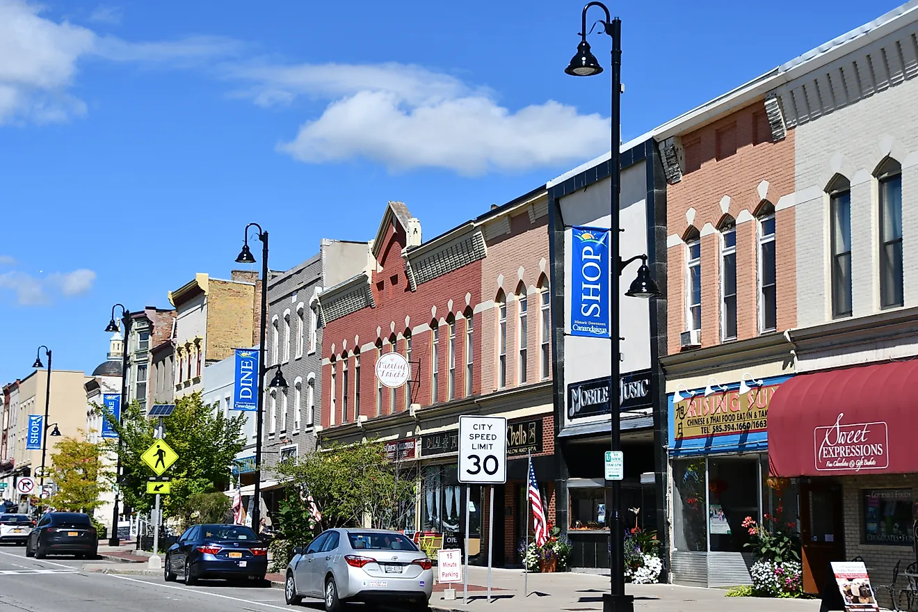
The Northeast is the smallest of the four regions by area, covering nine states that run up the Atlantic coast to the Canadian border. It splits neatly into New England (Connecticut, Maine, Massachusetts, New Hampshire, Rhode Island, and Vermont) and the Mid-Atlantic (New Jersey, New York, and Pennsylvania). Despite its size, it is densely populated, home to about 58 million people and to major cities including New York, Boston, and Philadelphia.

Healthcare is the region's top employer, followed by retail, education, and manufacturing. The Northeast is also one of the wealthiest regions in the country: as of 2023, its median household income of about $86,300 trailed only the West and sat well above the national median. Famous northeasterners include Denzel Washington, Cyndi Lauper, and John Travolta.
| State | Capital | Population (2025 est.) |
|---|---|---|
| Connecticut | Hartford | 3,688,496 |
| Maine | Augusta | 1,414,874 |
| Massachusetts | Boston | 7,154,084 |
| New Hampshire | Concord | 1,415,342 |
| New Jersey | Trenton | 9,548,215 |
| New York | Albany | 20,002,427 |
| Pennsylvania | Harrisburg | 13,059,432 |
| Rhode Island | Providence | 1,114,521 |
| Vermont | Montpelier | 644,663 |
Midwest

The Midwest is the region people argue about most, not because it is contentious but because no one quite agrees where its edges fall. The Census Bureau counts twelve states: Illinois, Indiana, Iowa, Kansas, Michigan, Minnesota, Missouri, Nebraska, North Dakota, Ohio, South Dakota, and Wisconsin. Its big cities include Chicago, Detroit, Indianapolis, Kansas City, Milwaukee, and Omaha.

A widely cited Bloomberg survey of thousands of Americans found broad agreement that those cities, plus Minneapolis and Columbus, are solidly Midwestern, but the boundaries got fuzzy at the margins. Pittsburgh and Buffalo are officially in the Northeast, yet some residents feel more Midwestern in accent and culture. Out in South Dakota, where the Midwest shades into the West, identity splits the same way. Whatever counts as America's "heartland," in other words, depends a bit on who you ask. The region is best known for its farmland and manufacturing base, and it spent the formative years of Abraham Lincoln. Famous Midwesterners include Betty White, Marlon Brando, James Dean, Madonna, David Letterman, Michael Jackson, and Chi McBride.
| State | Capital | Population (2025 est.) |
|---|---|---|
| Illinois | Springfield | 12,719,141 |
| Indiana | Indianapolis | 6,973,333 |
| Iowa | Des Moines | 3,238,387 |
| Kansas | Topeka | 2,977,220 |
| Michigan | Lansing | 10,127,884 |
| Minnesota | Saint Paul | 5,830,405 |
| Missouri | Jefferson City | 6,270,541 |
| Nebraska | Lincoln | 2,018,006 |
| North Dakota | Bismarck | 799,358 |
| Ohio | Columbus | 11,900,510 |
| South Dakota | Pierre | 935,094 |
| Wisconsin | Madison | 5,972,787 |
West

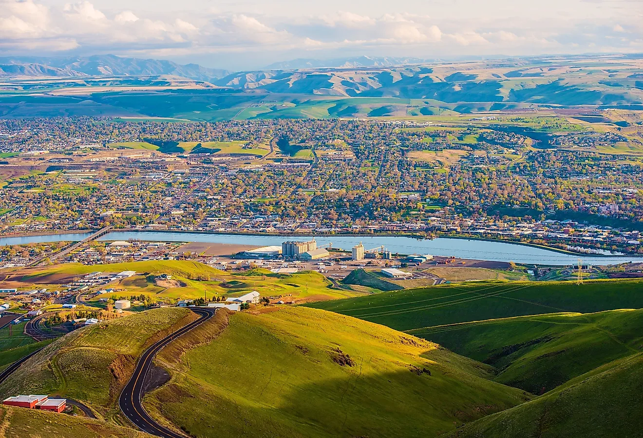
The American West is the country's largest region and the one most wrapped in folklore, equal parts frontier-cowboy legend and Hollywood glamour. It covers thirteen states: Alaska, Arizona, California, Colorado, Hawaii, Idaho, Montana, Nevada, New Mexico, Oregon, Utah, Washington, and Wyoming, and it is home to about 80 million people.

It is also the wealthiest region in the country. As of 2023, the West posted the highest median household income of any region, about $88,300, edging out the Northeast. Its economy leans on technology, agriculture, entertainment, hospitality, financial services, and manufacturing, anchored by some of the nation's largest metropolitan economies in California and the Pacific Northwest.
| State | Capital | Population (2025 est.) |
|---|---|---|
| Alaska | Juneau | 737,270 |
| Arizona | Phoenix | 7,623,818 |
| California | Sacramento | 39,355,309 |
| Colorado | Denver | 6,012,561 |
| Hawaii | Honolulu | 1,432,820 |
| Idaho | Boise | 2,029,733 |
| Montana | Helena | 1,144,694 |
| Nevada | Carson City | 3,282,188 |
| New Mexico | Santa Fe | 2,125,498 |
| Oregon | Salem | 4,273,586 |
| Utah | Salt Lake City | 3,538,904 |
| Washington | Olympia | 8,001,020 |
| Wyoming | Cheyenne | 588,753 |
South

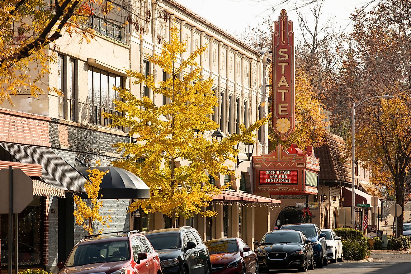
The South is the most populous of the four regions and the largest by number of states, taking in sixteen states plus the District of Columbia: Alabama, Arkansas, Delaware, Florida, Georgia, Kentucky, Louisiana, Maryland, Mississippi, North Carolina, Oklahoma, South Carolina, Tennessee, Texas, Virginia, and West Virginia. Its history is inseparable from slavery and, later, the legal segregation that divided schools, restaurants, and other public spaces by race well into the 1960s.

That system was challenged and dismantled through the civil rights movement, led in large part by Dr. Martin Luther King Jr., and outlawed by the Civil Rights Act of 1964, though its effects still echo through the region today. Modern economics tell a different story: the South has become a major engine of national growth, producing more than a third of the country's GDP, with booming metro areas like Atlanta, Dallas, Houston, and Charlotte drawing new residents and industry.
| State | Capital | Population (2025 est.) |
|---|---|---|
| Alabama | Montgomery | 5,193,088 |
| Arkansas | Little Rock | 3,114,791 |
| Delaware | Dover | 1,059,952 |
| Florida | Tallahassee | 23,462,518 |
| Georgia | Atlanta | 11,302,748 |
| Kentucky | Frankfort | 4,606,864 |
| Louisiana | Baton Rouge | 4,618,189 |
| Maryland | Annapolis | 6,265,347 |
| Mississippi | Jackson | 2,954,160 |
| North Carolina | Raleigh | 11,197,968 |
| Oklahoma | Oklahoma City | 4,123,288 |
| South Carolina | Columbia | 5,570,274 |
| Tennessee | Nashville | 7,315,076 |
| Texas | Austin | 31,709,821 |
| Virginia | Richmond | 8,880,107 |
| West Virginia | Charleston | 1,766,147 |
| District of Columbia | Washington (federal district) | 693,645 |
One Country, Four Regions
The four Census regions are administrative shorthand, but each has grown into something with its own flavor, history, and economy: the dense, wealthy Northeast; the agricultural and industrial Midwestern heartland; the fast-growing, history-laden South; and the expansive, prosperous West. The boundaries blur at the edges, and a single label can never capture a place as varied as Buffalo, Biloxi, or Boise. Taken together, though, the regions are a useful way to make sense of a country too big to take in all at once, and a reminder that its strength has always come from how different its parts are from one another.