Which Countries Have Coastlines On Both The Atlantic And The Pacific Oceans?
Russia borders the Atlantic Ocean. Honduras has only about 124 kilometers of Pacific shoreline, and it still counts. Chile's Atlantic frontage is a handful of small inlets at the southern end of the Strait of Magellan. The eleven countries below all have coastlines on both the Atlantic and the Pacific Oceans, though some are more direct about it than others. Most count their Atlantic side through marginal seas (the Caribbean, the Gulf of Mexico, the Baltic), while only Canada, the United States, and Chile touch the open Atlantic directly.
Canada
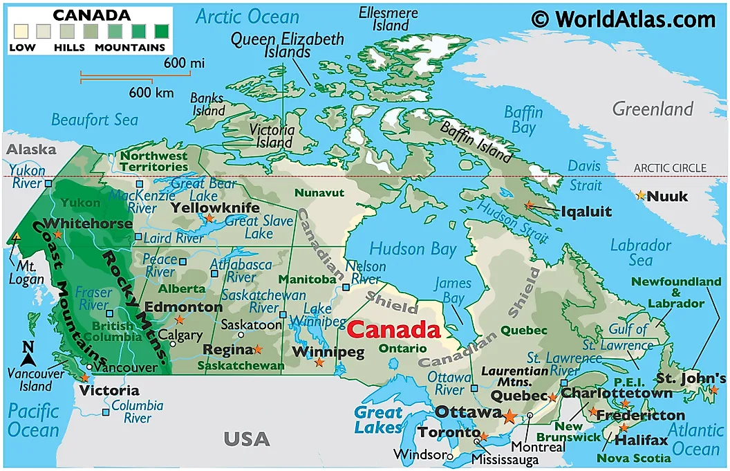
Canada has the longest total coastline of any country in the world at approximately 202,080 kilometers, much of it across the Arctic islands. The Pacific coast in British Columbia covers roughly 7,000 kilometers including the inlets and islands of the Inside Passage, with Vancouver and Prince Rupert as the major Pacific ports. The Atlantic coast runs from the Bay of Fundy (which holds the largest tidal range on Earth at up to 16 meters, twice a day) through Nova Scotia, New Brunswick, Quebec, and the entire Newfoundland and Labrador coast. Halifax operates one of the largest natural ice-free harbors in the world and was the main staging port for Canadian Atlantic convoys during both World Wars. Canada also has the second-longest Arctic Ocean coastline of any country, after Russia.
United States
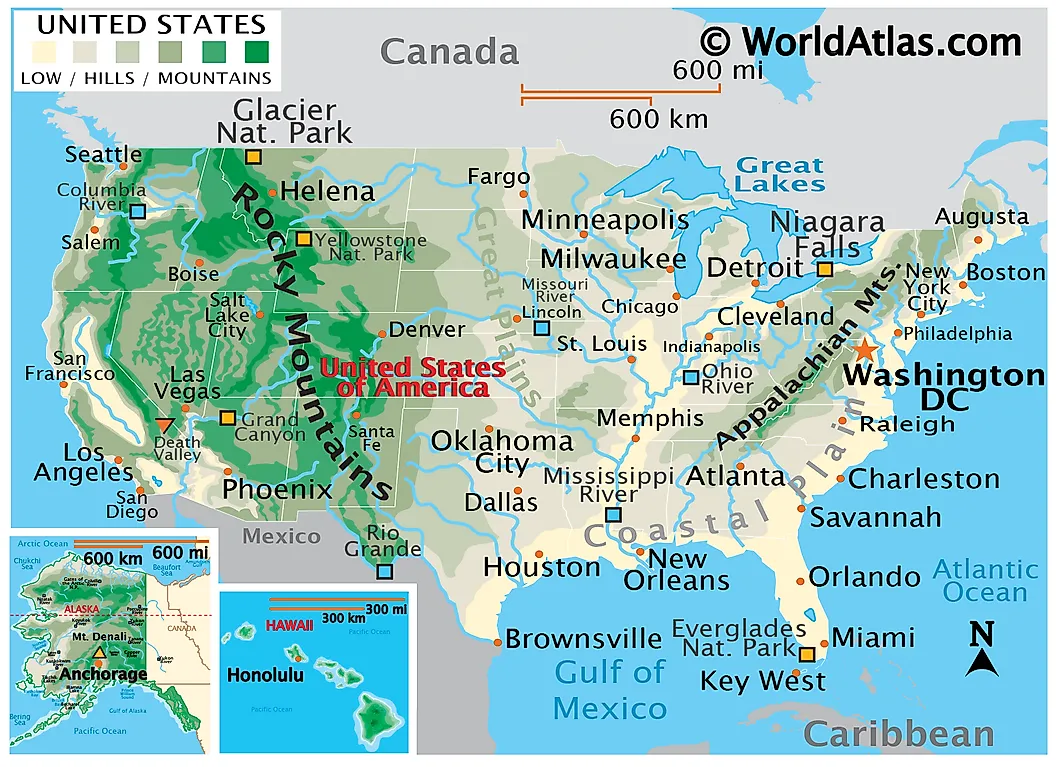
The United States has direct, unobstructed access to both oceans without going through marginal seas. The Atlantic coast covers the entire eastern seaboard, including the Northeast (Maine through New York), the Mid-Atlantic, and the Southeast (the Carolinas through Florida). The Gulf of Mexico (a marginal sea of the Atlantic) adds another 2,600 kilometers of southern coastline along Florida, Alabama, Mississippi, Louisiana, and Texas. The Pacific coast covers California, Oregon, and Washington in the contiguous US, and continues for several thousand more kilometers along the southern and western edges of Alaska. The combined ports of Los Angeles and Long Beach in California form the largest port complex in North America, handling roughly 40% of all US containerized imports. Alaska also gives the US its only Arctic Ocean frontage. Big Diomede Island (Russia) and Little Diomede Island (Alaska) sit just 3.8 kilometers apart in the middle of the Bering Strait, with the International Date Line running between them, so the two are effectively a day apart in calendar time.
Mexico
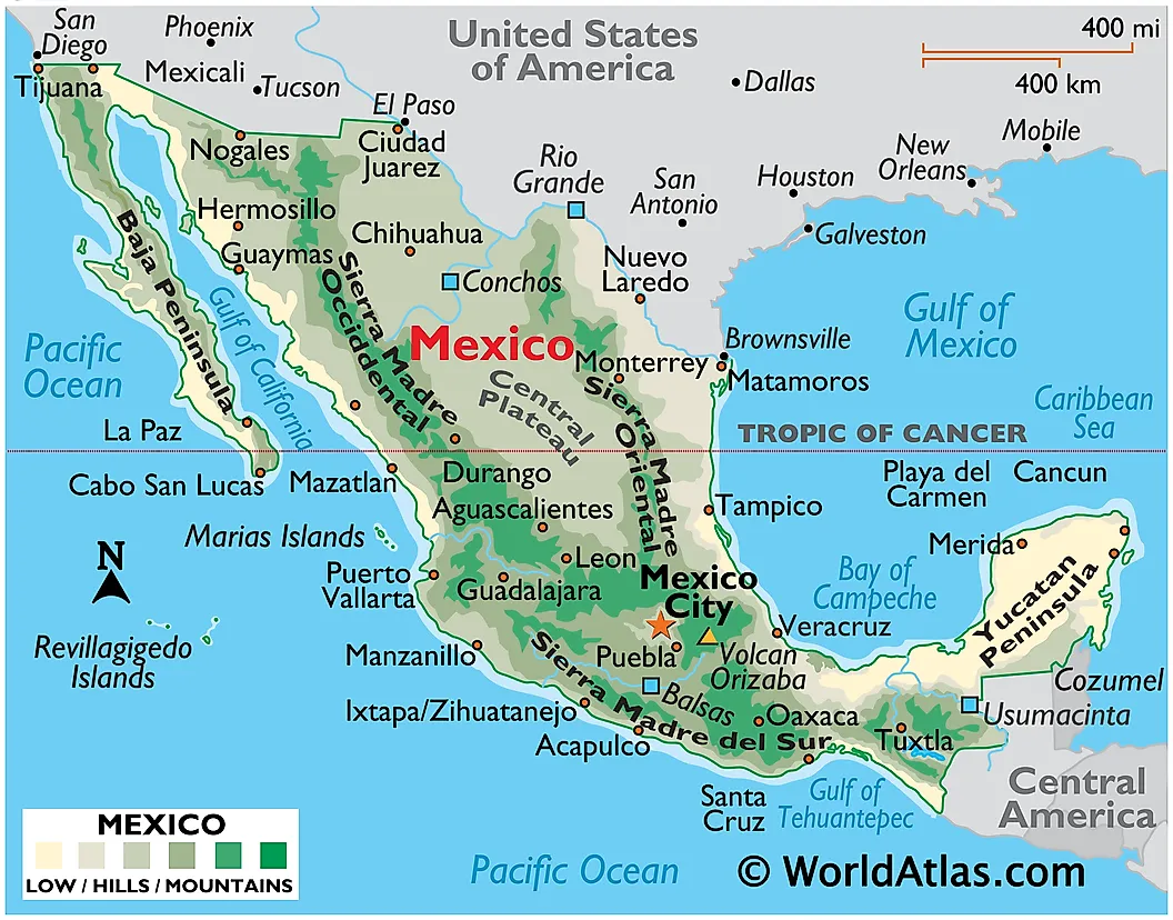
Mexico's Pacific coast covers about 7,300 kilometers of the country's western length, including Baja California, Sonora, Sinaloa, and the southern Pacific states down to Chiapas. The eastern side borders both the Gulf of Mexico and the Caribbean Sea (both marginal seas of the Atlantic) along the Yucatán Peninsula. The Pacific port of Manzanillo in Colima state is the busiest container port in Mexico, handling well over half of the country's Pacific container traffic. Lazaro Cardenas, in Michoacán, runs second. On the Atlantic side, Veracruz is one of the oldest ports in the Americas: Hernán Cortés founded it on Good Friday 1519 and used it as the staging point for his expedition inland to Tenochtitlán. The port of Altamira in Tamaulipas now handles most of Mexico's Gulf Coast cargo volume.
Guatemala
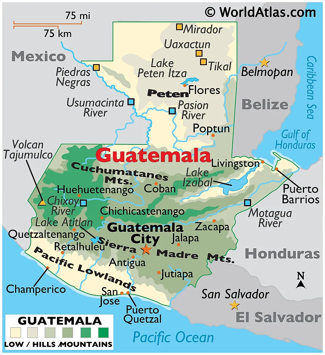
Guatemala has a short Pacific coast (about 254 kilometers) on its southern flank and an even shorter Caribbean (Atlantic) coast (about 148 kilometers) on its northeastern flank. The Pacific port of Puerto Quetzal handles the bulk of Guatemala's seaborne cargo traffic and is a regular stop for Pacific cruise itineraries. On the Caribbean side, the back-to-back ports of Puerto Santo Tomás de Castilla and Puerto Barrios provide Guatemala's only Atlantic access points. The Caribbean coast was a focus of British logging interests in the 18th and 19th centuries; the cultural mix between the Spanish-Pacific and Garifuna-Caribbean sides of the country still tracks closely along that east-west split.
Honduras
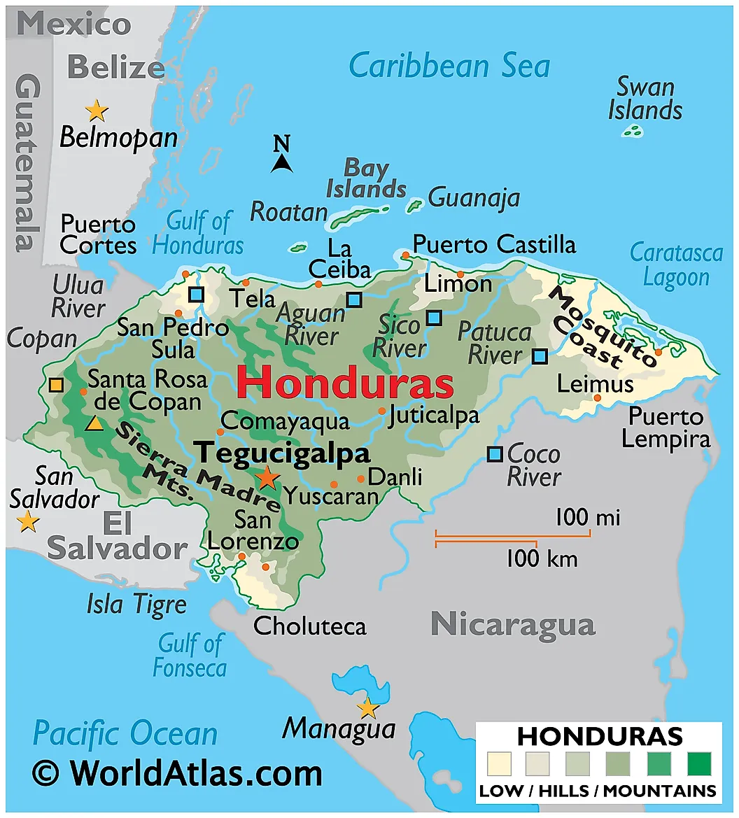
Honduras has one of the shortest Pacific coastlines of any country with one (about 124 kilometers on the Gulf of Fonseca, an inlet shared with El Salvador and Nicaragua) and a much longer Caribbean coastline (about 735 kilometers). The Pacific port of San Lorenzo handles the limited Gulf of Fonseca traffic. On the Caribbean side, Puerto Cortés is the busiest port in Honduras and one of the largest in Central America. The maritime boundaries inside the Gulf of Fonseca were disputed for centuries before the International Court of Justice ruling in 1992 finally settled them: the gulf is a "condominium" jointly administered by Honduras, El Salvador, and Nicaragua, with each country having a defined inner sector.
Nicaragua
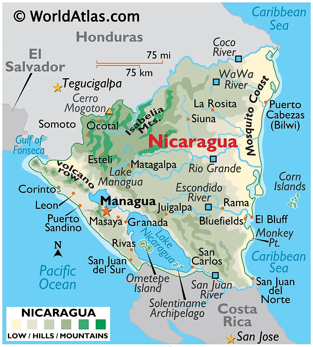
Nicaragua has a roughly 310-kilometer Pacific coast on its southwestern flank and a 480-kilometer Caribbean coast (the Mosquito Coast, named for the indigenous Miskito people, not the insect) on the east. Bluefields, the main Caribbean port, was a British protectorate from 1655 to 1860 and remains a Creole, English-speaking Caribbean enclave culturally distinct from the Spanish Pacific side of the country. Nicaragua was the leading 19th-century candidate for the inter-oceanic canal that eventually went to Panama, since the country has a low-elevation route across Lake Nicaragua. A revived Nicaraguan Canal project was announced in 2013 with Chinese investment but has stalled, and the Panama Canal remains the only operating sea route between the two oceans.
Costa Rica
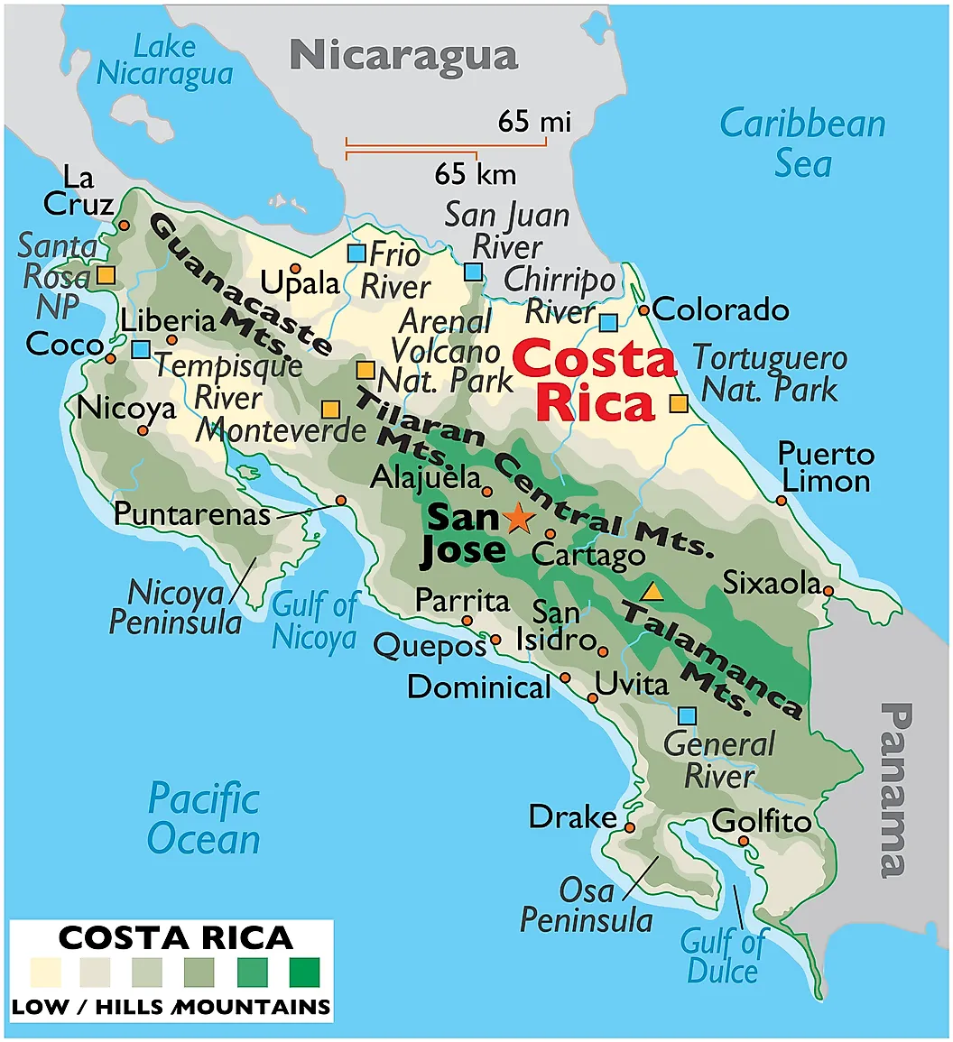
Costa Rica has roughly 1,016 kilometers of Pacific coast on its west and about 212 kilometers of Caribbean (Atlantic) coast on its east. The main Pacific port is Puerto Caldera, on the Gulf of Nicoya, while Puerto Limón handles the Caribbean traffic. The dual coastlines, combined with the central mountain spine that separates them, give Costa Rica one of the highest biodiversity densities on Earth: roughly 4-5% of all known species live on about 0.03% of the planet's land surface, and the Caribbean and Pacific sides have distinctly different ecosystems, with the Caribbean coast more rain-fed and the Pacific side seasonally drier.
Panama
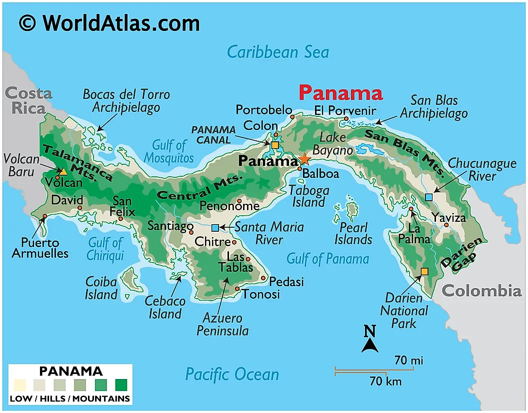
Panama is the narrowest of the inter-oceanic countries, with the Panama Canal cutting through the isthmus at a width of roughly 80 kilometers between the Atlantic and Pacific entrances. The canal opened on August 15, 1914, after a 33-year construction history that began under French engineer Ferdinand de Lesseps in 1881 and was abandoned in 1894 after malaria and yellow fever killed an estimated 20,000 to 22,000 workers and the project went bankrupt. The United States took over the project in 1904 and completed the canal in ten years (an additional 5,609 workers died during the US-led construction period). Control of the canal passed to Panama on December 31, 1999, under the 1977 Carter-Torrijos Treaty. The 2016 Neopanamax expansion, which cost roughly $5.25 billion and opened on June 26, 2016, added a third set of locks and roughly doubled the canal's capacity by allowing container ships of up to about 17,000 TEU. Roughly 5% of global maritime trade by volume passes through the Panama Canal in any given year.
Colombia
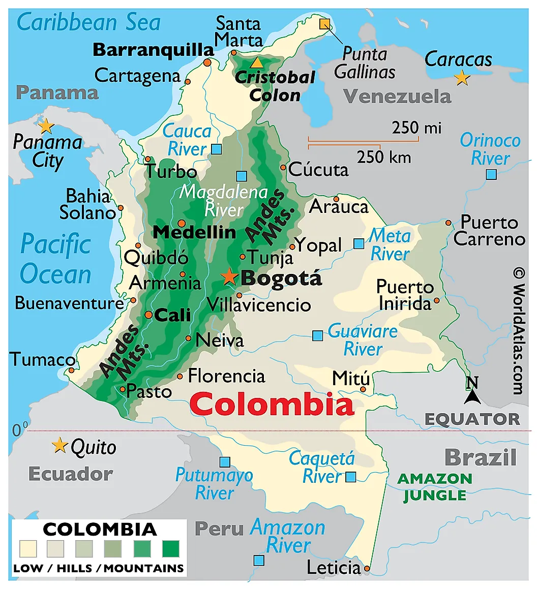
Colombia is the only South American country with coastlines on both the Caribbean (Atlantic) and the Pacific. The Pacific side runs about 1,300 kilometers and is mostly mangrove and rainforest, with Buenaventura as the dominant port. The Caribbean side, about 1,600 kilometers, is more developed and includes Cartagena (a UNESCO World Heritage Site since 1984 for its colonial fortifications) and Barranquilla as the major ports. Cartagena's massive stone walls were built between the 16th and 18th centuries to defend Spanish silver and gold shipments leaving the port for Europe; the city was attacked or blockaded repeatedly by English, French, and Dutch privateers and the walls survived all of them.
Chile
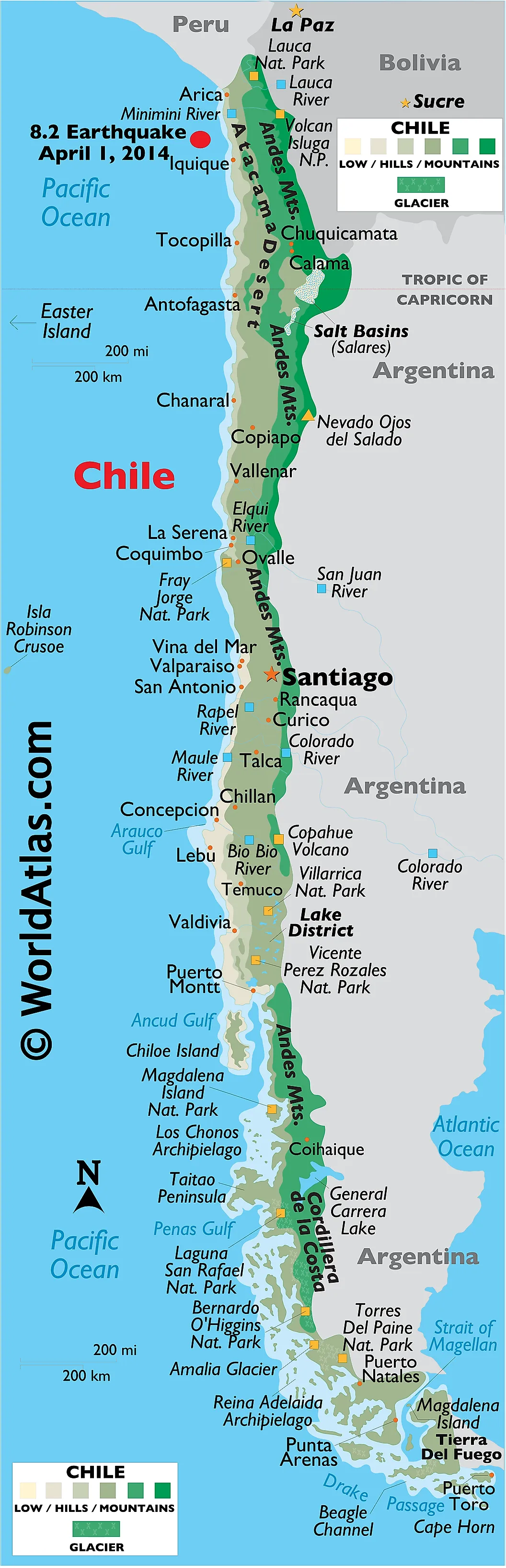
Chile has one of the longest Pacific coastlines of any country (about 6,435 kilometers) and a small Atlantic frontage at the southern end of Tierra del Fuego where the Strait of Magellan opens out into the Atlantic. Chile controls the Strait of Magellan, the navigable channel Ferdinand Magellan first crossed in November 1520 (the crossing took 38 days), and which served as the main shipping route between the Atlantic and Pacific for ships too large to round Cape Horn safely. Punta Arenas, on the Chilean side of the strait, was a major refueling port for inter-oceanic shipping until the Panama Canal opened in 1914 and pulled most of the through-traffic north. Puerto Toro, on Navarino Island at 55 degrees south, is regularly cited as the world's southernmost permanently inhabited settlement.
Russia
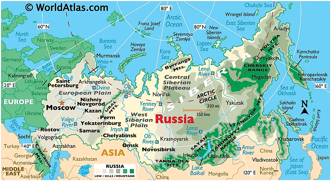
Russia borders the Pacific Ocean along its entire Far East coast, with the Bering Strait at the northern end and the North Korean border at the southern end, including the marginal Bering Sea and the Sea of Okhotsk, with Vladivostok as the dominant Pacific port. Russia's Atlantic access comes through two marginal seas of the Atlantic: the Baltic Sea (via the Gulf of Finland, with St. Petersburg as the largest port) and the Black Sea (which connects to the Atlantic via the Bosporus, the Sea of Marmara, the Dardanelles, the Aegean, the Mediterranean, and the Strait of Gibraltar, with Novorossiysk as the largest Russian Black Sea port). Russia also holds the longest Arctic Ocean coastline of any country at roughly 24,000 kilometers, with Murmansk as the largest ice-free Arctic port thanks to a warm North Atlantic current that keeps the harbor open year-round.
Why Bi-Oceanic Access Matters
Bordering two oceans gives a country two separate maritime trade routes, two separate exclusive economic zones (each extending up to 200 nautical miles from shore), and a strategic position relative to inter-oceanic shipping. The economics of that position vary by country. For Panama, the position is itself the economy: roughly 5% of global maritime trade by volume passes through the Panama Canal, and the 2016 Neopanamax expansion deepened the country's hold on that role. For larger bi-coastal countries like Canada, the United States, and Russia, the two ocean coasts function more like separate economic regions, with trans-continental rail and road networks handling most of the inter-coastal trade. For Mexico, Colombia, and the Central American countries between Guatemala and Panama, the Atlantic side runs through the Caribbean and the Gulf of Mexico, which makes the trade routes to Europe and the eastern United States short and the trade routes to Asia long. Chile occupies the inverse position: the Pacific is right there, but the Atlantic side of the country is so far south that any cargo headed for European markets either takes the long way through the Panama Canal or rounds Cape Horn the hard way.


