Maps of Panama
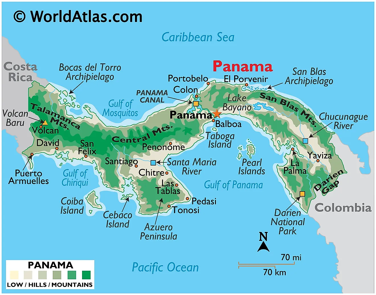
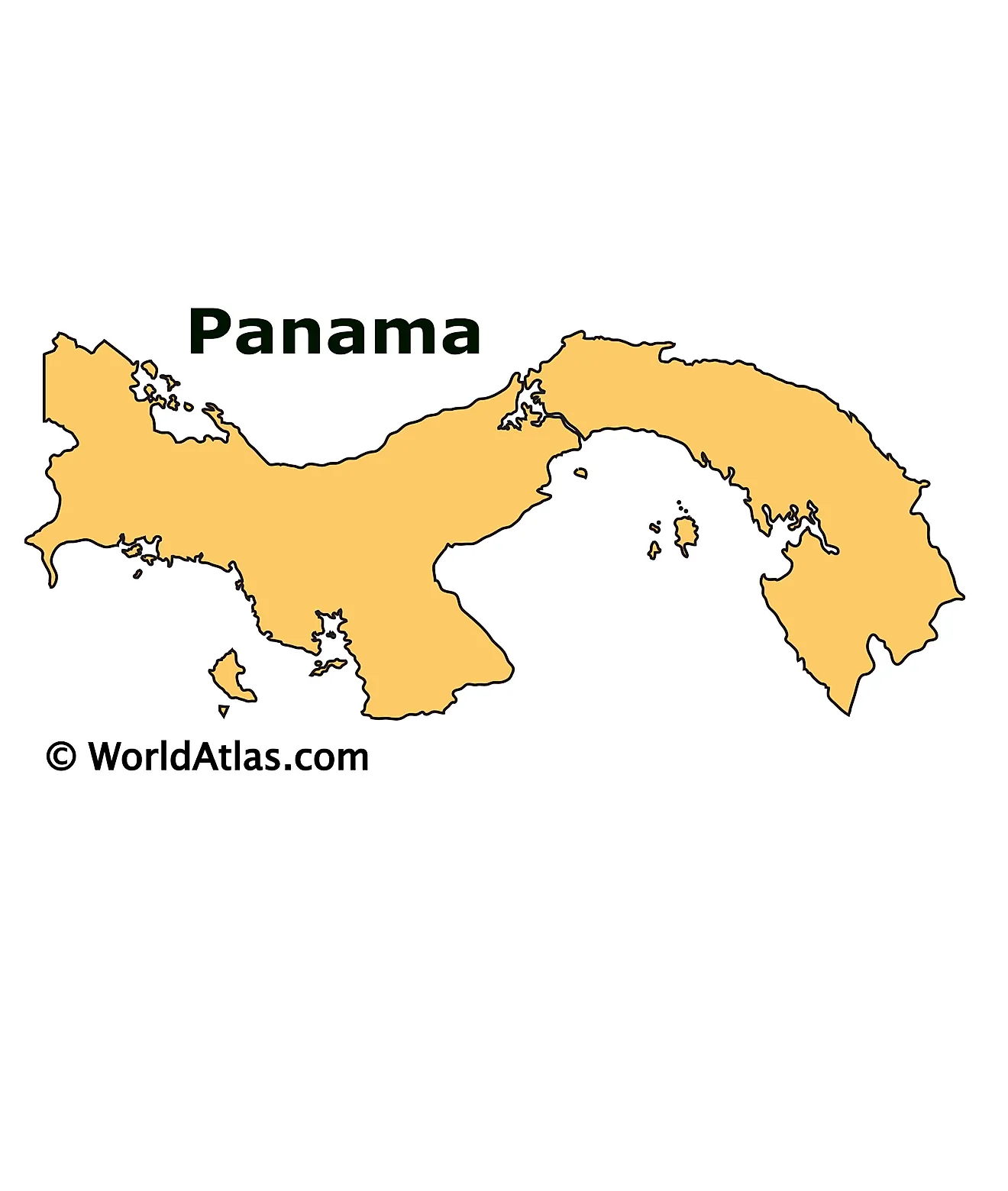
Panama, a narrow isthmus spanning approximately 29,1119 square miles (75,417 square kilometers), links Central and South America. It borders Costa Rica to the west, Colombia to the southeast, the Caribbean Sea to the north, and the Pacific Ocean to the south. This strategic position allows it to be a natural conduit for international maritime trade, especially through the well-known Panama Canal.
The country's geography encompasses several distinct regions. These include coastal plains, central mountains, and eastern lowlands, each with their unique geographical and ecological characteristics.
The coastal plains extend along both the Pacific and Caribbean coastlines. These low-lying areas are typically characterized by mangrove swamps and rainforests on the Caribbean side, whereas the Pacific coastal plains are drier and interspersed with savannahs and deciduous forests.
In contrast to the coastal plains, Panama's central mountains form a rugged spine running through the country's heart. This region encompasses two main ranges, the Cordillera Central and the Serranía de Tabasará, both of which rise to an elevation of over 11,000 feet (3,475 meters) at their highest point, Volcán Barú. This is the tallest peak in the country at 11,398 feet high (3,474) and an active stratovolcano.
The eastern lowlands, also known as the Darien region, is a sparsely populated and mostly undeveloped region that forms a natural border with Colombia. It includes the Darien Gap, a large swath of dense rainforest and swampy terrain that acts as a natural barrier to overland travel between Central and South America.
The country is home to many major bodies of water and rivers, the most significant of which is the Panama Canal. This human-made waterway cuts through the country, connecting the Atlantic and Pacific Oceans, and plays a critical role in global shipping and commerce.
Several significant rivers crisscross Panama. The Tuira River is the longest, flowing approximately 106 miles (170 kilometers) primarily through the Darien Province. The Chagres River, another key waterway, is integral to the operation of the Panama Canal. Its waters feed the canal and control the flow through the use of a series of dams and locks.
In terms of natural lakes, the largest is Lake Gatun, which also plays a vital role in the operation of the Panama Canal. Formed by the damming of the Chagres River, the lake allows for the passage of ships through the canal system.
The northern coastline is ringed by the hundreds of small islands that form the Bocas del Torro and San Blas Archipelagos. Significant islands along the southern coastlines include the Pearl Islands (of Survivor fame), Taboga, Cebaco and Coiba.
Provinces of Panama Map
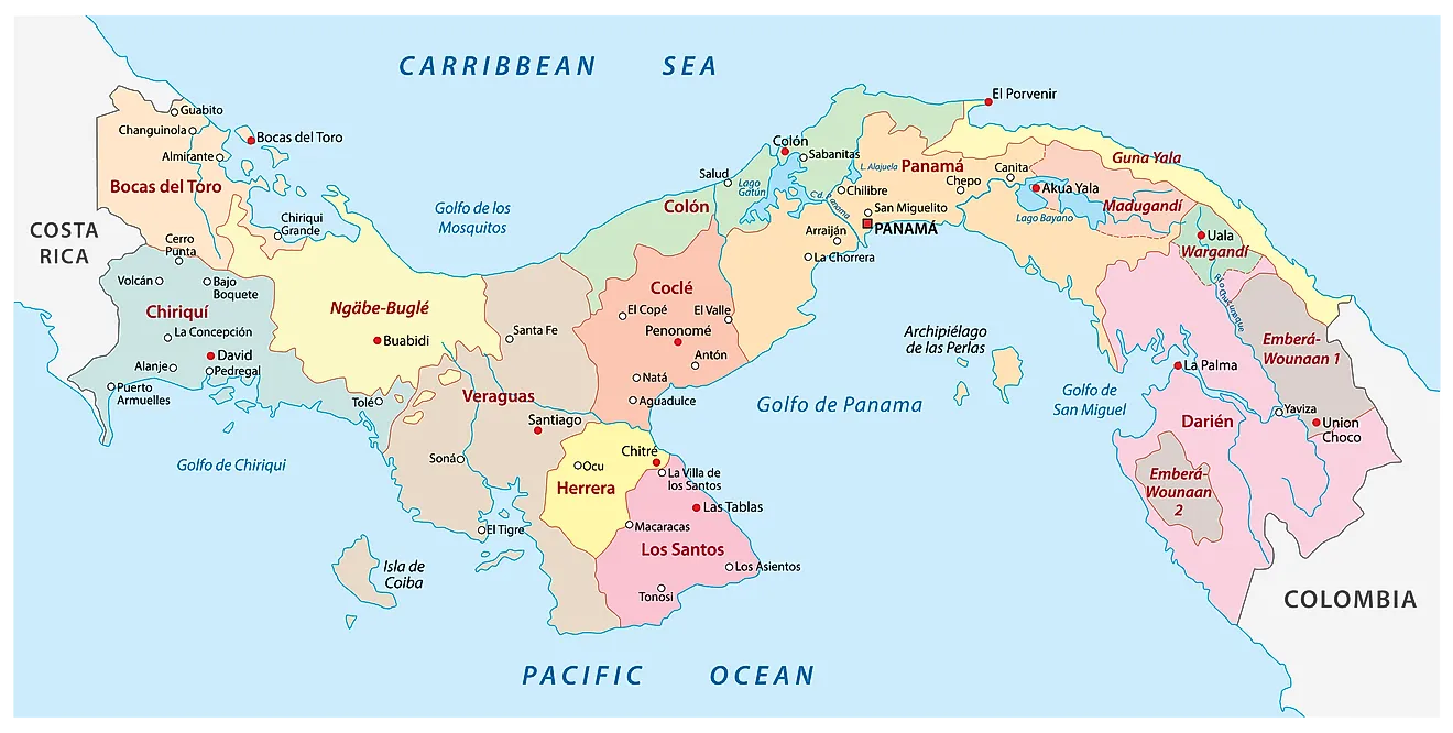
Panama (officially, the Republic of Panama) is divided into 10 administrative provinces (provincias, sing. provincia) and 3 indigenous regions (comarcas). In alphabetical order, the provinces are: Bocas del Toro, Chiriqui, Cocle, Colon, Darien, Herrera, Los Santos, Panama, Panama Oeste and Veraguas. Embera-Wounaan, Guna Yala and Ngobe-Bugle are the 3 indigenous regions of Panama. The provinces are further subdivided into districts and townships. Kuna de Madungandi and Kuna de Wargandi are the two indigenous comarcas within the administrative provinces which have the same status as that of a municipality (corregimiento).
Situated in the province of Panama, with a strategic position at the Pacific entrance of the Panama Canal is Panama City – the capital, the largest and the most populous city of Panama. It is also the administrative, commercial and banking hub of the country.
Where is Panama?
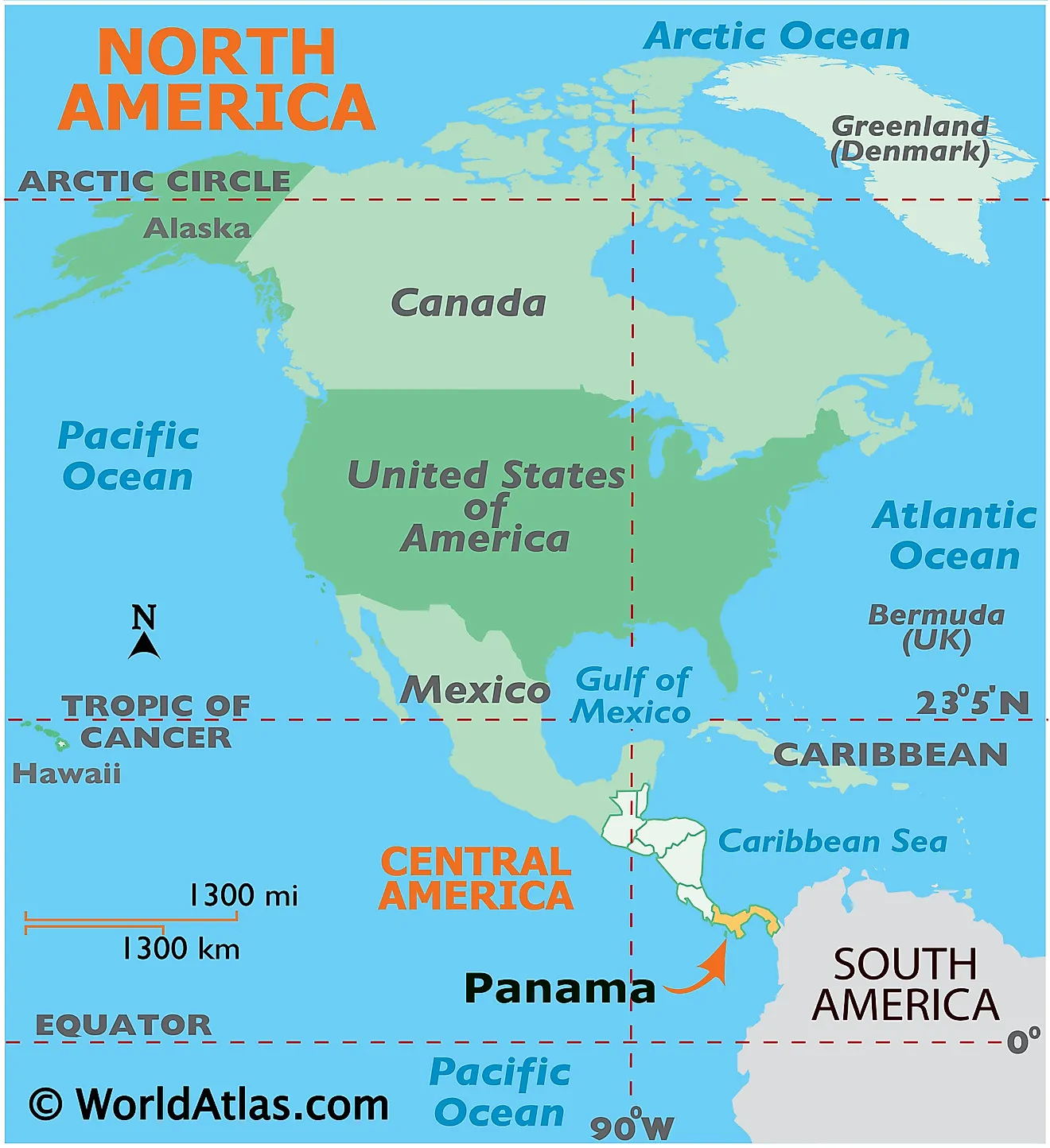
Panama is a transcontinental country – located in Central America; on the southern edge of the Isthmus of Panama (a narrow strip of land connecting the continents of North and South America). It is positioned in the Northern and Western hemispheres of the Earth. Panama is bordered by Columbia to the southeast and by Costa Rica to the west. It is bounded by the Caribbean Sea to the north and by the Pacific Ocean to the south.
Panama Bordering Countries: Costa Rica, Colombia.
Regional Maps: Map of North America
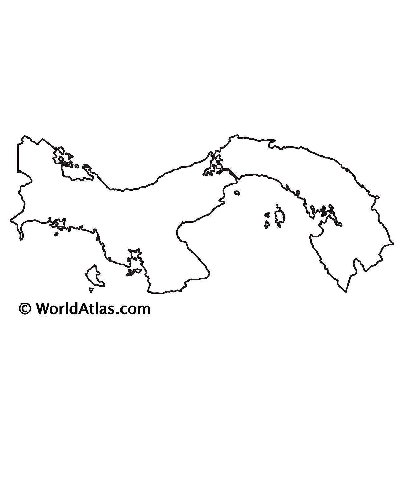
Outline Map of Panama
Key Facts
| Legal Name | Republic of Panama |
|---|---|
| Flag |
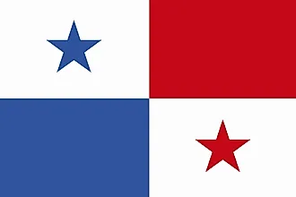
|
| Capital City | Panama City |
| 8 58 N, 79 32 W | |
| Total Area | 75,420.00 km2 |
| Land Area | 74,340.00 km2 |
| Water Area | 1,080.00 km2 |
| Population | 4,246,439 |
| Largest City |
Ciudad de Panamá (Panama City) (1,976,866) |
| Currency | Balboas (PAB) |
| GDP | $66.80 Billion |
| GDP Per Capita | $15,731.02 |
This page was last updated on June 19, 2023
