The 10 Tallest Mountains In New Mexico
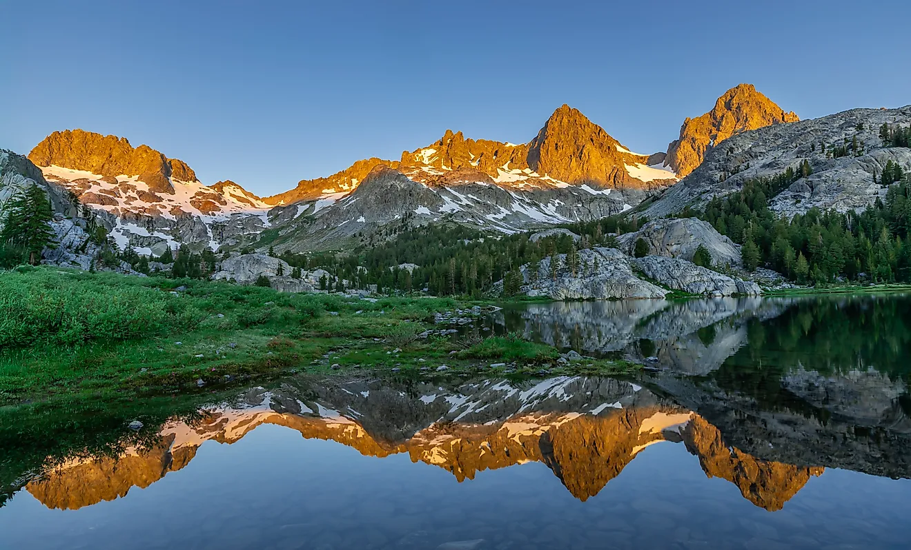
Truchas Peak was thought to be the highest mountain in New Mexico until 1948, when Harold D. Walter confirmed that Taos Peak (now Wheeler Peak) was higher. When it comes to settling which mountains are actually separate peaks, height isn't all that matters. Mount Walter stands at 13,141 feet, but only rises 53 feet above its saddle with Wheeler Peak, so it is counted as a part of Wheeler. But as for independent mountains, those rising at least 500 meters above their surroundings, that fall into the top ten highest in the state, nine of them are in the Sangre de Cristo range. Three of them belong to land that hikers cannot freely access.
Wheeler Peak

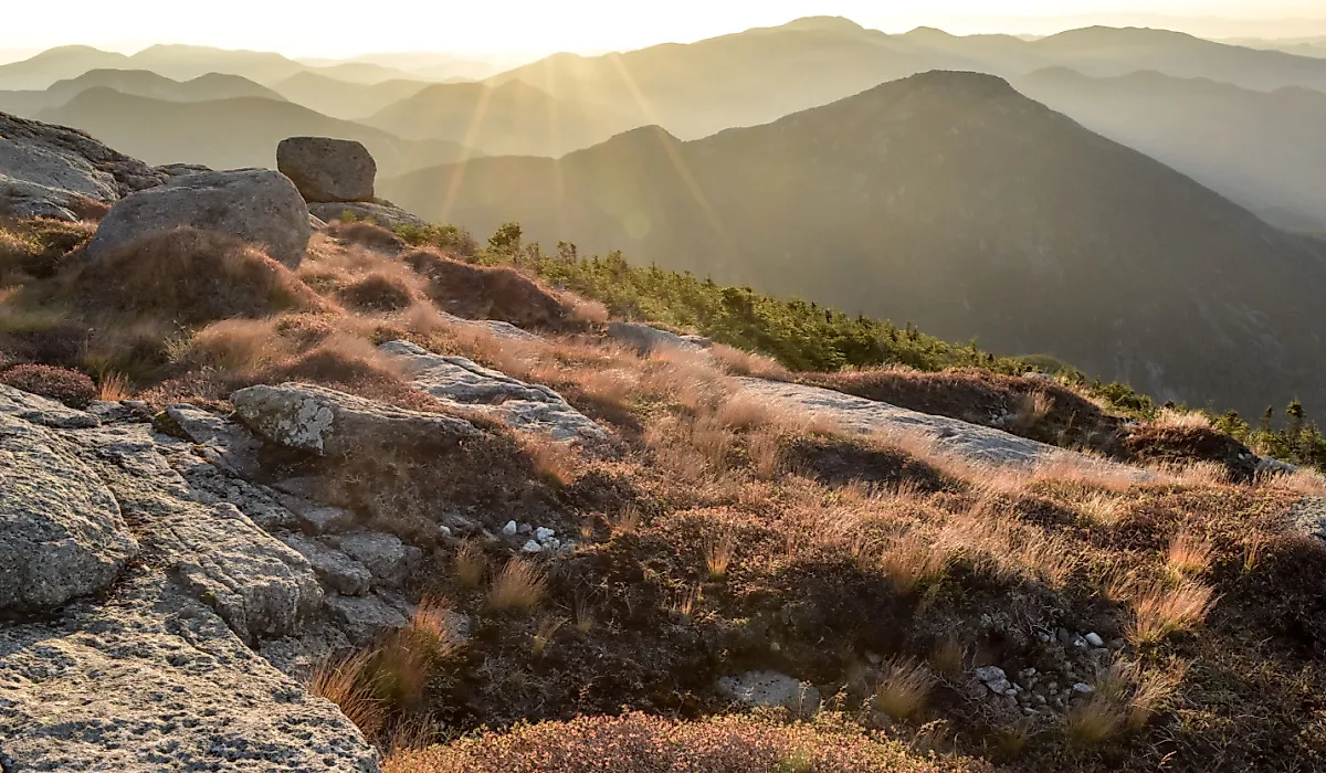
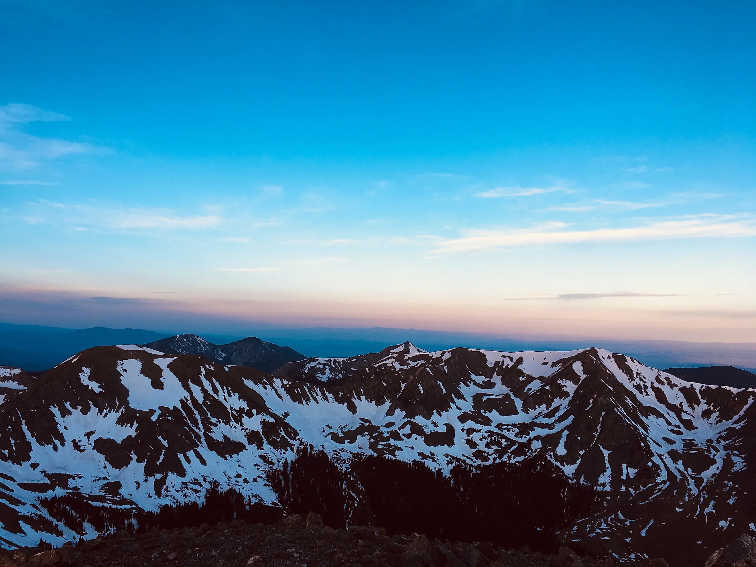
Wheeler Peak was originally called Taos Peak until 1950, when it was renamed for Major George Montague Wheeler, who spent a decade leading surveyors and naturalists across New Mexico as well as six other southwest states. Federal sources list it at 13,161 feet, though the NGS lists it at 13,167. It is the highest point in New Mexico and the highest point in the Taos Mountains, standing inside the Wheeler Peak Wilderness portion of the Carson National Forest.
Its western side borders Taos Pueblo, where 48,000 acres of national forest were returned to the pueblo in 1970, with Blue Lake being closed to anyone who is not a tribal member. The summit and Williams Lake basin also close for about a week every August for Taos Pueblo ceremonies. This year the closure ran from August 21 to the 28th, and affected the Williams Lake and Wheeler Summit trails, along with parts of the Wheeler Peak and Lost Lake trails.
During the rest of the year, climbers will usually begin with the Williams Lake trailhead, which runs about 7 to 8 miles round trip with 3,000 feet of gain. Its upper switchbacks were completed in 2011 by the Rocky Mountain Youth Corps and the Carson National Forest, who spent two summers building the 2.2-mile summit trail. The start of the trail crosses private land and camping isn't permitted within 300 feet of Williams Lake. Another option is the Bull-of-the-Woods route, which is 16 miles roundtrip.
Truchas Peak

Truchas Peak is the southernmost peak in the continental U.S. to rise above 13,000 feet, and is more prominent than Wheeler Peak, with 4,001 feet of prominence. It gets its name from the Spanish word for "trout" (plural), with its Tewa name being K'usenmp'in, which translates to "rock-horn mountain". It is the highest point in both Rio Arriba and Mora counties, featuring four summits on its massif. It is home to the North, Middle, Medio, and South Truchas summits, with South Truchas being the highest. It's located in the Pecos Wilderness, on the divide between the Rio Grande and Pecos River. Its north end also borders the Carson National Forest.
Despite being one of the highest summits in the state, the mountain sees fewer visitors than its counterparts due to its lack of nearby roads. Hikers coming in from the north have to start at the Santa Barbara Campground at the end of Forest Road 116, follow the Rio Santa Barbara for ten miles to the Santa Barbara Divide, then take the Skyline Trail to Truchas Lake. Those approaching from the south begin at Jacks Creek Trail, onto Pecos Baldy Lake and along Trailriders Wall. Both ways take two or more days to complete properly.
The summit block of the mountain is rated as a Class 2 scramble, with many climber logs describing the ridge between Medio and North Truchas as having some third-class sections and a few fourth-class moves on the headwall below North Truchas. The mountain is home to a large herd of Rocky Mountain bighorn sheep, who are frequently seen on the ridges. In the winter and early season, the glacier-cut cirques and steep ridges hold snow that can slide, and once it melts the gullies are left with loose rock, posing a danger to climbers.
Venado Peak

Venado Peak sits about eight miles northeast of Questa and is the highest point of the Latir Peak Wilderness, which was created in 1980. Its 2,971 feet of prominence makes it one of the most prominent peaks in the state. Its name comes from the Spanish word for "deer", and its neighbors are Latir Peak, sitting at 12,708 feet and Virsylvia Peak, at 12,594 feet. Like the rest of the Taos Mountains, it has a Precambrian metamorphic core around 1.8 billion years old.
Many hikers begin at Cabresto Lake. The last two miles of road are rough and require a vehicle that can handle it. A small campground run by the Forest Service is open from late spring through fall, depending on the weather. You'll take the Lake Fork Trail, with gains of about 1,000 feet over 2.5 miles to a junction with the Bull Creek Trail. Bull Creek will climb an additional 2,000 feet over 2.3 miles to the saddle between Cabresto and Venado. The last 0.8 miles crosses Venado's southeast slopes with a gain of 500 feet. The loop back down will take you past Heart Lake, totalling 13.5 miles with 3,900 feet of gain.
Gold Hill

Gold Hill Mountain originally got its name from gold mining in the area during the late 1800s. A camp named Amizette popped up in the valley during the 1893 rush, though it was abandoned by 1895 since the ore was too costly to haul out without a nearby smelter. Around 1902, prospector William Frazer persuaded Albert C. Twining, a New Jersey banker, to finance a smelter, and the new camp of Twining grew to around 350 people. Unfortunately, the first time it was fired, the molten ore froze to the walls and ruined it. The company went bankrupt, and the camp was empty by 1910. In 1955, it was bought by Ernie Blake and turned into the Taos Ski Valley.
The mountain is about six miles from Wheeler Peak and has 1,715 feet of prominence. Many begin by starting with the Bull-of-the-Woods Trail in the upper ski valley lot, then the Long Canyon Trail for about three and a half miles with a gain of 2,500 feet. Hikers return on the Gold Hill Trail, making a loop that is about ten to eleven miles overall with 3,300 feet of gain.
It is listed as an alternative climb during the Wheeler Peak closure in August, though late July and August storms bring unpredictable weather to the summit ridge often by the early afternoon.
Santa Fe Baldy

Santa Fe Baldy is the highest point in Santa Fe County, sitting 15 miles northeast of the city. It is on the divide between the Rio Grande and the Pecos River, with Lake Katherine in a cirque on its east side at 11,745 feet. Its Tewa name is Povip'in, meaning "flower mountain."
It has a lengthy history, with one of the more recent tragedies being on June 9, 2009, when New Mexico State Police Sergeant Andrew Tingwall and Officer Wesley Cox rescued a lost hiker by the name of Megumi Yamamoto. Despite successfully picking her up, their helicopter crashed shortly after takeoff, and both Tingwall and Yamamoto died. Cox was the only survivor.
Hikers hoping to summit it begin at the Ski Santa Fe parking lot, which is about 10,250 feet up on the Winsor Trail. It climbs to the Pecos Wilderness boundary, then drops to cross the Rio Nambe. It reaches the meadow at Puerto Nambe at 4.5 miles in. From there, you take the Skyline Trail to a saddle, then up a ridge to the summit. Round trip, it's roughly 14 miles with gains of 3,300 to 3,600 feet. It is one of the most popular hikes near Santa Fe, though winter climbs often require skis or snowshoes and come with the threat of avalanches.
Little Costilla Peak
Little Costilla Peak is the highest point in Colfax County and has the only alpine tundra in the Valle Vidal section of the Carson National Forest. It was private for most of the twentieth century, belonging to the Vermejo Park Ranch, which was used as a private hunting and fishing preserve. A Pennzoil subsidiary bought the ranch in 1973, then donated the Valle Vidal portion to the public in 1982. Vermejo Park Ranch still borders the unit to this day, though, with bison from the Ranch's herd occasionally wandering over the line.
There is no maintained trail to the summit, and most climbers begin at Clayton Corrals, a saddle at the high point of Forest Road 1950. The fence line leads up to the south ridge, then it's bushwhacking through timber to the treeline. Another route option is the Powderhouse-Little Costilla, which is longer at about ten miles, utilizing trailheads on Forest Road 1950 and 1900.
The Valle Vidal is home to one of the state's largest elk herds, and the Forest Service closes part of the area twice a year. The east side is closed from January to March to protect wintering elk, and the west side is closed May through June for calving. Roads stay open for driving, but the closed areas are off-limits to all other entry, and backpackers must camp at least a half mile from the forest roads.
Baldy Mountain

The mountain was a source of copper; then gold was discovered in 1866. Soldiers at Fort Union traded with Ute or Jicarilla Apache people for copper-bearing ore, then started climbing Baldy to find its source. They found the copper, and gold soon followed. Elizabethtown was founded on the mountain's west side, and the Mystic Lode copper mine was dug just below the summit at 12,144 feet. On the east side, the Aztec Mine worked on and off between 1868 and 1941. Baldy Town, the camp that served the mines, went desolate in 1942.
Baldy is the high point of the Cimarron Range and Philmont Scout Ranch. Miners left an estimated 70 miles of tunnels inside the mountain, and there is a joke mixed with a rumor that the workings will collapse one day and crown Mount Phillips as the highest peak in the area instead. The upper slopes are covered in blue- and green-stained rock from copper and iron. Baldy Town is now a staffed Philmont camp where crews pick up food, and the Aztec Mine is a guided tour area reached from French Henry. Philmont owns the summit and anything east of the ridge. An old mining road climbs the west slope, but since the summit is Philmont property, joining a Philmont trek is the only legal way to climb it. The climb itself is long and steep and exposed once hikers get above the treeline.
Sierra Blanca Peak

Sierra Blanca is New Mexico's most prominent summit as well as its only ultra-prominent one, rising 5,553 feet above its key saddle. The Mescalero Apache call the mountain Dził gais'ání, and it is one of four sacred mountains that mark the tribe's homeland. The other three are Tres Hermanas, Guadalupe Peak, and Oscura Mountain Peak. Sierra Blanca is the only one inside the reservation boundary.
Because the summit is on the Mescalero Apache Reservation, climbing requires tribal permission, and the tribe has said that climbing is no longer allowed at all. National forest trails stop short of the peak, with one option being Trail 15, which begins at Ski Apache. It climbs to the Crest Trail, then follows it to Lookout Mountain, standing at 11,580 feet. The ridge continues to Sierra Blanca, but that stretch is reservation land.
Cerro Vista

Cerro Vista is the highest point of the southern portion of the Sangre de Cristo Range, rising 2,519 feet above its key saddle, in the section of the range bounded by Taos, Mora and Picuris Pueblo. Its proximate parent is Jicarita Peak to the south, and Picuris Peak, sitting at 10,802 feet, is a neighboring mountain to the west. The summit is in the Carson National Forest, straddling the line between Taos and Mora counties.
The main approach is by vehicle using Forest Road 76, which follows the Rio La Junta for ten miles or so. Spur roads take you toward a saddle at around 11,230 feet, and from there climbers scale about 700 feet. The walking portion is less than a mile, and the peak has been given a Class 1 rating.
The dirt roads leading to the short hike can be affected by seasonal storms, and monsoon rains can leave the spur roads muddy and rutted. Lightning is also a hazard on the open summit during the summer months.
Mount Phillips

Originally called Clear Creek Mountain until 1960, some maps still utilize the old name. It was renamed after Waite Phillips, an Oklahoma oilman who gave ranch land to the Boy Scouts of America in 1938, donating even more in 1941, including the Villa Philmonte. It belongs to Philmont Scout Ranch, same as Baldy Mountain, and is its second-highest peak with 2,921 feet of prominence. The true summit is at the north end, and a false summit is to the south, looking toward the Angel Fire ski area.
Philmont groups it with Comanche Peak, Big Red, Bear Mountain, Black Mountain, and Schaefers Peak as the area's most demanding climbs. Four trail camps are near the summit, including Mount Phillips, Comanche Peak, Thunder Ridge, and Red Hills, with Red Hills being the only one that has water. The nearest staffed camp with water is Clear Creek.
The Colin Neblett State Wildlife Area borders the mountain on the west, and western approaches cross it. Since the summit is Philmont property, hikers who aren't a part of the Philmont program cannot climb it or use the trail camps.
The high country of New Mexico is concentrated in the north, with nine of ten summits being in the Sangre de Cristo Mountains, with only Sierra Blanca standing apart. Just as Truchas lost its title to Wheeler in 1948, ranking these peaks depends on how you measure them, and the biggest differentiator among them is not height, but access. Seven of the summits can be reached by public roads and trails, though Wheeler Peak and Little Costilla are affected by seasonal closures. Baldy and Mount Phillips are Philmont Scout Ranch property, and Sierra Blanca's summit belongs to the Mescalero Apache, making the most prominent mountain in the state one that hikers can only admire from a distance. For the peaks that are open, summer monsoon storms make early starts a must in July and August, and checking closures before heading out helps respect the tribes and landowners who share these mountains.