Pecos River
The Rio Pecos, Spanish for the Pecos River, is a 1,490 km river in the United States originating from the eastern slope of the Sangre de Cristo Mountain range in Mora Country, north of Pecos, New Mexico. Early day travelers have described the river as 20 to 30 m wide and 2 to 3 m deep, characterized by a fast current. The Pecos River is not of vital importance to humans and animals due to its salty nature.
Course Of The River

Starting from elevation of over 3,700 m, the river flows southeast through eastern New Mexico and western Texas before emptying into the Rio Grande River at the Amistad reservoir in Val Verde County, 38 miles northwest of Del Rio in southwestern Texas. The river drains about 99,200 km2, with a drainage basin approximating 115,000 km2.
Most of its tributaries flow from the west, such as the Gallinas River, the Rio Hondo, the Rio Felix, the Rio Penasco, the Delaware River, Independence Creek, Toyah Creek and Comanche Creek. The Eastern tributaries are Alamogordo, Taiban, Live Oak, and Howard.
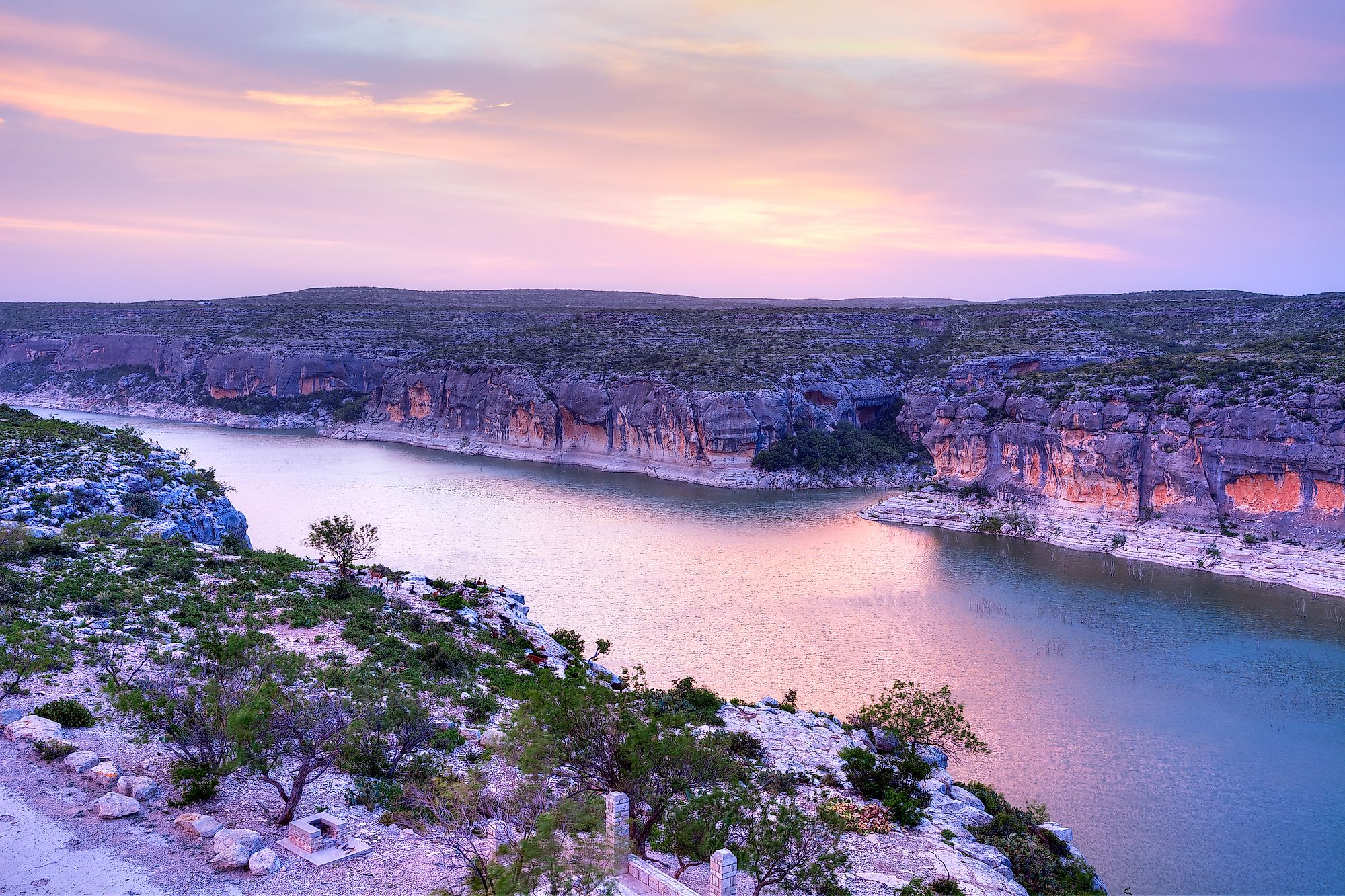
After leaving the mountains, the Rio Pecos flows over a desert-like land, leaving its channel dry most of the year. The river then widens into a basin near Roswell, New Mexico, and then closes to a broad valley at the Texas—New Mexico border. The river also enters a narrow canyon, reaching more than 1,000 feet (300m) deep, in the last 125 miles (201 km) of its course.

History
The Pecos River had several names, due to its characteristics and cultural significance. Antonio de Espejo called the river “Rio de las Vacas”, Spanish for “river of the cows” due to the number of buffalo in the vicinity. Gaspar Castano de Sosa, Spanish colonist and explorer, called it the Rio Salado due to its salty nature. The Mexicans also called the Rio Peurco, meaning “dirty river”. The name “Pecos” is derived from the Keresan term (a native American language) “Pecos Pueblo”, which is a historical city known was Cicuye.
The Pecos Pueblo Indians are the earliest-known settlers along the river, arriving at 800 A.D, approximately. Francisco Vazquez de Coronada is the first European to cross the river after he reached the area in 1541.
County Boundary Stream
The Pecos River is a county boundary stream since it serves as the boundary between Loving and Reeves, Reeves and Ward, Ward and Pecos and Crane, Pecos and Crockett, and Crockett and Terrel counties. In addition to being a boundary stream, the Pecos forms the eastern boundary of the most mountainous and arid region of Texas, also known as the trans-Pecos. The river was a significant factor in the exploration of Texas by the Spanish. The term “West of Pecos”, which was famous in the 19th century, was actually a reference to the infamous period of the Wild West.

Dams On The Pecos River
Several dams have been built across the Pecos River for multiple purposes. The Avalon and Brantley Dams, located north of Calsbad, New Mexico, help irrigate about 25,000 acres as part of the Carlsbad reclamation project. The Red Bluff Reservoir at the western part of Texas was also formed with the help of the Red Bluff Dam. The Summer Lake, located between Santa Rosa and Fort Sumner in New Mexico, is formed by the 1939 Sumner Dam.
Cultural Significance
The river and surrounding land have been linked to violence and death by storytellers since Pecos is the origin of the Wild West period. Historian J. Evetts Haley and folklorist J. Frank Dobie have immortalized the Pecos River in writing. The folklore even considers the area surrounding the river a “haven for outlaws” during the Civil war.


