Mount Whitney
Mount Whitney is located in the region of Sierra Nevada mountain range, California. It is the highest peak in the contiguous United States, with an elevation of 4421 meters. Incidentally, it is also located around 136 kilometers away from Badwater Basin in Death Valley, which is the lowest point in North America, at 86 meters below sea level.
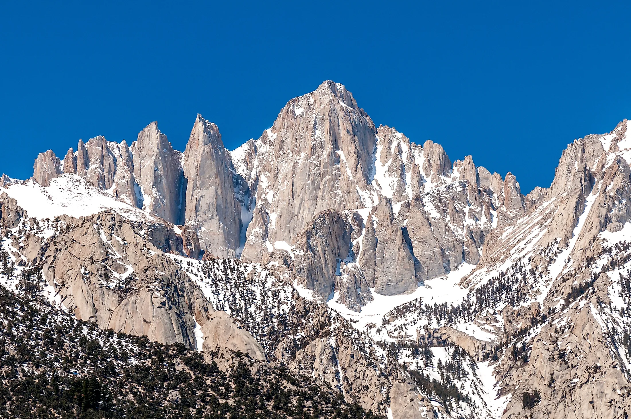
Geography Of Mount Whitney

The western slope of the mountain is part of Sequoia National Park, while the eastern slopes fall in the Inyo National Forest. The peak, or summit of the mountain is on the Sierra Crest, part of the Sierra Nevada mountain range, where most of the range’s highest peaks are. The peak is somewhat dome shaped, but does have distinctly sharp jagged ridges along its slopes, giving it that distinct appearance. The rise is steep on the eastern side, and overlooks Owens Valley and Lone Pine.
On the opposite, western side, the slope is much more gradual. This is easier for climbing, and rises around 900 meters above the John Muir Trail, and Guitar Lake.
Mount Whitney Wildlife

Mount Whitney sits above the natural tree line, and therefore is an alpine ecosystem. In alpine climates and regions, vegetation is sparse, and what does exist tends to be low-growing ground cover. Mosses and lichen are more common, or small flowering plants. Sky pilot, a type of cushion plant, can be found on Mount Whitney.
Similarly, there are rarely any animals seen in the upper regions of these mountain ranges. Only transient animals can reach the summit, such as butterflies and songbirds. Finches - like the gray-crowned rosy finch - are common here.
Climbing Mount Whitney

As the highest peak in the region, Mount Whitney is popular with experienced rock climbers looking to challenge themselves. For those less experienced, however, there are also a series of hiking and walking trails - mainly closer to the foot of the mountain.
Trails To The Summit
The main, and most well used path is the Mount Whitney Trail. This route begins at Whitney Portal, which is already at an elevation of 2,548 meters. It has an elevation gain of 1,895 meters to the top, and is roughly 35 kilometers out and back. The trial is permit-only, for both the safety of hikers and to ensure the trial is not overused. There is a lottery for these permits, during peak season, and include hiking and camping permission, as a one day hike would take 12 to 18 hours, on average, and is not recommended except for highly experienced and fit individuals.

An alternate route also exists, following the John Muir Trail, which is longer, and has the hikers approaching the summit from the western side. This route does connect up with the Mount Whitney trail for the upper regions. Both these trails are considered ’hiking’ trails, and though strenuous, do not generally require any scrambling or rock climbing, directly. Scrambles and climbs:For climbers, there are a few options of how to reach the summit of Mount Whitney. The Mountaineer’s Route is a gully-based route on the northern edge of the east face of the mountain. It is ranked as a Class 3 scramble. This route was first established by John Muir, for which one of the main trails is named.

There are a few other options for those looking to climb Mount Whitney, especially along the steep east face. The East Face route was established in 1931, and includes class 5.7 technical free climbing. The East Face is listed in the Fifty Classic Climbs of North America routes, and is very popular with climbers.
Those looking for less challenging options may choose one of the smaller, or minor summits which are located to the south of the main peak. These routes offer impressive big-wall climbs, including the Keeler Needle and Crooks Peak. Stunning and majestic, this impressive peak, and mountain range more generally, is a sight to behold. Rising to its great heights above the California deserts, it is a climber and hiker’s dream.


