The Largest Lakes In The Desert Southwest
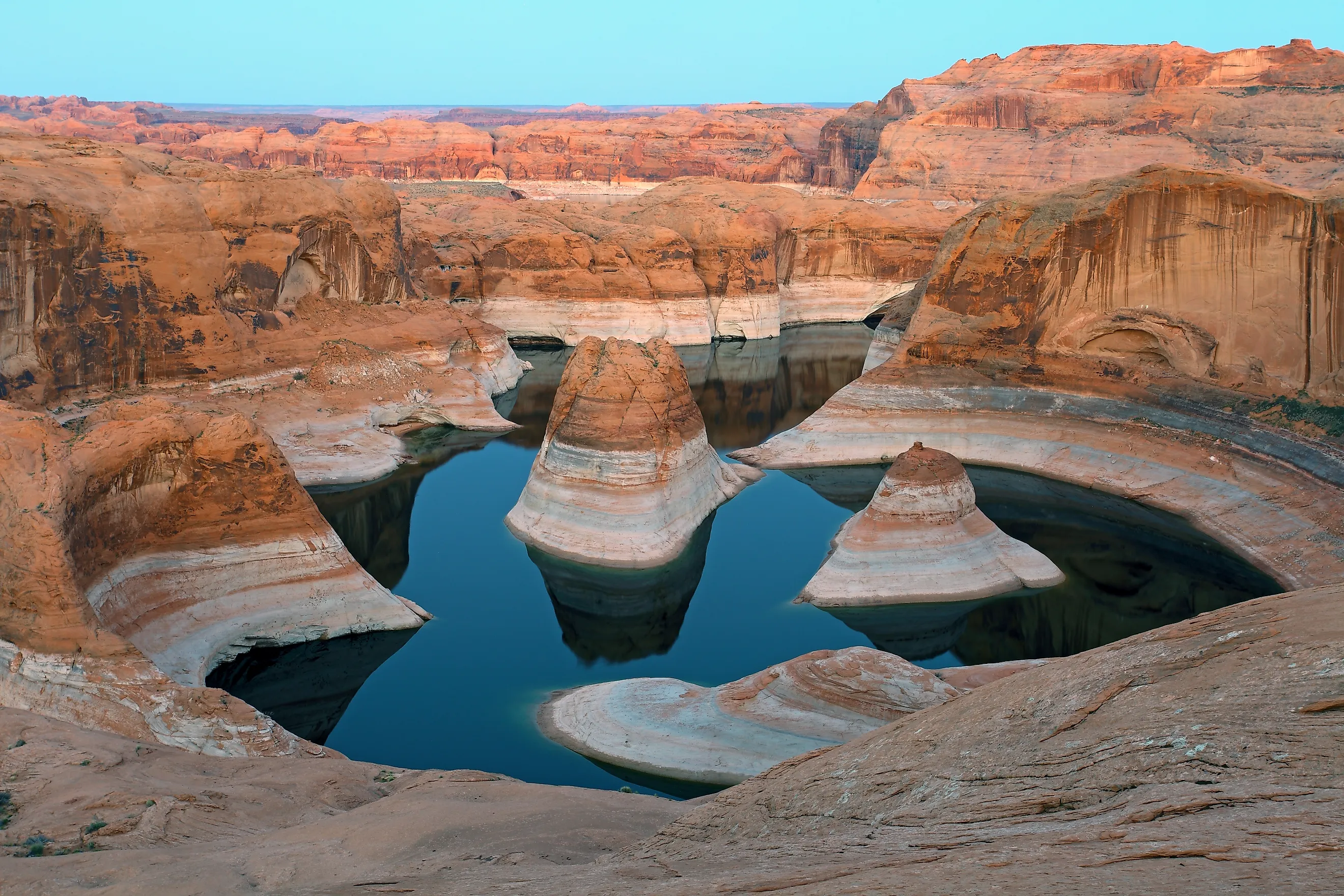
In 1905 the Colorado River broke through a set of irrigation works and poured into a dry basin in southern California. It did not stop for roughly 18 months. By the time the breach was sealed, the Salton Sea existed, and it has never emptied. It still covers close to 300 square miles, more than any other undammed lake in the Desert Southwest. The dammed ones run bigger. Lake Powell and Lake Mead each top 240 square miles at full pool, with pale bands on the canyon walls marking how far they have fallen. Measured at the levels federal agencies define as full, these are the ten largest lakes in the region.
Salton Sea, California

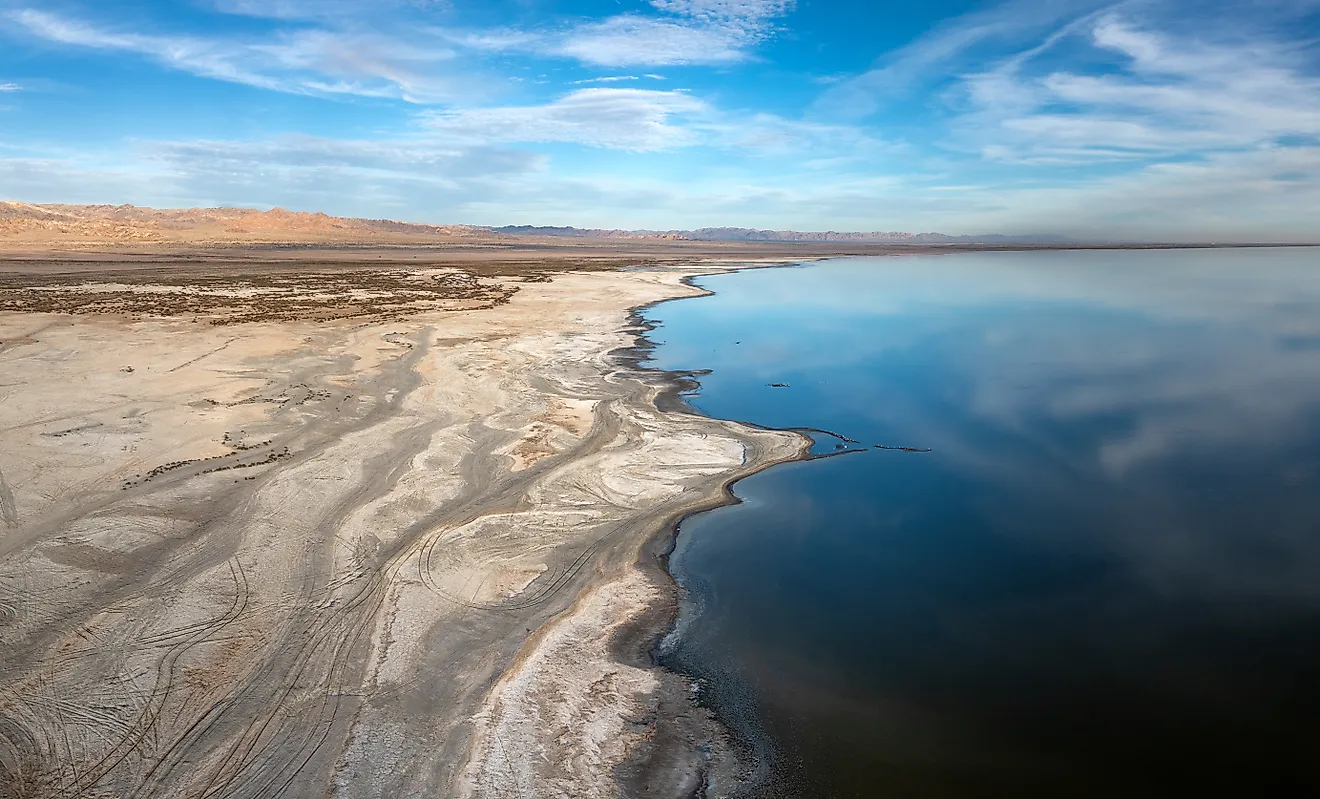
California's Salton Sea still covers close to 300 square miles, making it the largest natural lake in the Desert Southwest by surface area. The modern sea formed in 1905 after Colorado River floodwater broke through irrigation works and poured into the Salton Basin for roughly 18 months. The basin has no outlet, so incoming water can leave only through evaporation. Salt and other dissolved minerals stay behind, which has steadily increased the lake's salinity.
The shoreline has contracted sharply. A 2026 California State Water Resources Control Board report found that the sea had lost about 41,800 acres, equal to 65 square miles, compared with its 2003 footprint. The same report put recent shoreline loss near 2,400 acres per year. As water retreats, exposed lakebed can release windblown dust, while higher salinity reduces suitable habitat for fish and other aquatic organisms. Those changes are visible around former shoreline communities, where docks and old waterfront structures now sit well back from the water.
Lake Powell, Arizona and Utah

The Bureau of Reclamation lists Lake Powell at 161,390 acres, about 252 square miles, at normal pool. Glen Canyon Dam began storing Colorado River water in 1963, and a full reservoir can stretch about 186 miles upstream through the Colorado Plateau. The lake occupies a maze of flooded tributary canyons cut into Navajo Sandstone, with more than 90 named side canyons documented by federal agencies. Its actual surface area can fall far below the published normal-pool figure when Colorado River storage drops. The difference is easy to trace on canyon walls, where mineral deposits left by higher water levels form a pale band above the current shoreline. Lake Powell also functions as a major storage component of the Colorado River Storage Project, holding water that can later move downstream toward Lake Mead and the Lower Colorado River system.
Lake Mead, Arizona and Nevada

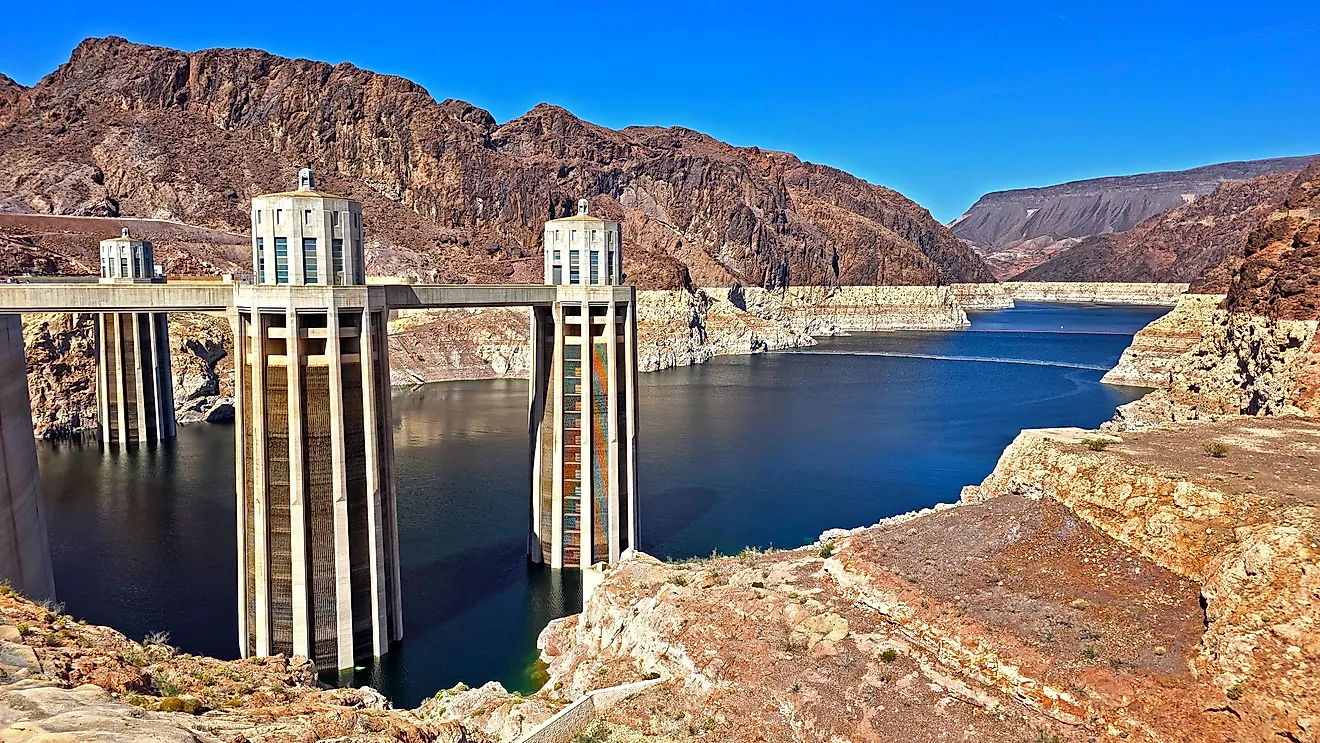
Lake Mead reaches 157,418 acres, or about 246 square miles, at full capacity according to the National Park Service. Hoover Dam created the reservoir by blocking the Colorado River in Black Canyon, and filling began in the 1930s.
Surface area is only one measure of its scale. Lake Mead is generally identified as the largest reservoir in the United States by storage capacity at full pool, even though Lake Powell has a slightly greater reference surface area. The two rankings measure different things.
The long decline in Colorado River storage has changed what visitors see along Mead's shore. Former high-water levels remain marked by pale mineral deposits on canyon walls, while marinas and access points have repeatedly been adjusted as the lake receded. The reservoir still plays a major role in supplying water to Arizona, Nevada, California, and Mexico. Hoover Dam also continues to generate hydroelectric power from water released downstream.
Amistad Reservoir, Texas and Mexico

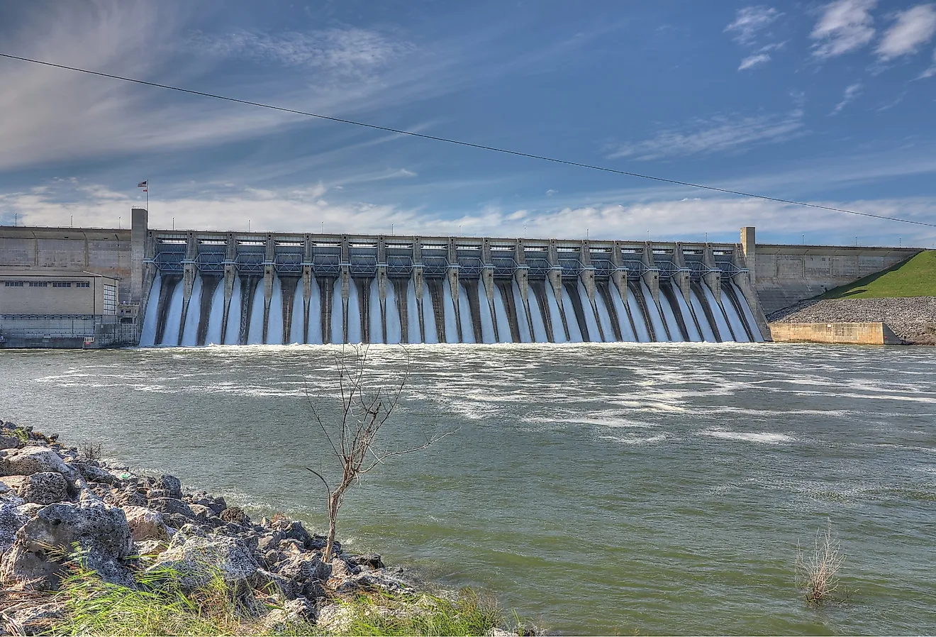
Amistad Reservoir covers about 65,000 acres, or 101.6 square miles, at its conservation level according to the International Boundary and Water Commission. That figure covers the entire reservoir, which spans the United States and Mexico along the Rio Grande. The National Park Service states that the United States holds a 56.2 percent share of the reservoir under the binational arrangement. Amistad Dam was completed in 1969 for flood control and water storage, with hydroelectric generation added to the project as well.
The reservoir sits near the meeting point of the Chihuahuan Desert and the limestone country of southwest Texas. Water backs into the lower Pecos River and Devils River, flooding sections of deep river canyons. Human occupation along those waterways predates the dam by thousands of years. Archaeological sites in the region preserve rock art and other evidence of people living along the rivers long before the reservoir existed. Changes in water level can expose or submerge portions of that landscape.
Mono Lake, California

Mono Lake covers roughly 65 square miles beneath the eastern Sierra Nevada. California State Parks describes it as more than one million years old, making it one of the oldest continuously existing lakes in North America. The lake has no outlet. Streams carry dissolved minerals into the basin, and evaporation removes water while leaving those minerals behind. The resulting water is alkaline and several times saltier than the ocean.
That chemistry produces Mono Lake's best-known formations. Calcium-rich spring water entering the lake reacts with carbonate in the lake water and forms calcium carbonate deposits called tufa. Many towers now stand above the surface because water levels fell after streams feeding the basin were diverted to Los Angeles during the twentieth century.
Mono Lake has no native fish population, but it supports enormous numbers of brine shrimp and alkali flies. Those organisms feed migrating birds using the lake as a stopover. California State Parks estimates that one to two million birds use Mono Lake each year.
Elephant Butte Reservoir, New Mexico

At its conservation-pool elevation, Elephant Butte Reservoir covers 36,897 acres, or about 57.7 square miles, according to the Bureau of Reclamation. Elephant Butte Dam was built on the Rio Grande between 1912 and 1916 as part of the Rio Grande Project, which supplies irrigation water in New Mexico and Texas. The reservoir occupies a broad basin surrounded by dry hills north of Truth or Consequences. Its size changes substantially with runoff and downstream water demand, so low-water years can expose large sections of lakebed. Federal sediment surveys add another dimension to those changes. Material carried down the Rio Grande has accumulated behind the dam since impoundment, gradually reducing storage space and altering the shape of the reservoir floor. Reclamation periodically repeats area-capacity surveys to measure that loss. Elephant Butte therefore has both a changing shoreline and a changing underwater profile, with each controlled by a different process.
Lake Mohave, Arizona and Nevada

Lake Mohave fills the Colorado River corridor between Hoover Dam and Davis Dam. A 2026 Bureau of Reclamation bathymetric survey calculated 28,890 acres of water, about 45.1 square miles, at elevation 647 feet. The same survey measured 29,600 acres at the top of Davis Dam. Those figures update reservoir mapping that had relied heavily on measurements dating to 1949.
The upper reservoir remains relatively narrow through Black Canyon before widening farther downstream. Davis Dam regulates releases from Lake Mead and helps control deliveries farther south on the Colorado River. Lake Mohave's operating level also changes during the year, exposing shoreline around shallow bays during lower periods. Because Reclamation has now remapped the reservoir floor with modern sonar data, scientists and water managers have a much clearer estimate of how much water different elevations actually represent.
Theodore Roosevelt Lake, Arizona

Theodore Roosevelt Lake covers about 21,383 acres, or 33.4 square miles, at an elevation of 2,151 feet in Bureau of Reclamation capacity tables. Roosevelt Dam blocks the Salt River northeast of Phoenix and was completed in 1911 as one of the earliest large federal reclamation projects in the West. Its stored water remains important to the Phoenix metropolitan area through the Salt River Project. The reservoir's shape also shows how quickly surface area can change with elevation. Reclamation calculated roughly 175 additional surface acres between 2,151 and 2,152 feet, so a relatively small vertical rise can spread water across a substantial amount of ground. The reason is visible around broad, gently sloping sections of shoreline where rising water can cover large horizontal distances. Higher terrain around the basin constricts other sections, producing a reservoir with sharply different shoreline responses from one cove to the next.
Lake Havasu, Arizona and California
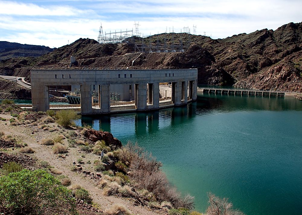
Lake Havasu covers 19,810 acres, about 31 square miles, at elevation 450 feet according to a 2026 Bureau of Reclamation survey. At the top of Parker Dam, the calculated surface area reaches 20,690 acres.
The reservoir is also a major water-transfer point. The Colorado River Aqueduct begins at Lake Havasu and carries water toward Southern California. The Central Arizona Project draws Colorado River water from the same general reservoir system before pumping it toward central and southern Arizona.
Parker Dam holds the lake across a narrow section of the Colorado River south of Lake Havasu City. Upstream, the reservoir widens enough to support extensive boating while still functioning as working water infrastructure. Reclamation's updated bathymetric survey refined measurements of both Lake Havasu and Lake Mohave, replacing older estimates with modern depth data. That work matters because accurate relationships between elevation, surface area, and storage are essential when reservoir levels change.
San Carlos Reservoir, Arizona

San Carlos Reservoir covers more than 16,600 acres, about 25.9 square miles, at the top of conservation storage according to Bureau of Reclamation documentation. Coolidge Dam impounds the Gila River on the San Carlos Apache Reservation, with storage at that level reaching roughly 880,000 acre-feet. The reservoir was built primarily to store irrigation water for farms downstream.
Few large Southwestern reservoirs show water variability as dramatically. Gila River inflow can swing sharply between wet and dry periods, while irrigation releases remove stored water during the growing season. Federal environmental studies describe years when storage becomes heavily depleted. During low-water periods, broad areas of reservoir floor can emerge around the remaining channel. Strong runoff can reverse part of that loss and spread water back across the basin. Those changes make San Carlos substantially different in appearance from reservoirs whose operating ranges stay comparatively narrow.