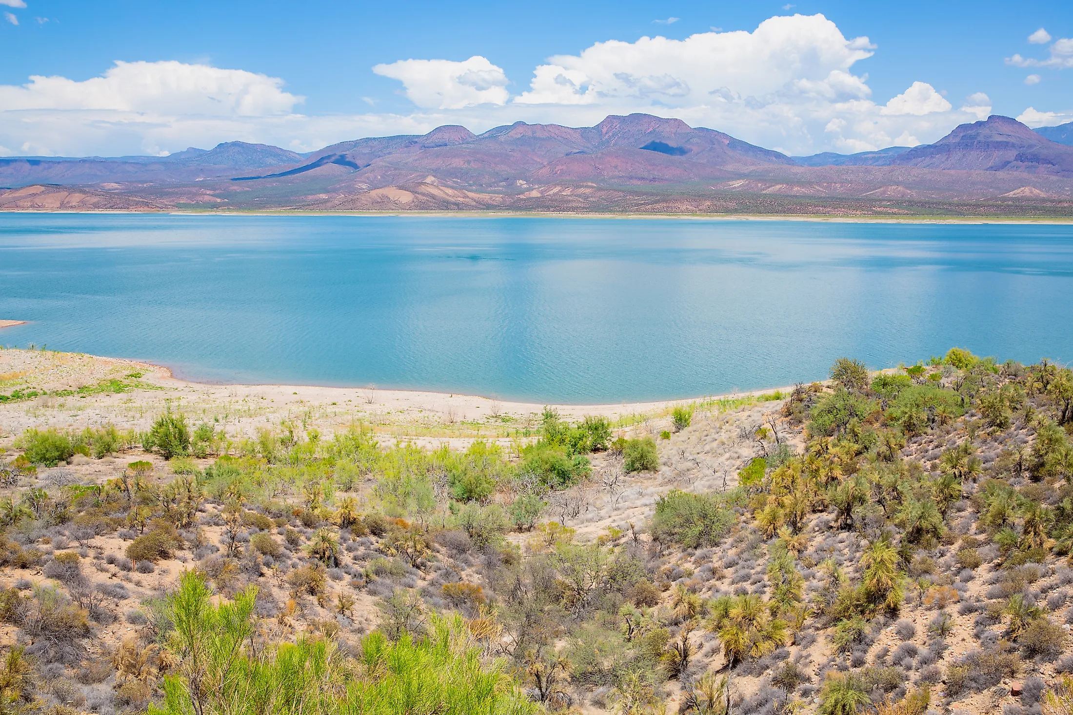
Theodore Roosevelt Lake
Arizona is located in the southwestern region of the United States. The State has diverse geography featuring volcanoes, mountains, canyons, plateaus, and deserts. Situated in the central part of the US State of Arizona, mostly within Gila County is the majestic Theodore Roosevelt Lake. This large lake is located in the Salt River Valley about 130km to the northeast of Phoenix – the State’s capital city, and 6km upstream from Apache Lake. The Theodore Roosevelt Lake was formed as a result of the construction of the Theodore Roosevelt Dam on the Salt River, as a part of the Salt River Project.
Content
Geography
The Theodore Roosevelt Lake occupies an area of 21,493 acres and is considered the largest lake that is situated fully within the boundaries of the US State of Arizona. It is also the largest among the four lakes that were created as a part of the Salt River Project. The Lake has a length of 35.8km and has a maximum width of 3.2km. The Lake is situated at an elevation of 638m and reaches a maximum depth of 106m. The Lake receives its primary water inflows from the Salt River and the Tonto Creek.

The Theodore Roosevelt Lake covers approximately 16km of the original riverbed of the Salt River and stretches for about 13km up the Tonto Creek, which is an important tributary of the Salt River that has its headwaters along the Mogollon Rim. The Lake also covers much of the southern part of the Tonto Basin, which is a low-lying area situated between the Superstition Mountains, the Sierra Ancha Mountains, and the Mazatzal Mountains. Located about 6km from the Theodore Roosevelt Dam is the Tonto National Monument and portions of the monument provide views of a major part of the Theodore Roosevelt Lake.

The Theodore Roosevelt Lake has the largest storage capacity among all the lakes of the Salt River Project and possesses the capacity to store about 2.039km3 of water, till the conservation limit of the Roosevelt Dam is reached. During the flood-control mode of the Roosevelt Dam, the Roosevelt Lake can store about 3.590km3 of water. However, this excess water that exceeds the dam’s conservation limit is released from the lake by the US Army Corps of Engineers within 20 days.
Recreation And Wildlife

The Theodore Roosevelt Lake hosts many game fishes such as carps, crappie, buffalo fish, channel catfish, flathead catfish, bluegill, largemouth bass, sunfish, and smallmouth bass. Till recent years, the lake also served as critical habitat for the endangered Southwestern willow flycatcher. During winters, the waters of the lake provide a habitat for the migratory waterfowls and raptors. The Theodore Roosevelt Lake serves as one of the most popular recreation destinations within the large Tonto National Forest. This artificial reservoir offers many recreational activities like fishing, boating, lakeshore camping, water sports, etc for the visitors.
There are several trailheads of the Arizona National Scenic Trail that are located near Theodore Roosevelt Lake. The 97.93km long Arizona State Route 188 highway runs closely along the shore of the lake for much of its length. A 1,280km long Arizona trail extends from the Arizona-Mexico border to Utah and crosses the Salt River on the Theodore Roosevelt Lake Bridge that traverses the Lake, just to the northeast of the Roosevelt Dam. Located about 400m from the shores of the Lake is the Grapevine Airstrip.
Brief History
During the beginning of the 20th century, the residents of the State’s capital city Phoenix recognized that their region’s potential was limited due to its unreliable supply of water. A group of such concerned citizens formed the “Salt River Valley Water Users Association” and demanded the establishment of a large-scale project for controlling the erratic flow of the Salt River and harnessing its waters for irrigation. The construction of the Roosevelt Dam began in 1906. The Roosevelt Lake was created after the completion of the Roosevelt Dam in 1911. At that time, the lake was regarded as one of the largest manmade lakes in the world and the Roosevelt Dam as the world’s largest “cyclopean-masonry” dam. The Roosevelt Dam thus helped in irrigating the surrounding desert land that could then be used as farmland. Both the dam and the lake has been named in the honor of US President Theodore Roosevelt. The President played a major role in approving the Newlands Reclamation Act of 1902, which enabled the government funding for irrigation projects in the arid lands. The Dam was dedicated by President Theodore Roosevelt on March 18, 1911.


