The California Lakes That Vanished And Came Back
Most of California's old lakebeds are farmland now, and the maps show them dry. Then a wet winter comes along and the water returns. Tulare Lake spread across 100,000 acres of San Joaquin Valley cropland in 2023. Owens Lake left behind the worst dust pollution source in the country. Death Valley held a lake at Badwater Basin deep enough for kayaks. Six California lakes have vanished and returned, some more than once.
Tulare Lake

In 2023, one of California's most famous vanished lakes suddenly came back from the dead. After a winter of relentless atmospheric rivers and record Sierra Nevada snowmelt, water spread across more than 100,000 acres of farmland in the southern San Joaquin Valley, recreating large sections of Tulare Lake for the first time in generations.
Satellite images from NASA and the U.S. Geological Survey showed a body of water so large it was visible from space, turning one of the state's biggest agricultural regions back into a lake that many Californians believed had disappeared forever.
For thousands of years, Tulare Lake was the largest freshwater lake west of the Mississippi River, covering as much as 690 square miles (1,787 km²) during exceptionally wet years. Fed by the Kings, Kaweah, Tule, and Kern rivers flowing out of the Sierra Nevada, it supported vast tule marshes, millions of migratory birds, abundant fisheries, and the Yokuts people, who lived around its shores long before European settlement. Tulare had no natural outlet, although during the wettest years it occasionally overflowed north through Fresno Slough into the San Joaquin River.
That changed during the late nineteenth and early twentieth centuries as dams, canals, levees, and irrigation projects diverted the rivers that fed the basin. By the 1920s, the lake had largely disappeared beneath some of California's most productive farmland. Yet the winter of 2022-23 demonstrated that Tulare Lake was never truly gone. When more water arrived than the state's engineered river system could contain, the ancient basin filled again for the first time in generations, then gradually receded during 2024.
Owens Lake

Few lakes have disappeared as completely, or as famously, as Owens Lake. After the Los Angeles Aqueduct began diverting water from the Owens River in 1913, one of California's largest inland saline lakes shrank so rapidly that within little more than a decade it had become a dry lakebed. What remained wasn't just empty land. The exposed playa turned into the largest single source of dust pollution in the United States, sending dust storms across the Owens Valley in one of California's most significant environmental disasters.
Before the aqueduct, Owens Lake covered roughly 110 square miles (285 km²) during wetter years, fed almost entirely by snowmelt flowing down the Owens River from the eastern Sierra Nevada. The lake held millions of migratory birds along the Pacific Flyway, extensive alkali ecosystems, and a productive fishery before its water supply was diverted to fuel Los Angeles' explosive growth.
More than a century later, the lake itself has never returned. Instead, beginning in the early 2000s, the Owens Lake Dust Mitigation Program intentionally re-flooded parts of the historic lakebed using shallow water, managed vegetation, and gravel to suppress blowing dust. Today, those projects cover roughly 48.6 square miles (126 km²) of the playa, reducing dust emissions by 99.4% while creating thousands of acres of wetlands that once again draw tens of thousands of migratory birds. Owens Lake hasn't come back the way Tulare Lake did, but its partial restoration ranks among the largest environmental recovery projects in California history.
Lake Manly

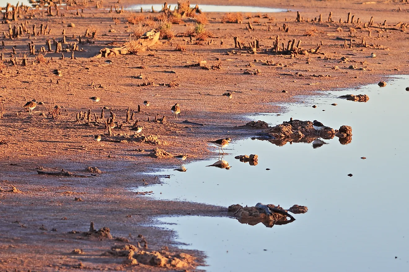
For most visitors, Badwater Basin is an endless white salt flat stretching across a national park at the lowest point in North America at 282 feet (86 m) below sea level. Every few years, however, that landscape changes completely. Heavy rainfall fills the basin, briefly resurrecting Lake Manly, a shallow lake named after Death Valley pioneer William Lewis Manly. The enormous Ice Age version of Lake Manly disappeared more than 10,000 years ago. Today's temporary lake forms whenever enough water collects in the closed basin before evaporating beneath one of the hottest climates on Earth.
Lake Manly's return has nothing to do with river restoration or water diversions. It is a natural phenomenon driven entirely by rare desert storms. The lake made international headlines in 2023 after the remnants of Hurricane Hilary dropped more than 2 inches (5 cm) of rain across Death Valley, filling a lake large enough for the National Park Service to temporarily allow kayaking for the first time in generations. A second atmospheric river in early 2024 expanded the lake to approximately 6 miles (9.7 km) long, 3 miles (4.8 km) wide, and about 1 foot (30 cm) deep. Powerful winds then pushed the water nearly 2 miles across the basin, producing what park officials described as a "traveling lake."
By spring, evaporation had once again exposed the famous polygon-shaped salt flats, restoring the landscape most visitors expect to see. The lake has reappeared several times since. Even one of the driest places on Earth can turn into a lake under the right conditions.
Mono Lake

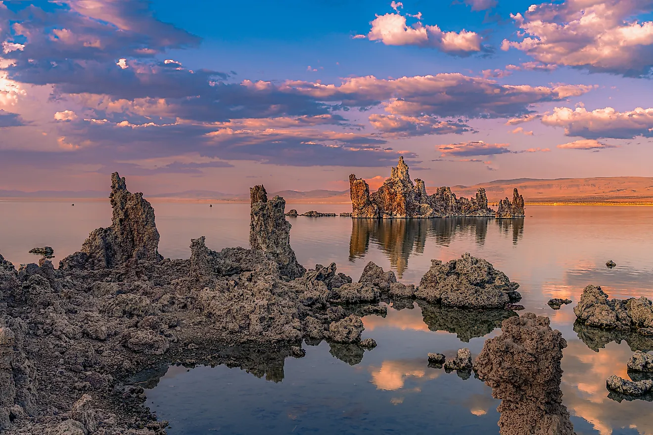
California's most famous reappearing lakes completely vanished at one stage. Mono Lake never did. It instead came perilously close to environmental collapse after decades of water diversions caused its surface to fall by 45 feet (13.7 m) between 1941 and 1982. It later became one of California's greatest environmental rescue stories.
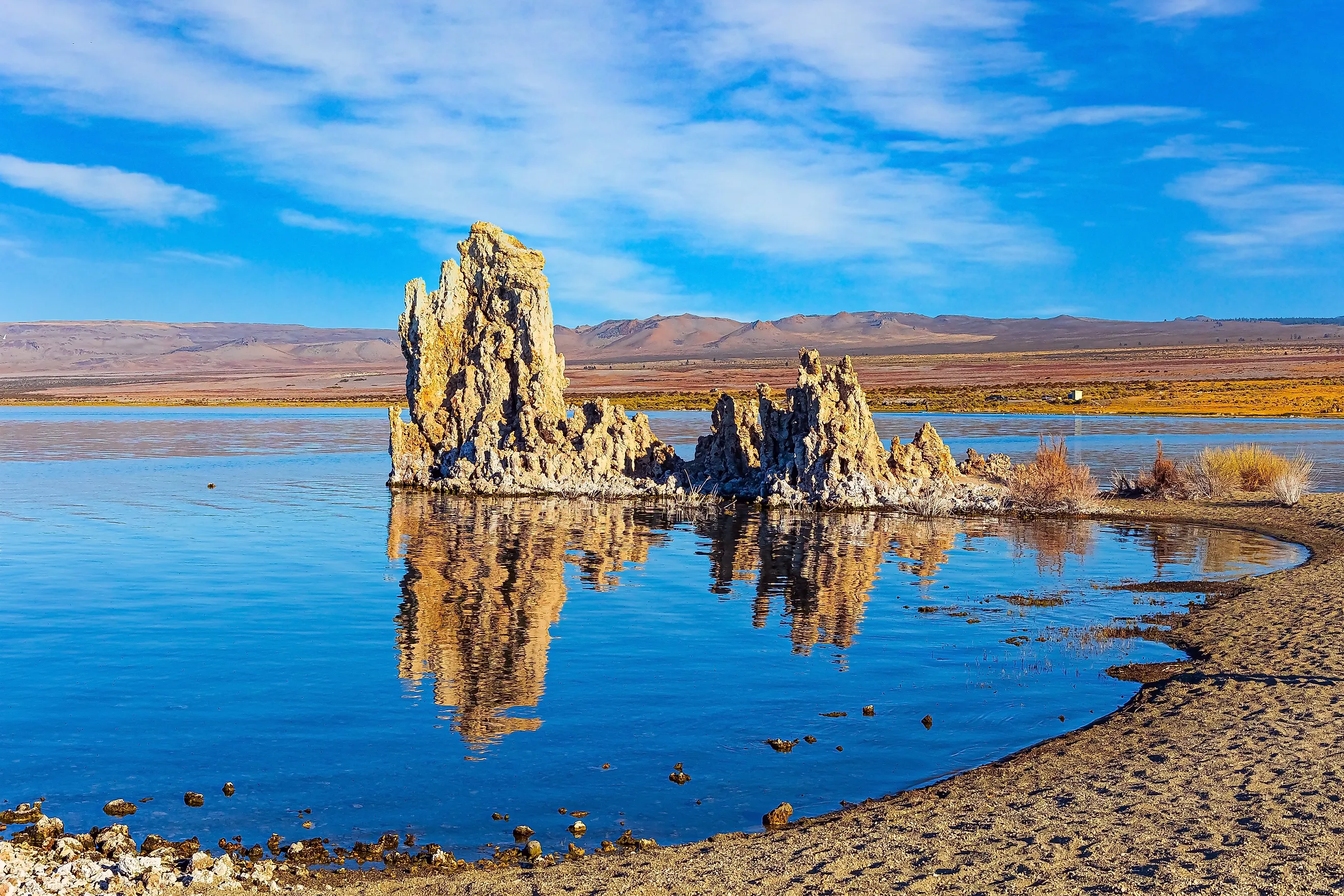
Located east of Yosemite National Park, Mono Lake is one of the oldest lakes in North America, estimated at more than 1 million years old. Because it has no outlet, minerals have accumulated over millennia, making the lake about 2½ times saltier than the ocean. Its unusual chemistry sustains billions of brine shrimp and alkali flies, feeding one of the Pacific Flyway's most important stopovers for millions of migratory birds, including California gulls, eared grebes, and phalaropes.
The lake's decline began after the Los Angeles Department of Water and Power started diverting streams flowing into the Mono Basin in 1941. As water levels dropped, salinity increased, nesting islands became connected to the mainland, and predators reached California gull colonies that water had long kept safe. Following years of legal challenges, California's State Water Resources Control Board adopted Decision 1631 in 1994, limiting water diversions and setting a long-term target lake elevation of 6,392 feet (1,948 m) above sea level to restore the lake's ecological health.
Mono Lake has risen significantly since its historic low in 1982, though it remains below that long-term management target because of prolonged drought and climate change. Rather than a complete comeback, Mono Lake represents an ongoing recovery, one of the largest and most closely monitored lake restoration efforts in the United States.
Buena Vista Lake

Overshadowed by neighboring Tulare Lake, Buena Vista Lake was once another vast seasonal lake in California's southern San Joaquin Valley. Fed primarily by the Kern River, it filled a broad basin west of present-day Bakersfield, expanding and shrinking with Sierra Nevada snowmelt. During especially wet years, the lake grew enough to merge with neighboring Kern Lake, forming a combined inland waterbody covering about 100 square miles (259 km²) before overflowing toward the much larger Tulare Lake basin.
By the 1920s, Buena Vista Lake had largely disappeared as dams, canals, levees, and agricultural development diverted and regulated the Kern River before it could reach the historic lakebed. More than a century later, California's notable 2022-23 winter, fueled by repeated atmospheric rivers and exceptional Sierra Nevada snowmelt, once again sent floodwater into parts of the historic Buena Vista Lake basin. The water eventually receded, but the flooding showed that the lake's natural basin never disappeared. Like Tulare Lake, it stays part of California's landscape, and water spreads back across its historic footprint whenever runoff overwhelms the modern water system.
Kern Lake

Ask most Californians to name the state's historic lakes and they'll probably mention Tulare Lake or Mono Lake. Few would think of Kern Lake, even though it once formed part of one of California's largest inland freshwater wetland systems. No reliable historical measurements exist for Kern Lake's maximum size. The lake expanded and contracted so dramatically with Sierra Nevada runoff that early surveys often described it as part of a much larger interconnected wetland system with neighboring Buena Vista Lake rather than assigning it a fixed surface area. Dense tule marshes ringed the lake and held immense numbers of fish and other wildlife, while Indigenous communities depended on its waters for thousands of years.
Kern Lake didn't disappear because it naturally dried up. It disappeared because engineering gradually redirected the river that created it. As irrigation expanded and Isabella Dam began regulating flows in the twentieth century, the historic lakebed was converted into farmland. Yet the basin never stopped being a lake. During California's extraordinary 2022-23 floods, water once again spread across parts of the historic Kern Lake basin, a brief reminder of where the lake once sat. Kern Lake's return was quieter than Tulare Lake's dramatic comeback, and perhaps more revealing for it. Some of California's vanished lakes haven't been erased so much as hidden beneath a century of water engineering.
Landscapes That Refuse To Stay Gone
Mono Lake's decades-long recovery and the temporary rebirths of Buena Vista, Kern, and Tulare all point to the same lesson. California's landscapes are far less permanent than they appear. River courses move, drought reshapes the ecosystems around them, and an exceptional winter refills a basin that generations assumed was gone for good. California's history isn't buried permanently beneath the ground. Sometimes it simply returns with the next great flood.