Kern River
Originally named the Rio de San Felipe and La Porciuncula, the Kern River is a 270-kilometer-long river in California, United States. The river originates at the foot of Mount Whitney in the Sierra Nevada Mountains in the Sequoia National Park in northeastern Tulare County. Draining an area of the southern Sierra Nevada mountains, northeast of Bakersfield in Kern County of California, the Kern River is the southernmost river system in the Sierra Nevada. Initially, the Kern River used to empty into Kern Lake after flowing through the Kern River Slough, a distributary of the Kern River, in addition to the currently dry Buena Vista Lake. In turn, Kern Lake would empty into the Buena Vista Lake via the Connecting Slough in the southeastern San Joaquin Valley at the southern end of Central Valley, California. Sometimes, changing sloughs of the Kern River would capture water overflowing from the Buena Vista Lake and then drain into the Tulare Lake in southern San Joaquin Valley, California. The Kern River is also considered to be perennial, as it flows all year round down to the lower Tulare Basin. The Kern has had several economic benefits, several of which are irrigation and recharging aquifers. Nearly all of the Kern River is accessible by the public, and it is a popular choice for several recreational activities, particularly hiking, kayaking, and whitewater rafting. Due to the Kern River’s outstanding natural, cultural and recreational values, the north and south forks of the Kern River are designated as Wild and Scenic by the National Wild and Scenic Rivers System under the Wild and Scenic Rivers Act of 1968, which aims to preserve rivers like the Kern.
Course Of The Kern River

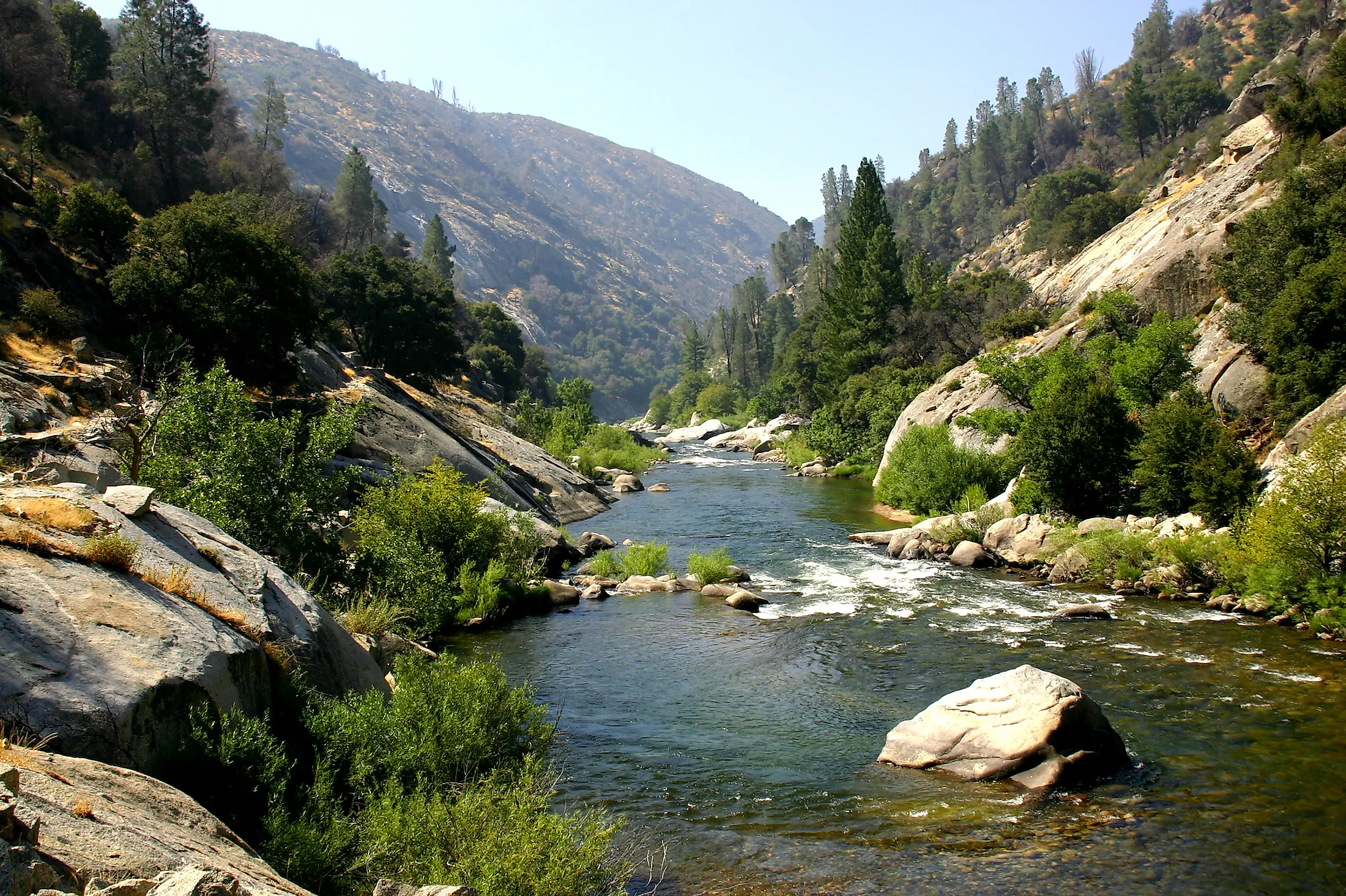
The North Fork Kern River or the Upper Kern, which is considered the main branch of the river and the section between Lake Isabella and the Johnsondale Bridge, originates from several lakes in a basin northwest of Mount Whitney of the Sierra Nevada mountains. The Great Western Divide, a mountain range that is part of the border between the Kings Canyon and Sequoia National Park, surrounds the headwaters of the river from the west, in addition to the Kings-Kern Divide from the north and the main Sierra Crest from the east. Flowing south, the Kern passes through Inyo and Sequoia National Forests in addition to the Golden Trout Wilderness. There are several tributaries to the Kern along this path, such as Rock Creek, Big Arroyo, Golden Trout Creek, and Rattlesnake Creek. The Little Kern River, a major tributary of the upper Kern River, joins the latter from the northwest at the Forks of the Kern after the latter deviates from its south course and heads east around Hockett Peak. More tributaries join the Kern River as it continues southwards after the Forks of the Kern, and these include Peppermint Creek, South Creek, Brush Creek, and Salmon Creek. These tributaries then end up as waterfalls, flowing into the Kern River Canyon. After the Kern River Canyon, the river emerges at Kernville into a wide valley where it meets Lake Isabella, formed by the Isabella Dam, an embankment dam in Kern River Valley halfway down the Kern River course. The South Fork Kern River or lower Kern, the largest tributary, joins the North Fork in Lake Isabella. This tributary originates in Tulare County, flowing south through Inyo National Forest and turns west after entering Kern County.
Geology Of The Kern River

Tectonic forces are the main driving factor behind the formation of the upper Kern River Canyon, in addition to the erosional force of the river. The Kern Canyon Fault runs beside the canyon for 150 kilometers, from the river’s origin to the south of Lake Isabella. However, this fault poses a significant threat to the stability and structure of the dam. The river’s course has also changed throughout history; prior to 10 million years ago, the Kern initially flowed into the San Joaquin Valley, along what is currently known as Walker Basin Creek. However, the river was blocked and forced to take the course northwards due to an uplift west of the Kern Canyon Fault, that also led to the formation of a gorge below Lake Isabella and Bakersfield. During the Ice Age, glaciers widened and deepened the upper part of the Kern River Canyon above Golden Trout Creek.

Another prominent aspect in the vicinity of the river is the Kern River Oil Field, which is adjacent to the river from the north, right before the river enters Bakersfield in Kern County. This field had generated approximately 320,000,000 cubic meters of oil by the end of 2006. However, it was a source of pollution to the river as it was allowing the drainage of wastewater into it. Luckily, current environmental regulations and treatment plants have managed to clean the water to be used for irrigation of farms in the valley to the west.
Brief History
It is believed that the Native Americans inhabited the Kern Valley as early as 100 A.D. Some of their evidences include rocks with grinding holes and petroglyphs, which are drawings or writings on rocks. The tribe was called Tubatulabal, and they were related to the Shoshone. Many descendants of this tribe currently live in the South Fork area to keep their ancient traditions and wisdom alive. Captain Joseph Reddeford is the first non-native American to enter the Kern Valley in May 1834. He also led the expedition of artist Edward M. Kern, after whom the river was named. Before that, the river was named “Rio de San Felipe” by Spanish missionary explorer Francisco Garces. The river was then renamed “La Porciuncula” by Padre Zavidea on August 2, 1806, for the day of the Porciuncula Indulgence.
Tourism And Activities In Kern River

The Kern Canyon in the north of Bakersfield is popular for several activities such as fishing and boating, particularly fly fishing, whitewater rafting, whitewater kayaking, and river boarding. The Lake Isabella Dams regulate the water flow of the Lower Kern which allows white water boarding activities to take place. Fishermen are mainly interested in the river’s unique freshwater fish such as the Kern River Rainbow Trout, the Little Kern Golden Trout, and the California golden trout. The Canyon is also a hotspot for camping, hiking, and picnicking.


