The Lowest National Park In The United States
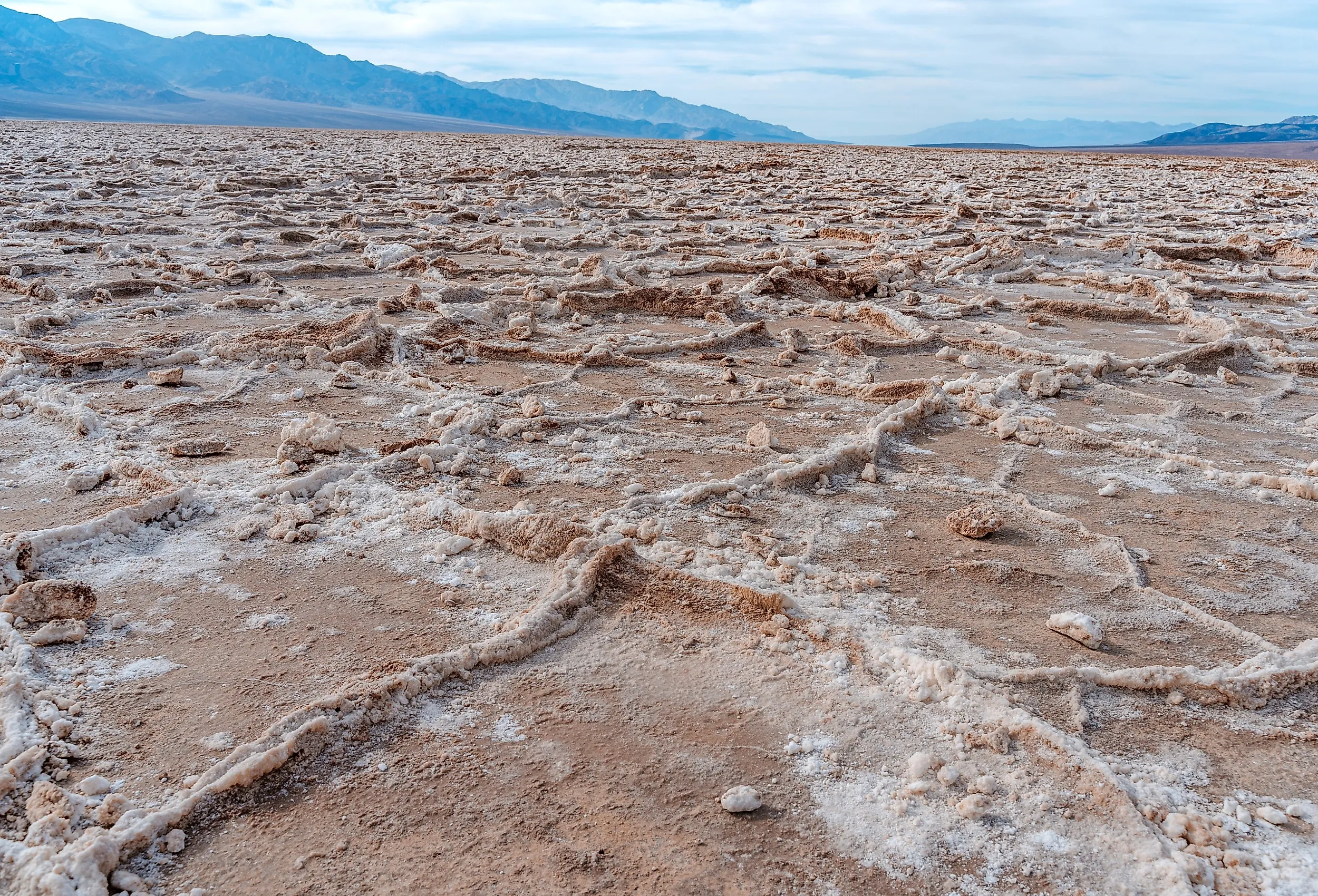
Death Valley National Park contains the lowest point in any US national park: Badwater Basin, at 282 feet (86 meters) below sea level. Spanning eastern California and a small section of Nevada, the park is also known for extreme heat. Furnace Creek's 134°F (56.7°C) reading of July 10, 1913, remains the world record recognized by the World Meteorological Organization, although a 2026 study in the Bulletin of the American Meteorological Society argues the measurement was roughly 14 degrees too high. The park is very dry as well, averaging about 2.2 inches of rain a year at Furnace Creek, while the surrounding mountains take in considerably more. Life persists anyway, in jackrabbits and sidewinder rattlesnakes, in wildflower superblooms that follow well-spaced rains, and in the salt flats and craters left behind by ancient lakes and volcanic eruptions.
The Lowest Point in Death Valley

Death Valley is not entirely below sea level. The park climbs to 11,049-foot (3,368-meter) Telescope Peak, which carries pinyon-juniper woodland on its higher slopes and stands more than two miles above the salt pan. No other place in the country presents that much vertical relief across such a short horizontal distance. The low ground itself, Badwater Basin, is also the lowest point in the United States and in North America.
Badwater Basin owes its depth to ongoing tectonic subsidence. Pleistocene Lake Manly and the shallow lakes that came after it concentrated mineral-laden runoff into salt flats that now cover nearly 200 square miles (about 520 square kilometers).

Remnants of Hurricane Hilary dropped 2.20 inches of rain on Furnace Creek in August 2023, close to a full year's average in a single day. A February 2024 atmospheric river added another 1.5 inches. The temporary lake that pooled on the salt pan measured about six miles long and three miles wide by mid-February, at a depth of roughly one foot. The National Park Service reported that it was briefly deep enough in a few spots to kayak.
Geology of Death Valley

Death Valley National Park has changed in many ways over the long prehistory that shaped the lowest and hottest national park in the United States. The oldest rocks here formed 1.7 billion years ago. It is unclear what this region was like back then, but most evidence points to a shallow sea covering it during the Paleozoic era, around 500 million years ago.
The mountains surrounding Death Valley were formed through tectonic activity. This corner of the northern Mojave Desert sits inside the broad boundary zone between the Pacific and North American plates, where the crust is being stretched and pulled apart. Volcanic eruptions in what is now Nevada blanketed the landscape in ash.

The valley itself formed around 3 million years ago, as land slid downward along faults. Badwater Basin is part of a block that has been gradually rotating to the east. Geological evidence shows that the valley floor continues to subside, leaving fresh fault scarps near Badwater Basin. One of the most recent geological events here is Ubehebe Crater, the largest in a cluster of explosion craters at the north end of the valley. It formed when rising magma reached groundwater and flashed it to steam, blasting out a hole roughly half a mile wide and 800 feet deep. The US Geological Survey dates that eruption to about 2,100 years ago, though a 2012 exposure-dating study proposed an age as young as 800 years, before later work argued back toward the older figure.
Wildflowers and Wildlife

One of the most unexpected sights in Death Valley National Park is the spring wildflower bloom, which brings out weakstem mariposa lily, desert dandelion, lilac sunbonnet, desert gold, and other short-lived annuals.
These annuals can remain dormant as seeds until sufficient, well-spaced rain triggers germination, with low-elevation blooms typically appearing between mid-February and mid-April. When conditions align, a superbloom covers vast swaths of the park. Those years are rare, averaging about one a decade. The park saw superblooms in 1998, 2005, and 2016, and the spring of 2026 produced the strongest display since 2016 after nearly three inches of autumn and winter rain.

Despite the heat, wildlife finds ways to survive here. Desert bighorn sheep can go several days without drinking, losing up to a third of their body weight to dehydration and then taking on several gallons at once when they reach water. Kangaroo rats do better still. They never need to drink at all, metabolizing the water they require from the dry seeds they eat and conserving it by producing very concentrated urine. Jackrabbits use their large, blood-vessel-rich ears as a cooling mechanism.
The park is also home to a venomous snake, the Mojave Desert sidewinder rattlesnake (Crotalus cerastes cerastes). Adults reach about 30 inches (76 centimeters), and their tan, blotched bodies disappear against the sand. The name comes from their looping, sideways locomotion, which carries them quickly across loose ground. Raised scales above the eyes give them a horned profile, and on hot days, they lie nearly buried in sand or wait out the heat in a burrow taken over from a rodent, hunting after dark instead.
Not every animal here is native, and the most conspicuous newcomer is the burro. Descended from African wild asses and brought in by miners in the 1880s, these feral donkeys weigh between 400 and 500 pounds and concentrate around water sources and desert vegetation. They consume a great deal of forage and damage the springs that native wildlife depends on.
Things To Do in Death Valley

In summer, the National Park Service advises against hiking at low elevations and recommends touring the main viewpoints by air-conditioned vehicle, staying on paved roads, and staying close to the car. At Furnace Creek, July's normal average high is about 117°F (47°C), and summer temperatures frequently exceed 120°F (49°C). The most popular stretch of the year runs January through April, when average highs sit between 67°F and 90°F. The park holds more than 1,000 miles of paved and dirt roads, and hikers can leave the trail almost anywhere.

Overlooks are the other draw. Artists Palette sits along the one-way Artists Drive loop, where oxidized metals in old volcanic deposits have stained the hills red, orange, yellow, blue, pink, and green. Zabriskie Point, named for a Pacific Coast Borax Company executive, looks past the badlands to the salt flats and the Panamint Mountains. The formation that dominates that view is Manly Beacon, an 823-foot (251-meter) outcrop named for William L. Manly, who, with John Rogers, guided a stranded party of Forty-niners out of the valley during the 1849 gold rush.
The borax industry left its own landmark at Harmony Borax Works. William T. Coleman built the plant at the mouth of Furnace Creek and began processing ore in late 1883. At full operation, it employed 40 men, most of them Chinese laborers who scraped raw "cottonball" ore off the valley floor, and it turned out three tons of borax a day. Twenty-mule teams hauled the finished product 165 miles to the railhead at Mojave. Summer stopped the process because the water in the crystallizing vats would not cool enough for borax to separate out, so Coleman shifted the workforce to his Amargosa plant near present-day Tecopa. The works closed in 1888, when Coleman's finances collapsed.
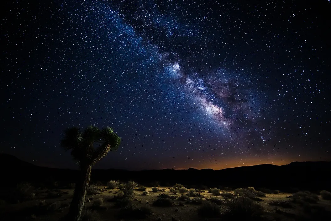
Night is another way to beat the heat. The park never closes, and its skies are dark enough that DarkSky International certifies it as a Gold Tier International Dark Sky Park. Rangers point stargazers toward Badwater Basin, where the horizon is low, and light pollution is close to absent.
The Park Is Alive
Despite the name, Death Valley National Park is far from a dead place. Rare weather sets off the improbable: superblooms after well-spaced rains, and the shallow return of Lake Manly to the lowest ground in North America. Visitors walk the badlands and the salt pan, and photograph wildlife that gets by on almost no standing water. More than 11,000 feet of elevation separates those salt flats from the top of Telescope Peak, which is how the hottest, driest, lowest national park in the country ends up holding both desert pupfish and bristlecone pines.