How Many Miles Of Shoreline Do The Great Lakes Have?
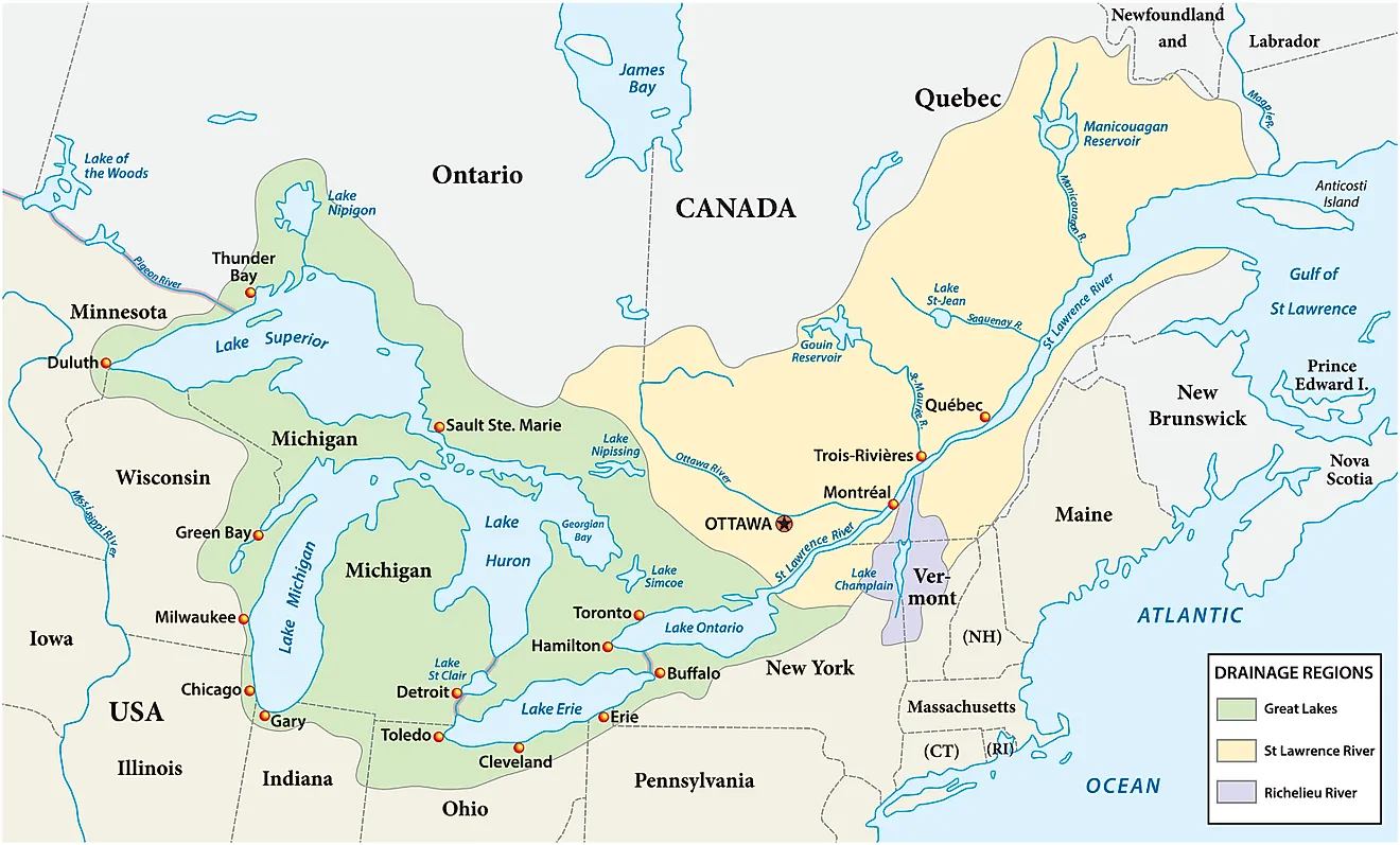
The Great Lakes have a total of 10,200 miles of shoreline, according to data from the EPA. This figure accounts for the 9,768 miles of total shoreline of all the Great Lakes, including islands, and the 432 miles on connecting channels through which the Great Lakes flow into each other, such as the Straits of Mackinac that bind together Lake Michigan and Lake Huron. In this story, we will break down each of the Great Lakes by coastline, starting with the smallest, and discuss the best beaches to go to on the coast.
Lake Ontario

Lake Ontario has the smallest shoreline at 712 miles. It is also the smallest by land area at 7,340 square miles, and the second smallest by water volume at 393 cubic miles. It has the lowest elevation of the Great Lakes, with an average elevation of 243 feet above sea level. Of the Great Lakes, it is the easternmost, straddling the border between Ontario and New York. It connects to the Atlantic Ocean via the St. Lawrence River.
On the Canadian side, one of the most visited beaches is the Sandbanks Provincial Park, due in large part to its baymouth barrier dunes, found right on the shores of the lake. Walking trails go around the dunes and wetlands. On the New York side, there's the Ontario Beach Park in Rochester, with 39 acres of sand beaches, a pier, and a 1905 Dentzel Menagerie Carousel. One can also find historic fortifications such as the Fort Ontario State Historic Site, a star fort built in the 1840s over the site of a fort from the War of 1812.
Lake Erie

Lake Erie has 871 miles of shoreline in New York, Pennsylvania, Ohio, Michigan, and Ontario. It has a surface area of 9,910 square miles and a water volume of 116 cubic miles, the smallest of the Great Lakes.
Lake Erie is the shallowest of the Great Lakes, only reaching an average depth of 62 feet. Due to this, the lake both warms up and freezes faster than the other lakes, reaching temperatures above 70 degrees Fahrenheit in the summer, and freezing over at up to 95% in the winter. It actually records lower temperatures overall in the winter than all the other Great Lakes.
On Pennsylvania's small Lake Erie shoreline, one can visit Presque Isle State Park, featuring sandy beaches on a peninsula just outside of the city of Erie. Sandusky, Ohio, makes the most out of its lakefront with the Cedar Point Beach and Cedar Point amusement park, featuring top-ranked roller coasters that draw in thousands of thrill-seekers in the summer.
Lake Michigan

Lake Michigan's shoreline stretches for 1,638 miles across four states: Wisconsin, Michigan, Illinois, and Indiana. It is the only one of the Great Lakes that has no shoreline in Canada. It is the third largest by surface area at 22,300 square miles and second largest by water volume at 1,180 cubic miles.
Lake Michigan is considered one of the most dangerous lakes for boats, as it is quite thin overall in width, meaning that storms that come through from the west can send boats off course to crash into the shoreline. Some estimate there could be up to 1,500 shipwrecks in Lake Michigan alone.
Lake Michigan is home to a national park, the Indiana Dunes National Park. Formerly a national lakeshore, it was declared a national park in 2019 due to its rare environment of freshwater dunes, formed by sand particles, wind, and currents. The largest of the dunes here is called Mount Baldy, which is 120 feet tall. This dune is still moving slowly to the south.
Lake Superior

Lake Superior earns its name in all respects, save for shoreline. It has 2,726 miles of shoreline, making it only the second longest of the Great Lakes. By every other metric, Lake Superior stands apart, with a water volume of 3,100 cubic miles, more than all the other Great Lakes combined, an average depth of 483 feet, and a surface area of 31,700 square miles. By surface area, it's the largest freshwater lake in the world.
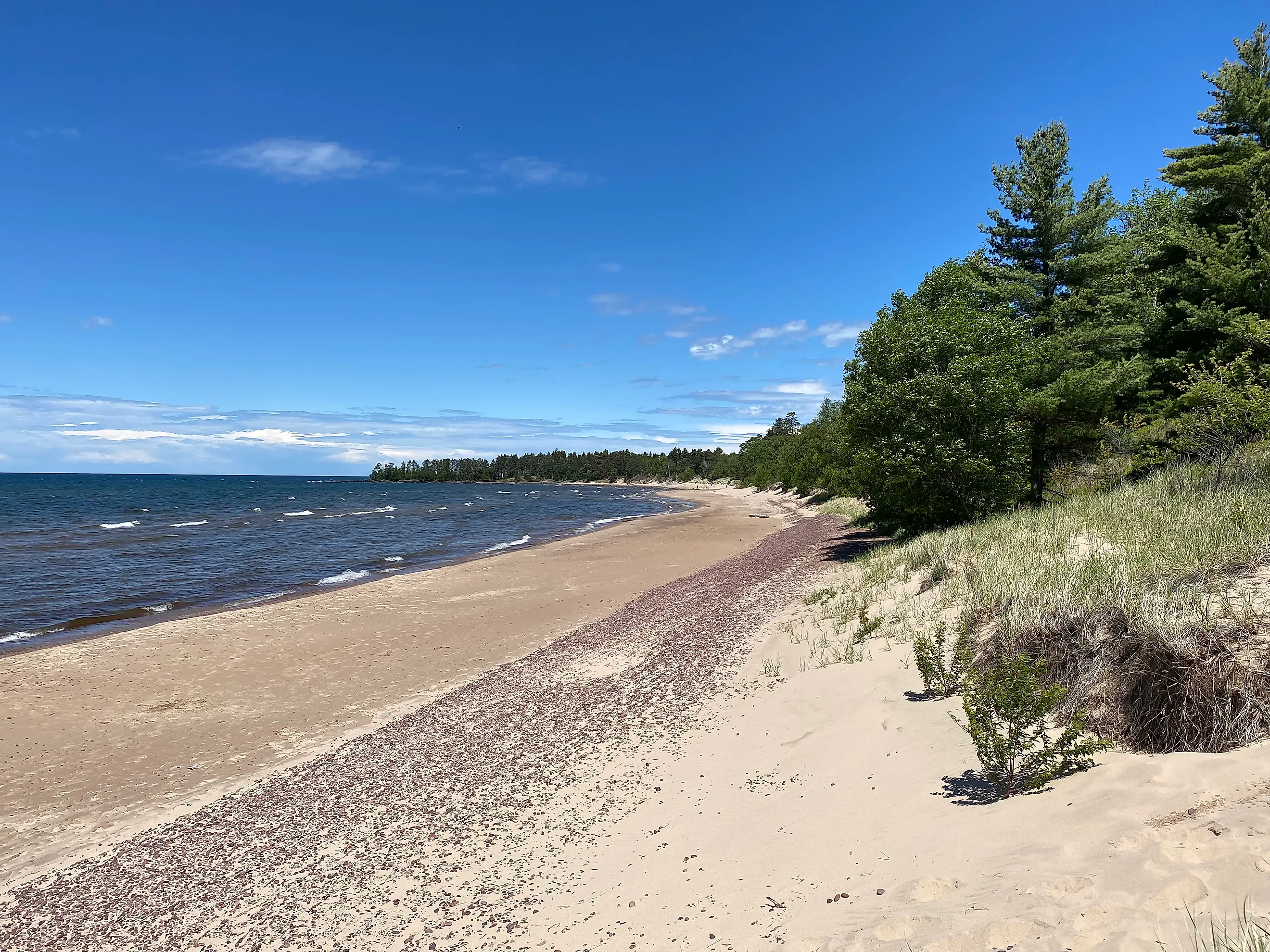
Lake Superior is the least developed of the Great Lakes, with forested shorelines across many state and national parks, such as the Pictured Rocks National Lakeshore in Michigan. This lakeshore gets its name from the red, copper, and manganese colors on its cliffs, which come from mineral deposits such as iron, copper, and manganese. The main national park on Lake Superior is located far off its main shore on Isle Royale National Park on a freshwater island. This is the only national park that shuts down in the winter, as it is only reachable by seaplane or boat.
Lake Huron

Lake Huron only borders Michigan and Ontario, but it has the longest shoreline of the Great Lakes, at 3,827 miles. Part of this length comes from its 30,000 islands, including the largest freshwater island on Earth, Manitoulin Island, at 1,068 square miles. Lake Huron is the second largest of the Great Lakes by surface area at 23,000 square miles and the third largest by water volume at 850 cubic miles.
There are no national parks on the U.S. shoreline of Lake Huron, but there is one on the Canadian side, Bruce Peninsula National Park. It is known for sea caves and ancient cedar forests that sit right on the shoreline. It is a popular dark sky sanctuary, as is Port Crescent State Park in Michigan. It has three miles of sandy beach and a dark sky viewing platform for stargazing.
These lakes are all connected
One could consider the Great Lakes as one large lake, or inland sea, as they are connected to each other. Lake Superior and Lake Michigan both flow into Lake Huron, which in turn connects with Lake Erie, and it flows eastward into Lake Ontario. Some have argued that the Great Lakes should be reclassified as an inland sea, due to their size and volume of water. After all, the Great Lakes contain close to 20% of all surface freshwater on Earth. However, the lakes are not all the same, as they vary based on their dimensions, wildlife, environments, and shorelines, spanning the untamed wilderness of Lake Superior and the warm amusement parks of Lake Erie.