The Best National Forests In The American West
America's western half features some of the largest and most geographically diverse national forests in the United States. These public lands encompass mountain ranges, volcanoes, deep canyons, alpine lakes, high deserts, and extensive wilderness areas that are generally open for you to explore. Some stretch across millions of acres and contain major landmarks that even rival those found in nearby national parks. They also usually provide access to hiking trails, ski hills, scenic drives, fishing waters, campgrounds, and remote backcountry.
This list focuses on national forests across a variety of states, including Colorado and California, that stand out for their beauty, scale, recreational opportunities, and ecological value, showcasing destinations that deserve serious consideration for anyone exploring the West today.
Coconino National Forest

Coconino National Forest covers more than 1.8 million acres across northern Arizona, surrounding Flagstaff and extending from the high country of the San Francisco Peaks into the red-rock landscapes near Sedona. Its elevation ranges up to 12,633 feet at Humphreys Peak, Arizona's highest point.
This rugged variation creates strikingly different environments within the same area, including ponderosa pine forests, tundra, desert grasslands, and juniper woodlands. With that, this Southwestern national forest contains several major recreation areas, too, including Oak Creek Canyon, Mormon Lake, and the Kachina Peaks Wilderness. The aforementioned Humphreys Peak is part of the Kachina Peaks Wilderness, while the Mogollon Rim forms another major geographic feature along the preserve's southern edge.
Hiking, camping, mountain biking, fishing, and scenic driving are all fan-favorite activities here, with numerous trails spanning short canyon walks and strenuous alpine climbs. Furthermore, Coconino National Forest contains numerous archaeological sites and landscapes associated with Indigenous peoples, adding significant historical importance to its already diverse terrain.
Inyo National Forest

Inyo National Forest boasts several notable landmarks that make it extremely important within the Sierra Nevada. Running along California's eastern Sierra and White Mountains, it holds about 1.9 million acres between the southern Sierra and the Nevada border. Inyo's most standout feature, Mount Whitney, is the tallest mountain in the Lower 48 at 14,505 feet and rises along its western side, forming a natural barrier to the forest that can be spotted from far away.
Lower down, the Ancient Bristlecone Pine Forest protects Great Basin bristlecone pines that can live for thousands of years. Other must-see spots include Mono Lake, which sits near the forest's northern edge, Mammoth Lakes, and the Owens Valley, all providing access to alpine recreation and a plethora of scenic overlooks. On top of that, much of the backcountry here is protected within the equally beautiful (but often quieter) John Muir, Ansel Adams, and Golden Trout wilderness areas.
Visitors come for long-distance hiking, mountaineering, fishing, skiing, and camping, but the forest's geology is notable as well. Epic glacial valleys, exposed granite, volcanic craters, and the steep eastern escarpment of the Sierra Nevada create an awe-inspiring place shaped by eons of tectonic activity, erosion, and glaciation.
Gifford Pinchot National Forest

Gifford Pinchot National Forest spans about 1.3 million acres in southern Washington State, stretching from the Columbia River Gorge northward toward Mount Rainier National Park. It is broadly dominated by the volcanic landscape of the Cascade Range, including Mount Adams, which rises to a lofty 12,276 feet and is the second-highest peak in Washington.
Much of the forest lies within the Mount Adams Wilderness, Goat Rocks Wilderness, and Mount St. Helens National Volcanic Monument. The latter encompasses the area surrounding Mount St. Helens, whose 1980 eruption dramatically reshaped the landscape and destroyed hundreds of square miles of nearby woodland (much of which is still slowly regenerating). On the other hand, many areas within Gifford Pinchot contain extensive old-growth and second-growth forests, wildflower meadows, and numerous rivers and lakes flowing through them.
Recreation options are plentiful and include hiking, backpacking, fishing, camping, horseback riding, and winter sports. The Pacific Crest Trail is a particular point of interest, crossing the eastern portion of the forest, while the Wind River and Cispus River drainages provide additional destinations for hiking and camping. Overall, its combination of major unmissable landmarks and sizable wilderness areas makes it a standout national forest in the Pacific Northwest and the West in general.
Deschutes National Forest

Few national forests in the West contain such a clear transition between volcanic mountains and high desert as Deschutes National Forest. Covering roughly 1.8 million acres in central Oregon, it includes much of the eastern slope of the Cascade Range and extends into the dry plateau beyond it.
The forest's western skyline is exemplified by the Three Sisters, Mount Bachelor, and Broken Top, while extensive lava fields and cinder cones reveal the region's tumultuous geological history. If that last part interests you, the Newberry National Volcanic Monument is a major highlight, being centered on none other than the Newberry Volcano and its enormous caldera, which contains Paulina Lake and East Lake.
Farther north, the Metolius River emerges from springs near Black Butte and is the site of a renowned fly-fishing area. For another waterside escape, this national forest also contains the Cascade Lakes, a scenic chain of lakes surrounded by high peaks and pine forests.
The forest's recreation is actually unusually diverse when you add it all up, with visitors being able to ski at Mount Bachelor, paddle on mountain lakes, hike through lava formations, fish the Metolius River, or mountain bike through the forest's extensive trail network, making it a location that truly caters to everyone.
Bridger-Teton National Forest

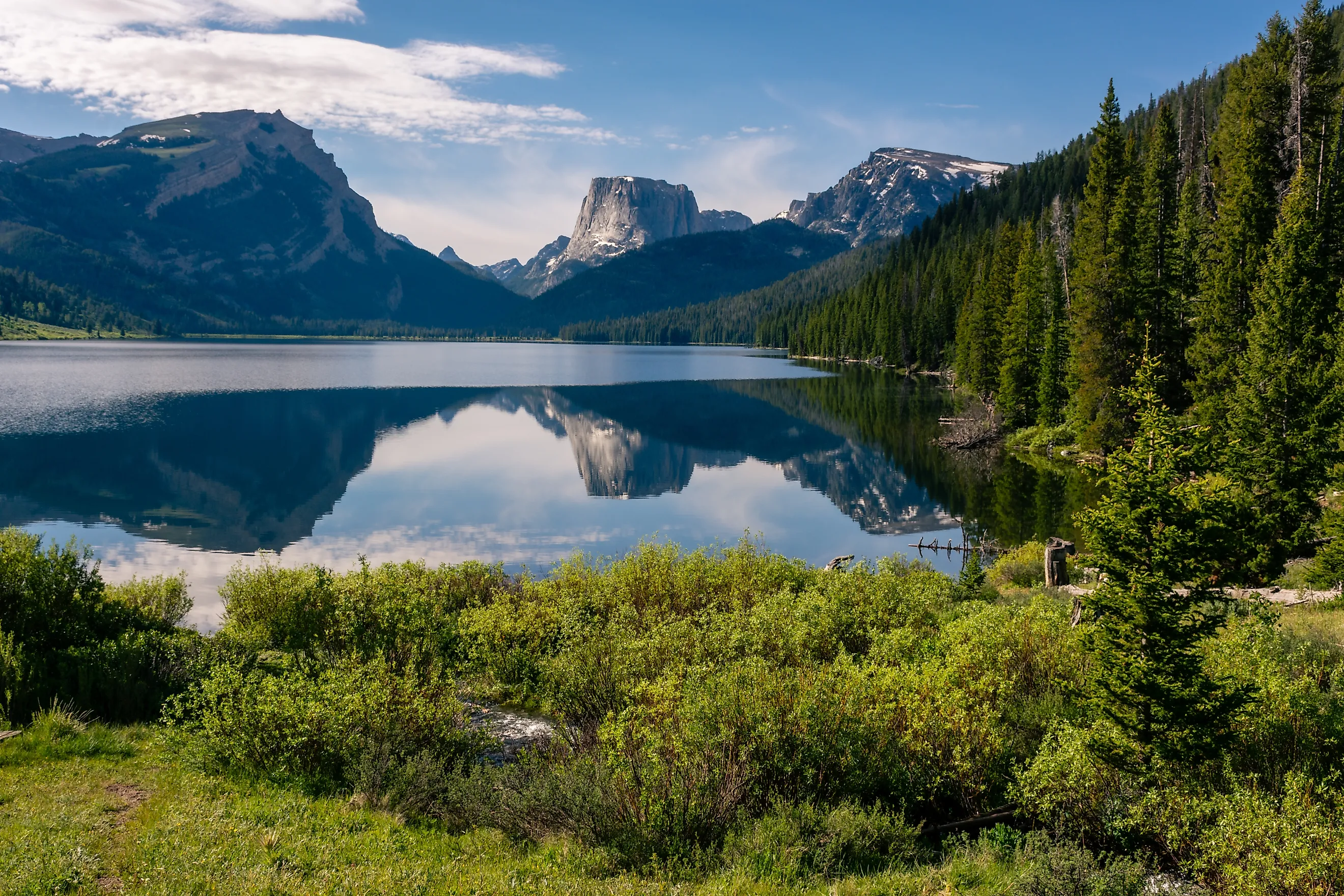
Deep in western Wyoming, the Bridger-Teton National Forest encompasses about 3.4 million acres, easily placing it among the largest national forests in the Lower 48. Spanning across the western slopes of the Wind River, Wyoming, Gros Ventre, and Salt River ranges, it is a fairly high-standing forestland, with elevations between roughly 5,000 feet and nearly 14,000 feet. In fact, Gannett Peak, Wyoming's highest mountain at a little over 13,800 feet, lies within the forest's Wind River Range.
A favorite for hikers and climbers alike, the Wind River Range contains more than 40 peaks exceeding 13,000 feet and hundreds of alpine lakes to match, making it a major destination for outdoorsmen who really want to get off the beaten path. The region also includes the Green River, Jackson Lake, and the Gros Ventre Wilderness, while bordering Grand Teton and Yellowstone national parks, too.
With few nearby towns and urban developments, grizzly bears, black bears, moose, elk, bighorn sheep, and mountain goats instead frequent the forest, making this one a hotspot for nature photography.
San Juan National Forest

San Juan National Forest is one of the most rugged expanses in Colorado, a state best known for being largely covered by the famous Rocky Mountain range. Located in the southwestern corner of the state, it incorporates about 1.8 million acres across the San Juan Mountains, where numerous peaks rise above 13,000 feet.
Locales like the Needles, Grenadier, and Weminuche Mountains, as well as large sections of the Weminuche Wilderness, make this Colorado's largest wilderness preserve. Furthermore, the Animas, Dolores, Los Pinos, and San Juan rivers cut through deep valleys and canyons, while countless lakes big and small occupy basins left by glaciers. The area also has a strong mining history, particularly around Silverton and Telluride, where abandoned mines, rail grades, and other old-timey structures remain throughout the mountains.
Many opt to experience the region via the Million Dollar Highway, which crosses part of the forest between Silverton and Ouray and reaches enormous elevations above 10,000 ft, making it one of the highest sections of roadway in the United States. But for a slower exploration, hiking and backpacking are major draws during summer, too, while winter here is the time for snowmobiling, backcountry skiing, and other snow sports.
See These Amazing Natural Spaces for Yourself
These magnificent green spaces out West demonstrate the broader region's enormous geographic range. With volcano-filled landscapes, mountainous lakes, snowcapped peaks, old-growth woodlands, and seemingly endless wilderness, each should provide a memorable experience. These forests also give you access to some of the West's most significant natural landmarks, allowing you to walk, camp, fish, climb, and even ski in and around them.