The American Counties With No Paved State Highway
In the United States, state highway systems extend across nearly every county. However, four counties in the U.S. have no state-designated, state-numbered highways at all. In Hawaii's Kalawao County, towering cliffs prevent vehicles from reaching the rest of Molokai by road. Massachusetts' Dukes County depends on ferries to connect Martha's Vineyard to the mainland. Meanwhile, Washington's San Juan County has hundreds of islands but no land-based state highways. While there are some special, additional cases which we will note at the end of this article, here are the four U.S. counties with no paved state highway.
Nantucket County, Massachusetts

The island of Nantucket, on which Nantucket County exists, has no state highways, state routes, or state-maintained roads. All of its roads are maintained by the Town and County of Nantucket, which lies about 30 miles south of Cape Cod. The only way to reach Nantucket County is to fly into Nantucket Memorial Airport or take a boat.
The idea of having no paved state highways in Nantucket County dates to 1893, when the Massachusetts Highway Commission planned out state roads on all but two counties (both of which were islands). Up until 1918, motor vehicles were banned entirely from Nantucket County. Nantucket County is a National Historic Landmark District today, with no traffic lights and a speed limit of 25 mph in thickly settled areas. Year-round, almost 15,000 residents live in Nantucket County. During the summer and peak tourist season, however, that number can jump as high as 80,000.
Kalawao County, Hawaii

Located on the isolated Kalaupapa Peninsula on the north coast of the island of Molokai, Kalawao is the smallest and least populated county in Hawaii. Separated by vertical cliffs more than 1,600 feet high from the rest of the island (Maui County), Kalawao County has no state highways or paved roads, and is accessible only by air, sea, or trail. The county, which was established in the 1860s as a colony for those with Hansen's disease (leprosy), maintains its own paved local streets and local access roads.
The closest highway to Kalawao County is Hawaii Route 470 (Kalae Highway), which ends at the Kalaupapa Lookout on the edge of Maui County. No vehicular roads go over the cliffs into Kalawao County. There is a historic 3.5-mile mule trail that traverses the steep cliffs, connecting Kalawao County to the rest of Molokai, that is only accessible by foot or mule. All vehicles in Kalawao County are used by the Hawaii Department of Health, the National Park Service, or the few (fewer than 100) residents of the island. Although non-residents must have permission from the state to enter Kalawao County, for those who are granted permission, the best ways to get there are by taking a cargo barge or flying into Kalaupapa Airport.
Dukes County, Massachusetts

Containing Martha's Vineyard and the Elizabeth Islands, Dukes County is the second county in Massachusetts with no state-numbered highways. There are no traffic lights in Dukes County, which has miles of publicly paved local roads maintained by the local government, all of which rely on stop signs and roundabouts. The Elizabeth Islands, which make up the town of Gosnold, have few to no public roads, with transportation limited to dirt tracks or golf paths.
You cannot reach Dukes County by bridge from the mainland. Instead, you must get there by boat or fly into Martha's Vineyard Airport. The county's main intersection in Vineyard Haven, otherwise known as Five Corners, handles most of the traffic coming off ferries from the mainland, creating an infamously complicated crossroads during peak summer travel. While about 21,000 live on the county as full-time residents, in the summertime, the population can soar to 95,000, creating quite a bottleneck of traffic at times.
San Juan County, Washington

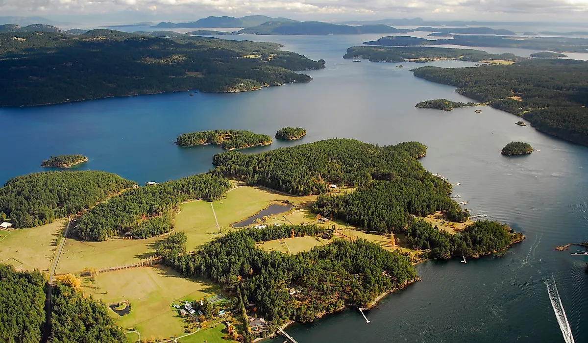
San Juan County is the only county in Washington state without a single mile of land-based asphalt state highways. As the county is an archipelago near Puget Sound's northern end made up entirely of hundreds of islands, the San Juan Islands in the Salish Sea, including Orcas, San Juan, and Lopez Islands, San Juan County's transportation system relies entirely on water and air. Local roads on the islands are maintained as county roads or town streets, not state highways. The county is home to 18,500 residents, but during the peak summer tourist season, its population can double to 36,000.
The Washington State Ferry routes are counted as part of the state highway system to connect San Juan County to the mainland. The only options to reach San Juan County are heading to Anacortes Ferry Terminal on the mainland to catch the ferry, catching passenger boats from Seattle or Port Townsend, or using regional flight and seaplane options from Anacortes and Seattle.
Alaska Boroughs and Census Areas

When counting U.S. counties without state highways, these four make up the list. Parts of Alaska, however, also do not have state highways. Alaska does not use traditional counties to describe its land. Instead, it is divided into 19 organized boroughs and one large unorganized borough, which the U.S. Census Bureau has divided into statistical units called census areas.
About 82% of Alaska's communities are completely disconnected from the state highway system. Dozens of bush regions and island boroughs in Alaska, like the Aleutians West Census Area, Wade Hampton/Kusilvak Census Area, and North Slope Borough communities that are off the main grid, have no paved state highway network. Transportation in these areas relies on the ferry network of the Alaska Marine Highway System, river barges, and air.
The four counties that have no paved state highways also share another important characteristic: they are all separated from the mainland by water. These counties remind us that asphalt is not a prerequisite for connection or community. In a nation defined by interstates, state highways, and traffic gridlock, these places remain uniquely tied to their natural geography, guided by ferry schedules, dirt tracks, and coastal tides. Within these counties, progress is not measured by how fast a state highway can cut through the landscape, but by how members of a community learn to live within its borders without highways.