10 Most Peaceful Small Towns On The Atlantic Coast
Some of the calmest corners of the Atlantic Coast can be found in the small towns that dot the shoreline, where a morning might center on a low-tide walk or a forest path to the water. In Camden, Maine, a quick climb above the harbor can be followed by a picnic at Barrett's Cove Beach on Megunticook Lake. In Little Compton, Rhode Island, piping plovers and least terns inhabit Goosewing Beach Preserve, a barrier beach between the Atlantic and Quicksand Pond. Farther south, St. Marys, Georgia, has a boardwalk at the Tilden Norris Marsh Walk that leads to a covered gazebo near the Florida line. These ten small towns offer some of the most peaceful outdoor time along the Atlantic Coast, with nature preserves, island ferries, and quiet beaches spread across eight states.
Lubec, Maine

In 1991, the McCurdy smokehouse stopped processing herring on the Lubec waterfront. Its packing shed on Water Street now houses the seasonal McCurdy Smokehouse Museum. For the coast itself, head to Quoddy Head State Park and the red-and-white tower of West Quoddy Head Light above the channel. The park's bog is crossed on a raised boardwalk. It is a one-mile return walk to the bog. Hamilton Cove Preserve has a much shorter way to the water: the Beach Trail drops through meadow to a cobble beach in a 0.1-mile round trip.
Camden, Maine

Camden has wooded hills directly above its harbor. Mount Battie looks over Camden and the islands in Penobscot Bay. There is a seasonal auto road to the top, as well as a hiking trail. The trail climbs steeply in places. For swimming in freshwater, Barrett's Cove Beach has a float in Megunticook Lake and picnic space by the water. There is no lifeguard on the beach.
Laite Memorial Beach has free entry to the harbor waterfront, with picnic tables above the small public beach. The Camden Riverwalk follows the Megunticook River. Its Tannery Section has benches and viewing platforms along the way. The Seabright Section follows a wooded river path toward a dam.
Brewster, Massachusetts

At Nickerson State Park, wooded paths run between freshwater kettle ponds across about 1,900 acres of inland Cape Cod. The park opens at sunrise. Brewster also has a saltwater shore on Cape Cod Bay, and Paine's Creek Beach is a place to walk out toward exposed sandbars at low tide. A summer beach parking permit is required. For a closer look at the habitats between shore and village, the Cape Cod Museum of Natural History leads field walks along the John Wing Trail. These field walks last about 90 minutes. The museum cancels walks when high tides prevent access.
Spring brings a different waterside stop at Stony Brook Gristmill and Museum, where footpaths follow herring on their upstream route to the ponds. That run generally lasts from mid-March into early May. The mill itself grinds corn during its Saturday openings in July and August, with free admission to the mill and museum.
Little Compton, Rhode Island

Little Compton, in the southeastern corner of Rhode Island, has a beach on the Atlantic with a pond behind the dunes. At Goosewing Beach Preserve, piping plovers and least terns nest on a strip of sand between the ocean and Quicksand Pond. South Shore Beach is the way in on foot, with a charge to park during summer. Inland, Simmons Mill Pond Management Area has paths among the ponds and trees of a coastal oak-holly forest. The 0.6-mile boardwalk at Whitehead Preserve passes through wet woods. Other paths circle three farm ponds. It opens throughout the year during daylight hours.
Shelter Island, New York

Woodland and tidal creeks fill much of Mashomack Preserve on Shelter Island. Its 2,350 acres include 11 miles of coastline, with walking trails closed throughout January. Ferries provide the crossing from the North and South Forks of Long Island. For a shore stop, Wades Beach has a public bathing area with lifeguards in season. Shell Beach has no lifeguards. Both are town beaches with parking restrictions in summer. From May 15 through September 15, visitors need permits at many beach parking areas, with one-day permits sold for particular locations.
Chincoteague, Virginia

Oyster fishing has widely shaped the waterfront economy at Chincoteague. That history is covered at the Museum of Chincoteague Island, which began as an oyster museum and now displays a lighthouse lens with locally carved decoys. Much of a day outdoors can be spent across the channel on Assateague Island, on the nearly level paths at Chincoteague National Wildlife Refuge. Pets are prohibited throughout the refuge, including inside vehicles.
The Wildlife Loop is a paved walk around a managed wetland, with benches for watching the winter waterfowl. Summer brings shorebirds to the mudflats. The loop admits cars from 3 in the afternoon. Morning visits are on foot or by bicycle. The wooded approach to Assateague Lighthouse climbs a sandy hill, and a service road offers an alternative for those who need easier access. Lighthouse tours run on Saturdays between Labor Day and Thanksgiving, with Friday tours also offered during the long summer season.
Ocracoke, North Carolina

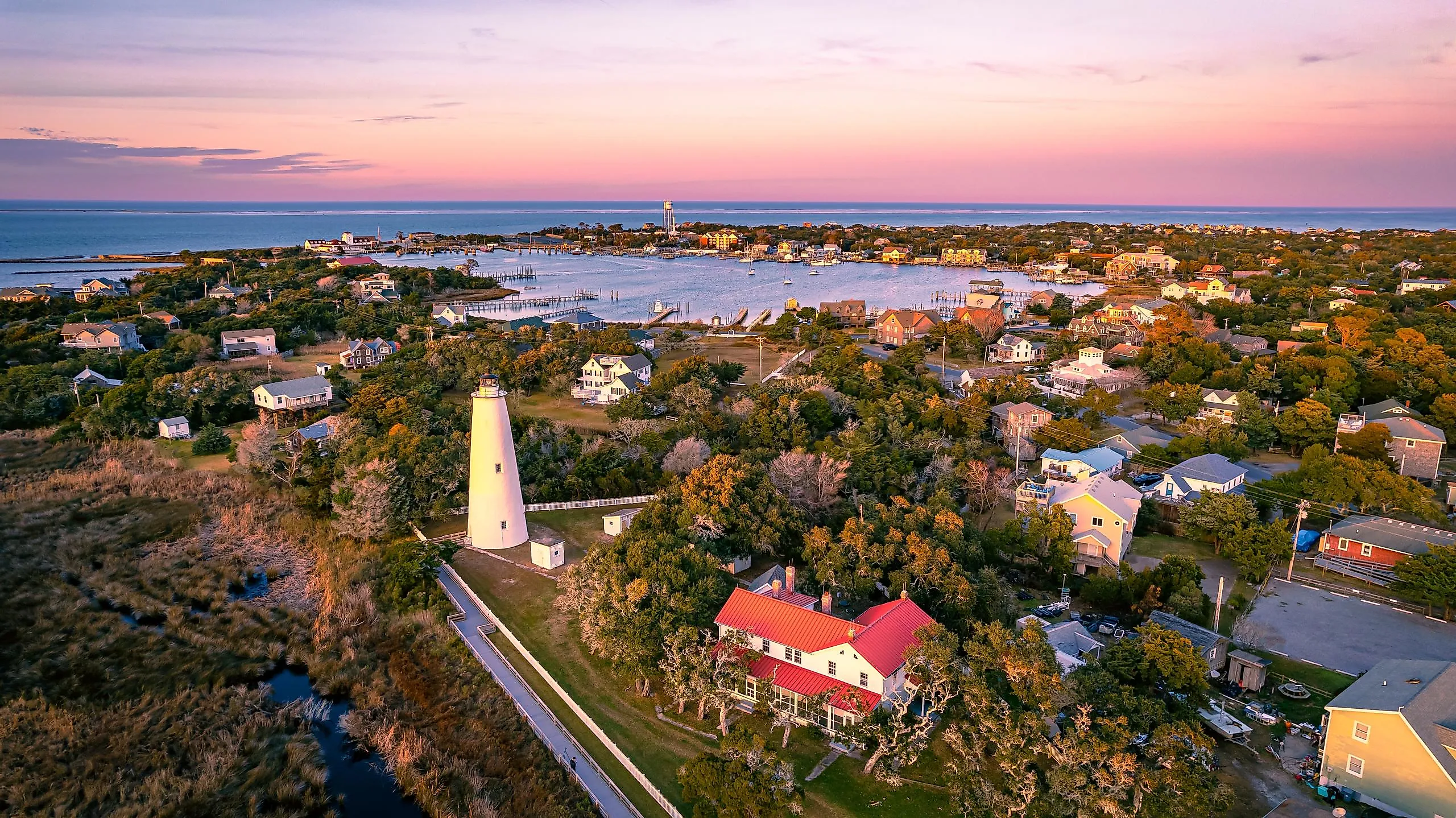
After 8 a.m., walkers at Springer's Point Preserve follow trails under live oaks to a beach on Pamlico Sound, leaving bicycles at the entrance rack. There is no car parking at the preserve. Maritime forest and salt marsh fill much of the preserve's 124 acres, with paths continuing to the water. The tower at Ocracoke Lighthouse isn't open for climbing, so visits stay at ground level. Even the ground floor opens only seasonally, with limited hours. Across from the campground, Hammock Hills Trail runs for a three-quarter-mile circuit through dunes and maritime forest, then out to views over the salt marsh.
Beaufort, North Carolina

Established in 1713, Beaufort faces a protected group of islands across Taylor's Creek, where salt marsh and dunes separate the waterfront from the open coast. The two acres of the Beaufort Historic Site contain six restored buildings, with guides to explain how people lived in the coastal settlement. The historical association also runs guided walks through the Old Burying Ground. A tour brochure is available for an independent visit.
To reach Rachel Carson Reserve, cross Taylor's Creek by kayak or passenger ferry from the waterfront. The reserve's islands support salt marshes and estuarine wildlife. Stay out of horse watering holes and shorebird nesting areas. Passenger ferries also leave Beaufort for the west end of Shackleford Banks. Shells draw walkers to its ocean beach, which is kept free of beach driving.
Edisto Beach, South Carolina

Civilian Conservation Corps crews built Edisto Beach State Park in the 1930s, and some of their buildings remain in use beside the island's forest and Atlantic shore. The park has 1.5 miles of beach. The Scott Creek Trail turns inland for 0.7 miles through maritime forest. There are views of the marsh from three boardwalks. The half-mile Forest Loop Trail passes live oaks draped with Spanish moss and stands of palmettos. The forest paths also reach the Environmental Learning Center. Fossils and live animals help explain the island's coastal habitats and the surrounding ACE Basin. The park opens at 7 a.m. for the day's first walks.
St. Marys, Georgia

Near the Florida line, St. Marys has a boardwalk to a covered gazebo in the river marsh at the Tilden Norris Marsh Walk. Inland, palmettos and oaks hung with Spanish moss surround the campsites at Crooked River State Park. A nature trail there crosses maritime forest and salt marsh. Herons and fiddler crabs live in the park.
For Cumberland Island National Seashore, the ferry leaves town for the Dungeness and Sea Camp docks. The island's woodland paths lead to 17 miles of undeveloped Atlantic beach. St. Marys Waterfront Park has picnic space along the St. Marys River, where boardwalks and piers provide places to watch shrimp boats.
Quiet Days On The Atlantic Coast
Camden combines a climb above the harbor with swimming at Megunticook Lake. In Little Compton, a beach walk at Goosewing can be followed by the boardwalk through Whitehead Preserve's wet woods. For an island stay, Ocracoke has walks beneath live oaks to the shore of Pamlico Sound. Choose the outing you want most, then check the preserve's opening days and ferry departures before booking, especially if an island crossing is part of the trip.