This Wyoming Scenic Byway Is The Road Trip Of A Lifetime
When it comes to selecting the ultimate in Wyoming road trips, the Flaming Gorge - Green River Basin Scenic Byway is hard to beat. This route follows two highways south from Interstate 80 in southwest Wyoming to the Utah state line, with the Flaming Gorge Reservoir sandwiched between them.
And don't just take our word for it. In February 2021, it became one of just 37 All-American Roads nationwide at the time, the top tier of the federal byways program and a status reserved for routes worth planning a trip around.
That makes the byway a road trip of a lifetime that includes high desert, red rock, and big water, with the option of stretching its 96 miles into a 160-mile loop through Utah's spectacular canyon country.
Built for Big Views

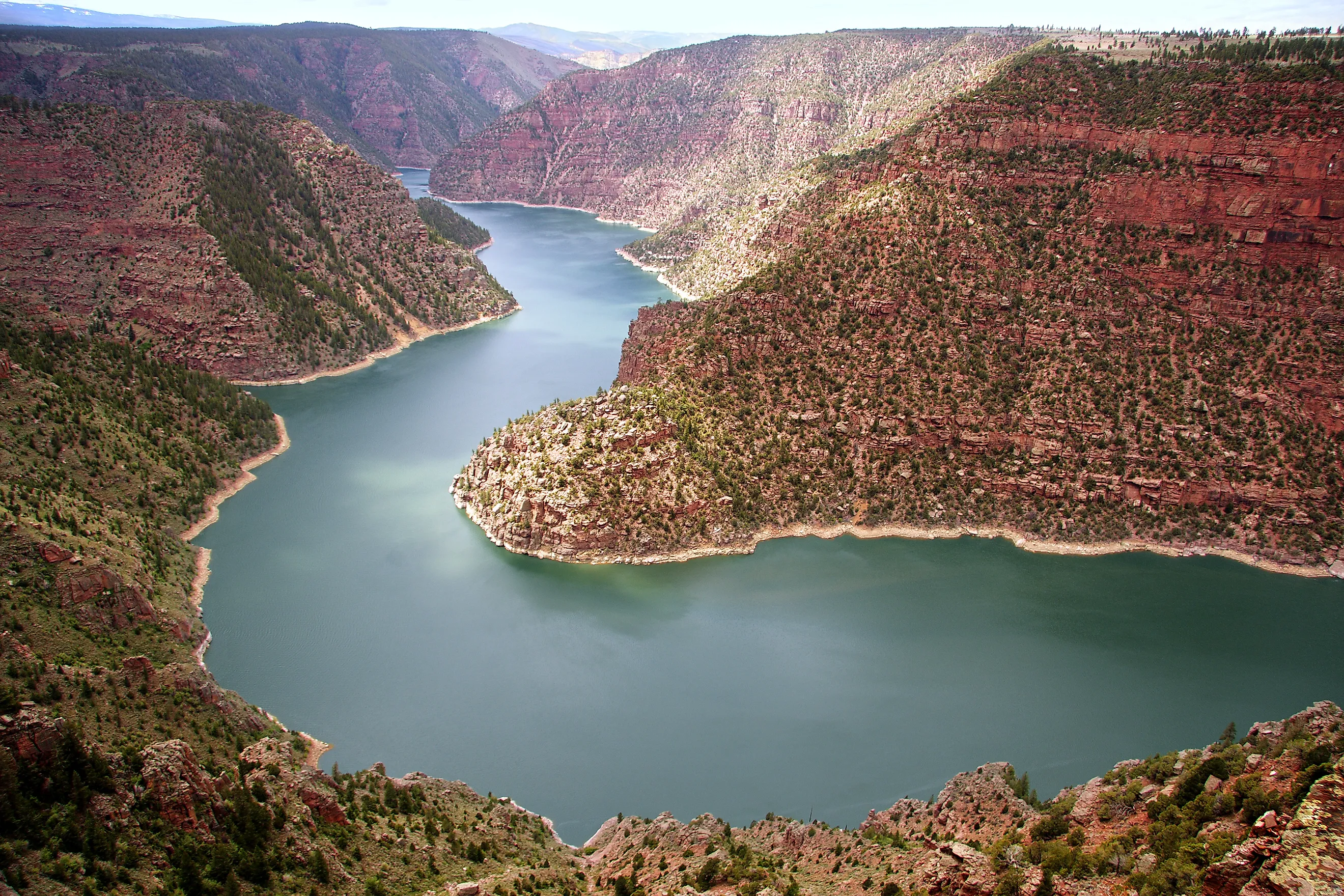
John Wesley Powell, the geologist and Civil War veteran who led the first recorded expedition down the Green and Colorado Rivers through the Grand Canyon in 1869, named the canyon after its sunlit red rock, describing "a flaring, brilliant, red gorge."
The gorge itself now lies under the Flaming Gorge Reservoir, created when the Flaming Gorge Dam in Utah blocked the Green River. Lady Bird Johnson, then the First Lady, dedicated the reservoir in August 1964 during a stop in the city of Green River, and the lake now stretches 91 miles north of the dam, mostly in Wyoming.
The two highways the byway uses are U.S. Highway 191, which heads south from Interstate 80 just west of Rock Springs, and Wyoming Highway 530, which runs south from Green River. Both end at the Utah line, and together they total 96 miles. Without stops, the route takes between two to two-and-a-half hours to drive, though stops at overlooks, campgrounds, and marinas are a must and will easily fill the day.
It's The Views That Count

It took Sweetwater County Travel & Tourism and its partners a decade of campaigning before All-American Road status was granted. Given the scale of the route, the fact it deserved the title was never in doubt. Part of the wait came down to the program itself, as the 2021 round was the first time the Federal Highway Administration had named new byways since 2009.
The road follows high ridges with spectacular 50-mile views, sometimes even farther. Thirty miles in, the Uinta Mountains appear on the southern horizon with peaks reaching as high as 13,528 feet.
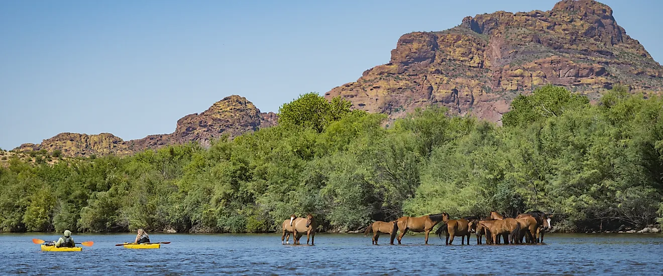
It's also something of a paradise for wildlife. The surrounding Green River Basin supports 390 species of birds, mammals, reptiles, amphibians, and fish. Pronghorn are among the bigger animals you're likely to see from the car, while wild horses, elk, and mule deer are also common sightings.
Rock Springs to Firehole Canyon

Most travelers start a Flaming Gorge road trip in Rock Springs, a coal-mining and railroad town on Interstate 80. Before heading south, stop at the Rock Springs Historical Museum, housed in the sandstone former city hall built in 1894. It's the only example in southwest Wyoming of Richardsonian Romanesque architecture, a heavy, round-arched style popular in the late 1800s. Exhibits cover coal mining, the Union Pacific Railroad, the 56 nationalities that settled the area, and outlaw Butch Cassidy, who is said to have picked up his nickname while working as a butcher in town.
From the Interstate 80 interchange, follow U.S. 191 south into open sagebrush country. Pull over for a selfie when you see the Flaming Gorge Gateway sign with its interesting interpretive panels explaining the forces that shaped the landscape.
Thirteen miles south of the interstate, Forest Road 106 branches west for ten miles to Firehole Canyon, the most dramatic scenery on the Wyoming side. Chimney-like rock spires and bluffs rise above the reservoir here, carved from sediments left behind by Lake Gosiute, an ancient lake that once covered the basin. The Firehole Campground in the Ashley National Forest has a swim beach, a boat ramp, and campsites with shade shelters.
Back on U.S. 191, the highway rolls south toward the state line through the Clay Basin area, a long stretch with good pullouts but no services. Fill the tank and pack water before leaving Rock Springs, as there's still a way to go before you reach the end of the drive.
Crossing Into Utah

Although the designated byway ends at the state line, the reservoir doesn't. The best way to see the gorge itself is to continue into Utah and loop back on Highway 530. U.S. 191 descends toward Dutch John, a town established in 1957 to house dam workers. Just under five miles north of town, the Antelope Flat overlook provides the first wide view of the water.
Flaming Gorge Dam clocks in at 502 feet high and 1,285 feet long, and its visitor center, open year-round, provides tours of the dam in summer. Close by, Cedar Springs Marina occupies a sheltered cove, and the Swett Ranch Historical Homestead was settled in 1909.
West of the dam, Utah Highway 44 leads to the turnoff for Red Canyon. The Red Canyon Visitor Center and its overlooks stand 1,700 feet above the reservoir with exhibits inside that cover the area's ecology, and the Native American and settler cultures that lived here.
The Canyon Rim Trail follows the edge for 6.5 miles, and Red Canyon Lodge is a mile up the access road for those wanting to break up the journey.
Closer to Manila, the Sheep Creek Geological Loop leaves Highway 44 just under six miles south of town. A 13-mile side trip, it follows the Uinta Fault past canyon walls that expose almost 800 million years of geologic history. Bighorn sheep live in the area, and in August and September, the kokanee salmon spawning run is in full swing.
Highway 530 and Green River

From Manila, Wyoming Highway 530 heads north up the west side of the reservoir along a quieter stretch of the route that crosses open benchland with the Uinta mountains in the rearview mirror.
Twenty-five miles south of Green River, Buckboard Crossing has a campground, and next door, Buckboard Marina is the only marina on the Wyoming side of the gorge. It offers boat slips, a restaurant, a bar, groceries, and fishing licenses.
Flaming Gorge is one of the country's top trophy lake trout fisheries, with fish over 50 pounds caught here. The fishing doesn't end when the water freezes over, as Buckboard is a popular ice fishing spot. Several popular tournaments are held here, including the Mac Attack and the Burbot Bash. Held in January, the latter is centered around burbot, an eel-like freshwater cod that state wildlife managers want anglers to remove to help the reservoir's fishery.
The byway ends in Green River, where Powell launched his expeditions down the Green and Colorado Rivers in 1869 and 1871. The launch site, Expedition Island, a National Historic Landmark since 1968, features a playground, picnic spots, and access to the Greenbelt Pathway along the river. It's also the put-in for tubing, kayaking, and rafting trips, and the venue for the Flaming Gorge Days festival.
A few blocks away, the Sweetwater County Historical Museum does a good job of explaining the county's Indigenous history, the railroad era, mining industries, and frontier settlement. Admission's free.
Planning Your Road Trip

The best way to do the full 160-mile loop is to spread it over two days. Leave Rock Springs the first morning, detour to Firehole Canyon and continue south to the dam and a tour, spending the night at Red Canyon Lodge or in Dutch John. Day two takes in the Red Canyon overlooks, the Sheep Creek Geological Loop, and a lunch stop in Manila before driving north on Highway 530. Take a break at Buckboard Marina with an evening walk on Expedition Island in Green River.
This is one byway you can drive in any season, as the main highways are kept open year-round. Winter brings ice and snow, though, and on the Utah side some secondary roads, including the stretch between the south end of the Sheep Creek loop and U.S. 191, sometimes close. The Firehole and Buckboard campgrounds operate from May through September, dam tours run in summer, and Swett Ranch opens on Memorial Day.
With an extra couple of hours, add the Pilot Butte Wild Horse Scenic Tour, a 24-mile route on gravel roads that links Rock Springs and Green River across White Mountain. Between 1,100 and 1,600 wild horses live on public lands, and pronghorn, elk, hawks, and eagles are also regulars. High-clearance, four-wheel-drive vehicles are best for this detour, and it's worth noting that cell service is spotty.
Room to Roam
The Flaming Gorge-Green River Basin Scenic Byway doesn't need hairpin bends or high mountain passes to earn its place among America's top drives. Its appeal is the size of the place: 50-mile views, a 91-mile reservoir, and the same red canyon walls that gave Powell the gorge's name more than 150 years ago.
You can drive the Wyoming highways in an afternoon or turn the trip into a two-day loop with a night at Red Canyon and a morning on the Sheep Creek loop. Start at the museum in Rock Springs, finish at Expedition Island, and you'll end your journey right where Powell started his.
Whatever time of year you go, this is the Wyoming road trip of a lifetime.