Maps of Oklahoma
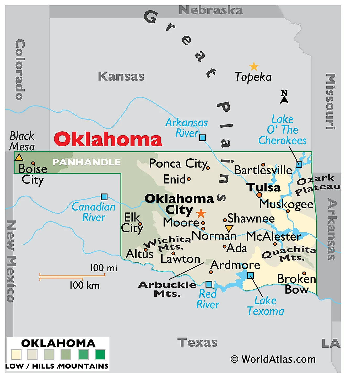
Oklahoma is a state in the south-central region of the United States. It shares its borders with six states: Texas to the south and west, New Mexico to the west at the tip of the panhandle, Colorado to the northwest, Kansas to the north, Missouri to the northeast, and Arkansas to the east. It is landlocked, encompassing a total area of about 69,899 square miles (181,037 square kilometers), which makes it the 20th largest state.

Oklahoma sits at a continental crossroads. It lies where the dry Great Plains of the west meet the wooded Interior Highlands of the east, and where northern and southern species ranges overlap. The state tilts steadily downhill from the northwest corner to the southeast, dropping from Black Mesa at 4,973 feet to just 289 feet on the Little River — a fall of more than 4,600 feet across roughly 500 miles. That single gradient explains almost everything about Oklahoma's landscapes, which shift from semi-arid mesa country through mixed prairie and cross timbers to genuine southern pine forest.
Where Is Oklahoma?

Oklahoma measures about 465 miles east to west and 230 miles north to south, with the panhandle adding a narrow arm 166 miles long and only 34 miles wide. That strip exists because of an accident of boundary-setting: when Texas entered the Union as a slave state in 1845, it could hold no territory north of the 36°30′ line, so the land above it was left unclaimed and ungoverned for decades, earning the name "No Man's Land."
With roughly 4.1 million residents, Oklahoma is the 28th most populous state. It is divided into 77 counties. Oklahoma City, near the center of the state, is both the capital and the largest city, and Tulsa anchors the northeast.
The High Plains

The High Plains cover the panhandle and the far northwest, forming the Oklahoma portion of the Great Plains. The terrain is flat to gently rolling and rises steadily westward, from around 2,000 feet at the eastern edge to nearly 5,000 feet at the New Mexico line. The climate is semi-arid, with under 20 inches of rain a year, and natural trees are scarce outside the stream valleys.
Black Mesa, in Cimarron County, is the state's highest point at 4,973 feet (1,516 meters). It is not a peak but the eroded end of a basalt lava flow that spilled east out of New Mexico roughly five million years ago — the hard volcanic cap protected the softer rock beneath while the surrounding land wore away. Cimarron County is the only county in the United States that touches four other states.
The Gypsum Hills

East of the High Plains, the Gypsum Hills form a north-south belt of mesas, buttes, and short canyons across western Oklahoma. Their character comes from thick beds of gypsum — a soft sulfate mineral deposited when shallow seas evaporated during the Permian period — layered above red shale and sandstone. Where the gypsum caps a hill, it glitters in sunlight, which is why the range is also called the Glass Mountains.
Gypsum dissolves readily in water, so the region contains caves, sinkholes, and disappearing streams, including Alabaster Caverns, one of the largest gypsum caves open to the public anywhere in the world.

Nearby, the Great Salt Plains are a flat crust of salt left behind by an ancient sea, where brine still seeps to the surface and evaporates. It is the only place on earth where hourglass selenite crystals form, and visitors are permitted to dig for them.
The Red Beds Plains

The Red Beds Plains are the largest single region in Oklahoma, running the full width of the state through its center from the Kansas border to the Red River. Gently rolling terrain sits on Permian sandstone and shale stained deep red by iron oxide — the source of the red soil and red rivers the state is known for.
Much of this belt carries the Cross Timbers, a distinctive band of stunted post oak and blackjack oak woodland that marks the transition between the wetter forests of the east and the open prairie of the west. Early travelers described it as almost impassable, and it still forms a sharp biological boundary for many plant and animal ranges.
The Wichita Mountains

Rising abruptly from the plains of southwestern Oklahoma, the Wichita Mountains are a cluster of granite and gabbro knobs, entirely separate from the Ouachita Mountains in the southeast despite the similar name. They formed roughly 500 million years ago, were buried almost completely under sediment, and have since been partly re-exposed by erosion — meaning what stands above ground today is only the upper portion of a far larger buried range.
Mount Scott, at 2,464 feet, is the best-known summit. The Wichita Mountains Wildlife Refuge protects nearly 60,000 acres and one of the few remaining tracts of mixed-grass prairie, along with free-ranging American bison, Rocky Mountain elk, and Texas longhorn cattle.

The refuge was established in 1901 and received fifteen bison from the New York Zoological Park in 1907, a transfer that helped save the species from extinction. The herd descended from those animals still roams the range today.
The Arbuckle Mountains

The Arbuckle Mountains of south-central Oklahoma are among the oldest exposed rock formations in the United States. Their core includes granite and metamorphic rock around 1.4 billion years old, overlain by rhyolite and by a thick sequence of sedimentary layers that were folded and faulted during an uplift roughly 300 million years ago.
Once likely as high as the Rockies, they have been worn down to hills rising only a few hundred feet above the surrounding plains. What remains is a geologist's showcase: road cuts along Interstate 35 expose tilted strata spanning hundreds of millions of years in a few miles, and the area draws university field courses from across the country. Turner Falls, fed by Honey Creek, drops 77 feet and is the tallest waterfall in Oklahoma.
The Sandstone Hills and Prairie Plains

The Sandstone Hills run north to south through east-central Oklahoma, a belt of ridges and rolling hills where resistant sandstone layers stand above softer shale. Blackjack and post oak forest covers much of it.
The Prairie Plains lie to the north and east of the Sandstone Hills, wrapping around the western and southern flanks of the Ozark Plateau in the northeastern quarter of the state. Note that this region belongs to the Central Lowland, not the Great Plains — the Great Plains province ends far to the west, at the Gypsum Hills. The Prairie Plains have flat to gently rolling terrain, fertile soils, and coal-bearing Pennsylvanian rock beneath, and they have long been central to Oklahoma's oil production.
The Tallgrass Prairie Preserve in Osage County protects nearly 40,000 acres here — the largest remaining tract of tallgrass prairie on earth, an ecosystem that once covered 170 million acres of North America and has been reduced by about 96%.
The Ouachita Mountains

Southeastern Oklahoma holds the Ouachita Mountains, which are unusual in North America for running east to west rather than north to south. The ridges are tightly folded sandstone and shale, compressed during the same continental collision that raised the Appalachians, and the parallel ridge-and-valley pattern is striking from the air.

This is the wettest and most heavily forested part of the state, receiving over 50 inches of rain a year and supporting shortleaf pine and hardwood forest more typical of Arkansas than of the plains. Kiamichi Mountain and Rich Mountain are among the high points, and the Talimena National Scenic Byway follows the ridgeline into Arkansas. The state's lowest point, 289 feet on the Little River in McCurtain County, lies just south of here — the only part of Oklahoma within the range of the American alligator.
The Ozark Plateau

The far northeastern corner of Oklahoma sits on the Ozark Plateau, a continuation of the uplift that dominates southern Missouri and northern Arkansas. As elsewhere in the Ozarks, the structure is a plateau rather than a mountain range: flat-lying limestone and dolomite that streams have cut into steep hills and narrow valleys.
The limestone produces karst topography — caves, springs, and clear spring-fed streams such as the Illinois River. Locals call this part of the state Green Country, and it is the most forested and highest-rainfall region outside the Ouachitas.
Rivers

Virtually all of Oklahoma drains to the Gulf of Mexico through two systems. The Arkansas River gathers the northern half of the state, entering from Kansas and running southeast past Tulsa before crossing into Arkansas. Its main Oklahoma tributaries are the Cimarron, the Canadian, the North Canadian, the Verdigris, and the Grand or Neosho.
The Red River drains the southern half and forms the entire boundary with Texas. Its colour, like the state's soil, comes from iron-rich Permian sediment. The Washita and the Kiamichi are its principal Oklahoma tributaries, and the Little River joins it just past the state line.
Several of these rivers are notably salty, picking up dissolved minerals as they cross the gypsum and salt deposits of western Oklahoma. The McClellan-Kerr Arkansas River Navigation System, completed in 1971, made the Arkansas navigable as far as the Tulsa Port of Catoosa, giving landlocked Oklahoma a barge route to the Mississippi and the sea.
Lakes and Reservoirs

Oklahoma has almost no natural lakes of any size — just a scattering of oxbows along the larger rivers and around 600 shallow playa basins in the west that hold water only after rain. What it does have is reservoirs: more than 200 of them, giving the state over a million surface acres of water and, by some counts, more man-made shoreline than the Atlantic and Gulf coasts combined.
Lake Eufaula, on the Canadian River, is the largest, covering roughly 102,000 acres with 600 miles of shoreline. Lake Texoma, on the Red River, is second at about 88,000 acres and is shared with Texas; it remains one of the most-visited Corps of Engineers lakes in the country.

Grand Lake o' the Cherokees, formed by Pensacola Dam on the Grand River in 1940, covers about 42,000 acres and was the first major hydroelectric project in the state. Broken Bow Lake and Tenkiller Ferry Lake, both in the forested east, are the deepest and clearest.
Climate

Oklahoma's climate is humid subtropical in the east and semi-arid in the far west, with a steep moisture gradient between them. Annual precipitation ranges from under 17 inches in the panhandle to more than 56 inches in the southeastern corner — a threefold difference across a single state, and one of the sharpest rainfall gradients in the country.
Because no mountain barrier lies in any direction, cold Canadian air, warm Gulf moisture, and dry air off the Rockies all converge here freely. That makes Oklahoma one of the most meteorologically volatile places on earth. The state sits at the heart of Tornado Alley and records roughly 50 to 60 tornadoes a year, with a secondary peak in autumn as well as the main spring season. Drought is the other recurring hazard: the western counties formed part of the Dust Bowl of the 1930s, when sustained drought and plowed-up prairie sod produced some of the worst soil erosion in American history.
Oklahoma Geography at a Glance
| Feature | Detail |
|---|---|
| Total area | Approx. 69,899 sq mi (181,037 sq km) — 20th largest state |
| Dimensions | Approx. 465 mi east-west; 230 mi north-south |
| Highest point | Black Mesa, 4,973 ft (1,516 m), Cimarron County |
| Lowest point | Little River, 289 ft, McCurtain County |
| Bordering states | Six: Texas, New Mexico, Colorado, Kansas, Missouri, Arkansas |
| Major regions | Ten, from High Plains in the west to Ozark Plateau in the northeast |
| Main drainage | Arkansas River (north) and Red River (south), both to the Gulf of Mexico |
| Largest lake | Lake Eufaula, approx. 102,000 acres (reservoir) |
| Natural lakes | Essentially none; over 200 man-made reservoirs |
| Counties | 77 |
| Capital and largest city | Oklahoma City |
Counties Map
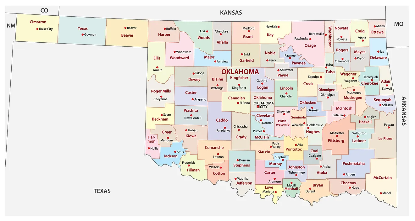
The State of Oklahoma is divided into 77 counties. In alphabetical order, these counties are: Adair, Alfalfa, Atoka, Beaver, Beckham, Blaine, Bryan, Caddo, Canadian, Carter, Cherokee, Choctaw, Cimarron, Cleveland, Coal, Comanche, Cotton, Craig, Creek, Custer, Delaware, Dewey, Ellis, Garfield, Garvin, Grady, Grant, Greer, Harmon, Harper, Haskell, Hughes, Jackson, Jefferson, Johnston, Kay, Kingfisher, Kiowa, Latimer, Le Flore, Lincoln, Logan, Love, Major, Marshall, Mayes, McClain, McCurtain, McIntosh, Murray, Muskogee, Noble, Nowata, Okfuskee, Oklahoma, Okmulgee, Osage, Ottawa, Pawnee, Payne, Pittsburg, Pontotoc, Pottawatomie, Pushmataha, Roger Mills, Rogers, Seminole, Sequoyah, Stephens, Texas, Tillman, Tulsa, Wagoner, Washington, Washita, Woods, and Woodward.
With an area of 181,037 sq. km, the State of Oklahoma is the 20th largest and the 28th most populous state in the USA. Located near the state's center, along the North Canadian River, is Oklahoma City – the capital and the largest city in Oklahoma. It is home to the Oklahoma National Stockyards, the world's largest stocker and feeder cattle market, which has operated since 1910.
Where is Oklahoma?
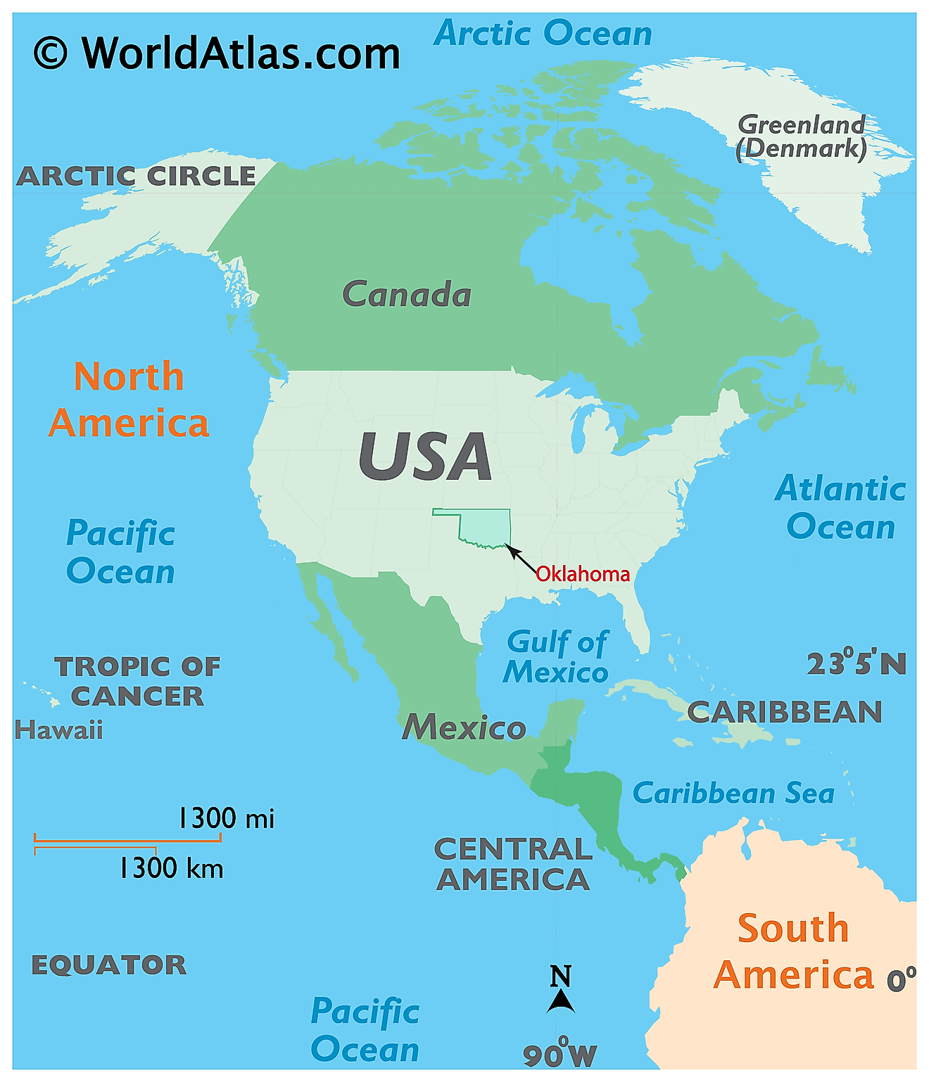
The State of Oklahoma is located in the South-central region of the United States. Oklahoma is bordered by the state of New Mexico in the west; by Colorado in the northwest; by Texas in the west and south; by Kansas in the north; by Arkansas in the east and by Missouri in the northeast.
Regional Maps: Map of North America
Outline Map of Oklahoma
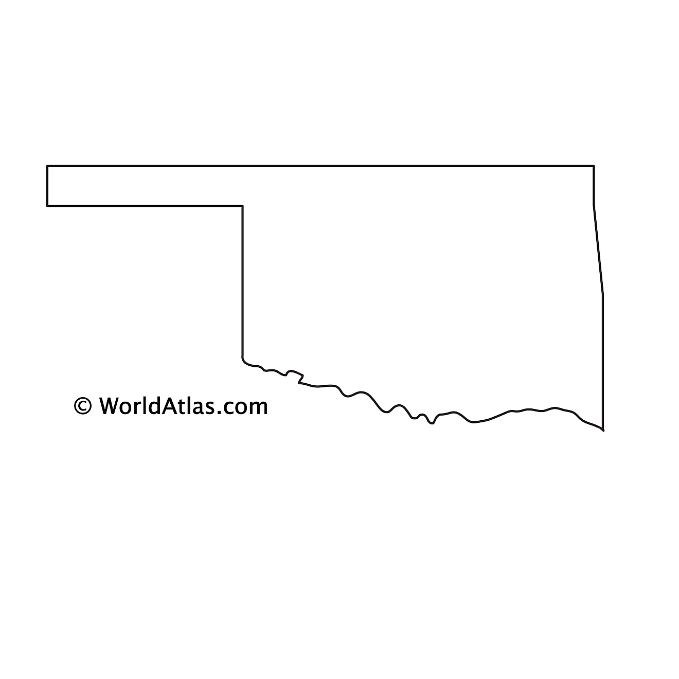
The above blank map represents the State of Oklahoma, located in the South-central region of the United States. The above map can be downloaded, printed and used for geography education purposes like map-pointing and coloring activities.
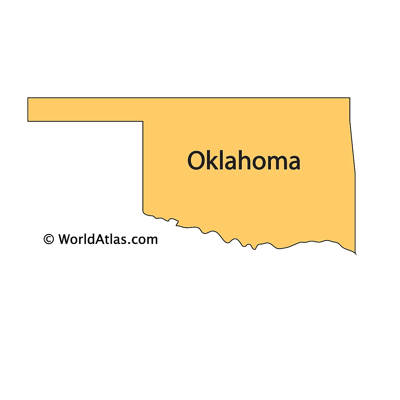
The above outline map represents the State of Oklahoma, located in the South-central region of the United States.
Key Facts
| Legal Name | State of Oklahoma |
|---|---|
| ISO 3166 Code | US-OK |
| Capital City | Oklahoma City |
| Major Cities |
|
This page was last updated on September 17, 2026